

Little Bay-Orleans
Little Bay brings together the residence, boathouse, landscape, topography, and waterfront setting into a coordinated existing-conditions record. Pointknown combined field capture, architectural documentation, aerial imagery, and Revit modeling to give the project team a clearer understanding of the property before design work moves forward.
Not just a model.
A complete starting point.
For this coastal property in Orleans, Pointknown documented more than the residence itself. The scope brought together the building, site, topography, waterfront conditions, and boathouse to create a coordinated record of the property as it exists today.
Field capture, aerial documentation, architectural drawings, and Revit modeling were developed as connected parts of the same documentation process. Together, they give the design team a clearer understanding of the property before renovation, planning, or other design work moves forward, while drone and 360° context provides an additional visual reference for the site and surrounding conditions.
Understanding the property in context
Aerial documentation connects the residence to its landscape, topography, boathouse, and waterfront—giving the project team a broader understanding of how the property works as a whole. The resulting site information can also support measured CAD documentation for downstream planning and design.
From field capture to a usable project package
Pointknown brought field capture, aerial documentation, site information, and architectural modeling together to create a coordinated record of the Little Bay property for future design work.
Document the conditions that matter
LiDAR scanning, 360° documentation, drone capture, and site documentation record the residence, surrounding property, topography, waterfront, and boathouse as existing conditions.
Turn field information into usable documentation
Measured information is translated into an existing-conditions Revit model, floor plans, elevations, and coordinated site information that can support future architectural work.
Give the design team a dependable starting point
Models, drawings, aerial imagery, visual references, and documentation are brought together so the project team can review the property and move forward without starting from scratch.
From captured reality to usable project information
Little Bay's existing conditions were translated into a coordinated set of models, drawings, and property documentation — giving the project team multiple ways to understand the same place. These highlights show how the Little Bay property was documented, coordinated, and translated into information the project team can use.
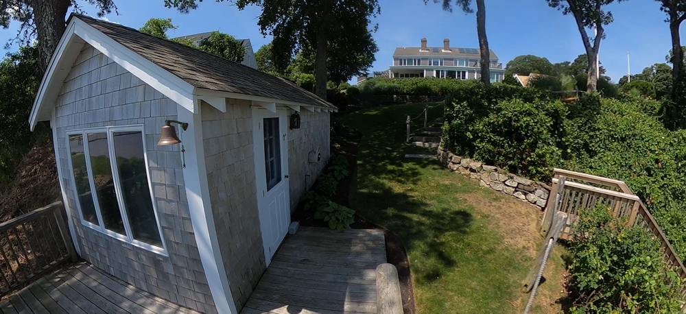
The property documented as one connected record.
The residence and boathouse are captured together within the broader property context, establishing a clear visual reference for the existing site.
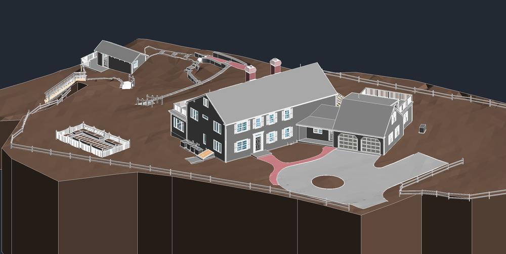
Measured geometry translated into architectural documentation.
The existing floor plan provides a clear reference for the building's layout, rooms, circulation, and spatial relationships.
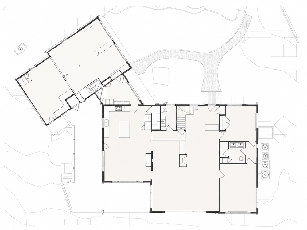
Measured geometry translated into drawings
The existing-conditions floor plan turns captured field information into a clear architectural reference, making rooms, circulation, walls, and spatial relationships easier to review during planning and design.
Experience the property beyond the drawing set.
Aerial documentation adds another layer of context to the existing-conditions record, showing the relationship between the residence, landscape, waterfront setting, and surrounding site conditions from above.
Drone video provides an additional visual record of Little Bay, showing the relationship between the residence, boathouse, landscape, waterfront, and surrounding site conditions from above.
One property. Multiple layers of usable information.
Little Bay was documented as a connected property rather than a collection of individual drawings and images. The residence, boathouse, site, topography, and waterfront context can be understood together, giving the project team a broader view of existing conditions.
Property-scale coordination
The main residence, boathouse, landscape, site features, circulation, and waterfront conditions remain connected within the same project record.
Design-ready geometry
LiDAR field capture is translated into an existing- conditions Revit model developed within the client's project template, providing a measured foundation for future architectural work.
Multiple ways to verify conditions
Revit, drawings, 360° documentation, photography, and aerial capture provide cross-references to the same property, giving the project team more than one way to understand and verify existing conditions.
A baseline built for the next decision
The documentation gives the architectural team a dependable starting point for evaluating the residence, site, topography, and waterfront conditions before design work moves forward.
A coordinated record of the property
The value of the Little Bay documentation is in how the different forms of capture work together — measured geometry, aerial context, architectural drawings, digital modeling, and site information brought into one project record.
LiDAR Scanning
Accurate field capture provides the measured foundation for documenting the existing building and developing coordinated project information.
Drone Capture
Aerial documentation adds broader site and waterfront context, helping the project team understand the residence in relation to the surrounding property.
Architectural Drawings
Existing-condition floor plans and elevations translate measured information into conventional architectural references that can support design and coordination.
Revit Model
An existing-conditions model developed within the project's established Revit environment provides a coordinated digital record for future architectural work.
Site + Topography
Existing site relationships, grade, landscape, waterfront conditions, and the relationship between the residence and boathouse remain part of the overall project record.
Preserve the details the project team needs to carry forward.
Little Bay was documented across architectural geometry, model information, and site conditions so the residence could be understood clearly before the next stage of work.
Existing conditions translated into architectural documentation.
Measured conditions were translated into conventional architectural documentation, preserving the building's existing geometry and vertical relationships as a reference for future design work.
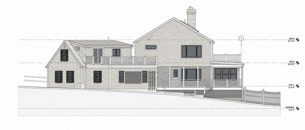
The building's vertical geometry stays legible.
Existing elevation documentation records the exterior geometry and vertical relationships of the residence, complementing the plan information shown earlier in the project.
The documented building can be read beyond a single view.
The floor plan establishes the building's organization, while the elevation preserves its exterior geometry. Together, these references give the project team a clearer understanding of existing conditions without repeating the same visual information in this section.
Technical views that keep the documented geometry legible.
The existing-conditions model provides another way to understand the property. Different model views emphasize geometry, structure, and surrounding conditions without turning the documentation into a rendered presentation.
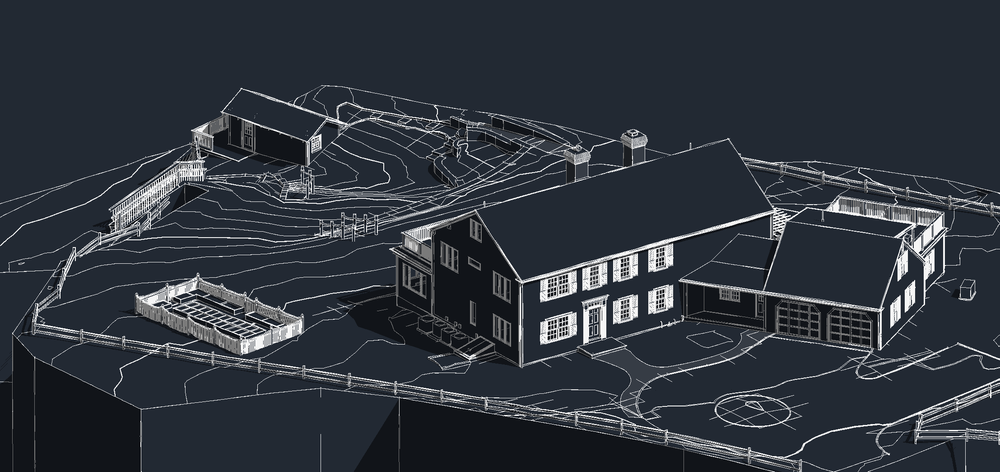
Geometry without unnecessary presentation graphics.
The monochrome model view keeps the existing geometry easy to read and inspect as technical project information.
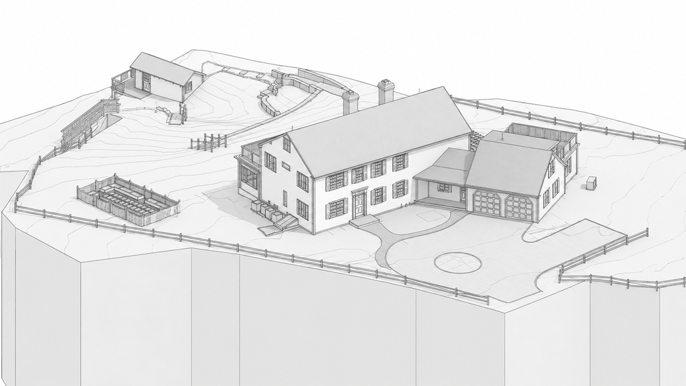
Building geometry stays connected to its context.
A coordinated Revit view shows the documented residence in relation to surrounding conditions within the project model.
The documentation becomes something the design team can work from.
Captured conditions are organized into model geometry that can support coordination, design development, and future documentation rather than remaining as disconnected field information.
The immediate site remains part of the existing-conditions record.
Documentation extends beyond the residence to include the immediate yard and exterior conditions that shape how the property is experienced and understood.
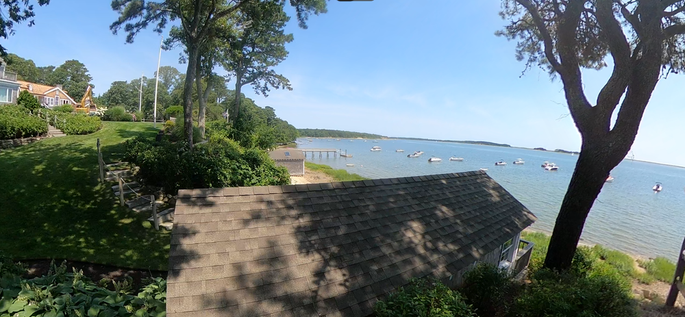
The immediate property context stays in the record.
Existing yard and exterior conditions provide additional context for understanding how the residence meets the surrounding landscape and property.
The building is documented as part of the property, not in isolation.
Architectural documentation establishes the building record, model views preserve its measurable geometry, and site documentation keeps the immediate surroundings in view. Together, these layers provide a more complete record of Little Bay before the next project decision is made.
Experience shows up in the handoff
The best documentation teams do not simply collect data. They know what matters, what to ignore, what to model, what to share, and how to package it so the next team can work.
We scope for the decision ahead
Each capture effort is shaped around what the client, architect, consultants, and builder need to understand next.
We know the deliverable ecosystem
Revit, CAD, SketchUp, PDF, drone media, 360 photography, and shared file structures all play different roles in helping a project move forward.
We make complex properties easier to communicate
The goal is not to show every piece of data. The goal is to make the right information accessible, clear, and usable for the people who need it.
If you are planning, renovating, leasing, or evaluating a building, clear existing conditions matter.
Pointknown helps design teams and property stakeholders move forward with confidence by turning existing buildings into usable, decision-ready information.