

Reality Capture Context for Existing Buildings
Drone, 360, and immersive visual documentation that helps project teams understand the site before they design, coordinate, or make decisions.
Existing-condition drawings and models are the baseline. Visual context adds the “what does this actually look like?” layer — roof access, site relationships, ceiling conditions, finishes, equipment, circulation, and the small realities that usually require another site visit.
Drawings show what is there. Context helps the team understand it.
A plan, model, or point cloud can answer a lot. But when the project team needs to see roof access, surrounding site conditions, finishes, ceiling conditions, exterior relationships, or what the space actually feels like, visual context becomes the easy button.
It bridges the gap between technical documentation and real-world understanding—so architects, owners, consultants, and contractors can move faster with fewer assumptions and clearer alignment.
Reduce follow-up visits
Give the team a shared visual record they can revisit before asking someone to return to the site.
Coordinate faster
Architects, owners, consultants, and contractors review the same conditions instead of relying on scattered photos or memory.
Understand complex spaces
Roofs, basements, historic buildings, schools, restaurants, and irregular sites become easier to interpret visually.
Support better decisions
Combine imagery with CAD, Revit, scan data, and field notes to move forward with fewer unknowns.
Look around the space from a single captured position.
A 360 photo lets the project team pan in every direction and better understand views, finishes, ceiling conditions, openings, and the relationship between the interior and its surroundings.

Explore the view in every direction
Click to load the interactive Kuula 360 photo. Drag to look around the interior and out toward the Boston skyline.
Single-position 360 photography hosted on Kuula — useful for understanding a space beyond the limits of a conventional still photograph.
Site, roof, access, and surroundings from the angles that matter.
Drone imagery helps teams understand the larger setting: rooflines, equipment, slopes, waterfront or urban constraints, site access, neighboring buildings, facade relationships, and conditions that are hard to understand from the ground alone.
When paired with field capture, drone context also helps tell the project story — what we captured, where we were, and why the visual record matters to the next phase of work.
Roof, property, access, and surrounding context in a single frame.
The strongest drone images do more than look good. They explain scale, relationships, circulation, roof geometry, equipment, and the setting around the building.

Westwood, New Jersey shopping plaza
Tenant relationships, roof areas, parking, access, circulation, and surrounding neighborhood context.

Commonwealth Avenue, Brighton
Rooftop equipment, active work areas, adjacent buildings, and the Boston skyline in the background.
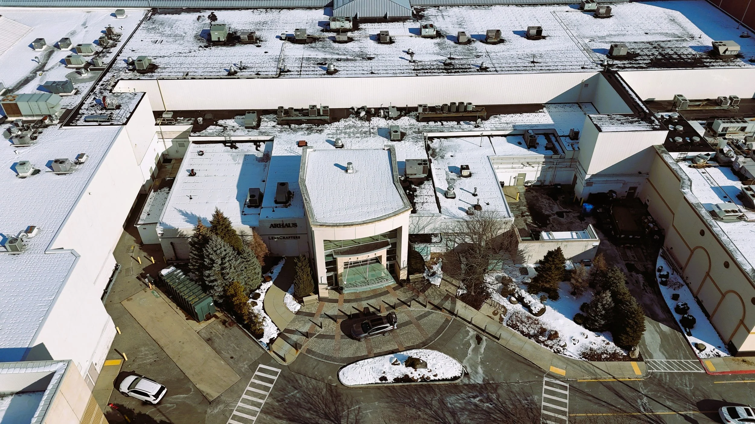
Burlington Mall
Entrance conditions, rooftop equipment, circulation, service access, and adjacent building relationships.
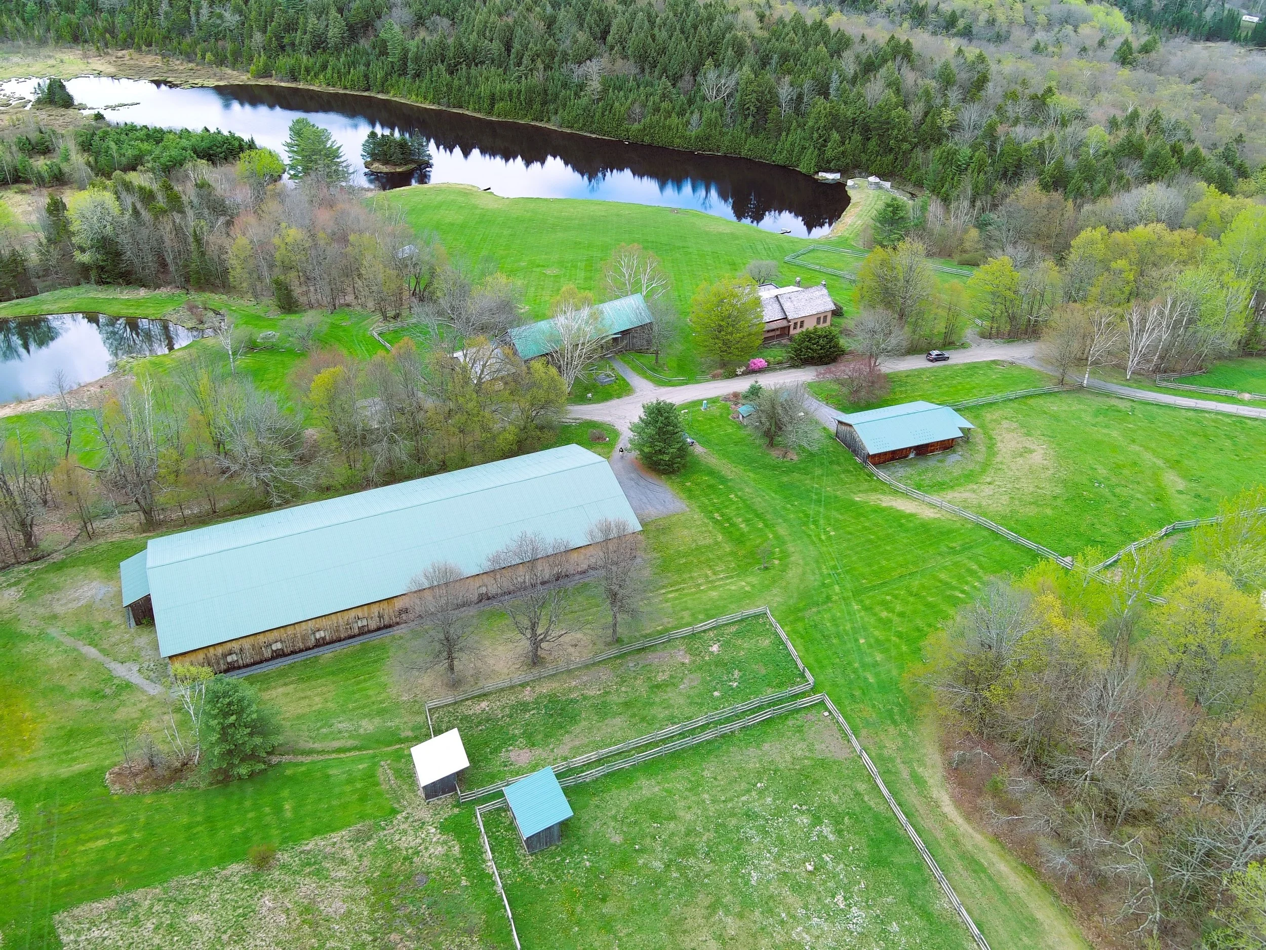
Morristown, Vermont
Buildings, drives, fields, water, fences, and the broader property seen as one coordinated site.
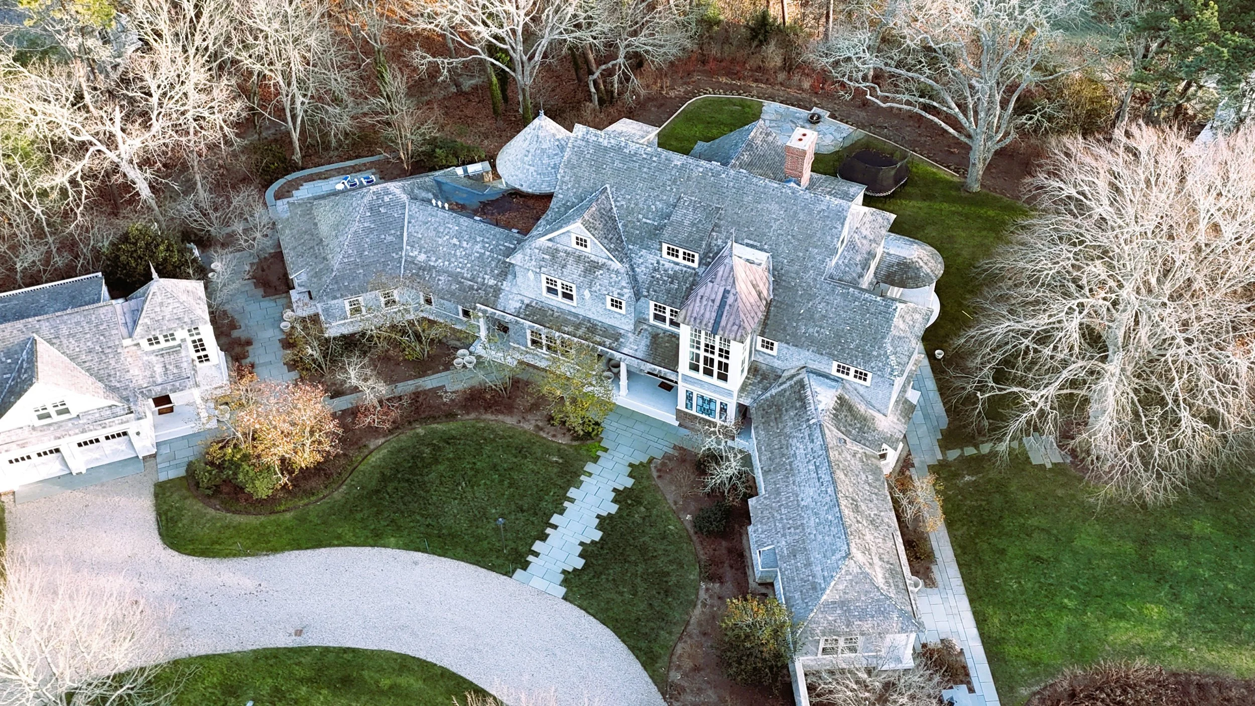
Marstons Mills residential property
Dormers, chimneys, additions, courtyards, roof intersections, and connected building forms from above.