Harbor Watch
A waterfront compound documented from property scale to room detail — LiDAR, drone, 360° capture, Revit modeling, CAD output, and full-site context brought into one coordinated existing-conditions baseline.
A complete existing-conditions baseline for a complex waterfront property
This Newport, Rhode Island property required more than a measurement of the main residence. Pointknown documented the property as a connected system — from the 2.74-acre site and waterfront context to the main residence, private guest cottage, exterior conditions, and room-level detail.
LiDAR, drone, 360° capture, and photography were brought together with Revit modeling, CAD exports, PDF drawings, and site/topographic information to create one coordinated existing-conditions baseline. The result gives the project team a clearer understanding of the property before design, planning, or renovation decisions begin.
A waterfront property with multiple layers of context.
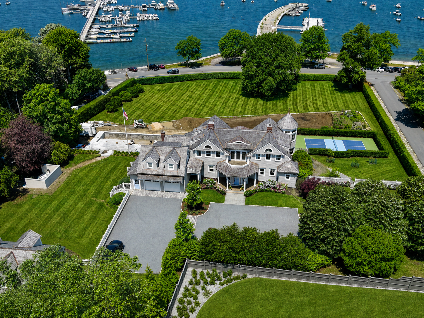
Harbor Watch extends beyond the main residence. The documentation connects the guest cottage, landscape, access, waterfront setting, and surrounding site conditions, with drone photography adding another view of the property as a whole.
From field capture to a coordinated project baseline
Harbor Watch required more than a single survey or model. Pointknown combined LiDAR scanning, drone and 360° capture, photography, modeling, and drawing production into one coordinated existing-conditions workflow.
Document the conditions that matter
The main residence, guest cottage, site, exterior conditions, access, waterfront context, and relevant visual references were captured as part of one coordinated effort.
Turn field information into usable files
Measured information was translated into a Revit existing-conditions model, CAD exports, PDF documentation, and full-site and topographic information for downstream use.
Hand off a package the team can actually use
Models, drawings, imagery, video, 360° documentation, and organized project files were brought together so the team could review the property and move forward.
From measured data to a coordinated property record
Harbor Watch was documented at multiple scales, combining terrestrial and aerial capture with coordinated modeling and technical documentation. The result is a project baseline that connects the site, buildings, and interior conditions.
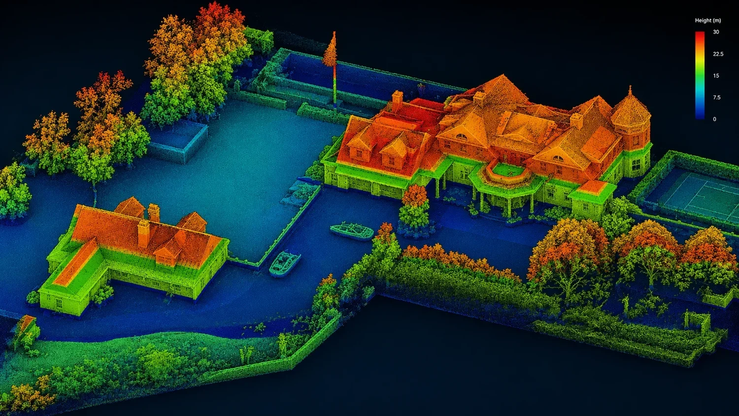
The measured layer behind the model
The point data makes the capture process visible: roof geometry, grade changes, mature landscape, secondary structures, and the relationship between the main house and guest cottage register in one spatial dataset.
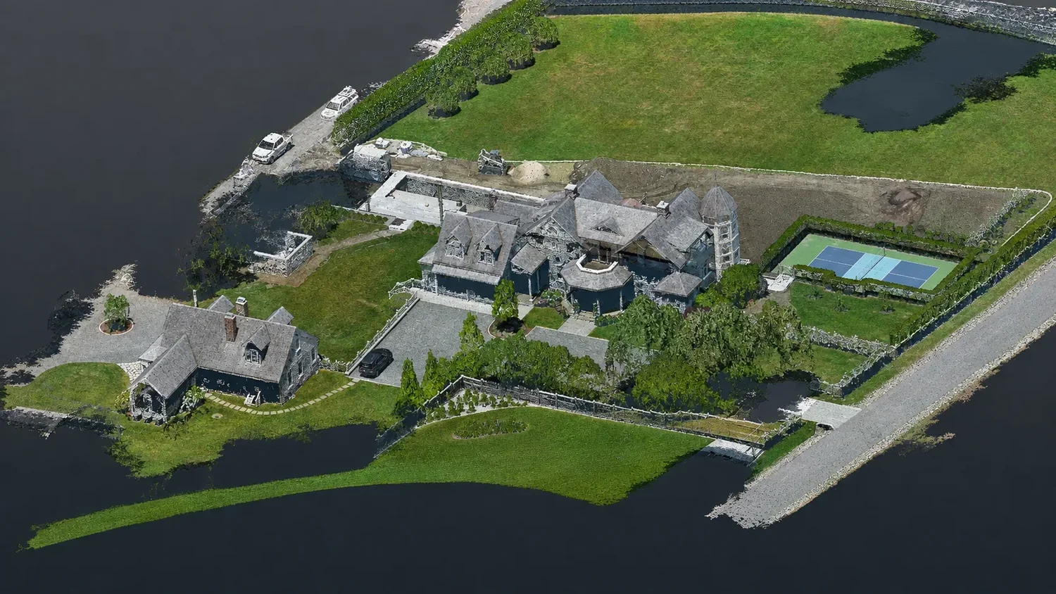
A second lens on the same property
True-color drone-derived 3D data retains recognizable site texture while preserving the spatial context needed to understand the entire compound. Used together with terrestrial capture, it strengthens the property-scale record.
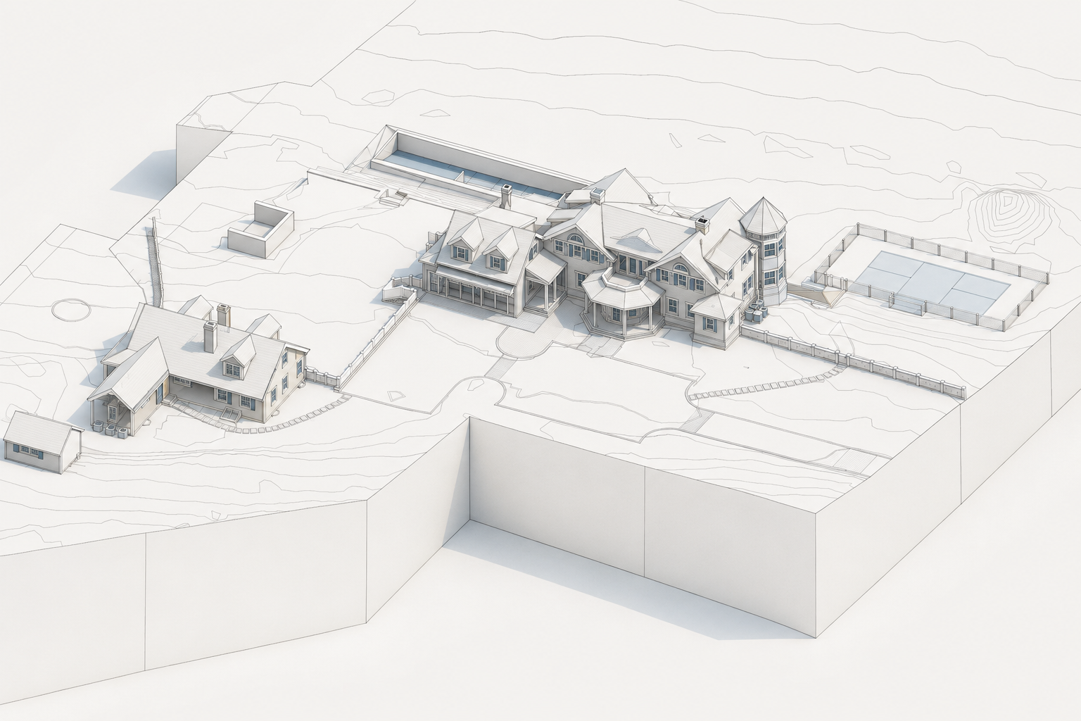
One coordinated digital baseline
Main residence, guest cottage, site walls, exterior circulation, court, and topography stay in one model environment rather than becoming disconnected deliverables.
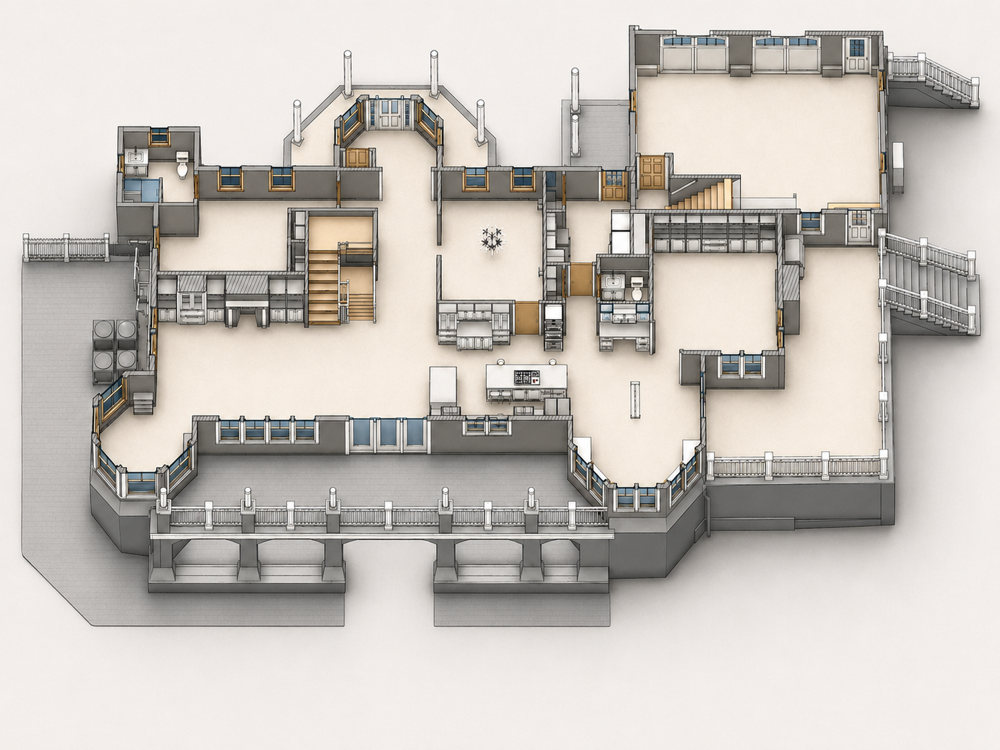
Spatial relationships without the guesswork
The cutaway makes room relationships, circulation, cabinetry, stairs, exterior decks, and perimeter geometry understandable in one view — a useful bridge between the 2D drawing set and the full BIM model.
From measured geometry to project-ready drawings
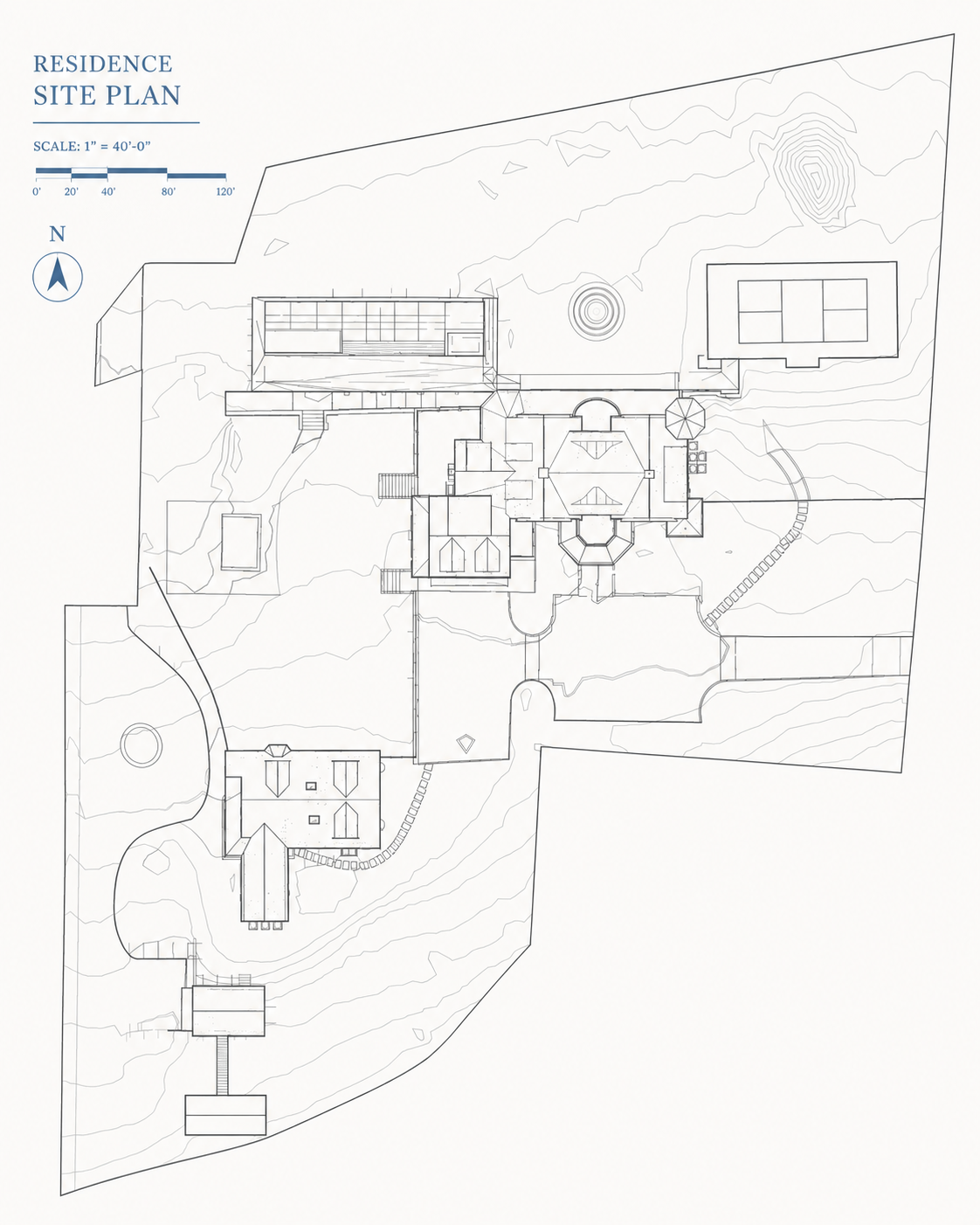
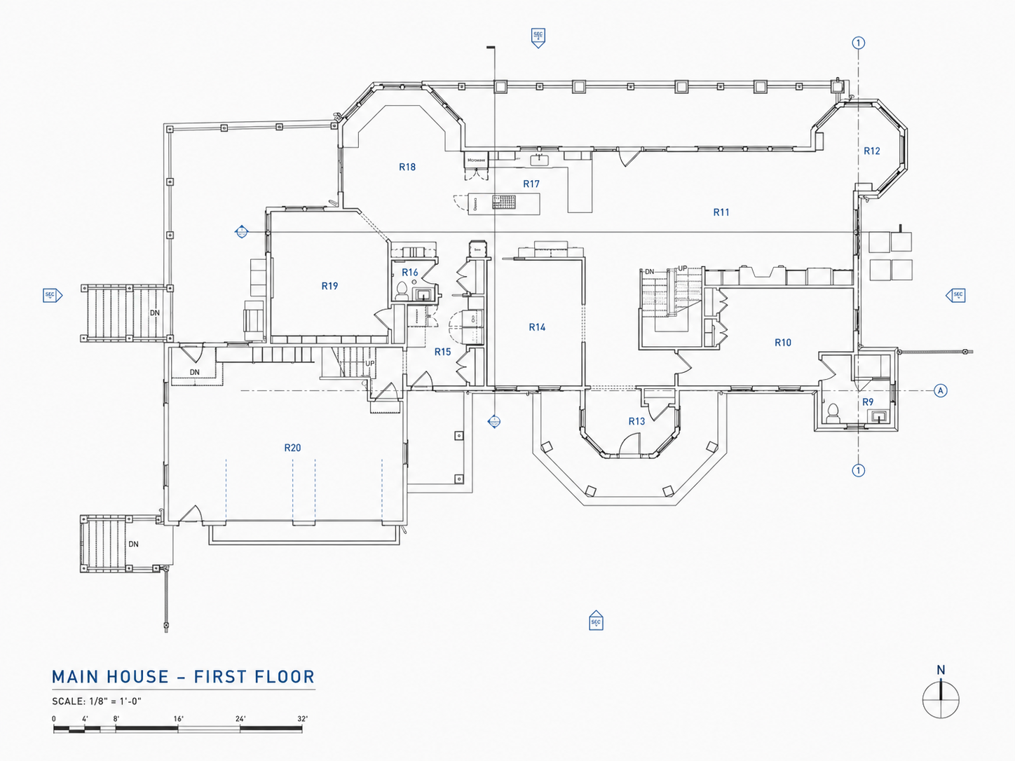
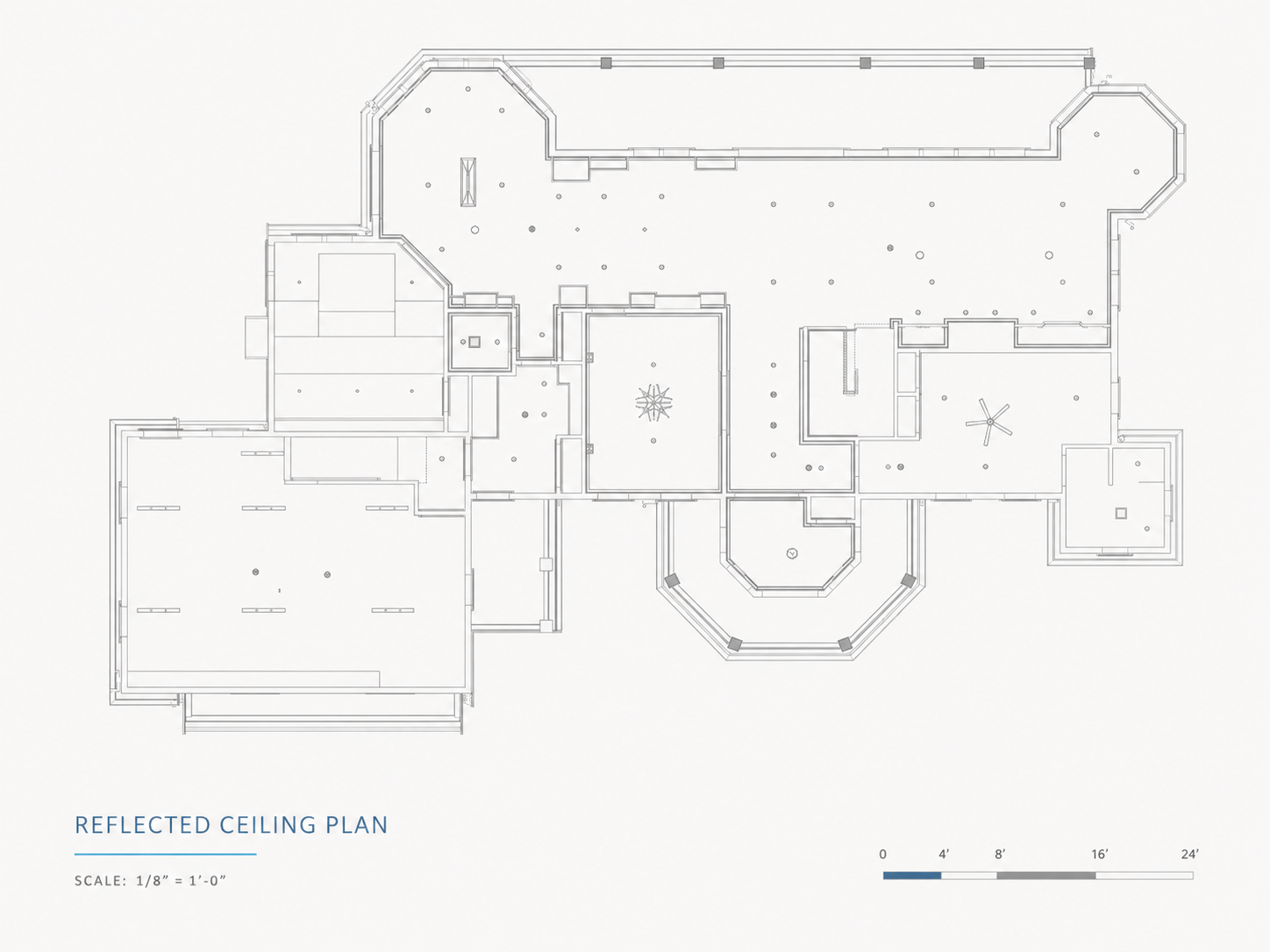
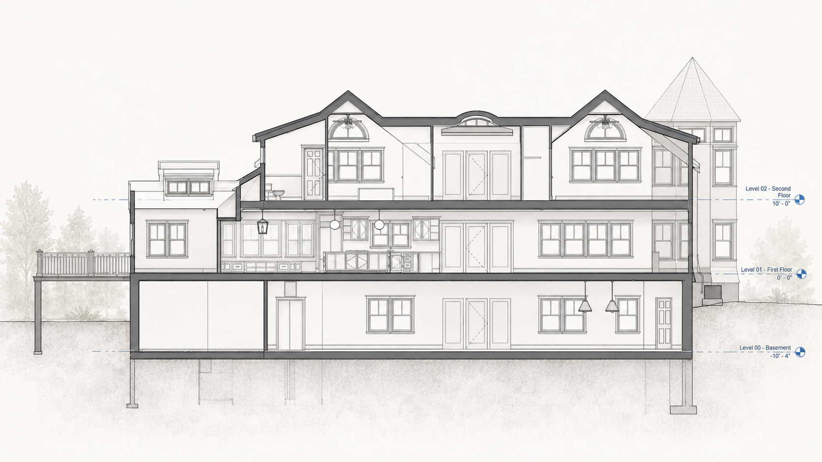
Site plans, floor plans , reflected ceiling information, and building sections translate the measured conditions into technical references the project team can work from.
Experience the property beyond the drawing set
Harbor Watch was documented not only as measured geometry, but as a place that can be revisited. Interactive 360 photography provides an immersive reference for spatial conditions, while aerial video adds broader context for understanding the property's buildings, landscape, and surroundings.
Look around the property from a captured position
Explore the Harbor Watch 360 capture to revisit spatial conditions and relationships without returning to the site.
Explore the property in every direction
Click to load the interactive 360° experience. Pan through the captured environment and revisit conditions from the site.
Interactive 360 documentation used for spatial understanding, review, and remote project coordination.
A moving view of the property and its surroundings.
Drone photography and 360° context add another layer of site understanding, showing the relationship between the buildings, landscape, waterfront, access, and surrounding conditions from above.
See the property from above
Watch the aerial video for a broader view of the property and its surrounding site context. The video can also be opened directly on YouTube.
Drone video provides an additional visual record of the property, showing the relationship between the buildings, landscape, waterfront setting, and surrounding site context from above.
One property. Multiple layers of usable information.
Harbor Watch was not treated as a collection of isolated buildings or deliverable types. The existing-conditions record connects the main residence, guest cottage, site, topography, exterior conditions, and interior geometry so the project team can understand how those pieces relate.
Property-scale coordination
The main residence, guest cottage, site features, circulation, and topography remain connected within the same project record.
Design-ready geometry
Measured conditions are translated into coordinated model and drawing outputs that can support renovation, planning, and design development.
Multiple ways to verify conditions
Model, drawings, photography, 360° documentation, and aerial data provide cross-references to the same property, giving the project team more than one way to understand and verify existing conditions.
A baseline built for the next decision
The documentation gives the project team a reliable starting point for evaluating existing conditions before design work moves forward.
A complete record of the property, ready for what comes next.
Harbor Watch was documented as more than a collection of individual files. The final handoff brings together measured geometry, model intelligence, drawing outputs, aerial data, and immersive visual references so the project team can understand the property from multiple perspectives.
Property + Site Context
A coordinated record of the Harbor Watch property captures the main residence, guest cottage, pool, court, grading, and broader site relationships across the approximately 2.74-acre property.
Measured Model + Geometry
Reality capture is translated into structured model information that gives the project team measurable existing conditions to reference during design, coordination, renovation planning, and documentation.
CAD + PDF Documentation
Drawing outputs provide a practical technical reference alongside the model, giving project teams accessible plans, elevations, sections, and supporting documentation for review and downstream project work.
Aerial + 3D Site Data
Drone imagery and derived 3D site information extend the documentation beyond the building envelope, helping the team understand site relationships, exterior conditions, roof geometry, access, and surrounding context.
Interactive Revisit
360° imagery, video, and organized visual references keep the captured property accessible after fieldwork is complete, allowing the team to revisit conditions without reconstructing the site from memory.
Preserve the details the model needs to carry forward.
Existing conditions are most valuable when they retain the architectural details that matter later. At Harbor Watch, 360° imagery and modeled millwork provide a direct reality-to-model reference.
Capture what makes the building specific.
Architectural details such as millwork, wall conditions, and interior geometry were documented with both visual references and modeled information, creating a direct connection between what was captured in the field and what the project team can work from later.
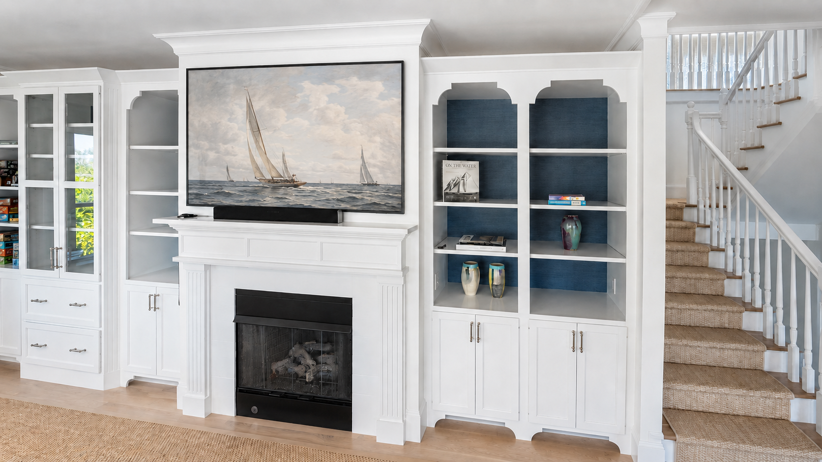
The existing condition stays accessible.
360° imagery preserves the real wall, millwork, finishes, and surrounding context as they existed during capture.
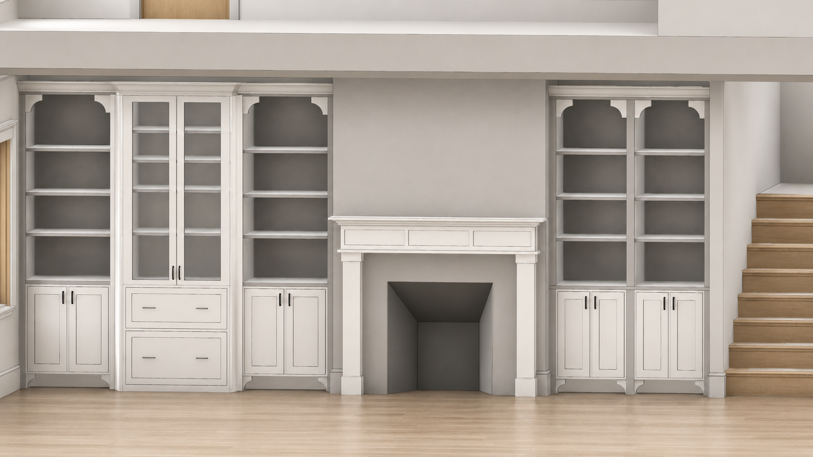
The same condition becomes usable geometry.
The modeled interior elevation translates the captured condition into coordinated geometry the architect can reference during design and documentation.
One captured condition, preserved in two useful forms.
The photographic record keeps the real condition accessible after the site visit. The model translates the same wall into coordinated geometry the architect can work from. Together, the two references connect what was observed in the field with what the project team can use downstream.
A compound, not a single building.
The guest cottage stays part of the same story. The separate structure adds another set of exterior and interior conditions and another layer of site coordination. Keeping it connected to the same existing-conditions baseline matters when future work crosses property, landscape, and building scopes.
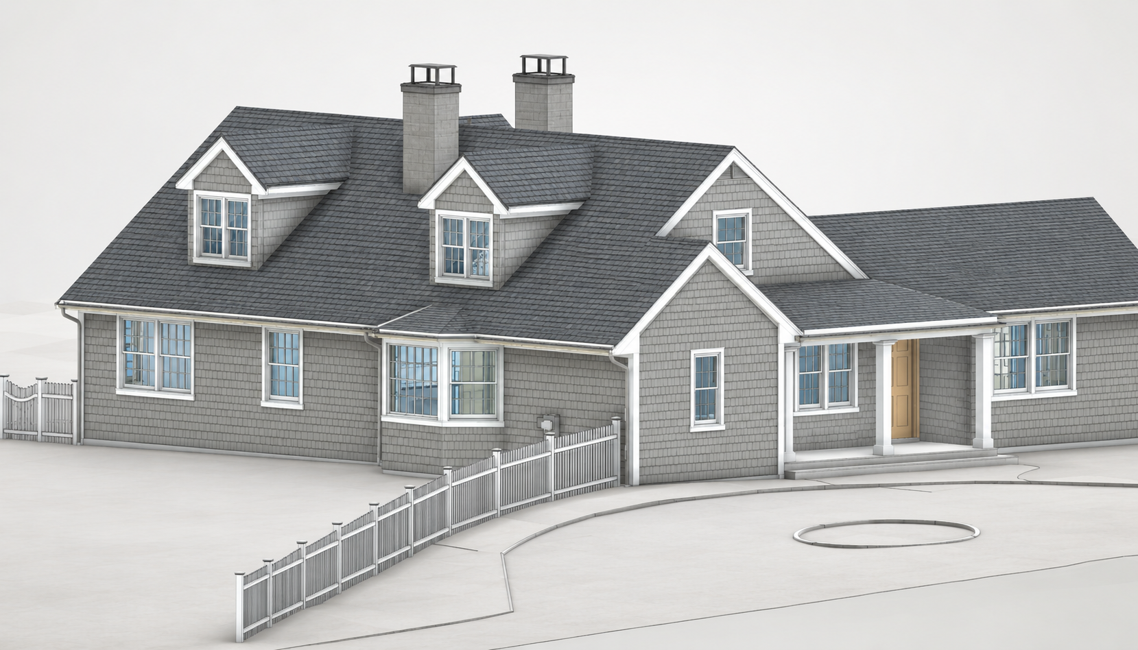
The second structure stays connected to the property record.
The guest cottage was documented as part of the same existing-conditions story, keeping the separate structure tied to the broader site and property context.
Exterior conditions remain part of the same baseline.
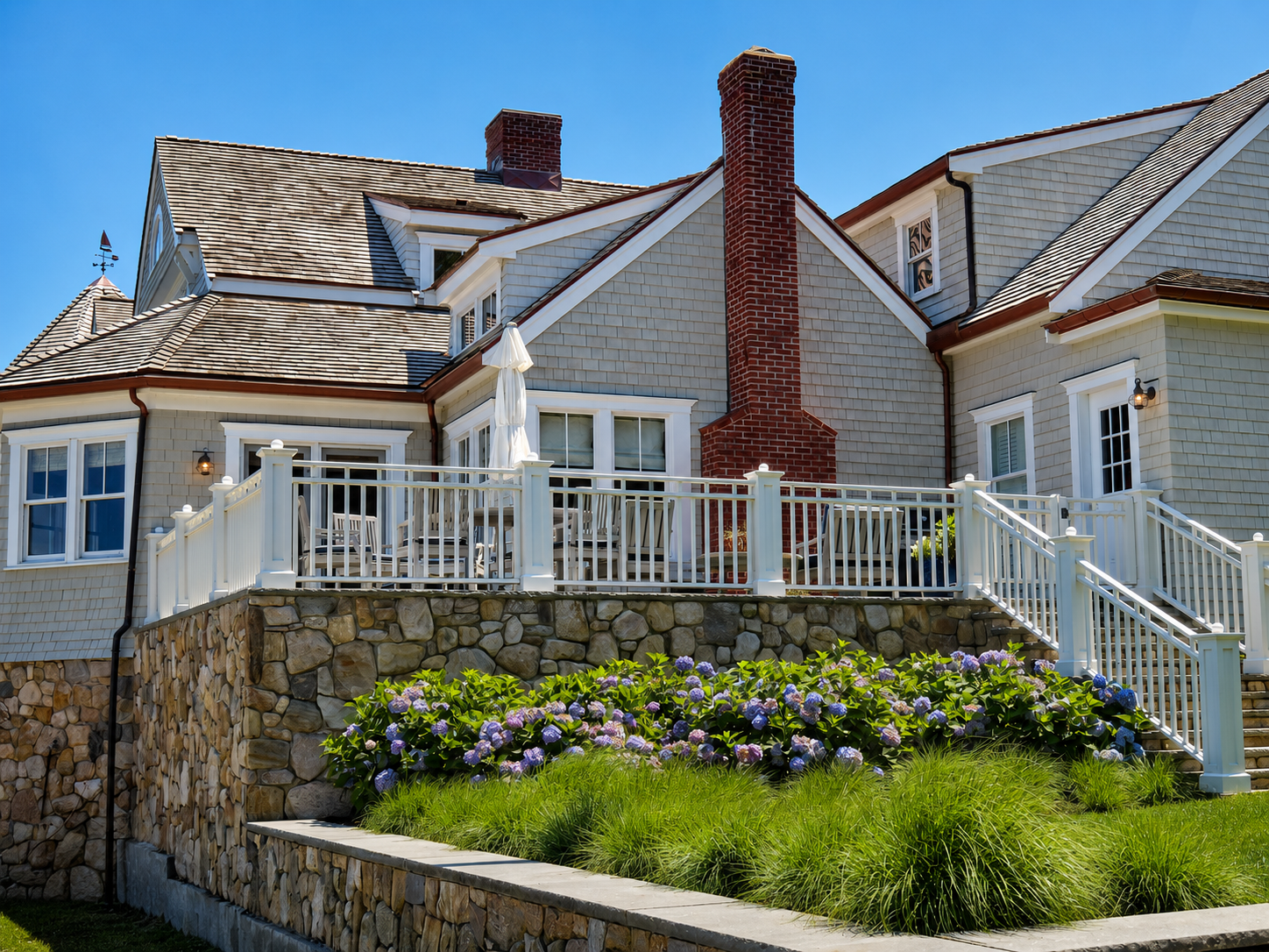
Exterior photography preserves the visible condition of the property and provides another reference alongside measured and modeled information.
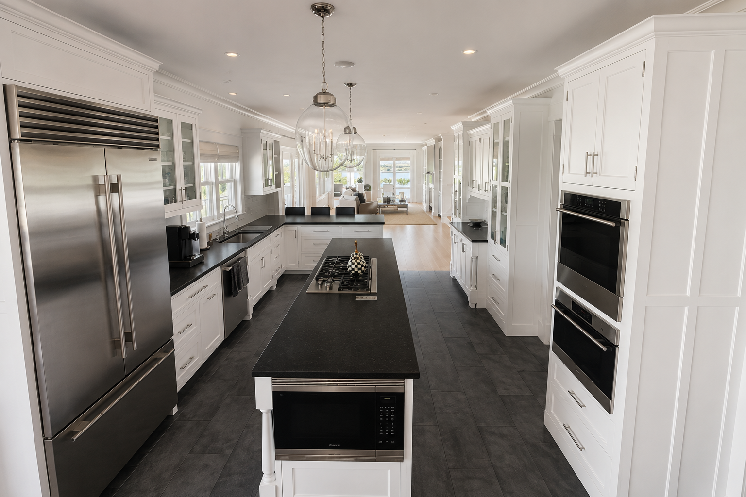
Interior context stays accessible too.
360° interior documentation provides a visual record that can be revisited alongside the property's other existing-conditions information.
The documentation stays coordinated as the scope expands.
By documenting the guest cottage alongside the main residence and broader site, Harbor Watch retains a connected reference for building, landscape, access, and property-level decisions instead of treating each structure as an isolated record.
Experience shows up in the handoff
The best documentation teams do not simply collect data. They know what matters, what to ignore, what to model, what to share, and how to package it so the next team can work.
We scope for the decision ahead
Each capture effort is shaped around what the client, architect, consultants, and builder need to understand next.
We know the deliverable ecosystem
Revit, CAD, SketchUp, PDF, drone media, 360 photography, and shared file structures all play different roles in helping a project move forward.
We make complex properties easier to communicate
The goal is not to show every piece of data. The goal is to make the right information accessible, clear, and usable for the people who need it.
Need a clearer picture of an existing property?
Tell us about the property, what you are planning, and what you need to understand. We can help determine the right capture approach and deliverables for the project.
Prefer email? projects@pointknown.com