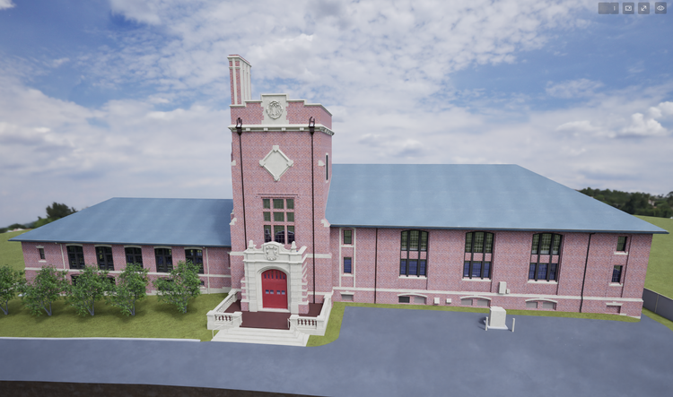
WORCESTER ACADEMY · MASSACHUSETTS

Worcester Academy

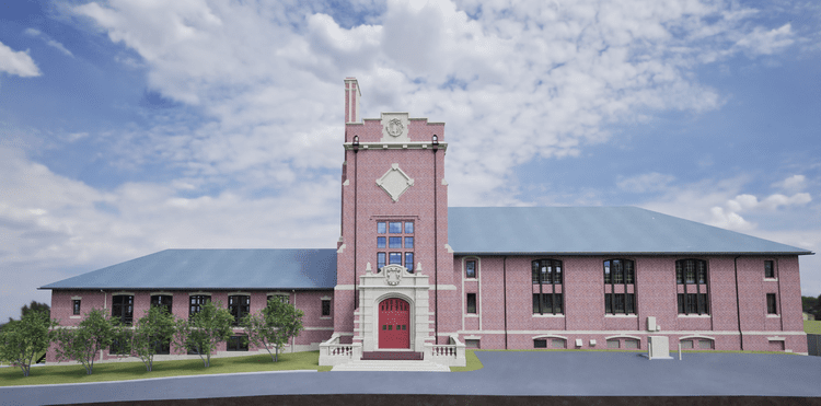
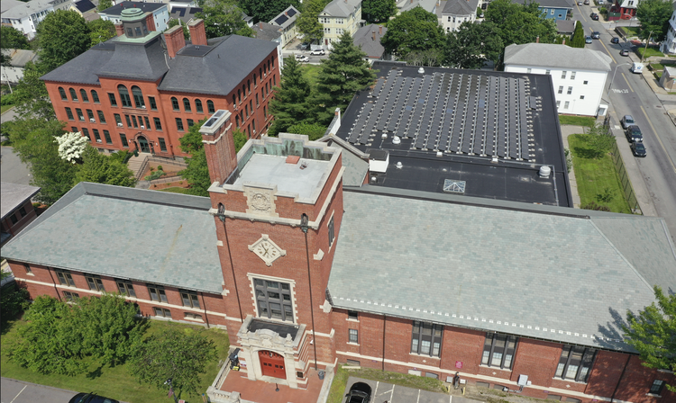
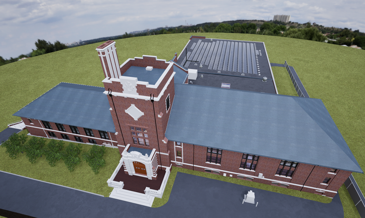
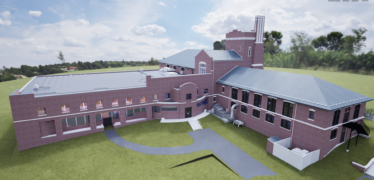
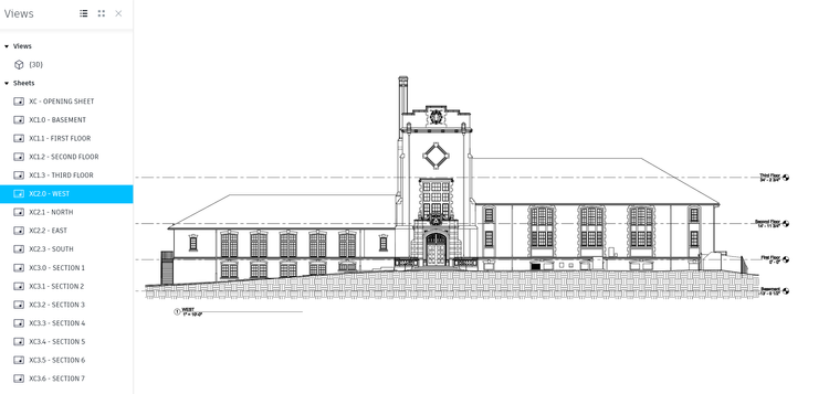
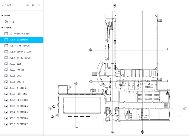
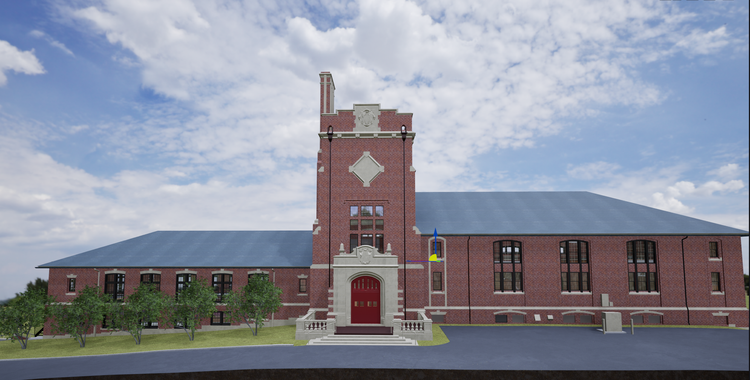
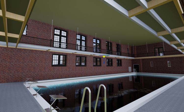
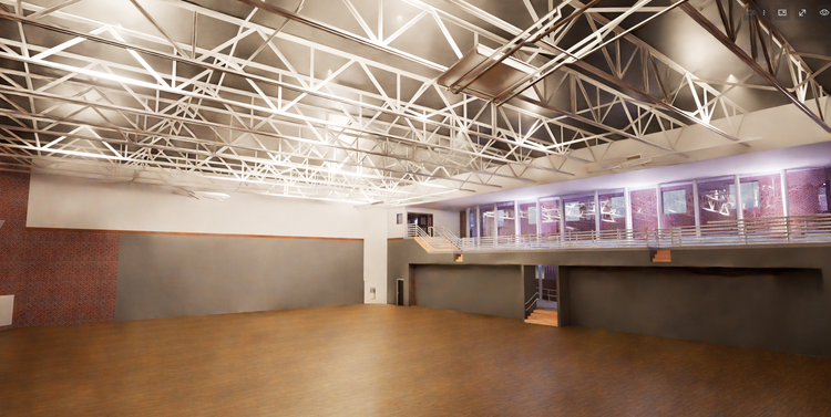
Pointknown documented Daniels Hall at Worcester Academy using a blend of mobile LiDAR laser scanning and drone capture—bringing the entire facility into a clean, future-ready Revit existing-conditions model. From the indoor track, pool, and gymnasium to the exposed structure and rooftop solar panels, our goal was simple: deliver accurate building truth that architects can immediately design from.

Daniels Hall at Worcester Academy
Drone Capture + Revit
Project Type
Academic
Deliverables
Revit Model + CAD
Location
Worcester, MA
Use Case
Precise Design-ready Digital Model
Measured once. Delivered ready for design.
What was documented
Our team captured the full building envelope and interior athletic program spaces, including the indoor track, swimming pool, and gymnasium. Detailed scanning documented architectural geometry, circulation paths, and vertical relationships such as stairs, mezzanines, and open structural zones. Exposed mechanical systems, trusses, and rooftop conditions—including solar panel layouts—were also recorded using drone capture for complete site coverage.
What was delivered
Pointknown delivered a fully coordinated Revit existing-conditions model developed directly from registered scan and drone data. Supporting outputs included CAD exports derived from Revit views, building sections, and tailored drawing sets for architectural workflows. The dataset was structured to allow flexible export into multiple formats depending on project requirements.
Why it matters
Facilities like Daniels Hall combine complex structural systems with high-activity program spaces, making accurate documentation essential for renovation planning and long-term maintenance. By establishing a precise digital baseline, the project reduces design uncertainty, improves coordination, and allows teams to move faster from concept to execution without repeated site verification.
PROJECT HIGHLIGHTS

A complete existing conditions package, from reality capture to usable deliverables.

This project demonstrates the value of integrating interior LiDAR capture with aerial drone data to fully document large-span athletic facilities. The inclusion of exposed structural and MEP systems provided a deeper level of insight for design teams, while visualization outputs in Twinmotion helped communicate spatial complexity and design potential more effectively to stakeholders.

Project highlight

Project highlight

Project highlight

Project highlight

Project highlight

Project highlight

Project highlight

Project highlight

Project highlight

Project highlight

WHY POINTKNOWN

The value is not in the scan itself. It is in what your team can do next.

Design-ready deliverables

Measured information is structured into clean Revit and CAD outputs so architects, owners, and developers can move quickly.

Clear communication

Pointknown focuses on clarity. The process stays in the background. The usable result stays front and center.

One source of truth

A single field effort supports visualization, planning, modeling, and documentation—without repeated site visits or fragmented information.

Interested in something similar?

If you are planning, renovating, leasing, or evaluating a building, clear existing conditions matter.

Pointknown helps design teams and property stakeholders move forward with confidence by turning existing buildings into usable, decision-ready information.