

Stamford
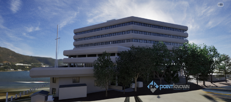
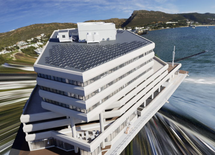
Pointknown was engaged to document and model an existing waterfront property on Seaview Boulevard in Stamford, Connecticut, supporting its transition from a former industrial site into future waterfront residential use. The goal was to create a precise, design-ready digital foundation to guide redevelopment and architectural planning.
Stamford’s waterfront has undergone significant transformation over the years, evolving from a heavily industrial and maritime working shoreline into one of Connecticut’s key redevelopment corridors. Former industrial sites like this one are increasingly being reimagined as residential and mixed-use communities, requiring accurate documentation to bridge legacy structures with modern design intent.
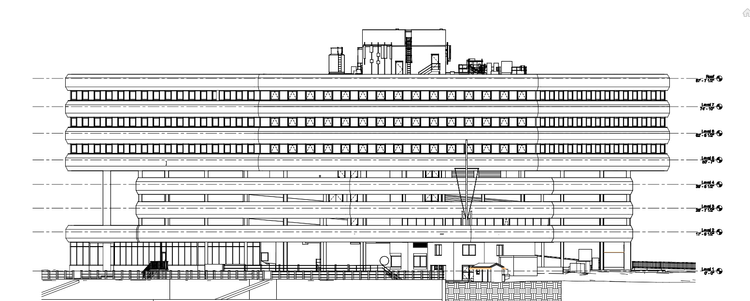
A complete existing conditions package, from reality capture to usable deliverables.
This project demonstrates how reality capture supports urban transformation—preserving the integrity of existing structures while enabling future residential redevelopment. The resulting digital model allows the design team to move forward with clarity, ensuring that every design decision aligns with real-world site conditions.


The value is not in the scan itself. It is in what your team can do next.
Design-ready deliverables
Measured information is structured into clean Revit and CAD outputs so architects, owners, and developers can move quickly.
Clear communication
Pointknown focuses on clarity. The process stays in the background. The usable result stays front and center.
One source of truth
A single field effort supports visualization, planning, modeling, and documentation—without repeated site visits or fragmented information.
If you are planning, renovating, leasing, or evaluating a building, clear existing conditions matter.
Pointknown helps design teams and property stakeholders move forward with confidence by turning existing buildings into usable, decision-ready information.