

Searles Castle
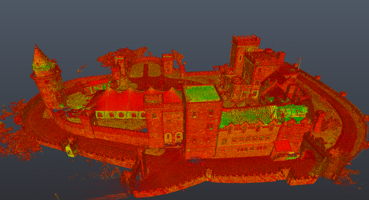
Pointknown documented Searles Castle, a striking historic estate in Windham, New Hampshire, originally completed in 1915. Designed to resemble the English manor Stanton Harcourt Manor, the castle sits within an expansive landscape and features highly detailed masonry, architectural ornamentation, and site elements. The goal of this project was to create a precise, design-ready digital record of the property to support preservation, planning, and future use.
Completed in 1915. Built to resemble Stanton Harcourth in Oxfordshire, England. It was built mostly from stone cut from Edward Searles quarries in NH and designed by Henry Vaughan.
Searles Castle was commissioned by Edward Francis Searles and designed by noted architect Henry Vaughan. Much of the structure was built using stone sourced directly from Searles’ own quarries in New Hampshire, contributing to its distinctive character and craftsmanship. Inspired by English estate architecture, the property reflects early 20th-century interpretations of historic European design, blending romanticism with American construction methods.
A complete existing conditions package, from reality capture to usable deliverables.
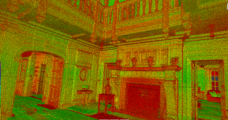
This project highlights the value of combining terrestrial LiDAR, drone capture, and immersive documentation techniques to record highly detailed historic environments. Complex rooflines, stone detailing, and decorative elements were integrated into a unified digital twin that allows stakeholders to understand the property at both architectural and site scales.


The value is not in the scan itself. It is in what your team can do next.
Design-ready deliverables
Measured information is structured into clean Revit and CAD outputs so architects, owners, and developers can move quickly.
Clear communication
Pointknown focuses on clarity. The process stays in the background. The usable result stays front and center.
One source of truth
A single field effort supports visualization, planning, modeling, and documentation—without repeated site visits or fragmented information.
If you are planning, renovating, leasing, or evaluating a building, clear existing conditions matter.
Pointknown helps design teams and property stakeholders move forward with confidence by turning existing buildings into usable, decision-ready information.