

Phillips Wetherell
Dining Hall
Pointknown documented Phillips Exeter Academy’s Wetherell Dining Hall in Exeter, New Hampshire, capturing the exterior envelope along with key interior spaces including the kitchen, commissary, and dining areas to establish a dependable digital baseline for future planning and renovation.
Preserving existing conditions.
Supporting what comes next.
Historic buildings demand a different level of documentation. Existing conditions must be captured with accuracy and care so architects, preservation teams, and consultants can understand the structure as it exists before planning restoration, renovation, or adaptive reuse. Pointknown provided a coordinated documentation package that establishes a dependable foundation for every decision that follows.
Through high-accuracy reality capture, BIM modeling, and technical documentation, the project was translated into organized Revit models, CAD drawings, and digital references that preserve existing building conditions while supporting modern design workflows. The result is a complete digital record that helps project teams work confidently without relying solely on repeated site visits.
Measured conditions built from disciplined capture.
Field teams combined laser measurement, photography, and photogrammetry to document complex interior and exterior conditions with consistency and accuracy.
From field measurements to a coordinated digital foundation
Historic renovation projects begin with reliable existing conditions. Every measurement, drawing, and model was developed to accurately document the building's existing state while giving the design team organized files they could immediately build upon.
Document
Existing conditions were carefully captured throughout the historic structure, recording architectural features, dimensions, and spatial relationships needed to establish an accurate digital baseline.
Model
Field information was translated into coordinated Revit models, CAD drawings, and supporting documentation that preserved the building's geometry while remaining practical for renovation and restoration workflows.
Deliver
The completed package gave architects and consultants a dependable set of existing conditions, reducing uncertainty and allowing planning, coordination, and future preservation work to begin from verified building information.
Historic architecture documented with precision and clarity
Every deliverable was developed to preserve existing conditions digitally—from detailed Revit models to coordinated drawing sets—giving architects and preservation teams dependable information for renovation, restoration, and future planning.
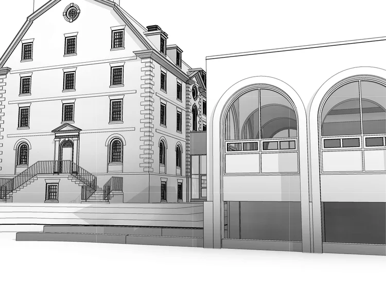
A complete digital representation
The coordinated Revit model captures the building's overall form, roof geometry, and architectural relationships, providing a dependable foundation for future preservation work.
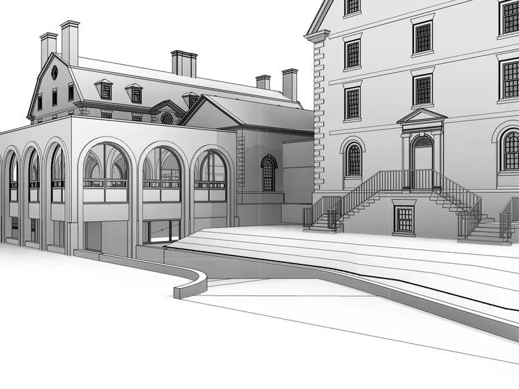
Architectural character preserved
Existing conditions were modeled to accurately represent historic architectural features, proportions, and exterior detailing before renovation begins.
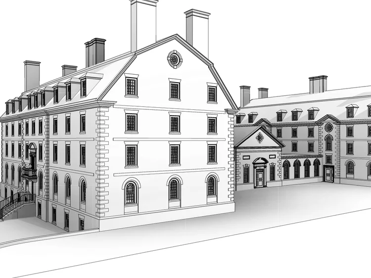
Clear building massing
Three-dimensional views make it easier for project teams to understand spatial relationships and communicate design intent.
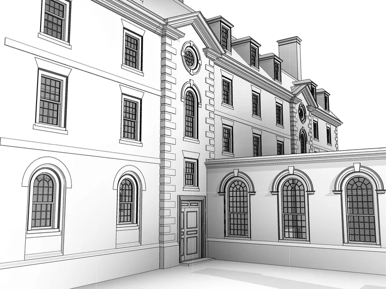
Complex forms accurately modeled
Detailed geometry provides architects with reliable references for planning restoration and renovation work.
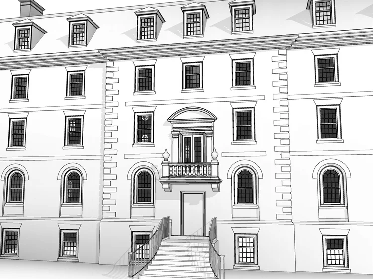
Multiple perspectives for review
Model views from different angles help architects and consultants review existing conditions without repeated site visits.
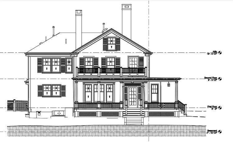
Historic facades documented accurately
Coordinated elevation drawings provide reliable references for façade restoration, detailing, and preservation planning.
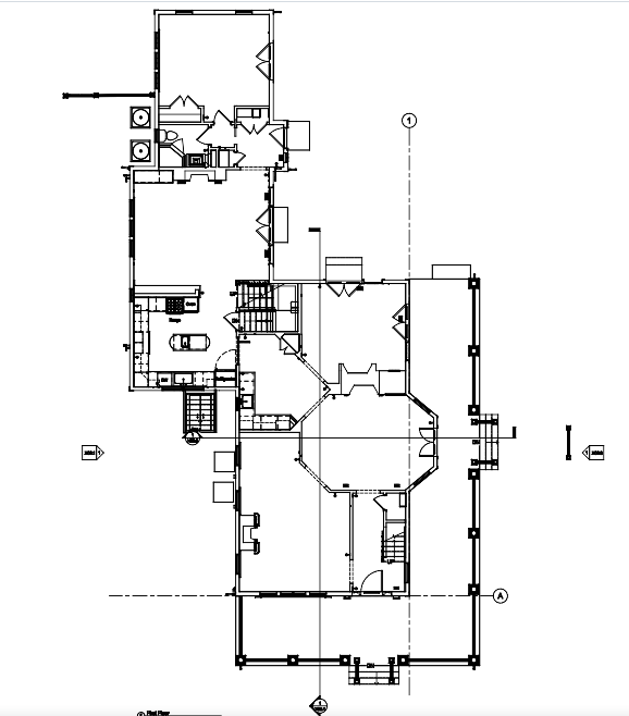
Measured plans for future work
Accurate floor plans establish a dependable baseline for renovation, coordination, and long-term building documentation.
A Complex Institutional Environment
Dining halls of this scale require precise coordination between public dining areas, service zones, and back-of-house systems.
The objective was to create a reliable digital foundation that reflected real-world conditions across both structure and operational spaces without interpretation or assumption.
Reliable documentation for preserving historic architecture
Historic buildings require more than measurements—they require documentation that respects existing architecture while providing modern design teams with dependable digital information. Pointknown translated field documentation into coordinated Revit models and technical drawings that support restoration, renovation, and long-term preservation planning.
A dependable digital record of a historic structure.
Every model and drawing was created to accurately represent the building's existing conditions while preserving its architectural character. The completed documentation package provides architects, preservation specialists, and project teams with dependable information they can confidently use throughout design and restoration.
Experience shows up in the handoff
The best documentation teams do not simply collect data. They know what matters, what to ignore, what to model, what to share, and how to package it so the next team can work.
We scope for the decision ahead
Each capture effort is shaped around what the client, architect, consultants, and builder need to understand next.
We know the deliverable ecosystem
Revit, CAD, SketchUp, PDF, drone media, 360 photography, and shared file structures all play different roles.
We make complex properties easier to communicate
The goal is not to show every piece of data. The goal is to make the right information accessible, clear, and usable.
If you are planning, renovating, leasing, or evaluating a building, clear existing conditions matter.
Pointknown helps design teams and property stakeholders move forward with confidence by turning existing buildings into usable, decision-ready information.