

Olympic Blvd Los Angeles
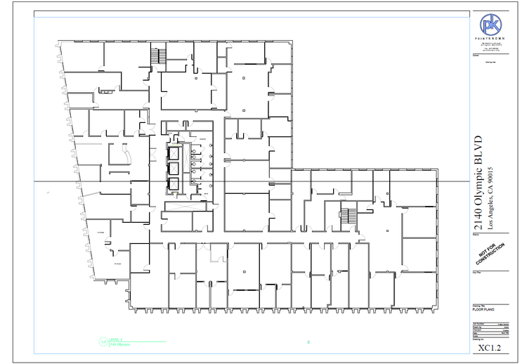
For this Los Angeles project, Pointknown combined PKNAIL workflows, terrestrial laser scanning, and targeted photographic documentation to capture the building accurately and efficiently. The result was a coordinated digital record and full Revit model that provided the project team with a dependable foundation for planning, renovation, and future design work.
Building a dependable digital foundation for future work.
Projects like this demonstrate how accurate existing-conditions documentation supports teams long before design work begins.
Pointknown was brought in to capture the property's exterior shell, interior spaces, and critical building conditions using a coordinated field workflow built around laser scanning, photography, and structured documentation.
The collected information was translated into a full Revit model, creating a reliable digital baseline for planning, renovation, and future decision-making.

Coordinated field data transformed into a design-ready digital representation of the property.
Reliable decisions begin with reliable information.
Olympic Boulevard was originally known as 10th Street. In preparation for hosting the 1932 Summer Olympics, the City of Los Angeles transformed the narrow, 40-foot-wide route into a massive 100-foot-wide thoroughfare to accommodate expected traffic
A complete existing conditions package, from reality capture to usable deliverables.
This Los Angeles commercial building project combined terrestrial laser scanning, field photography, and PKNAIL workflows to create a coordinated Revit model from verified field data, demonstrating Pointknown's ability to deliver design-ready documentation on projects across the country.


The value is not in the scan itself. It is in what your team can do next.
Design-ready deliverables
Measured information is structured into clean Revit and CAD outputs so architects, owners, and developers can move quickly.
Clear communication
Pointknown focuses on clarity. The process stays in the background. The usable result stays front and center.
One source of truth
A single field effort supports visualization, planning, modeling, and documentation—without repeated site visits or fragmented information.
If you are planning, renovating, leasing, or evaluating a building, clear existing conditions matter.
Pointknown helps design teams and property stakeholders move forward with confidence by turning existing buildings into usable, decision-ready information.