

Needham Office
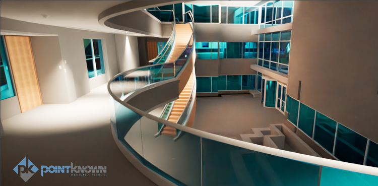
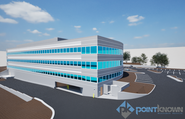
Pointknown provided comprehensive reality capture and existing-conditions documentation services for an office building in Needham, Massachusetts. The project focused on creating an accurate digital representation of the property to support renovation planning, design coordination, leasing analysis, and future building improvements.
Needham has evolved into a growing commercial and professional hub within the Greater Boston area, with many office properties undergoing modernization, interior reconfiguration, and adaptive reuse to meet changing workplace needs. Accurate building documentation plays an important role in helping owners and design teams plan upgrades efficiently while minimizing disruptions and unknown conditions.
A complete existing conditions package, from reality capture to usable deliverables.
This project combined laser scanning, reality capture, and BIM modeling to produce a highly accurate digital twin of the property. The resulting dataset supports space planning, renovation analysis, leasing evaluation, and long-term facility management while reducing the need for repeat site visits and manual measurements.


The value is not in the scan itself. It is in what your team can do next.
Design-ready deliverables
Measured information is structured into clean Revit and CAD outputs so architects, owners, and developers can move quickly.
Clear communication
Pointknown focuses on clarity. The process stays in the background. The usable result stays front and center.
One source of truth
A single field effort supports visualization, planning, modeling, and documentation—without repeated site visits or fragmented information.
If you are planning, renovating, leasing, or evaluating a building, clear existing conditions matter.
Pointknown helps design teams and property stakeholders move forward with confidence by turning existing buildings into usable, decision-ready information.