MONUMENT STREET · CONCORD

Monument Street Concord

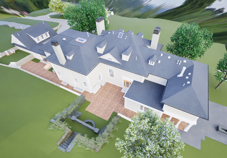
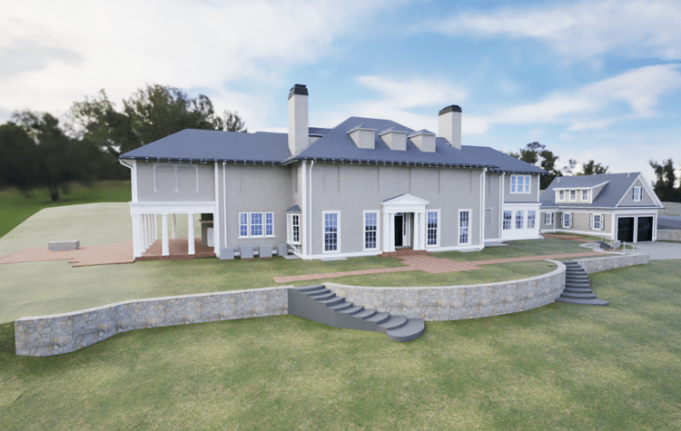
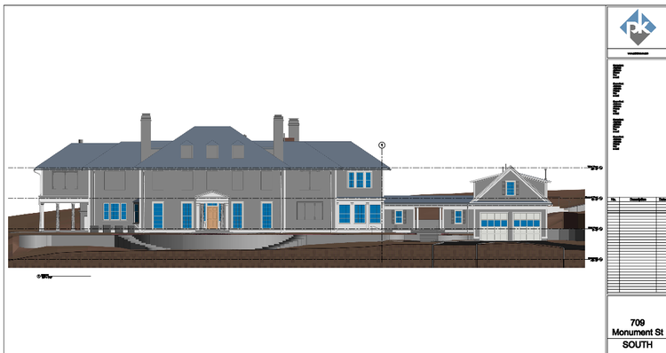
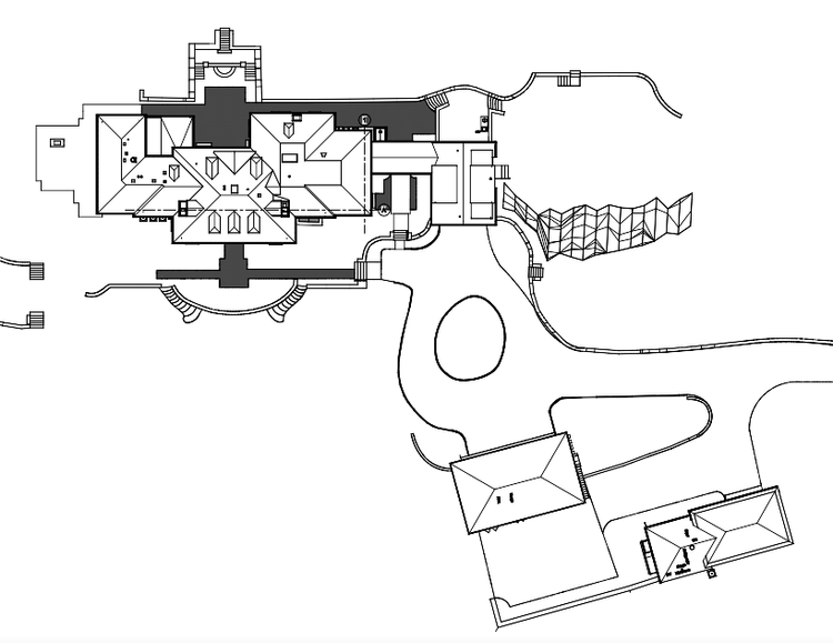
At Pointknown, we specialize in documenting existing buildings with the level of precision today’s projects require. Our work along Monument Street in Concord, Massachusetts combined LiDAR scanning, drone capture, 360° photography, and Revit-ready modeling to create a reliable foundation for renovation planning on a historically significant estate.

9,443 SF Residence
Historic Estate (1903)
5025 Acres
Project Type
Historic Residence
Deliverables
Point Cloud + Revit Model + Ortophotos + 360 Walkthrough
Location
Concord, MA
Use Case
Renovation & Planning
Measured once. Delivered ready for design.
What was documented
We captured the full existing conditions of the building using a combination of high-density laser scanning workflows. Multiple SLAM-based scans were completed across the interior and exterior, supplemented by high-definition terrestrial LiDAR (Faro Focus) to ensure full coverage of structural and architectural details. All datasets were registered into a unified coordinate system to create a complete representation of the property.
What was delivered
The final deliverable was a fully developed Revit model generated from a clean, registered point cloud dataset. This model captures the building’s architectural and structural conditions with high accuracy, providing a dependable foundation for future renovation, analysis, and documentation needs.
Why it matters
Healthcare and institutional buildings require precise, verified existing conditions due to their complexity and operational constraints. Accurate documentation reduces uncertainty, minimizes field rework, and supports safer, faster decision-making during planning and upgrades.
PROJECT HIGHLIGHTS

A complete existing conditions package, from reality capture to usable deliverables.

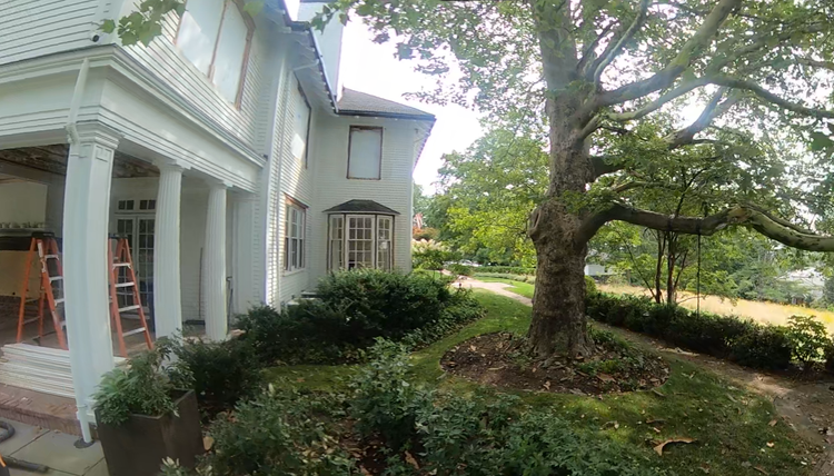
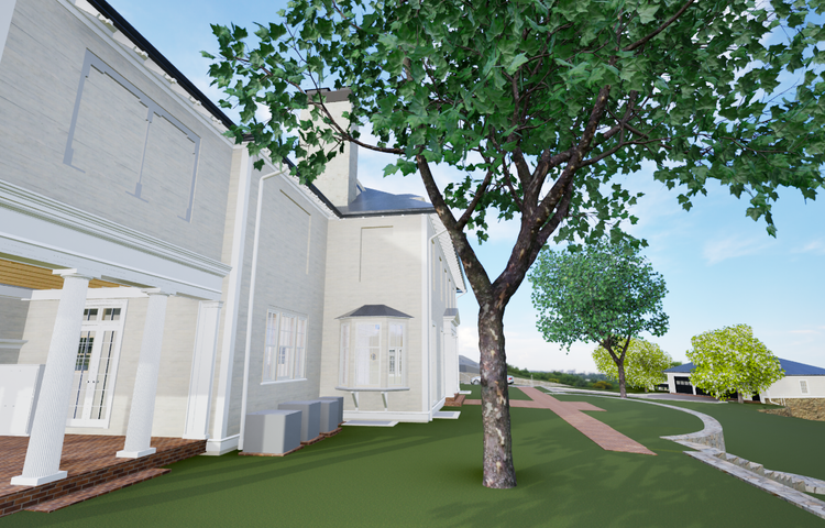
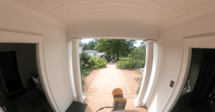
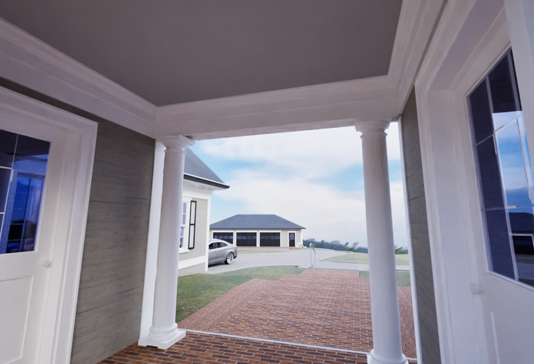
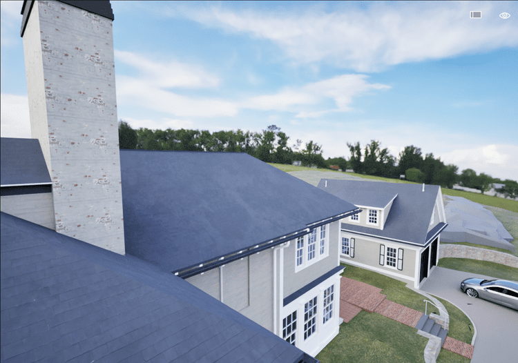
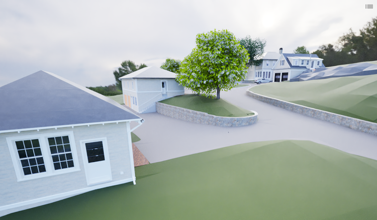
We captured the entire estate, including interior spaces, exterior façades, outbuildings, and surrounding site conditions. Drone imaging provided roof geometry and full site context, while 360° photography preserved spatial and material reference throughout the property.

Project highlight
Project highlight
Project highlight
Project highlight
Project highlight
Project highlight
Project highlight
Project highlight
Project highlight
Project highlight
Project highlight
Project highlight
Project highlight
WHY POINTKNOWN

The value is not in the scan itself. It is in what your team can do next.

Design-ready deliverables

Measured information is structured into clean Revit and CAD outputs so architects, owners, and developers can move quickly.

Clear communication

Pointknown focuses on clarity. The process stays in the background. The usable result stays front and center.

One source of truth

A single field effort supports visualization, planning, modeling, and documentation—without repeated site visits or fragmented information.

Interested in something similar?

If you are planning, renovating, leasing, or evaluating a building, clear existing conditions matter.

Pointknown helps design teams and property stakeholders move forward with confidence by turning existing buildings into usable, decision-ready information.