

Marston Mills
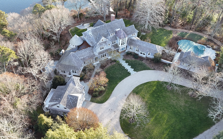
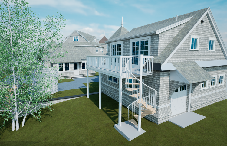
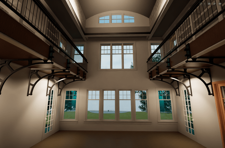
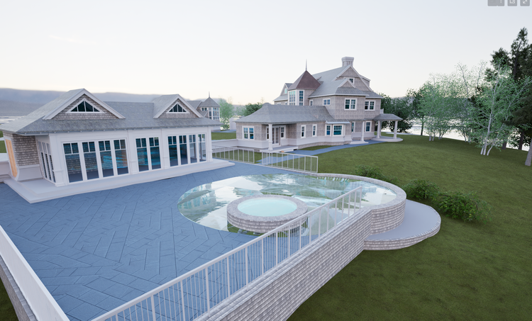
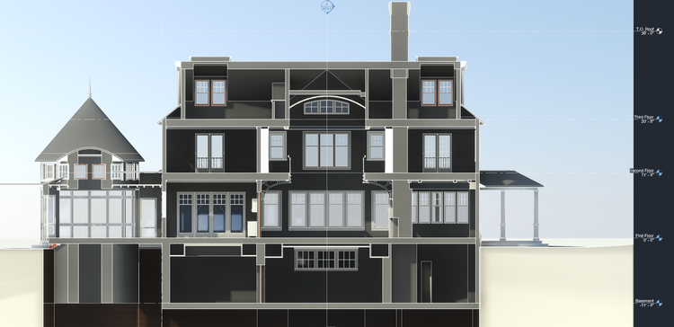
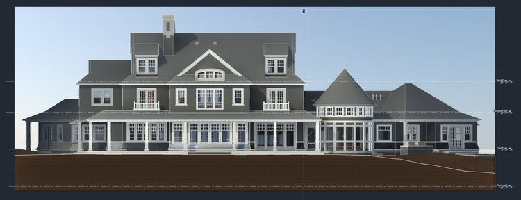
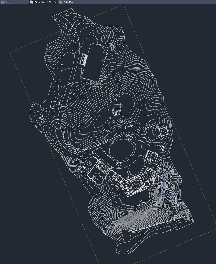
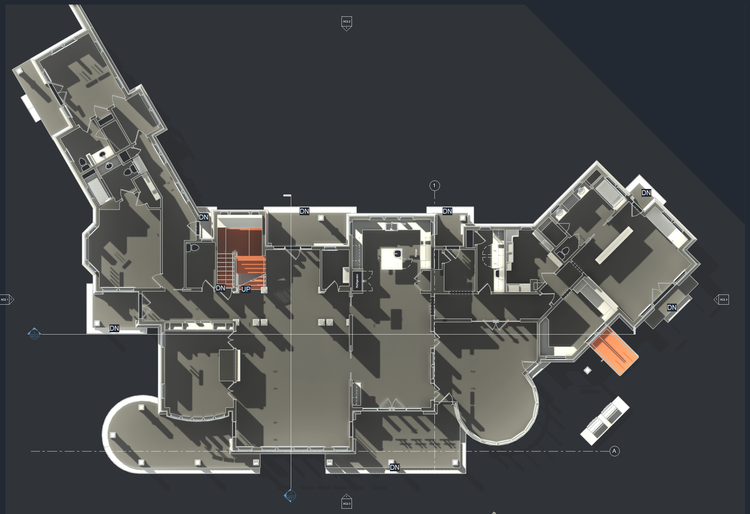
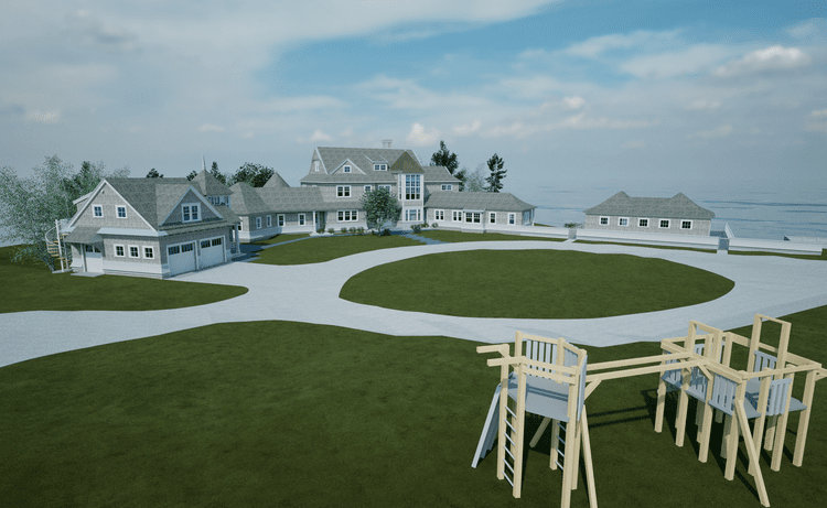
This project involved comprehensive existing‑conditions documentation of a multi‑acre coastal estate in Marston Mills, Cape Cod, Massachusetts. The scope extended well beyond a single structure—capturing the entire site and multiple buildings with a level of detail that allowed the design team to move immediately into planning, analysis, and future design work. Set directly along the coast, the property includes a main residence, carriage house, pool house, tennis court, and landscaped grounds, all of which were captured, modeled, and coordinated into a unified digital dataset.
A complete existing conditions package, from reality capture to usable deliverables.
A complete multi-acre existing conditions package capturing both architecture and landscape, delivered through high-accuracy reality capture and detailed modeling—providing a design-ready foundation of buildings, terrain, and spatial relationships for coordinated planning and visualization.
The value is not in the scan itself. It is in what your team can do next.
Design-ready deliverables
Measured information is structured into clean Revit and CAD outputs so architects, owners, and developers can move quickly.
Clear communication
Pointknown focuses on clarity. The process stays in the background. The usable result stays front and center.
One source of truth
A single field effort supports visualization, planning, modeling, and documentation—without repeated site visits or fragmented information.
If you are planning, renovating, leasing, or evaluating a building, clear existing conditions matter.
Pointknown helps design teams and property stakeholders move forward with confidence by turning existing buildings into usable, decision-ready information.