MANCHESTER BY THE SEA · MA

Manchester by the Sea

In 
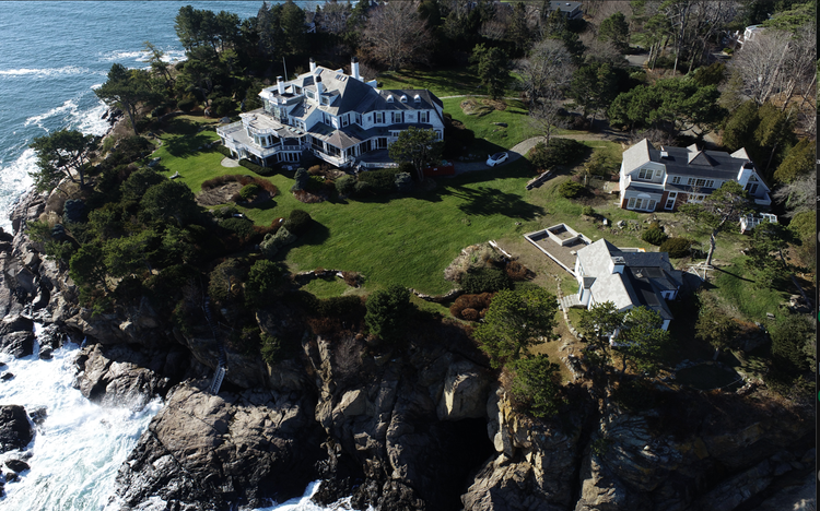
Manchester-by-the-Sea
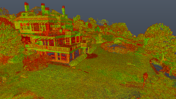
, MA, Pointknown documented a coastal residential property defined by complex site conditions, including landscape, hardscape, and dramatic topography with a cliff walk and retaining wall. The project focused on capturing the full relationship between the home and its surrounding environment.

Waterfront Residence
Revit Model + CAD Plans
Project Type
Residential
Deliverables
Revit Model + CAD Plans
Location
Manchester by the Sea, MA
Use Case
Planning & Design
Measured once. Delivered ready for design.
What was documented
Our team utilized SLAM-based laser scanning, drone photogrammetry, 360° imagery, and field-verified control measurements to capture the full property. The workflow documented the residence, surrounding terrain, circulation paths, exterior site features, elevation changes, and waterfront edge conditions as one integrated digital environment.
What was delivered
Pointknown delivered a coordinated Revit model along with 3D CAD exports, 2D CAD views, and a SketchUp model to support architectural design, visualization, and planning workflows. The resulting deliverables provided the project team with accurate existing-conditions data ready for renovation, analysis, and future development coordination.
Why it matters
Waterfront and cliffside properties present unique challenges involving terrain variation, erosion-sensitive conditions, and complex relationships between built and natural elements. Accurate documentation of both the residence and surrounding landscape helps architects, engineers, and contractors make informed decisions while reducing risk during planning and construction.
PROJECT HIGHLIGHTS

A complete existing conditions package, from reality capture to usable deliverables.

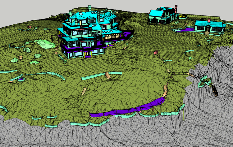
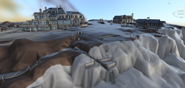
This project combined terrestrial scanning and aerial mapping to create a unified digital twin of a highly complex coastal site. By capturing the residence alongside the cliff walk, retaining walls, and shoreline topography, Pointknown provided the design team with a complete understanding of the property’s architectural and environmental context.

Project highlight

Project highlight

Project highlight

Project highlight

Project highlight

Project highlight

Project highlight

Project highlight

Project highlight

Project highlight

Project highlight

Project highlight

Project highlight

Project highlight

Project highlight

Project highlight

Project highlight

WHY POINTKNOWN

The value is not in the scan itself. It is in what your team can do next.

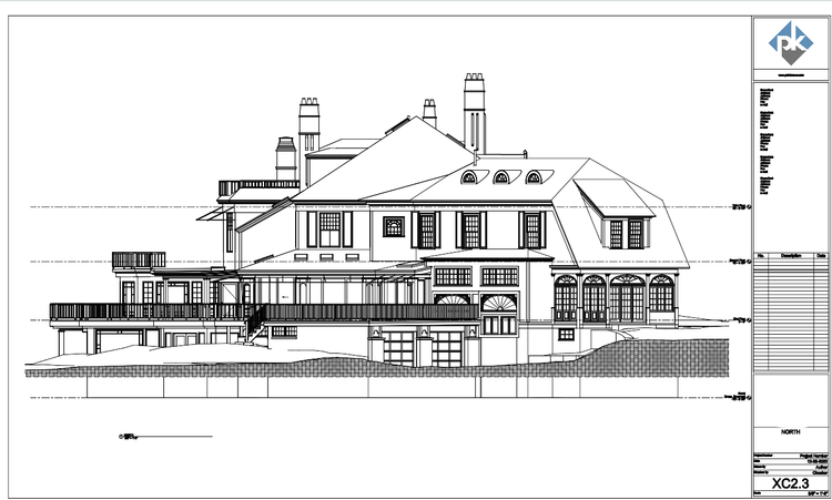
Design-ready deliverables

Measured information is structured into clean Revit and CAD outputs so architects, owners, and developers can move quickly.

Clear communication

Pointknown focuses on clarity. The process stays in the background. The usable result stays front and center.

One source of truth

A single field effort supports visualization, planning, modeling, and documentation—without repeated site visits or fragmented information.

Interested in something similar?

If you are planning, renovating, leasing, or evaluating a building, clear existing conditions matter.

Pointknown helps design teams and property stakeholders move forward with confidence by turning existing buildings into usable, decision-ready information.