

Lexington Center
What began as a request for existing floor plans at Lexington Center evolved into a long-term example of how accurate reality capture can continue delivering value throughout the life of a project. Pointknown initially documented the property using 3D laser scanning to create detailed floor plans from a single field visit. As the project expanded over time, the same dataset was reused to provide additional services—including space calculations and eventually a full Revit model with reflected ceiling plan information—without requiring return site visits. By capturing once and capturing thoroughly, Pointknown created a flexible digital foundation that continued supporting the client as project needs evolved.
Capture once.
Keep building from it.
For Lexington Center, Pointknown used 3D laser scanning to create a detailed record of the existing building from a single comprehensive site visit. The initial goal was straightforward: accurate floor plans. But the value of the capture extended far beyond that first deliverable.
As project needs evolved, the same dataset was reused for space calculations and later developed into a full Revit model with reflected ceiling plan information. By capturing the building thoroughly from the start, Pointknown gave the client a reliable digital foundation that could support planning, coordination, and future design work without requiring repeated site visits.
One capture. A building the team can keep working from.
The 3D laser scan created a detailed record of Lexington Center that could be revisited as project needs changed. What began as floor plan documentation became a reusable foundation for space calculations, coordination, and a full Revit model without requiring another site visit.
A coordinated package from capture to project handoff
The process goes beyond documenting individual spaces. Pointknown captured the existing conditions at Lexington Center, translated that information into usable digital models and documentation, and organized the results to support renovation, planning, and future design decisions.
Capture
Document the existing conditions — Pointknown captured the building geometry, interior spaces, architectural elements, and key conditions needed to understand the existing Lexington Center environment accurately.
Translate
Turn field information into usable documentation — Existing conditions were translated into coordinated digital model information and drawing outputs that provide a reliable foundation for renovation, planning, and design development.
Share
Give the team a dependable starting point — The completed documentation provides project stakeholders with a clear reference for existing geometry, spatial relationships, and conditions as the Lexington Center continues to evolve.
Existing conditions captured from street context to design-ready documentation
A coordinated documentation package combining field capture, point cloud data, Revit modeling, and technical drawing outputs to give the team a clear understanding of Lexington Center's existing conditions.
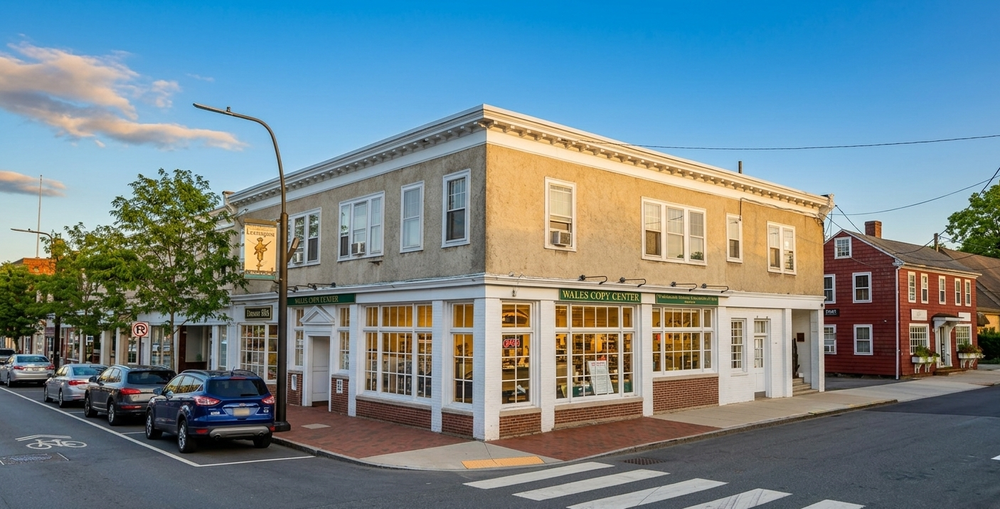
The building understood in its real-world setting
Exterior documentation places Lexington Center within its Massachusetts Avenue context, helping establish the building's scale, frontage, and relationship to the surrounding streetscape.
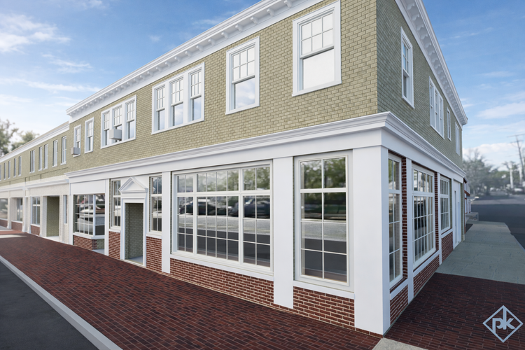
Exterior geometry captured clearly
The existing conditions model documents the building's exterior form, storefront rhythm, scale, and relationship to Massachusetts Avenue.
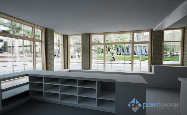
Interior conditions made legible
Interior model views provide a clear reference for existing spaces, layouts, and architectural relationships within the center.
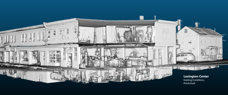
Existing conditions captured in the field
Point cloud data provides the measured foundation behind the documentation, capturing the building's existing geometry for accurate modeling and reference.
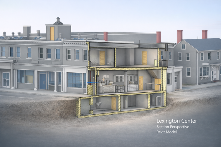
Interior and exterior relationships in one view
A coordinated Revit perspective brings interior spaces, exterior geometry, and building relationships together for easier review and coordination.
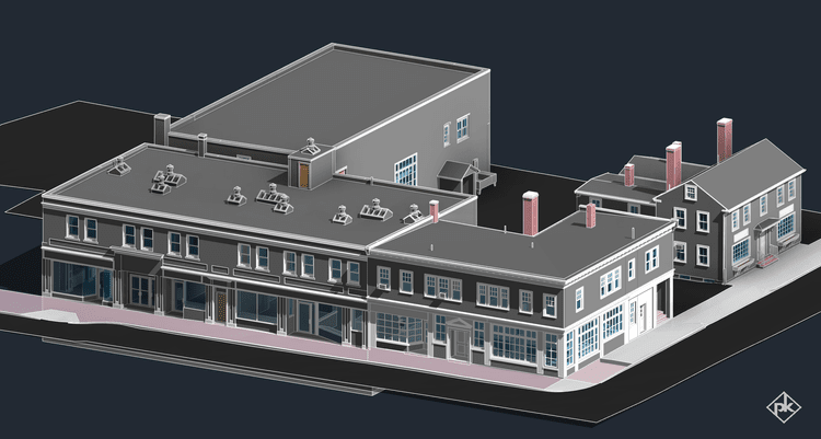
A complete digital foundation for planning
The completed Revit model brings the documented building together into a coordinated reference that can support planning, renovation, coordination, and future design development.
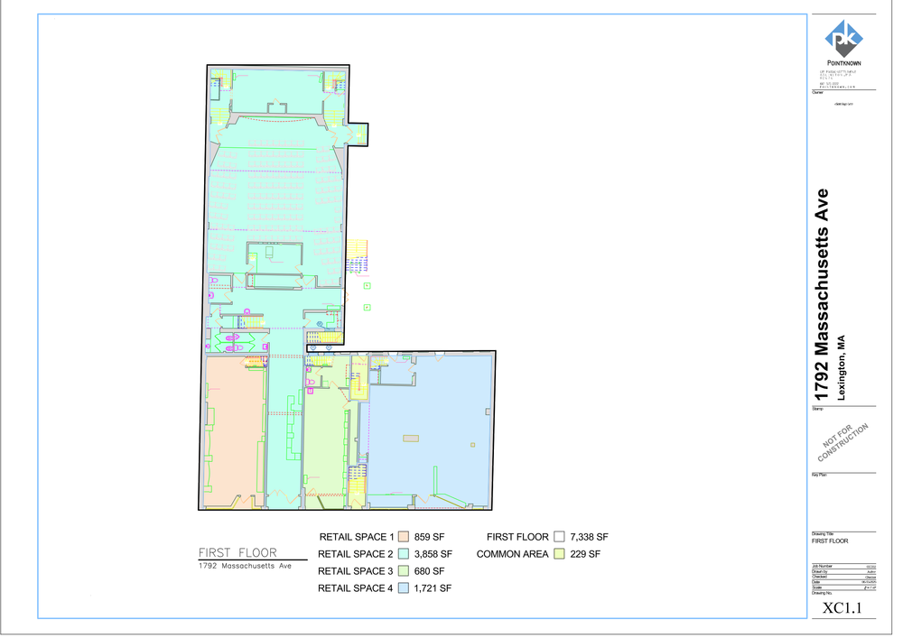
Technical documentation ready for use
Detailed CAD documentation provides a practical reference for layout, circulation, space organization, and existing building conditions.
Turn existing conditions into a reliable design reference
Lexington Center is an active mixed-use environment where existing building conditions, tenant spaces, storefronts, circulation, and architectural relationships all need to be understood before design work moves forward. Pointknown's documentation brings those conditions into one coordinated digital reference.
The value is not only in the model. It is in making the existing building easier to understand.
For a complex center with multiple spaces and active commercial conditions, design decisions depend on having a clear understanding of what exists. Coordinated field capture, point cloud information, Revit modeling, and drawing outputs turn existing conditions into information the project team can review, coordinate, and build from.
The information needed to move the project forward
The value is not one file type. The value is having coordinated existing-condition information that gives the project team multiple ways to understand the building, review the documentation, and begin design from a reliable starting point.
Revit Existing-Conditions Model
Coordinated digital building information providing a reliable foundation for planning, design development, and future project coordination.
Point Cloud Capture
Registered field-capture data preserving the measured conditions behind the model and providing a detailed reference for existing geometry.
CAD Floor Plans
Organized plan documentation showing layouts, circulation, spaces, and existing conditions in a format suited to technical review.
Presentation Plans
Cleaned plan graphics that make the building layout and space relationships easier to review, communicate, and understand.
Coordinated Model Views
Interior, exterior, and section perspectives provide additional context for understanding the building beyond two-dimensional drawings alone.
Experience shows up in the handoff
The best documentation teams do not simply collect data. They know what matters, what to ignore, what to model, what to share, and how to package it so the next team can work.
We scope for the decision ahead
Each capture effort is shaped around what the client, architect, consultants, and builder need to understand next.
We know the deliverable ecosystem
Revit, CAD, SketchUp, PDF, drone media, 360 photography, and shared file structures all play different roles.
We make complex properties easier to communicate
The goal is not to show every piece of data. The goal is to make the right information accessible, clear, and usable.
If you are planning, renovating, leasing, or evaluating a building, clear existing conditions matter.
Pointknown helps design teams and property stakeholders move forward with confidence by turning existing buildings into usable, decision-ready information.