

Kimball Farm
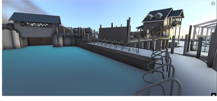
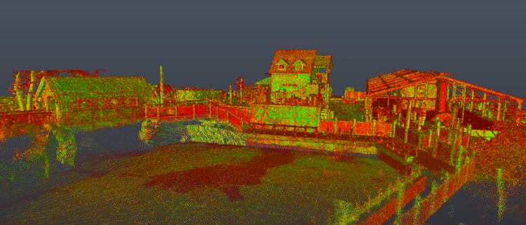
Pointknown documented Kimball Farm in Westford, Massachusetts, capturing a diverse mix of structures, hardscape, bridge elements, and portions of a historic mill building containing antiquated equipment. The project focused on creating a complete digital representation of the property to support planning, preservation, renovation, and future development efforts.
Kimball Farm is one of the region’s best-known family destinations, blending historic New England farm character with entertainment, dining, and recreational spaces. Properties like this often evolve over decades, creating a layered environment where historic structures, modern additions, and outdoor infrastructure coexist within a single site.
A complete existing conditions package, from reality capture to usable deliverables.
This project integrated SLAM laser scanning, drone mapping, and detailed visual documentation to capture a property that combines historic mill elements, active public spaces, and extensive site infrastructure. The result is a highly adaptable digital twin that supports planning, visualization, and long-term asset management across the entire property.


The value is not in the scan itself. It is in what your team can do next.
Design-ready deliverables
Measured information is structured into clean Revit and CAD outputs so architects, owners, and developers can move quickly.
Clear communication
Pointknown focuses on clarity. The process stays in the background. The usable result stays front and center.
One source of truth
A single field effort supports visualization, planning, modeling, and documentation—without repeated site visits or fragmented information.
If you are planning, renovating, leasing, or evaluating a building, clear existing conditions matter.
Pointknown helps design teams and property stakeholders move forward with confidence by turning existing buildings into usable, decision-ready information.