

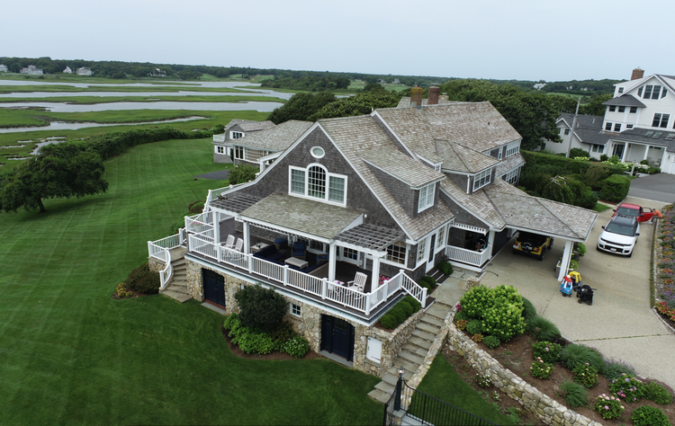
Hyannisport Residence
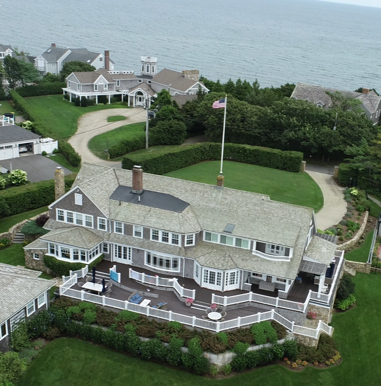
Pointknown was engaged to document a classic coastal residence in Hyannis Port, Massachusetts in preparation for upcoming renovations. Located just steps from the water, the home required precise existing-conditions documentation to support future design planning while preserving its coastal character and architectural integrity.
Hyannis Port, Massachusetts is one of Cape Cod’s most recognized waterfront communities, known for its historic seaside homes, maritime heritage, and long-standing association with prominent New England families. The area’s architecture reflects generations of coastal living, where preservation and thoughtful renovation continue to shape the character of the neighborhood.
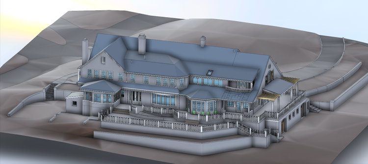
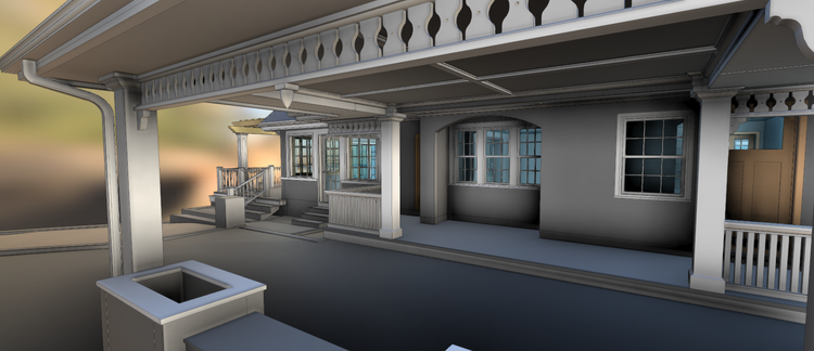
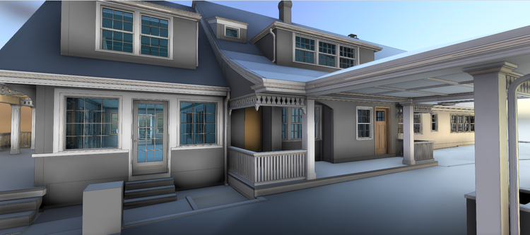
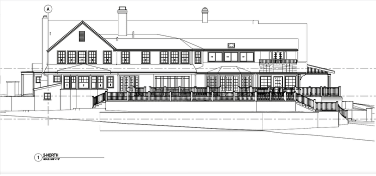
A complete existing conditions package, from reality capture to usable deliverables.
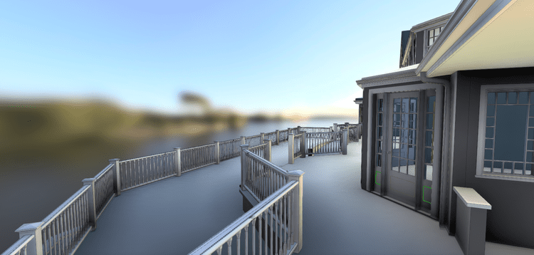
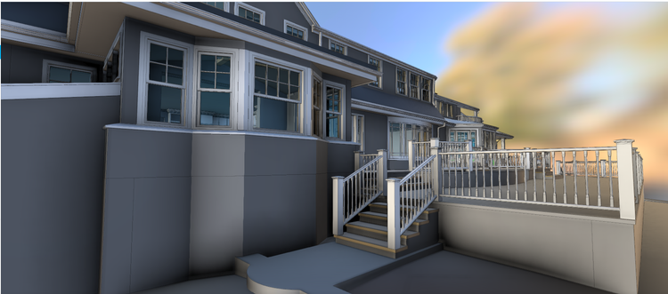
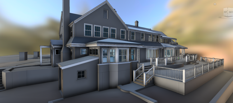
This project combined high-precision terrestrial scanning with aerial capture methods to efficiently document a waterfront property with complex exterior conditions and outdoor living spaces. The inclusion of decks, façade geometry, and shoreline context provided a comprehensive understanding of how the residence interacts with its coastal setting.


The value is not in the scan itself. It is in what your team can do next.
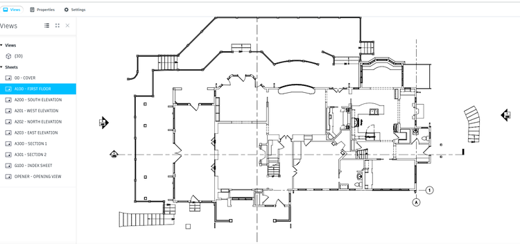
Design-ready deliverables
Measured information is structured into clean Revit and CAD outputs so architects, owners, and developers can move quickly.
Clear communication
Pointknown focuses on clarity. The process stays in the background. The usable result stays front and center.
One source of truth
A single field effort supports visualization, planning, modeling, and documentation—without repeated site visits or fragmented information.
If you are planning, renovating, leasing, or evaluating a building, clear existing conditions matter.
Pointknown helps design teams and property stakeholders move forward with confidence by turning existing buildings into usable, decision-ready information.