RADCLIFFE QUADRANGLE · CAMBRIDGE MA

Harvard University

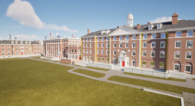
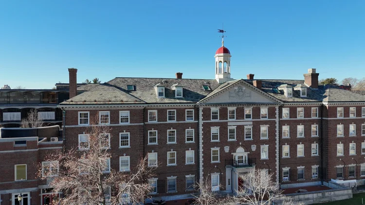
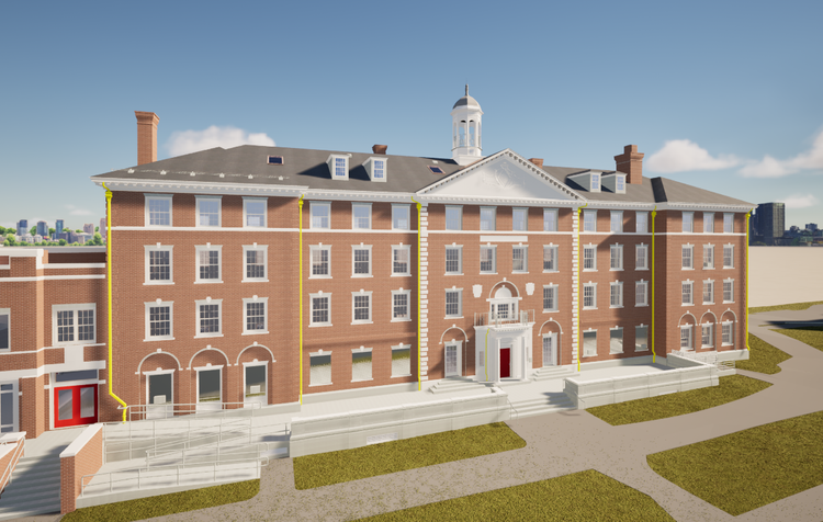
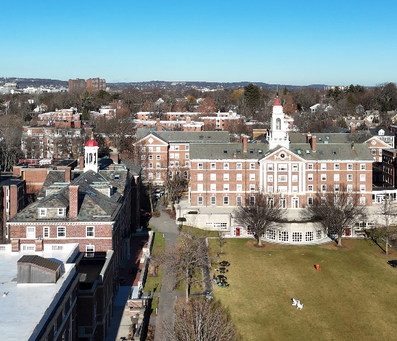
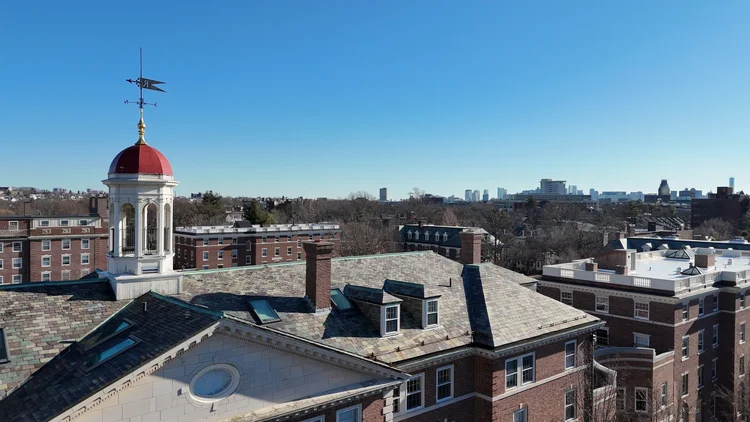
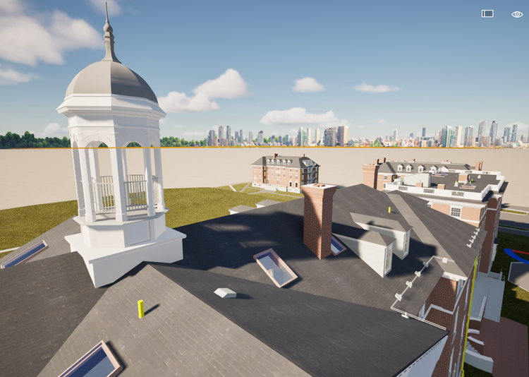
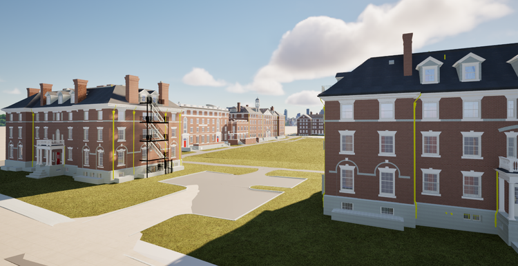
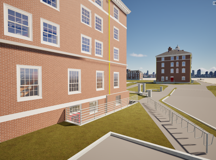
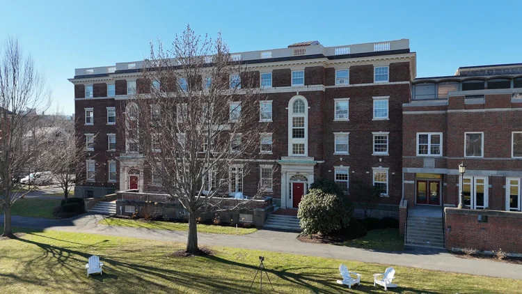
At the heart of Harvard University’s historic Radcliffe Yard campus in Cambridge, Massachusetts, our team at Pointknown was commissioned by the architectural firm ARC to deliver full-existing-conditions documentation across several key buildings: Cabot House, Holmes Hall, Bertram Hall, and Eliot Hall.

3D Laser Scanning & BIM Modeling
Revit/BIM models
Project Type
Academic
Deliverables
Revit Model + 2D CAD
Location
Cambridge, MA
Use Case
Maintenance, Renovation, Digital-Asset Management
Measured once. Delivered ready for design.
THE CHALLENGE
The client required high-fidelity Revit/BIM models to support upcoming renovation and adaptive reuse work on these early 20th-century structures. Traditional field-measurement methods posed risks of inaccuracy, extended timelines and cost-drift amid active campus operations.
What was documented
Our team captured the full building exteriors and key interior spaces using a hybrid reality capture workflow that combined terrestrial LiDAR scanning, SLAM-based mobile scanning, drone photogrammetry, and field verification measurements. Roof structures, façades, circulation spaces, and architectural detailing were all documented and registered into a unified point cloud dataset aligned to the campus coordinate system.
What was delivered
Pointknown delivered coordinated Revit/BIM models for Cabot House along with supporting interior and exterior models for Holmes Hall, Bertram Hall, and Eliot Hall. The deliverables also included registered point clouds, photo datasets for QA/QC, and 2D CAD exports such as plans and interior elevations for design and documentation workflows.
Why it matters
Historic academic buildings require a high level of accuracy due to layered renovations, structural complexity, and ongoing campus operations. By providing a unified and verified digital twin of multiple structures, the project enables architects and engineers to move directly into design phases with confidence, reducing uncertainty, site re-visits, and coordination delays.
PROJECT HIGHLIGHTS

A complete existing conditions package, from reality capture to usable deliverables.

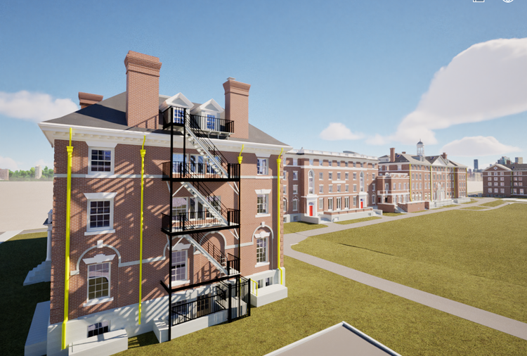
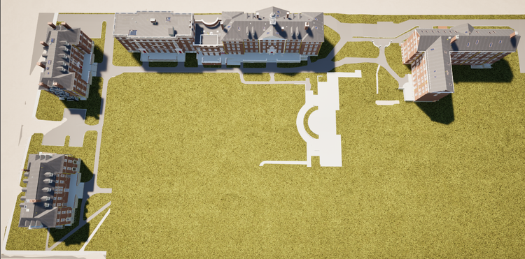
This project demonstrates the value of campus-scale coordination across multiple historic buildings. By integrating LiDAR, SLAM, and drone capture into a single workflow, Pointknown delivered a consistent and interconnected dataset that supports both individual building renovations and broader campus planning initiatives.

Project highlight

Project highlight

Project highlight

Project highlight

Project highlight

Project highlight

Project highlight

Project highlight

Project highlight

Project highlight

Project highlight

Project highlight

WHY POINTKNOWN

The value is not in the scan itself. It is in what your team can do next.

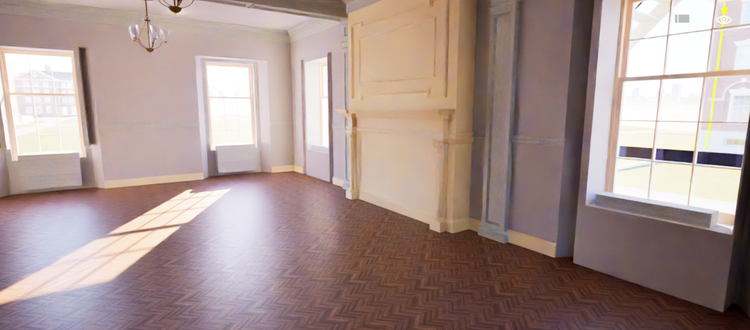
Design-ready deliverables

Measured information is structured into clean Revit and CAD outputs so architects, owners, and developers can move quickly.

Clear communication

Pointknown focuses on clarity. The process stays in the background. The usable result stays front and center.

One source of truth

A single field effort supports visualization, planning, modeling, and documentation—without repeated site visits or fragmented information.

Interested in something similar?

If you are planning, renovating, leasing, or evaluating a building, clear existing conditions matter.

Pointknown helps design teams and property stakeholders move forward with confidence by turning existing buildings into usable, decision-ready information.