

Franklin Mill
Working for a developer and architect team, Pointknown provided full existing conditions documentation for this mixed-use industrial and commercial property at 305 Union Street. The scope combined mobile LiDAR, terrestrial scanning, drone capture, 360 imagery, surrounding topo and hardscape documentation, and a full Revit model of the site and buildings.
Speed, accuracy, and smarter preservation planning.
The work gave the project team a reliable digital base for design, coordination, and decision-making. Accurate existing conditions documentation replaced assumption with measured information, reducing uncertainty and helping the team move faster with more confidence.
The documentation also supported preservation-minded redevelopment and helped preserve important exterior character — contributing to planning strategies tied to historical tax credit opportunities.
A complete existing conditions package, from reality capture to usable deliverables.
Franklin Mill showcases how reality capture can simplify highly complex industrial properties and transform them into organized, usable information. Instead of treating five interconnected mill buildings as separate structures, Pointknown documented the entire environment as a unified system. This approach provided a clearer understanding of relationships between floor levels, structural conditions, and site context while preserving the building’s historic character. By creating a reliable digital foundation early in the project, the team gained the ability to resolve challenges digitally before construction began—reducing uncertainty and supporting more efficient redevelopment planning.

Drone Aerial
Site-wide aerial capture providing roof, massing, and context information.
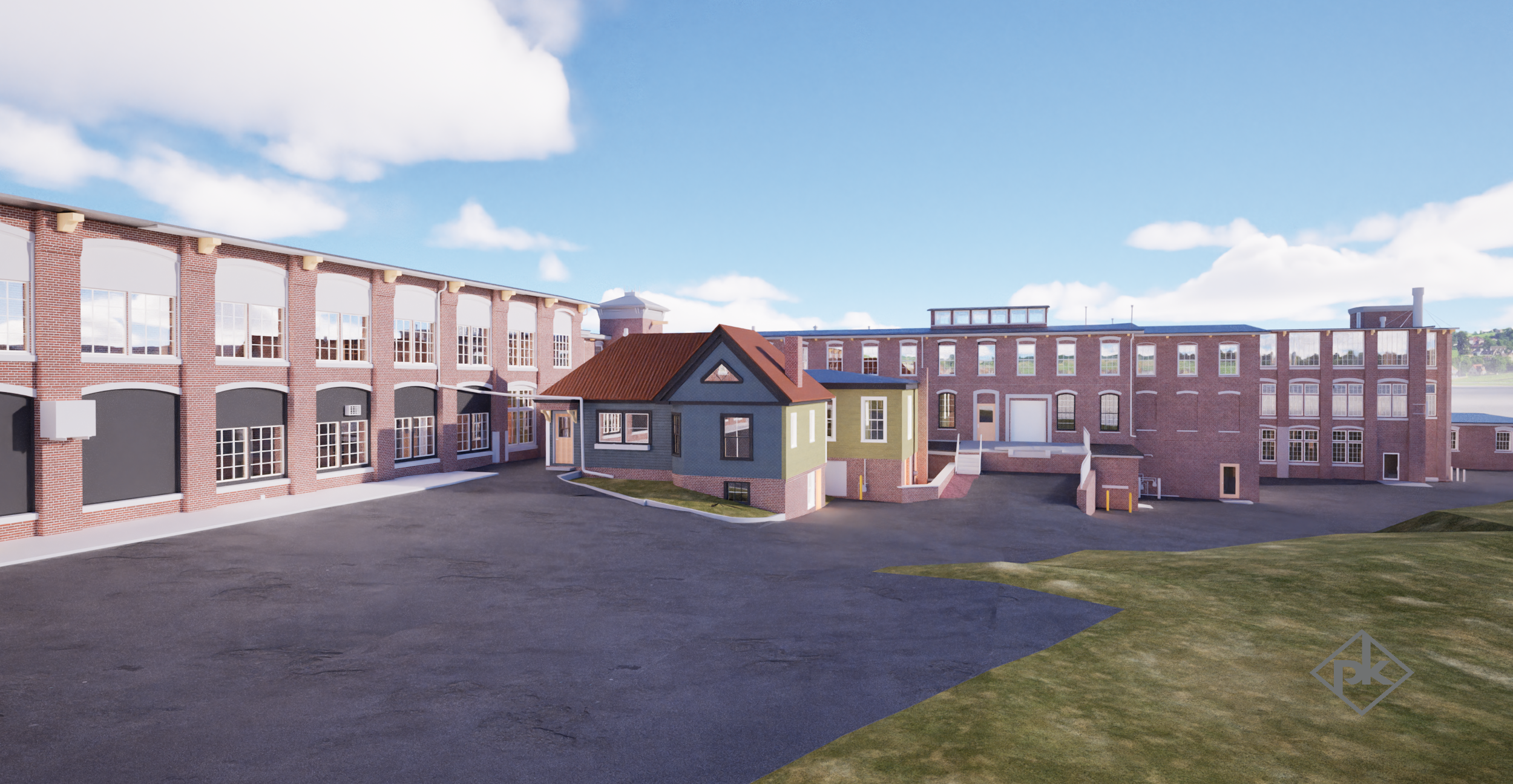
Exterior Render — Front
Visualization showing internal building relationships and redevelopment potential.

Exterior Render — Rear
Visualization documenting the rear utility zone, site conditions, and surrounding grade relationships.

Interior Render — Room View
Interior visualization showing daylight, historic window rhythm, and reuse character.

Interior Render — Open Floor Plate
Large open floor view capturing column spacing, structural rhythm, and adaptive reuse potential.
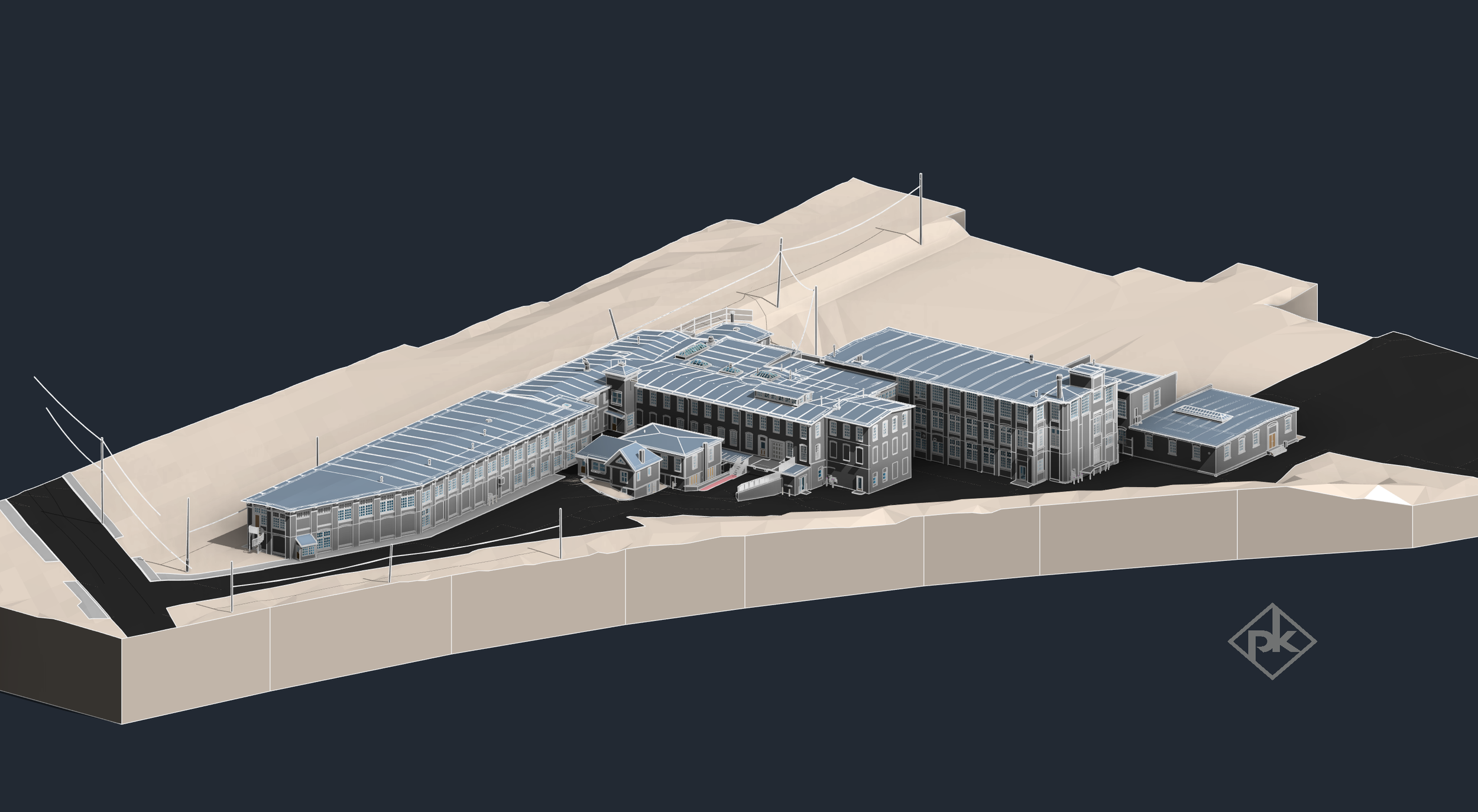
Full Revit Model
Overall 3D model view showing the interconnected mill complex and surrounding topographic context.
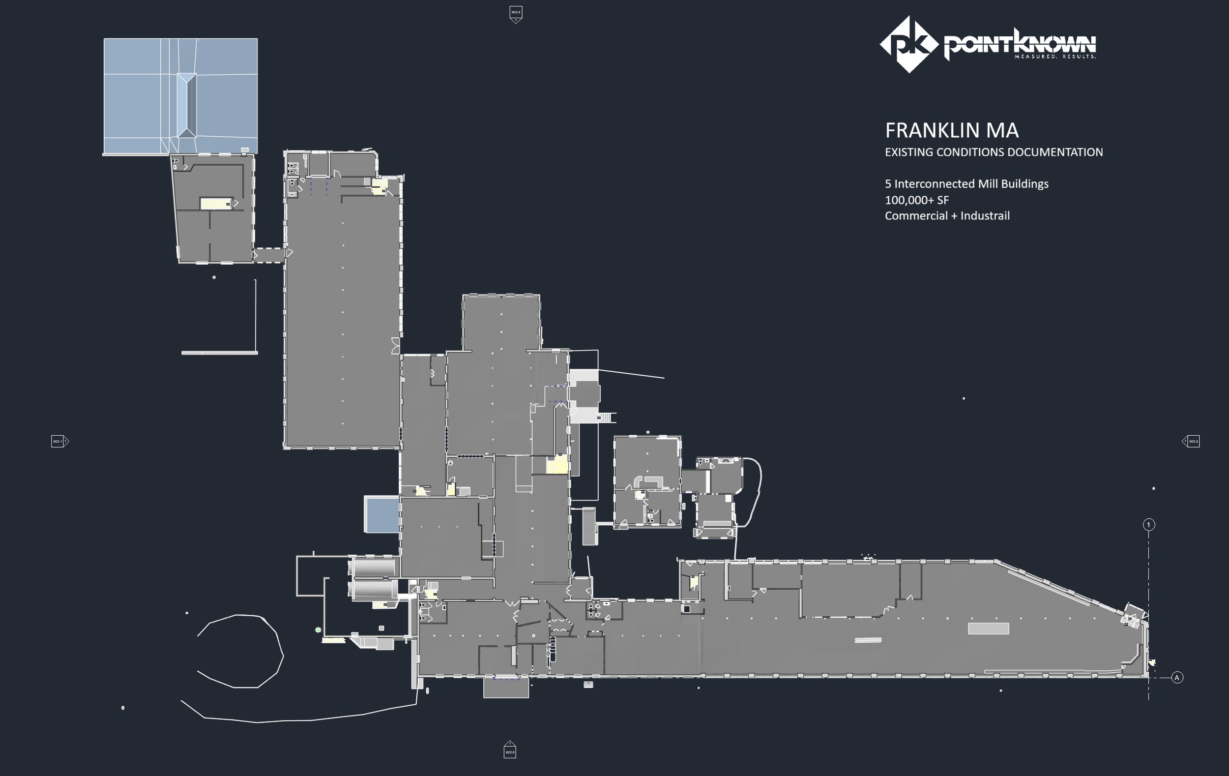
Presentation Floor Plan
Floor plan documentation used to support design coordination and redevelopment planning.
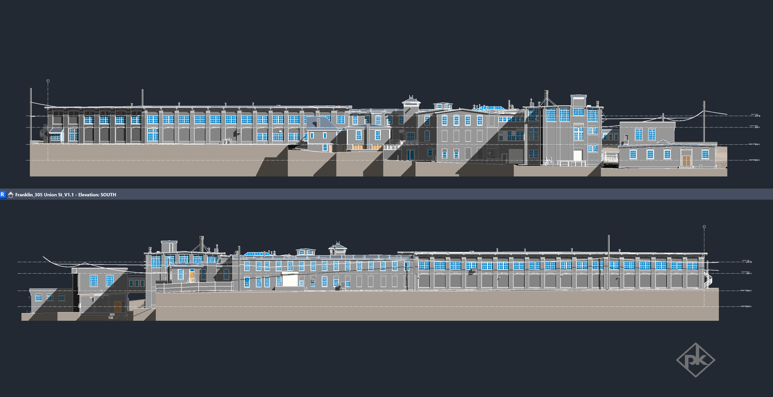
Architectural Elevations
Exterior elevation documentation capturing the as-built geometry and relationships across the building complex.
The value is not in the scan itself. It is in what your team can do next.
Design-ready deliverables
Measured information is structured into clean Revit and CAD outputs so architects, owners, and developers can move quickly.
Clear communication
Pointknown focuses on clarity. The process stays in the background. The usable result stays front and center.
One source of truth
A single field effort supports visualization, planning, modeling, and documentation—without repeated site visits or fragmented information.
If you are planning, renovating, leasing, or evaluating a building, clear existing conditions matter.
Pointknown helps design teams and property stakeholders move forward with confidence by turning existing buildings into usable, decision-ready information.