

Martha’s Vineyard Home
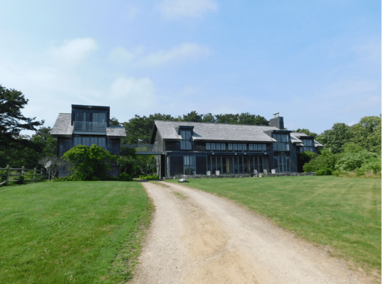
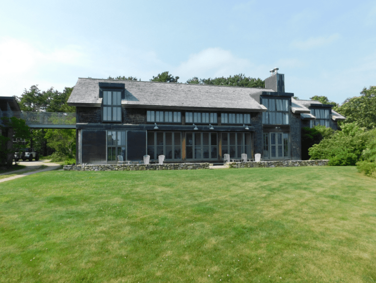
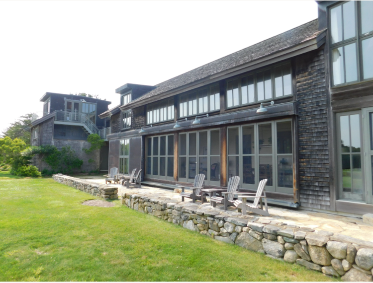
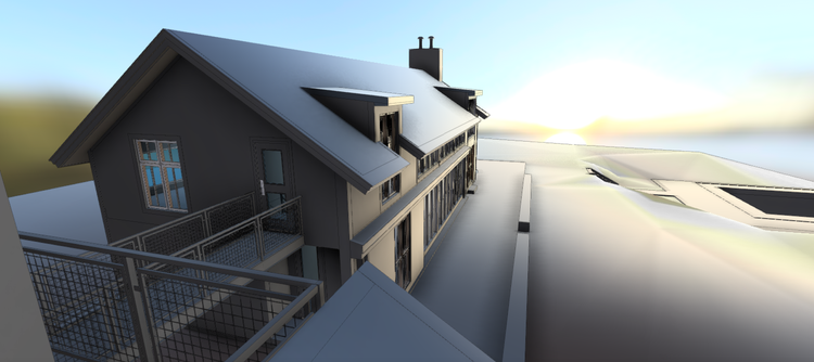
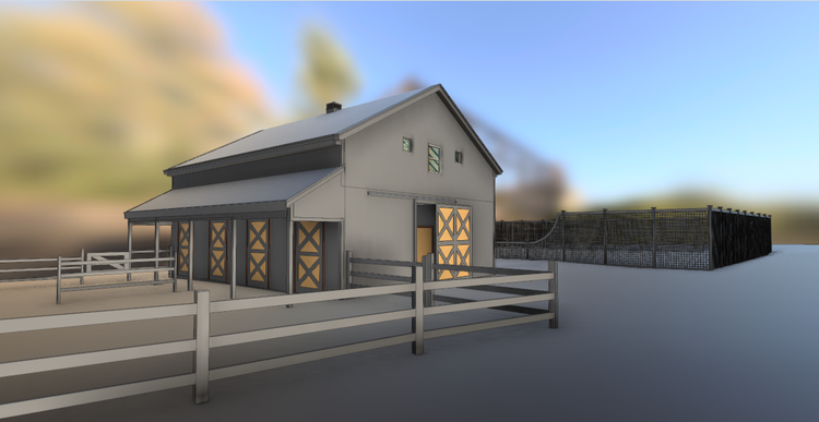
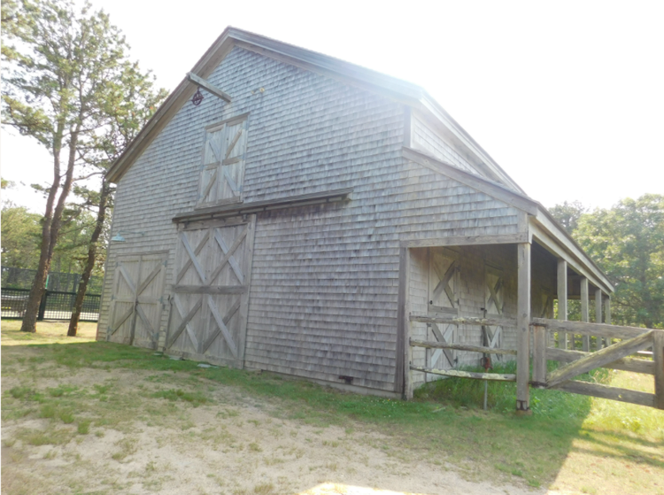
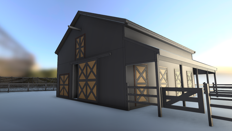
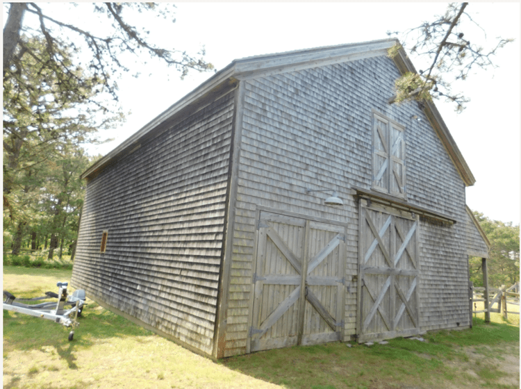
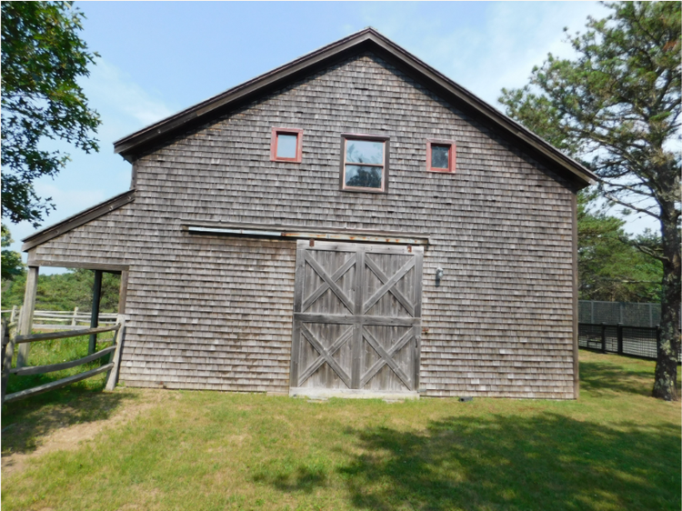
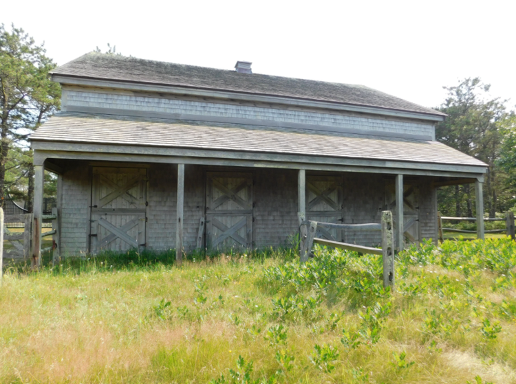
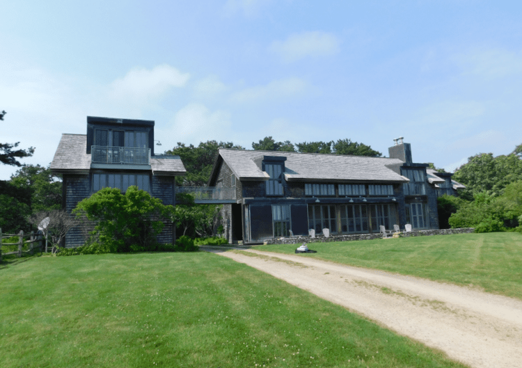
Pointknown documented a private residential property in Edgartown, Massachusetts on Martha’s Vineyard, capturing the main home, barn, and surrounding hardscape to create a complete, design-ready digital model. The project focused on delivering an accurate existing-conditions dataset to support planning, renovation, and long-term property management.
Edgartown is known for its coastal heritage, historic architecture, and carefully preserved residential character. Properties on Martha’s Vineyard often include a mix of primary homes, outbuildings, and landscaped grounds, requiring comprehensive documentation to fully understand spatial relationships and site conditions.
A complete existing conditions package, from reality capture to usable deliverables.
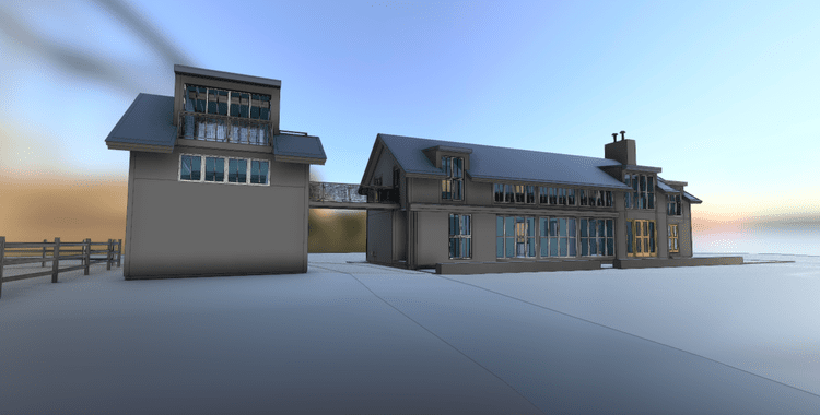
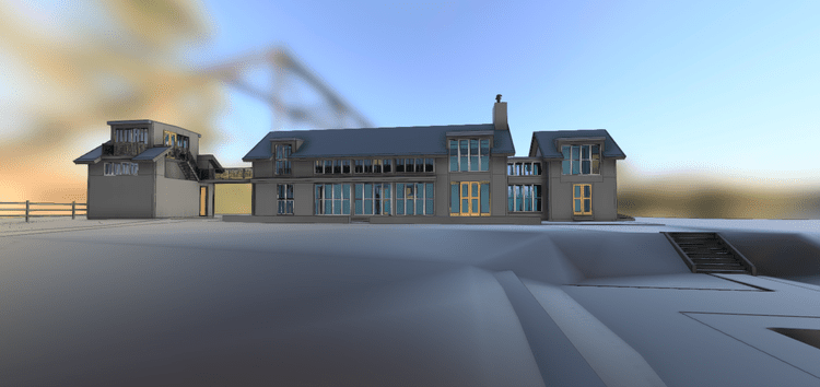
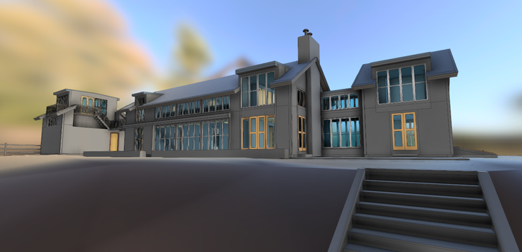
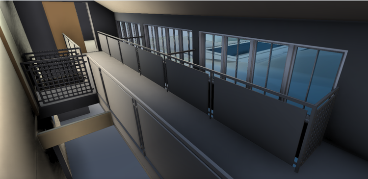
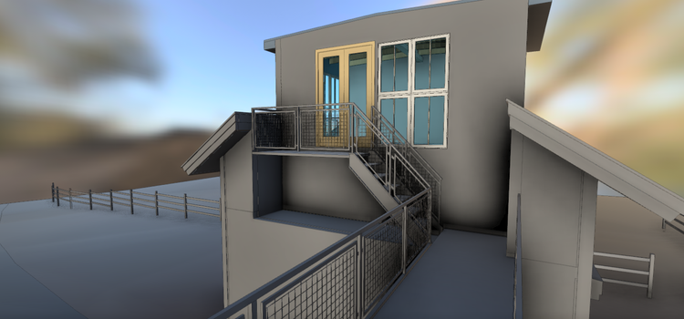
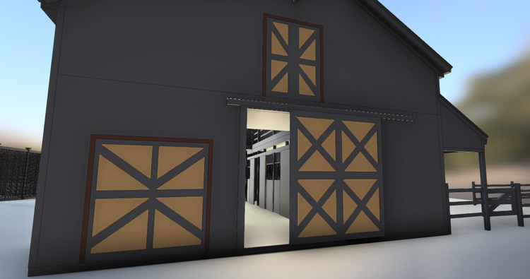
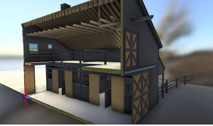
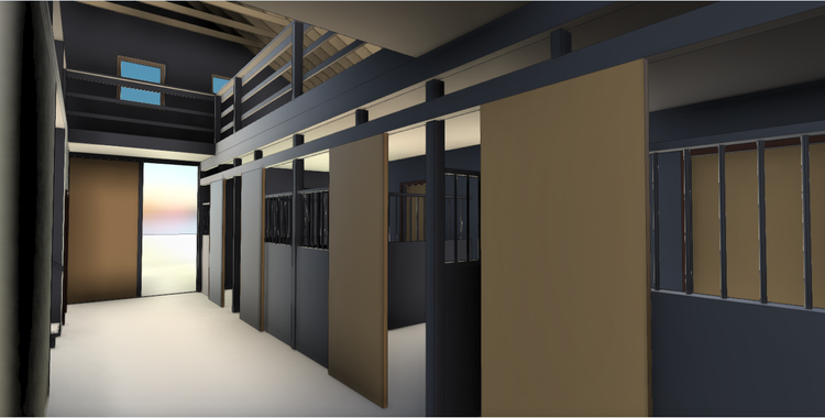
This project combined mobile LiDAR scanning, drone photogrammetry, and 360° documentation to capture both buildings and landscape as a cohesive system. The result is a high-accuracy digital twin that reflects the full property—supporting everything from architectural design to site planning with clarity and precision.
The value is not in the scan itself. It is in what your team can do next.
Design-ready deliverables
Measured information is structured into clean Revit and CAD outputs so architects, owners, and developers can move quickly.
Clear communication
Pointknown focuses on clarity. The process stays in the background. The usable result stays front and center.
One source of truth
A single field effort supports visualization, planning, modeling, and documentation—without repeated site visits or fragmented information.
If you are planning, renovating, leasing, or evaluating a building, clear existing conditions matter.
Pointknown helps design teams and property stakeholders move forward with confidence by turning existing buildings into usable, decision-ready information.