EASTHAMPTON ELEMENTARY · MA

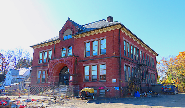
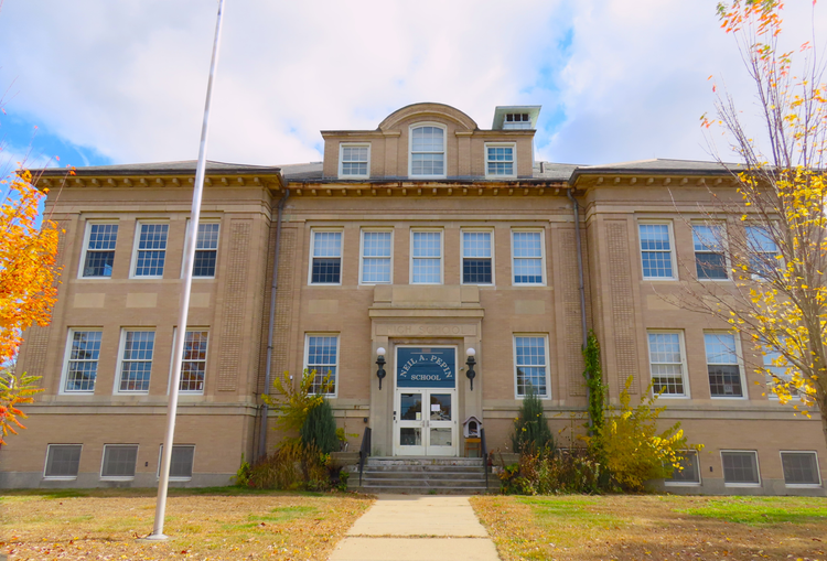
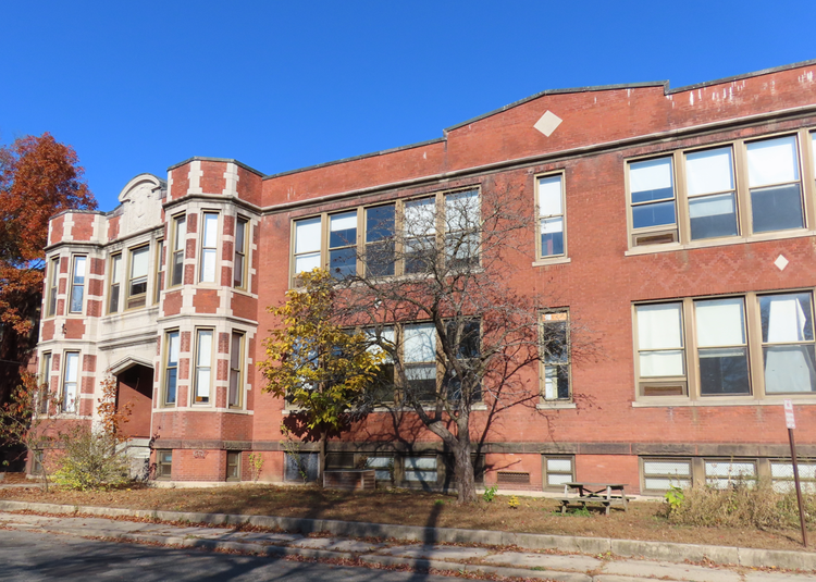
Easthampton Elementary

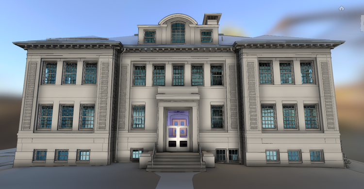
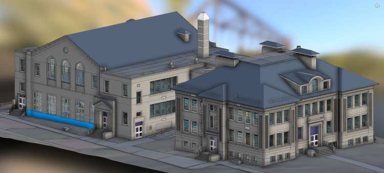
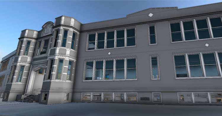
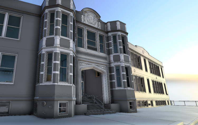
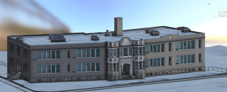
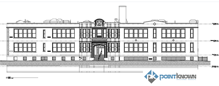
Pointknown contributed to the renovation and adaptive reuse efforts for three elementary schools in Easthampton, Massachusetts: Center School, Maple School, and Pepin School. The project focused on creating accurate digital documentation of the existing facilities to support future architectural planning, renovation, and long-term community redevelopment initiatives.

Historic School
Community Impact
Center, Maple, & Pepin Schools
Project Type
Academic
Deliverables
3 Separate Revit Models & Adjacent Hardscape
Location
Easthampton, MA
Use Case
Renovation & Adaptive Reuse
Measured once. Delivered ready for design.
What was documented
Our team captured both interior and exterior conditions of all three schools using laser scanning, drone photography, and 360° video documentation. Architectural geometry, circulation spaces, roof structures, and surrounding site conditions were documented and assembled into coordinated datasets to provide a complete understanding of each property.
What was delivered
Pointknown delivered three separate Revit existing-conditions models, each paired with documentation of the adjacent hardscape and surrounding site context. The datasets provided architects and planners with a reliable digital foundation for renovation studies, reuse planning, and future design coordination.
Why it matters
Historic school buildings often contain layered construction conditions and evolving spatial needs that can be difficult to document using conventional methods. By combining LiDAR scanning, aerial capture, and immersive visual documentation, Pointknown created accurate and accessible building records that reduce uncertainty and support informed design decisions.
PROJECT HIGHLIGHTS

A complete existing conditions package, from reality capture to usable deliverables.

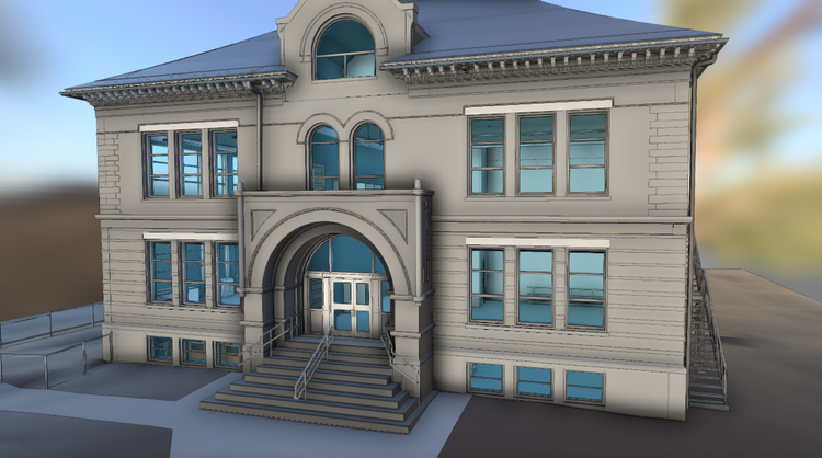
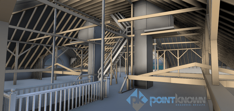
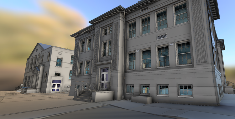
This project demonstrates how reality capture technology can help communities preserve and revitalize important civic spaces. The combination of scanning, drone imagery, and 360° visualization provided design teams with both precise geometry and contextual understanding, allowing them to approach renovation and reuse efforts with greater clarity and confidence.

Project highlight
Project highlight
Project highlight
Project highlight
Project highlight
Project highlight
Project highlight
Project highlight
Project highlight
Project highlight
Project highlight
Project highlight
WHY POINTKNOWN

The value is not in the scan itself. It is in what your team can do next.

Design-ready deliverables

Measured information is structured into clean Revit and CAD outputs so architects, owners, and developers can move quickly.

Clear communication

Pointknown focuses on clarity. The process stays in the background. The usable result stays front and center.

One source of truth

A single field effort supports visualization, planning, modeling, and documentation—without repeated site visits or fragmented information.

Interested in something similar?

If you are planning, renovating, leasing, or evaluating a building, clear existing conditions matter.

Pointknown helps design teams and property stakeholders move forward with confidence by turning existing buildings into usable, decision-ready information.