

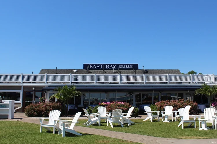
Eastbay Grille
Pointknown documented East Bay Grille, a waterfront dining destination in Plymouth, Massachusetts, to support accurate existing-conditions documentation for planning and design. The project focused on capturing the full building and its relationship to the surrounding waterfront, creating a precise digital foundation for renovation, coordination, and future improvements.
Located along Plymouth’s historic harbor, East Bay Grille sits within one of New England’s most recognizable coastal settings. Waterfront properties often present unique challenges—from complex site conditions to exposure and structural considerations—making accurate documentation essential for any updates or redesign efforts
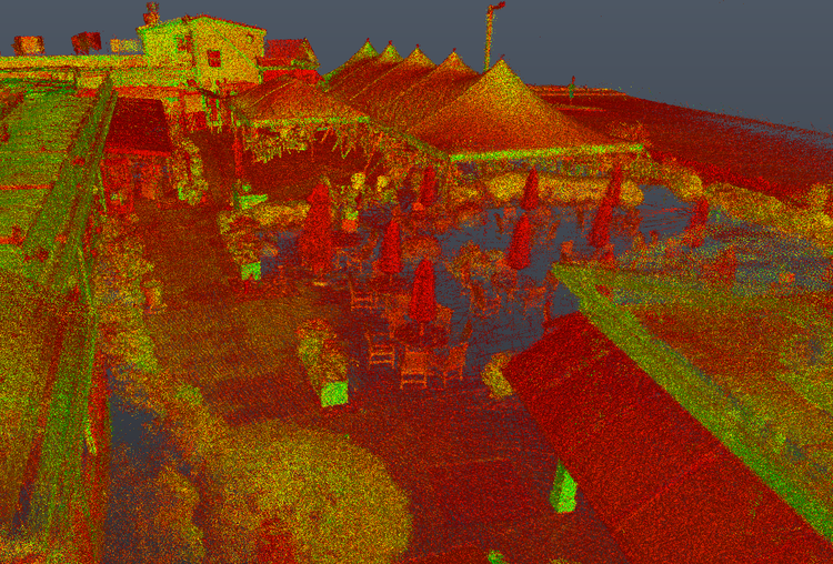
A complete existing conditions package, from reality capture to usable deliverables.
This project combined SLAM laser scanning, drone photogrammetry, and 360° media capture to create a complete digital twin of a waterfront restaurant environment. The result is a clean, coordinated dataset that supports design, visualization, and long-term planning for a high-profile coastal property.


The value is not in the scan itself. It is in what your team can do next.
Design-ready deliverables
Measured information is structured into clean Revit and CAD outputs so architects, owners, and developers can move quickly.
Clear communication
Pointknown focuses on clarity. The process stays in the background. The usable result stays front and center.
One source of truth
A single field effort supports visualization, planning, modeling, and documentation—without repeated site visits or fragmented information.
If you are planning, renovating, leasing, or evaluating a building, clear existing conditions matter.
Pointknown helps design teams and property stakeholders move forward with confidence by turning existing buildings into usable, decision-ready information.