

Dracut-Beaver Brook Village
Beaver Brook Village required more than documenting several connected buildings. Pointknown captured, modeled, and coordinated the entire historic mill property into a comprehensive existing conditions package, providing accurate floor levels, site context, hardscape, topography, and surrounding massing to support fit-outs, renovations, and future site planning.
A coordinated site model
built for informed decisions.
Beaver Brook Village spans multiple connected mill buildings with varying floor elevations, grade changes, and decades of additions. Rather than documenting each structure independently, Pointknown created a coordinated existing conditions model that establishes a single reference across the entire property.
The deliverables capture more than building geometry. Floor levels, hardscape, topography, surrounding massing, and exterior context were documented together to give architects and project teams a reliable foundation for renovations, fit-outs, and future site planning.
The value is knowing where you stand—anywhere on the property.
On a property like Beaver Brook Village, understanding how the entire site fits together is just as important as documenting each building. A coordinated existing conditions model provides a reliable reference for floor relationships, grade transitions, surrounding context, and existing conditions—helping project teams make informed decisions before design begins.
Existing conditions organized for confident coordination.
Beaver Brook Village was documented as one coordinated existing conditions package, giving the project team a dependable foundation for design. From the Revit model to plan documentation and supporting site context, every deliverable was organized to simplify coordination and accelerate the next phase of the project.
Capture
Drone imagery, exterior photography, and field documentation preserved the property's roofscape, hardscape, surrounding context, and existing conditions before design work began.
Coordinate
The Revit model established a consistent reference across the connected mill buildings, making floor relationships, elevations, and existing conditions easier to review and coordinate.
Plan
Topography, surrounding massing, and site features were documented alongside the buildings to support future planning, site studies, and informed design decisions.
A complete existing conditions record of a complex mill property
From aerial context to detailed model views, Pointknown captured the existing conditions of Beaver Brook Village as a coordinated visual and technical reference. The documentation provides clarity across multiple buildings, historic elements, site relationships, and future planning decisions.
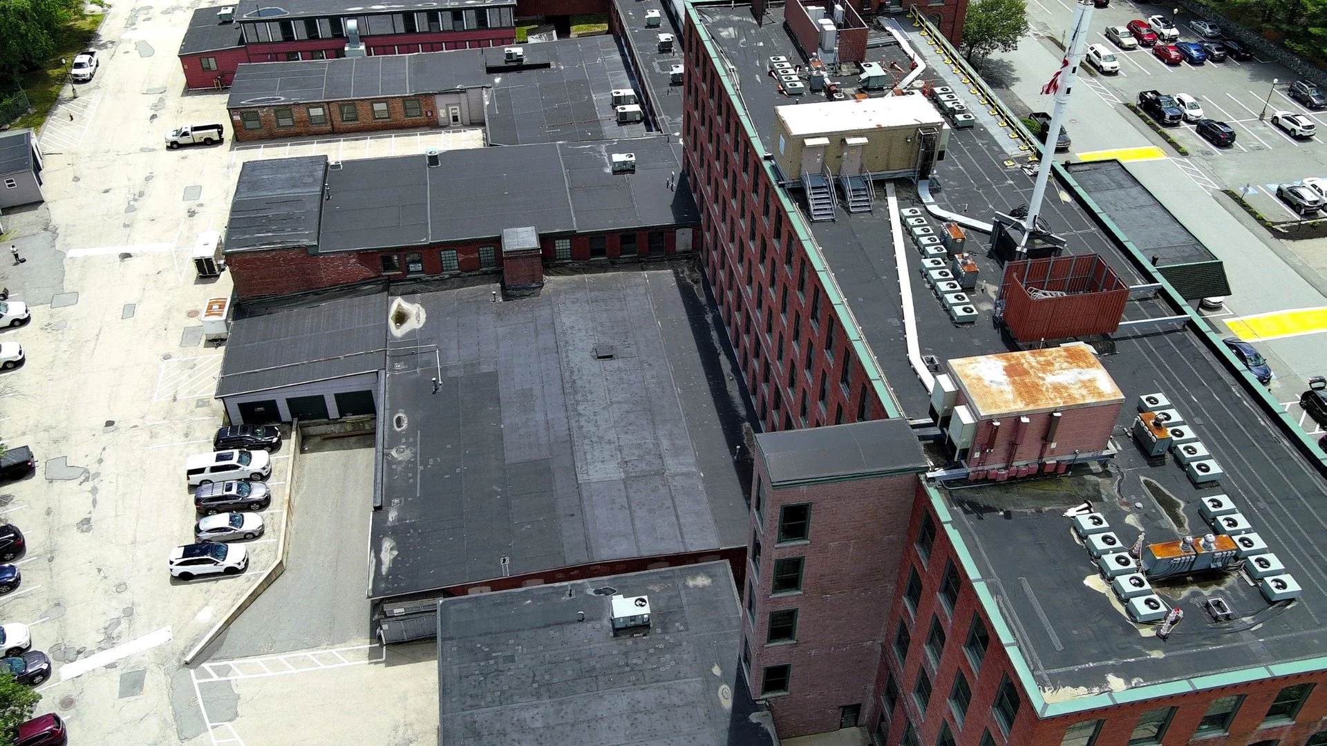
Property context from above
Aerial capture reveals the relationship between connected buildings, roof forms, access paths, and surrounding site conditions across the Beaver Brook Village property.
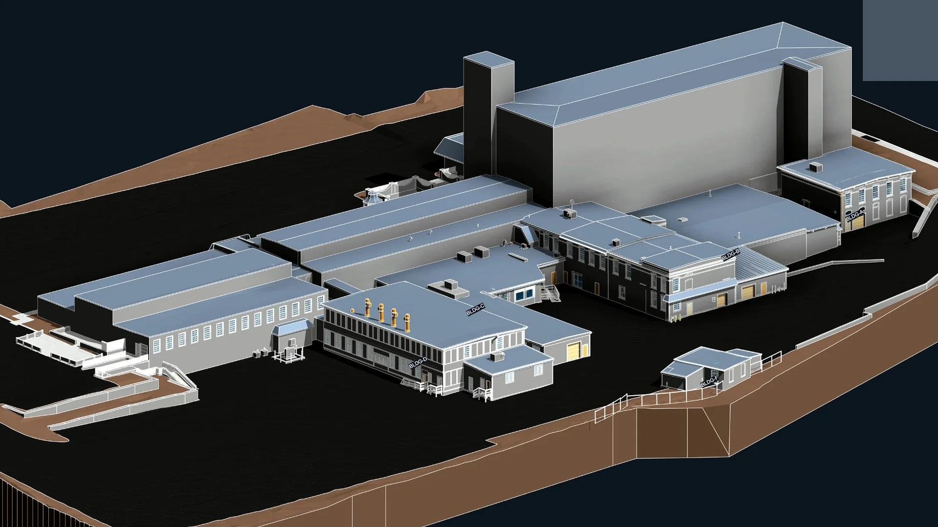
One coordinated view of the campus
The existing conditions model brings multiple structures together into a single reference point for understanding scale, connections, and future planning opportunities.
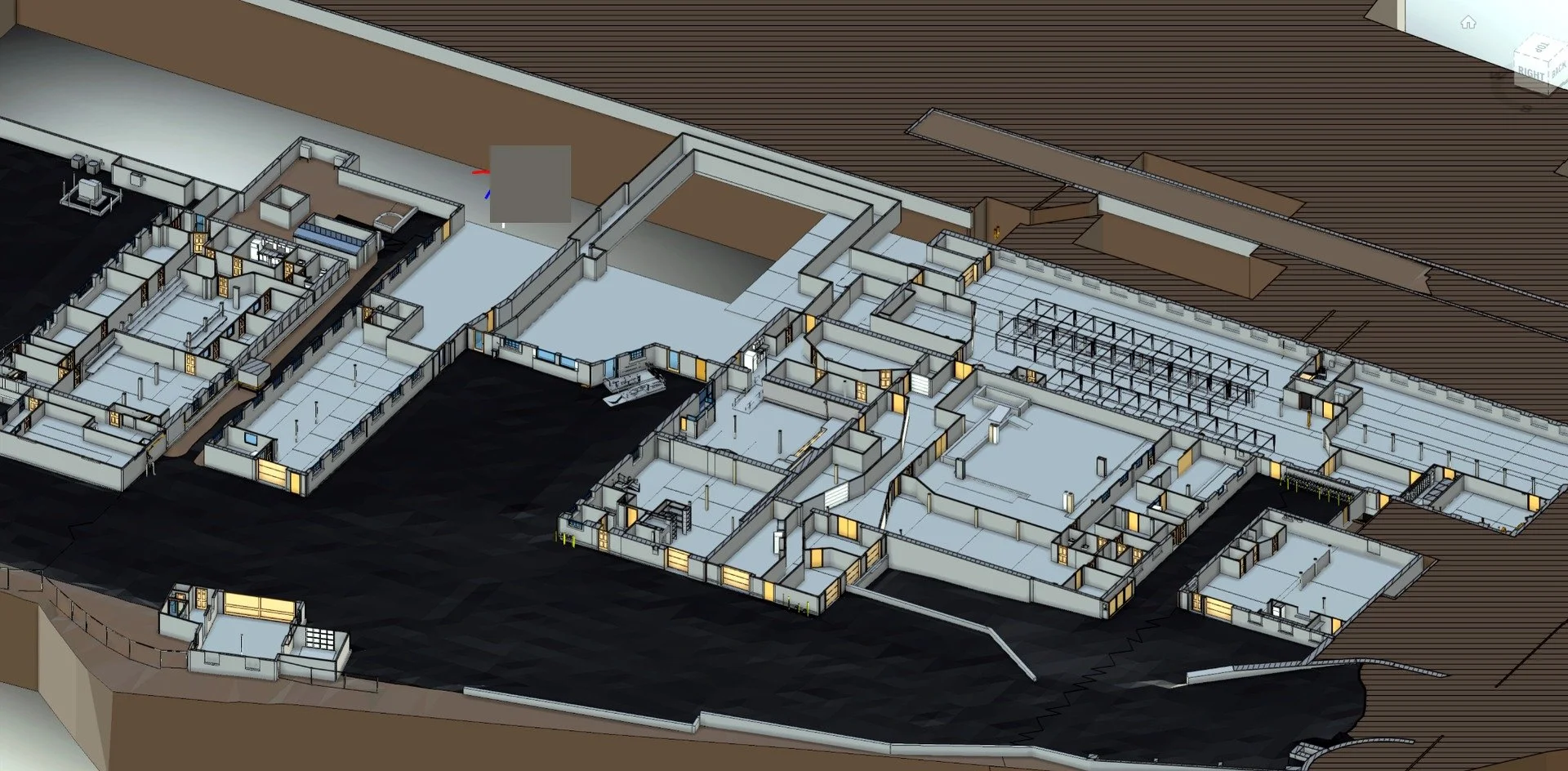
Building relationships made clear
Cutaway views combine model geometry and plan information to help teams understand floor levels, circulation, and existing spatial conditions.
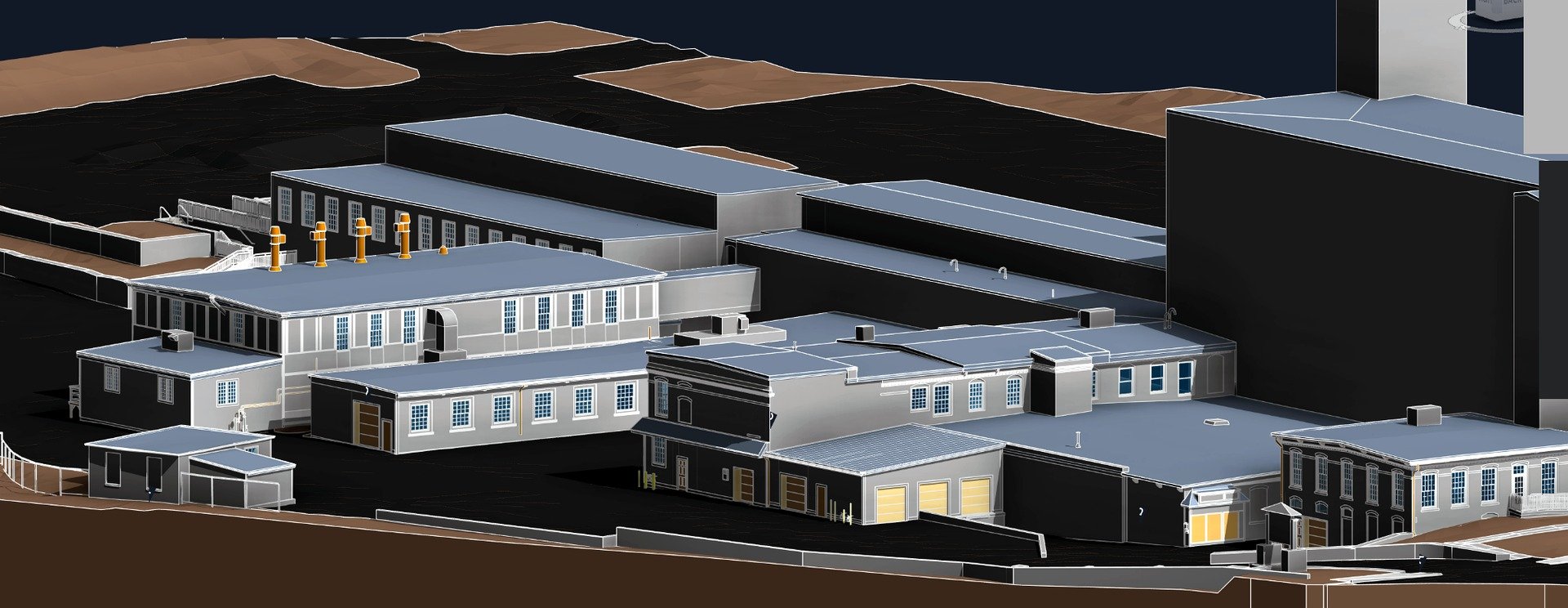
Site transitions documented
Detailed model views capture hardscape, grade changes, retaining conditions, and the connections between buildings.
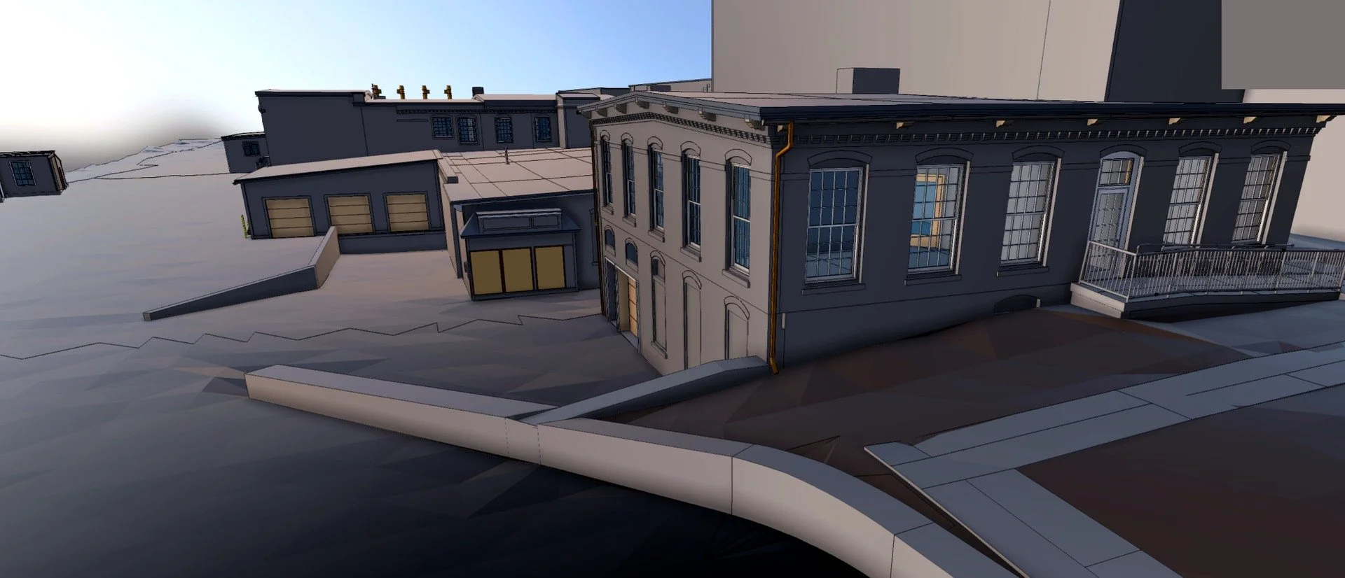
Existing character preserved digitally
Focused view of the historic wing, openings, massing, and changing site edge.
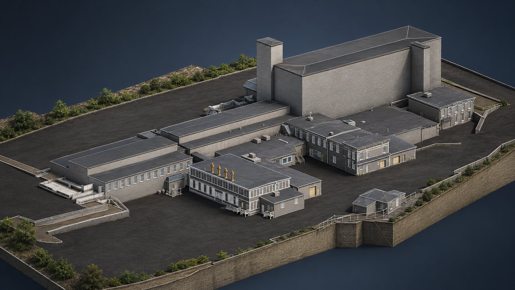
A clearer way to understand the property
Review-ready perspectives provide an intuitive view of the existing campus, helping teams align before design decisions begin.
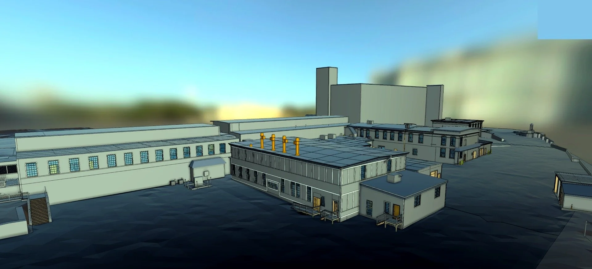
A clearer view of existing relationships
A review-focused model perspective helps teams understand the connected buildings, overall massing, and organization of the property.
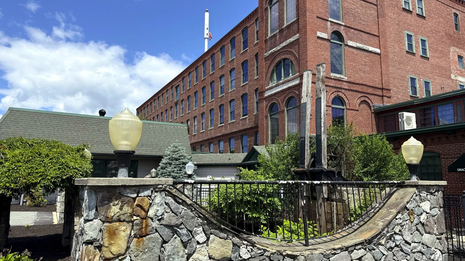
Existing conditions beyond the model
Exterior imagery records entry conditions, materials, and architectural details that complete the understanding of the existing property.
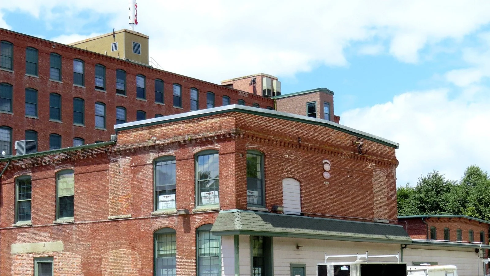
Architectural details preserved
Material conditions, brickwork, openings, and exterior character are documented to provide a complete record of the existing building.
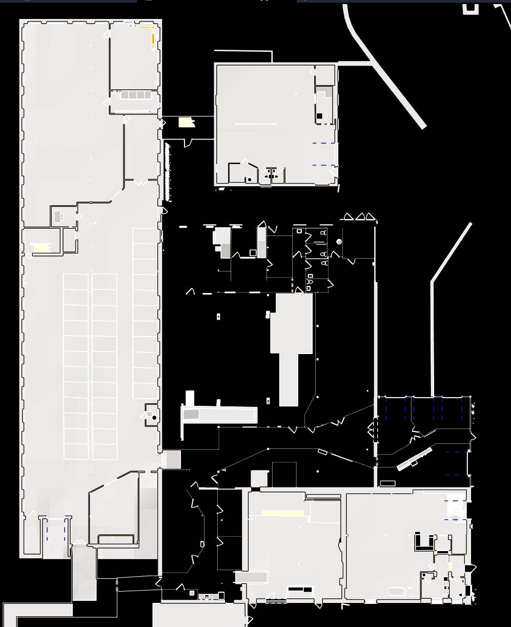
Detailed floor plan reference
Plan details provide a closer look at interior organization, existing conditions, and areas requiring coordination during future planning.
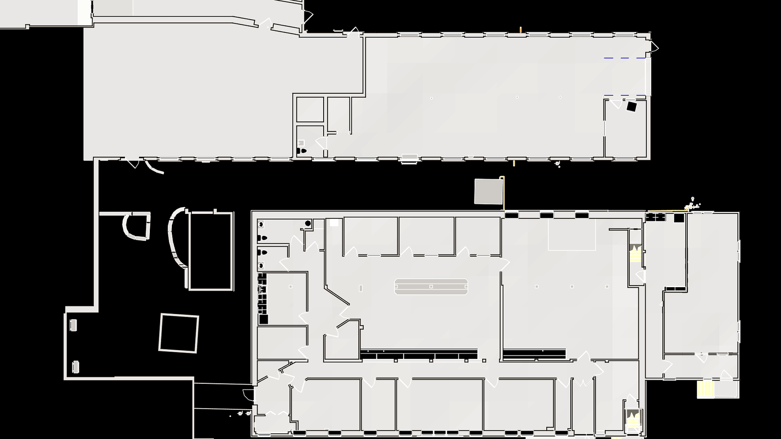
Technical information ready for coordination
Additional plan views provide a reliable reference for reviewing layouts, existing conditions, and future design opportunities.
Understanding a complex property before the next phase begins
Large existing properties often contain layers of history, multiple structures, and interconnected site conditions. Pointknown created a coordinated digital record of Beaver Brook Village, allowing teams to evaluate the property with greater clarity before future planning and design decisions.
The challenge was understanding how every building, space, and site condition worked together.
Beaver Brook Village required more than isolated measurements. The documentation needed to capture the relationship between multiple buildings, historic elements, exterior conditions, and surrounding site features. A coordinated existing-conditions package provides a reliable foundation for architects, engineers, and project teams moving forward.
Everything the team needs to understand the property
The value is not a single deliverable. It is the complete picture created from coordinated models, drawings, aerial documentation, and visual references that allow teams to evaluate Beaver Brook Village with confidence.
Revit Existing Conditions Model
A coordinated digital model capturing building geometry, connected structures, floor relationships, and existing site conditions for future planning.
Campus + Building Documentation
A complete reference of the property layout, building relationships, circulation paths, exterior conditions, and key site elements.
Plan + Drawing Outputs
Organized plan views and documentation outputs provide technical references for review, coordination, and future project development.
Drone Aerial Context
Aerial imagery captures the overall property, roof conditions, access points, surrounding landscape, and relationships between structures.
Visual Review Package
Model perspectives and existing-condition imagery provide an easy way for stakeholders to review the property and align on next steps.
Experience shows up in the handoff
The best documentation teams do not simply collect data. They know what matters, what to ignore, what to model, what to share, and how to package it so the next team can work.
We scope for the decision ahead
Each capture effort is shaped around what the client, architect, consultants, and builder need to understand next.
We know the deliverable ecosystem
Revit, CAD, SketchUp, PDF, drone media, 360 photography, and shared file structures all play different roles in helping a project move forward.
We make complex properties easier to communicate
The goal is not to show every piece of data. The goal is to make the right information accessible, clear, and usable for the people who need it.
Need an existing-conditions model your team can actually plan from?
Pointknown helps architects, owners, and project teams start with a clear record of what is actually there—geometry, levels, as-is floors, hardscape, topography, massing, plans, and visual context tied together in one usable package.