

Dover MA
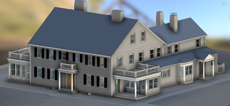
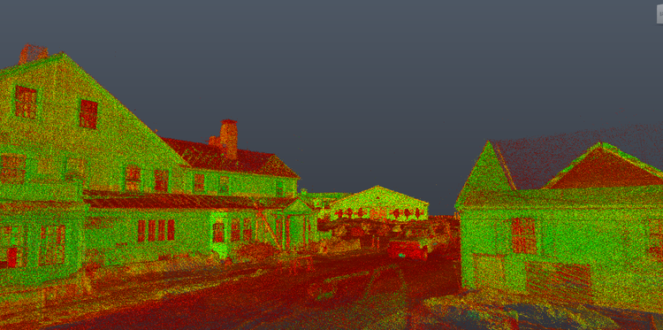
In Dover, MA, Pointknown documented a residential farm property, capturing both the main residence and surrounding site conditions. The project focused on translating a large rural estate into a precise digital model to support design, coordination, and future planning.
Dover, Massachusetts is known for its expansive rural landscapes, equestrian properties, and preserved open space. The town has maintained a strong agricultural and residential identity while remaining closely connected to the Greater Boston area, making it a unique setting where historic land use and modern residential design often intersect.
A complete existing conditions package, from reality capture to usable deliverables.
This project demonstrates the flexibility of Pointknown’s workflow across residential and rural environments. The combination of mobile scanning, aerial capture, and cross-platform BIM deliverables created a coordinated digital twin suitable for architectural, engineering, and infrastructure-focused workflows alike.


The value is not in the scan itself. It is in what your team can do next.
Design-ready deliverables
Measured information is structured into clean Revit and CAD outputs so architects, owners, and developers can move quickly.
Clear communication
Pointknown focuses on clarity. The process stays in the background. The usable result stays front and center.
One source of truth
A single field effort supports visualization, planning, modeling, and documentation—without repeated site visits or fragmented information.
If you are planning, renovating, leasing, or evaluating a building, clear existing conditions matter.
Pointknown helps design teams and property stakeholders move forward with confidence by turning existing buildings into usable, decision-ready information.