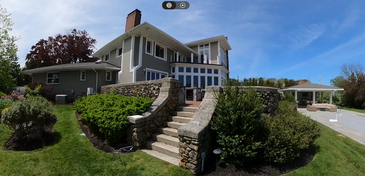
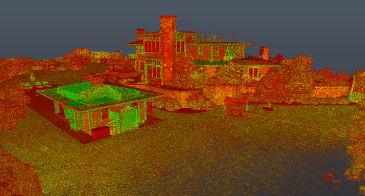
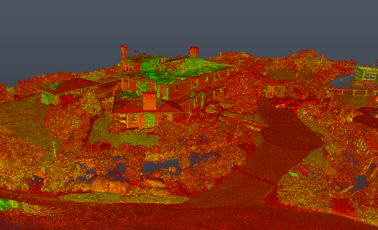
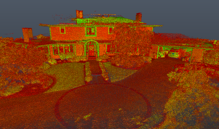
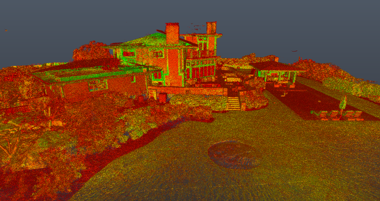
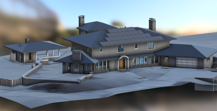
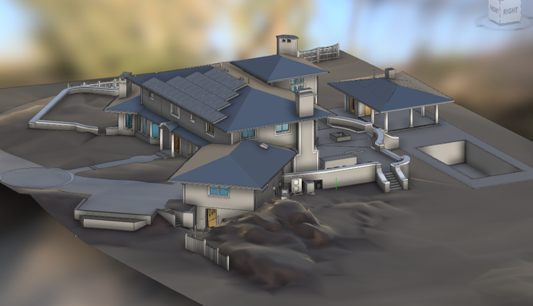
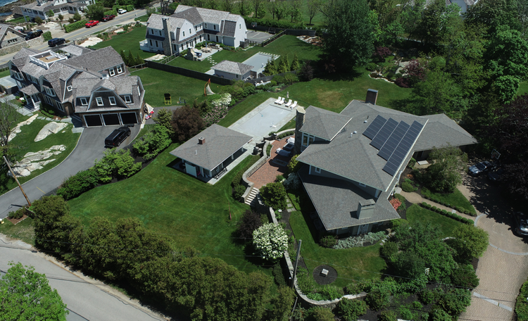
COHASSET · MASSACHUSETTS

Cohasset

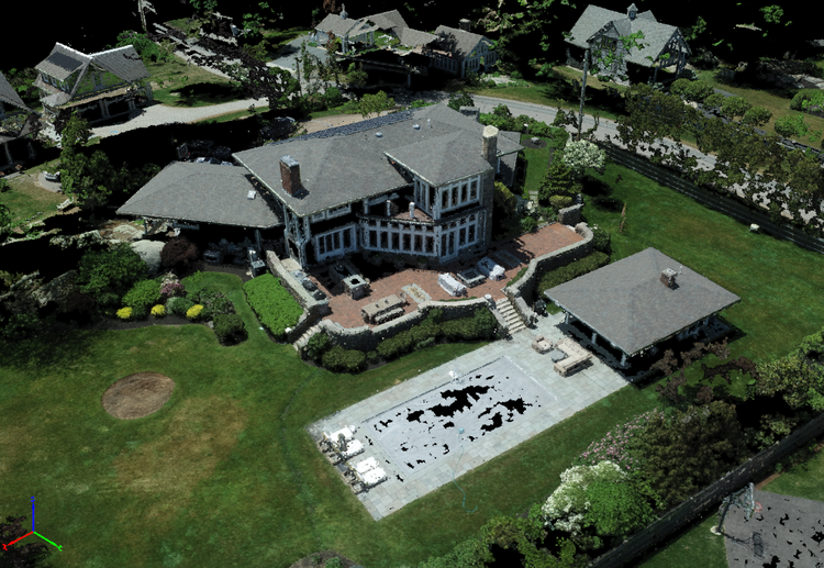
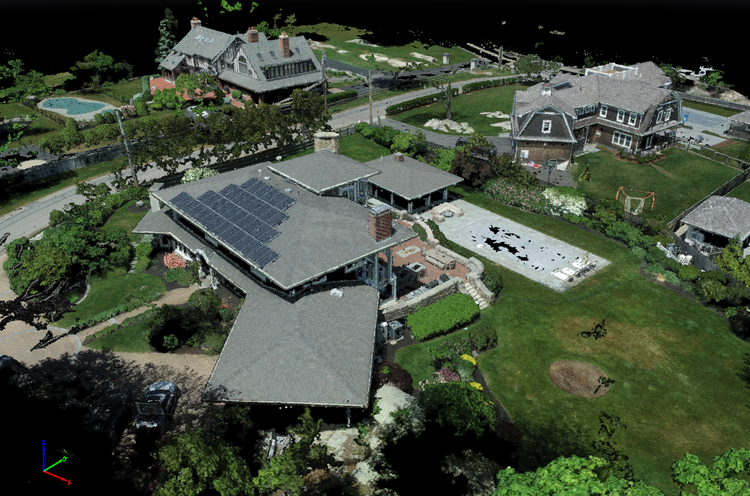
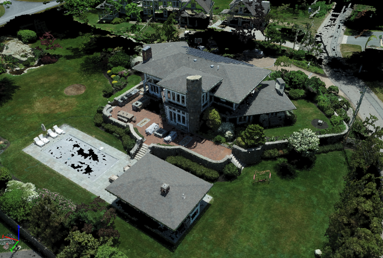
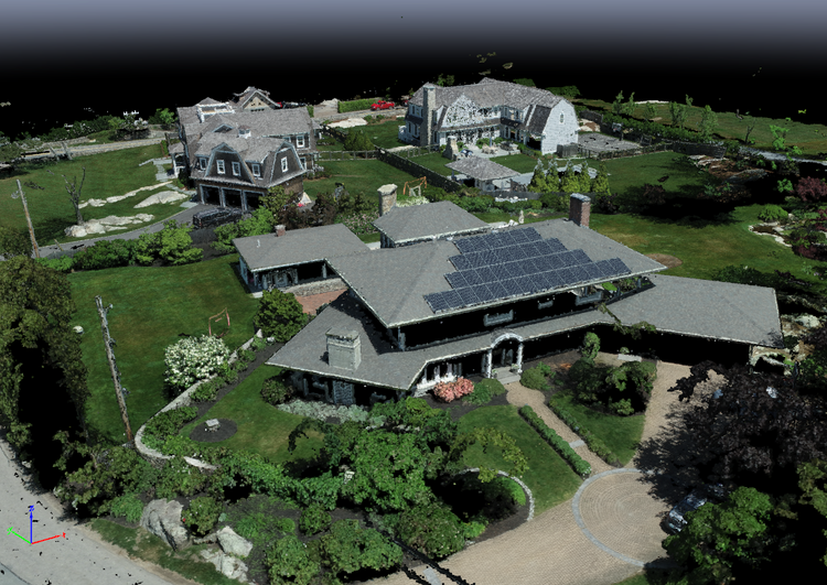
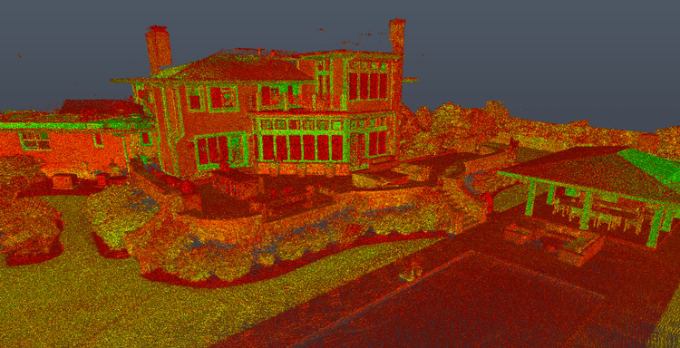
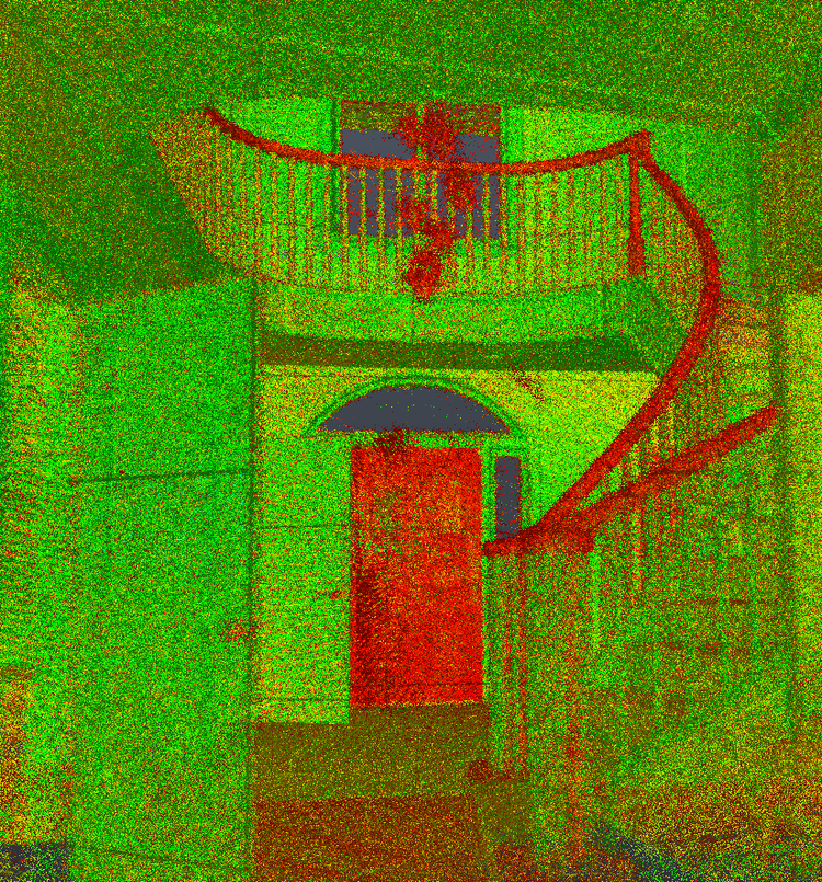
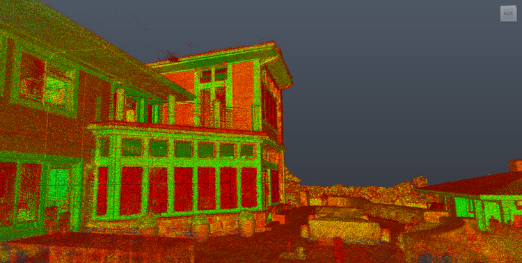
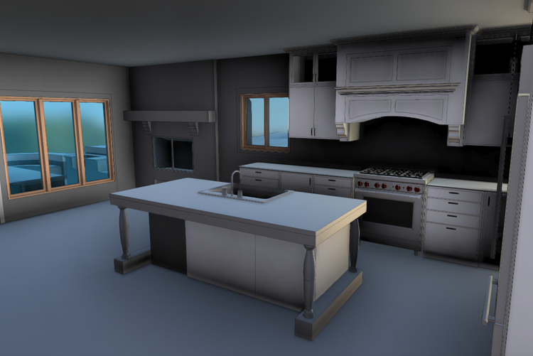
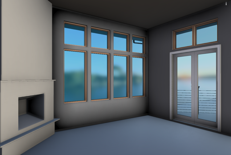
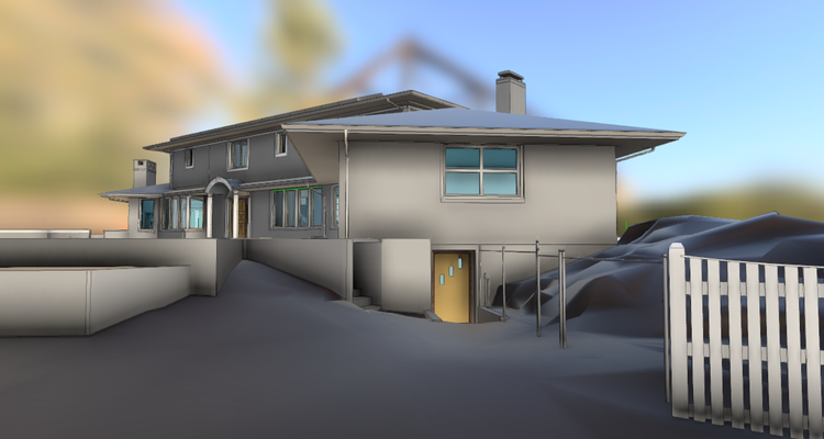
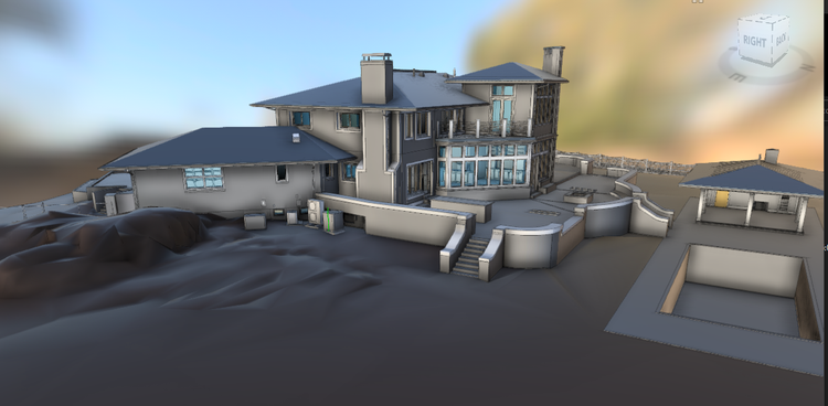
Pointknown was engaged to document a coastal residential property in Cohasset, Massachusetts, with a unique focus on both the main residence and the surrounding natural hardscape. The project included a distinctive rock ledge formation that is physically integrated into the basement foundation, requiring highly accurate reality capture to fully understand the relationship between structure and site.

Residence
Waterfront Estate
Project Type
Residential
Deliverables
Revit Model
Location
Cohasset, MA
Use Case
Accurate Reality Capture
Measured once. Delivered ready for design.
What was documented
The entire property was captured using a combination of SLAM-based mobile laser scanning, terrestrial measurements, drone photogrammetry, and 360° imagery. Special attention was given to the exposed rock ledge and its interface with the building’s foundation, along with exterior landscaping, grade changes, and public-facing spaces. These elements were combined into a unified, spatially accurate dataset.
What was delivered
Pointknown delivered a detailed existing-conditions Revit model representing both the residence and integrated site conditions. The model includes architectural geometry, exterior hardscape, and the rock formation tied directly into the basement structure, providing a reliable foundation for design and engineering review.
Why it matters
Waterfront and coastal properties often involve complex interactions between natural geology and built structure. Capturing these relationships accurately is essential for renovation planning, structural evaluation, and long-term risk management. This model reduces uncertainty by clearly defining how the building engages with the site’s natural rock formation.
PROJECT HIGHLIGHTS

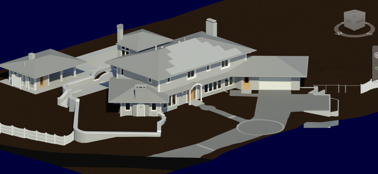
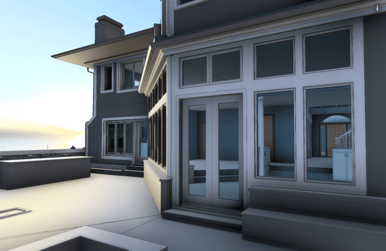
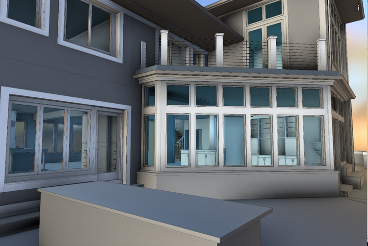
A complete existing conditions package, from reality capture to usable deliverables.

This project stands out for its integration of natural and built environments into a single digital model. By capturing the rock ledge as part of the building system—not just the landscape—Pointknown provided a deeper level of insight into structural conditions that would be difficult to assess through traditional documentation methods alone.

Project highlight

Project highlight

Project highlight

Project highlight

Project highlight

Project highlight

Project highlight

Project highlight

Project highlight

Project highlight

Project highlight

Project highlight

Project highlight

Project highlight

Project highlight

Project highlight

Project highlight

Project highlight

Project highlight

Project highlight

Project highlight

Project highlight

Project highlight

Project highlight

Project highlight

Project highlight

Project highlight

Project highlight

WHY POINTKNOWN

The value is not in the scan itself. It is in what your team can do next.

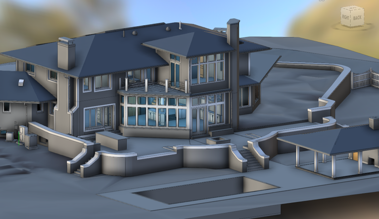
Design-ready deliverables

Measured information is structured into clean Revit and CAD outputs so architects, owners, and developers can move quickly.

Clear communication

Pointknown focuses on clarity. The process stays in the background. The usable result stays front and center.

One source of truth

A single field effort supports visualization, planning, modeling, and documentation—without repeated site visits or fragmented information.

Interested in something similar?

If you are planning, renovating, leasing, or evaluating a building, clear existing conditions matter.

Pointknown helps design teams and property stakeholders move forward with confidence by turning existing buildings into usable, decision-ready information.