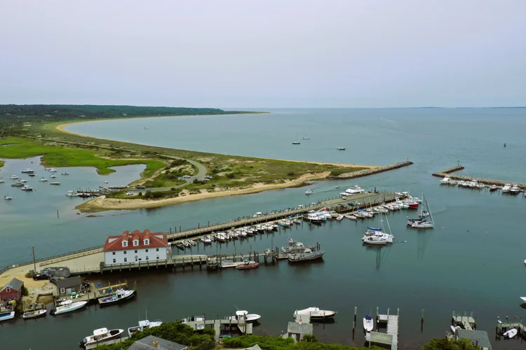
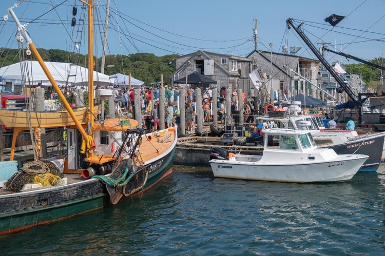
CHILMARK · MASSACHUSETTS

Chilmark

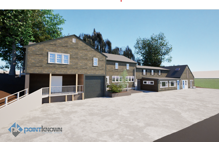
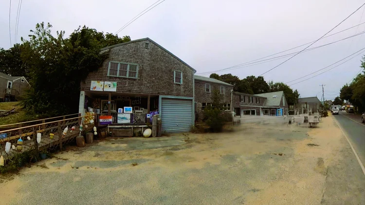
At 24 Basin Road in Chilmark, Massachusetts, Pointknown was engaged to document a key waterfront property supporting the Martha’s Vineyard Fishermen’s Preservation Trust. The project focused on creating a complete and accurate digital record of the existing conditions to support long-term preservation, planning, and adaptive reuse decisions for a site that plays an important role in the island’s working waterfront. Using high-resolution 3D laser scanning and reality capture workflows, the team captured both building and site conditions in detail, including structures, exterior elements, and surrounding context. The resulting dataset provides a reliable foundation for architects, planners, and engineers working to preserve and responsibly evolve the property in alignment with the Trust’s mission.

Waterfront
Historic & Cultural Preservation Support
Project Type
Historic
Deliverables
Revit Model & CAD Exports
Location
Boston, MA
Use Case
Design & Planning
Measured once. Delivered ready for design.
What was documented
Pointknown completed full existing-conditions documentation of the 24 Basin Road property in Chilmark, Massachusetts, capturing both the building and its surrounding site conditions. Using high-accuracy 3D laser scanning and reality capture methods, the team recorded interior spaces, exterior façades, roof geometry, and site relationships to create a complete spatial record of the property. The scan data was collected to support both architectural understanding and long-term preservation planning.
What was delivered
The project delivered a coordinated existing-conditions Revit model supported by CAD exports for architectural and planning use. The dataset provided accurate as-built geometry of the structure and site, enabling architects, planners, and engineers to work directly from verified conditions. The final package was structured to support preservation, renovation, or adaptive reuse workflows while maintaining clarity and consistency across all documentation outputs.
Why it matters
This project supports the mission of preserving Chilmark’s working waterfront and the cultural heritage of Martha’s Vineyard’s fishing community. By creating an accurate digital record of the property, Pointknown provided a foundation for informed decision-making that balances preservation with future adaptation. The resulting documentation helps ensure that any future changes to the site can be made with respect for its historical and community significance, reducing uncertainty while protecting long-term value.
PROJECT HIGHLIGHTS

A complete existing conditions package, from reality capture to usable deliverables.

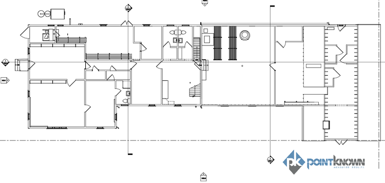
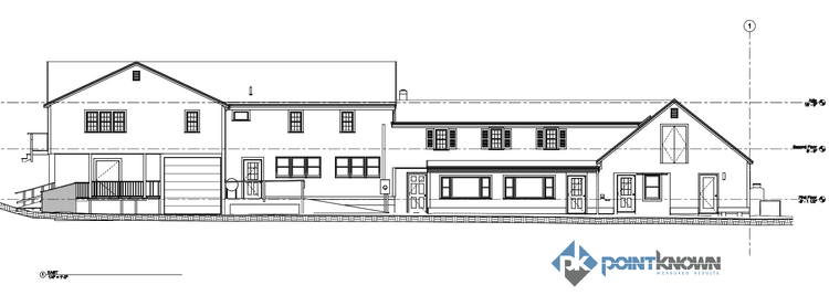
A high-precision reality capture of a Chilmark waterfront property, delivered as a Revit and CAD-ready model to support the preservation of Martha’s Vineyard’s working fishing infrastructure.

Project highlight
Project highlight
Project highlight
Project highlight
Project highlight
Project highlight
WHY POINTKNOWN

The value is not in the scan itself. It is in what your team can do next.

Design-ready deliverables

Measured information is structured into clean Revit and CAD outputs so architects, owners, and developers can move quickly.

Clear communication

Pointknown focuses on clarity. The process stays in the background. The usable result stays front and center.

One source of truth

A single field effort supports visualization, planning, modeling, and documentation—without repeated site visits or fragmented information.

Interested in something similar?

If you are planning, renovating, leasing, or evaluating a building, clear existing conditions matter.

Pointknown helps design teams and property stakeholders move forward with confidence by turning existing buildings into usable, decision-ready information.