

Chestnut Hill Residence
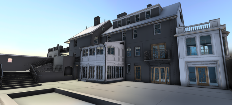
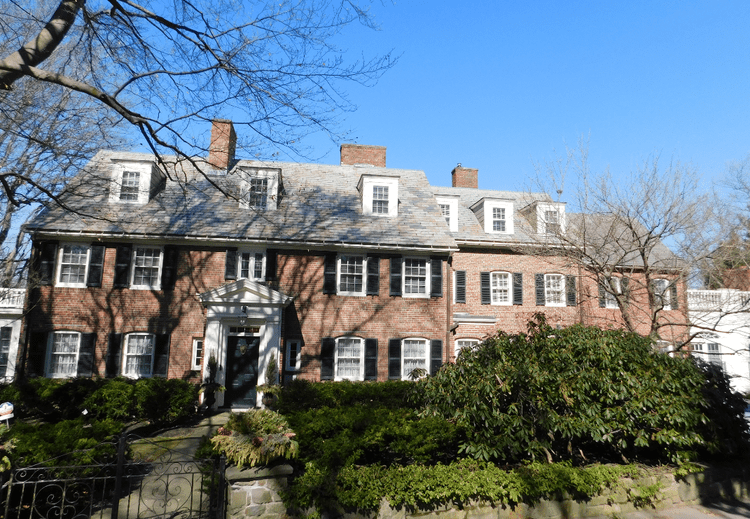
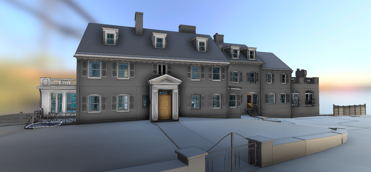
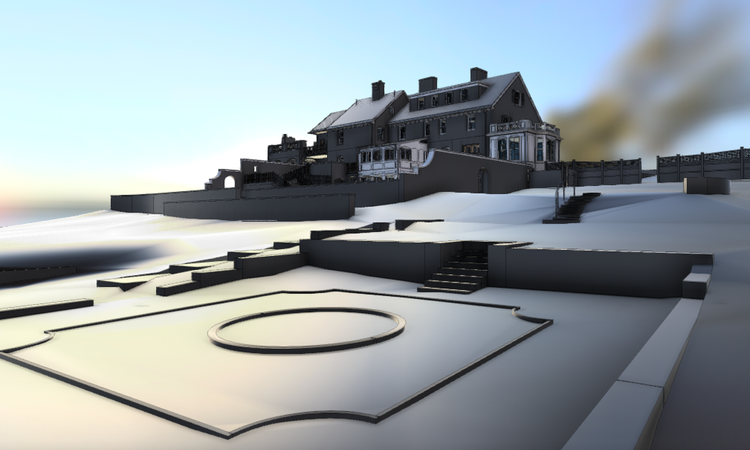
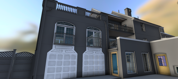
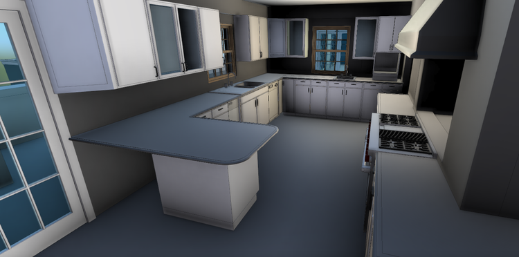
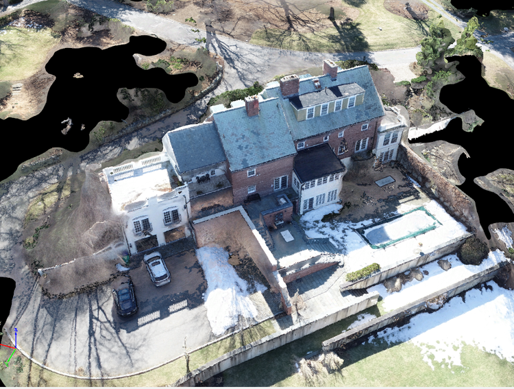
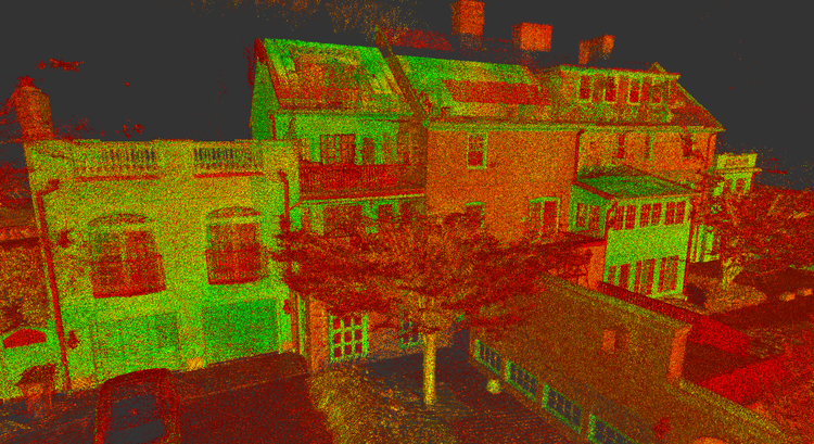
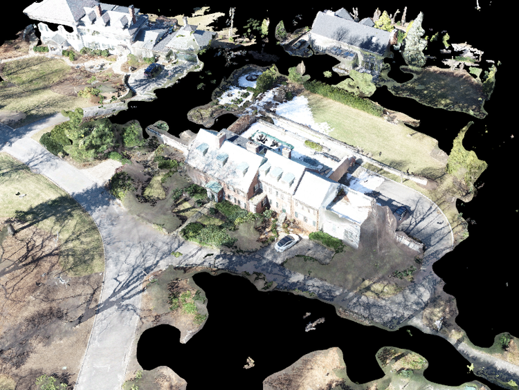
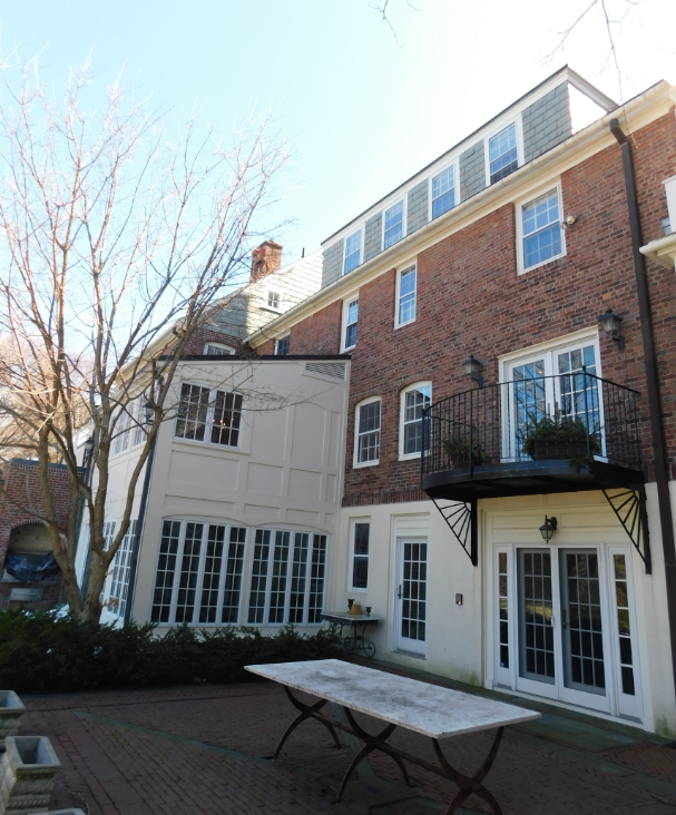
In Chestnut Hill, MA, Pointknown documented a large-scale residential property spanning over 12,500+ GSF, including both the main structure and surrounding landscape. The project focused on creating a precise digital foundation to support design, planning, and coordination.
Cambridge is known for its layered architectural fabric, where historic homes, adaptive reuse properties, and hidden residential compounds coexist within dense urban neighborhoods. Properties like this one reflect the city’s long tradition of evolving residential spaces that blend historic character with functional additions and outbuildings over time.
A complete existing conditions package, from reality capture to usable deliverables.
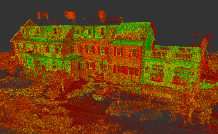
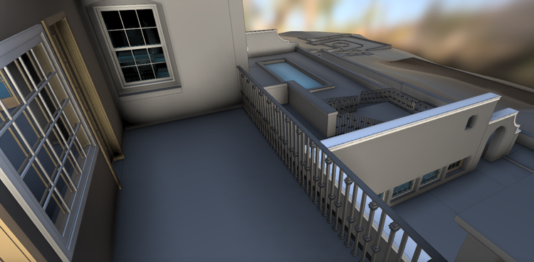
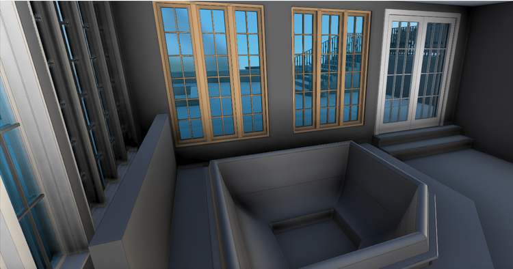
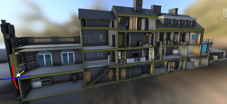
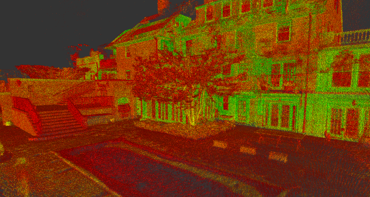
This project demonstrates how reality capture can reveal the full complexity of a property hidden within a tight urban setting. The combination of drone mapping and laser scanning allowed the team to accurately document the residence, decks, and oversized barn as one unified dataset—capturing both architectural detail and overall site context in a way traditional field measurements cannot efficiently achieve.
The value is not in the scan itself. It is in what your team can do next.
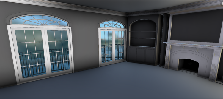
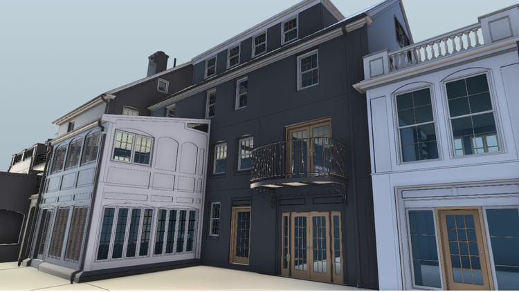
Design-ready deliverables
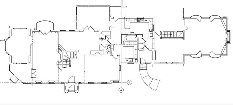
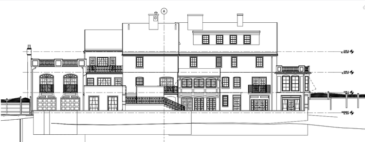
Measured information is structured into clean Revit and CAD outputs so architects, owners, and developers can move quickly.
Clear communication
Pointknown focuses on clarity. The process stays in the background. The usable result stays front and center.
One source of truth
A single field effort supports visualization, planning, modeling, and documentation—without repeated site visits or fragmented information.
If you are planning, renovating, leasing, or evaluating a building, clear existing conditions matter.
Pointknown helps design teams and property stakeholders move forward with confidence by turning existing buildings into usable, decision-ready information.