

Carnegie Heights Residence
A full-context existing-conditions package for a waterfront residence—captured, modeled, documented, and shared so the client and design team could move forward with confidence from day one.
Not just a model. A complete starting point.
For this waterfront property, Pointknown created a package that gives the next team more than measured geometry. The project combined technical documentation, model files, immersive review tools, drone context, exterior media, and organized file sharing into one coordinated handoff.
That matters on complex residential work. The architecture, roof geometry, grade, hardscape, shoreline context, exterior features, and visual references all influence early decisions. Our role is to capture enough context, translate it cleanly, and deliver it in formats the client and project team can use immediately.
Site information the team can actually see
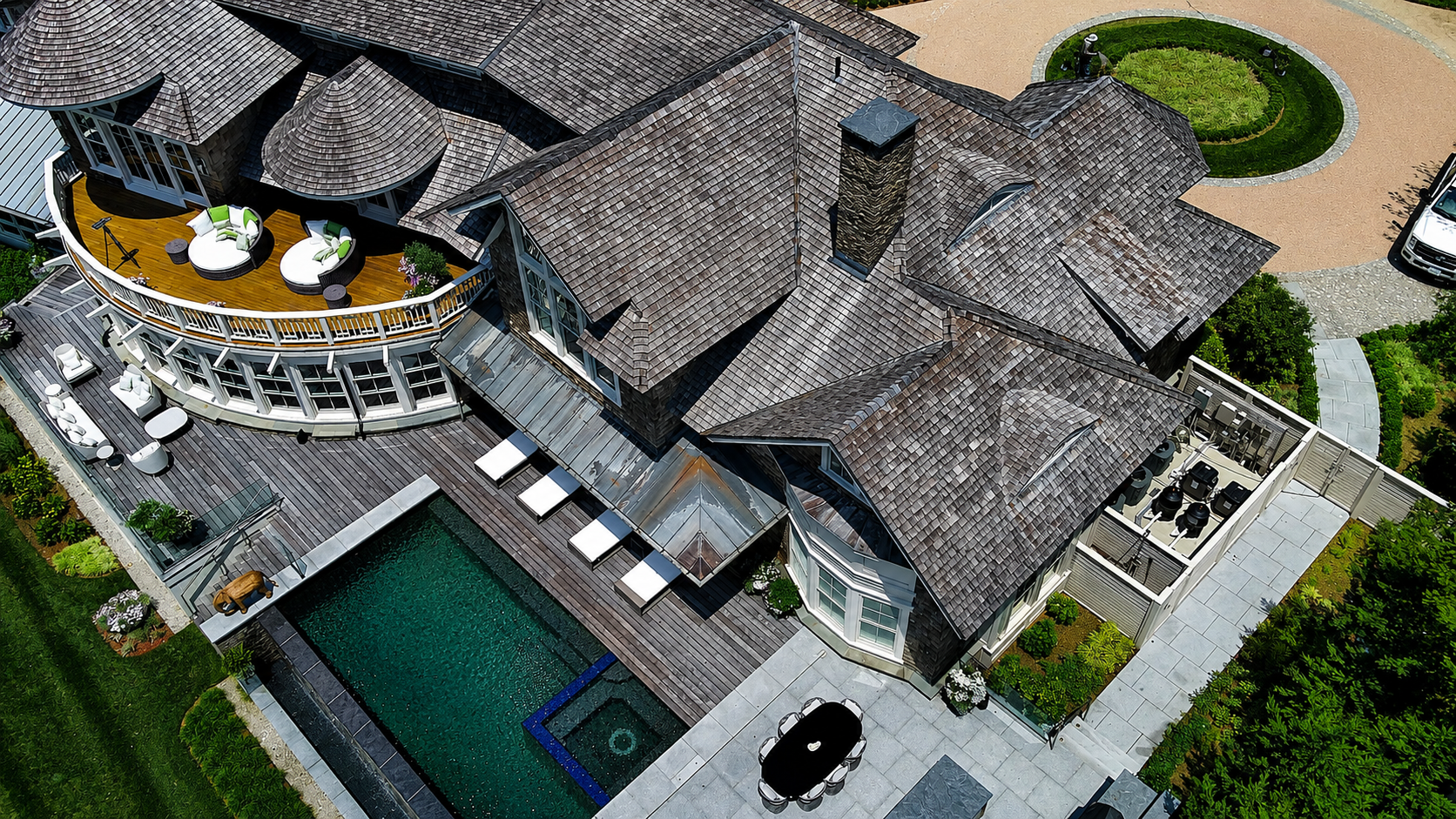
Drone imagery, exterior photos, video, and 360 review tools give the client a richer understanding of the property than drawings alone can provide.
A full package from capture to client handoff.
The process is not just documentation. It is a structured workflow that moves from field capture, to technical translation, to a fully organized handoff the entire team can use immediately.
Capture
Collect the full story — We documented the residence, exterior conditions, site relationships, shoreline context, and visual references through a coordinated capture effort.
Translate
Build usable deliverables — Field information was converted into clean Revit, SketchUp, CAD, and PDF outputs—organized around how design teams actually work.
Share
Make the client look ready — The handoff included drawing sheets, model views, drone media, 360 imagery, and a shared project folder so the team could review, communicate, and hit the ground running.
Existing conditions captured across every critical system.
A coordinated documentation package that brings together site context, modeling, drawings, and visual clarity so the next team can start with confidence instead of assumptions.
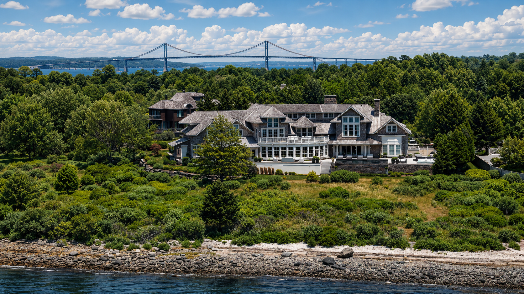
Waterfront context, captured clearly.
High-level site views help the team understand the residence in relation to the shoreline, landscape, arrival sequence, and surrounding property conditions.
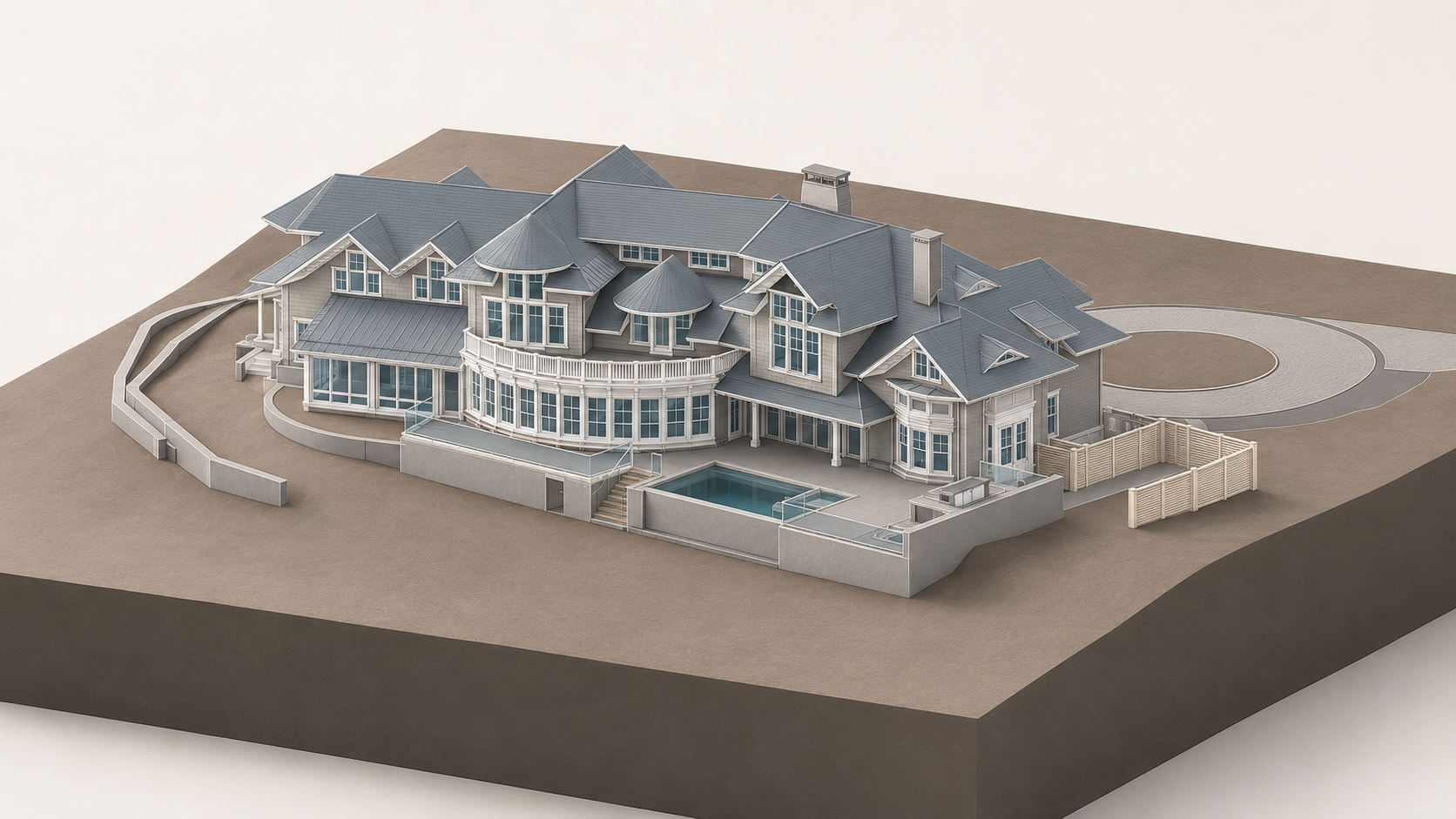
A clean model foundation.
The Revit model gives the design team a coordinated baseline for roof forms, exterior geometry, openings, terraces, and major site relationships.
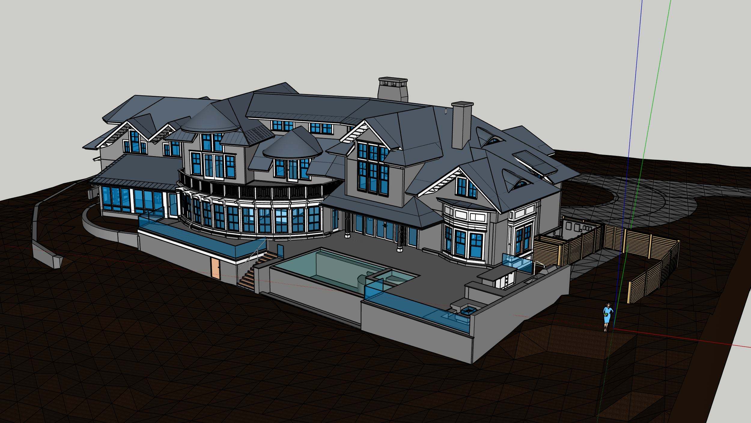
Flexible visual context.
A SketchUp model supports quick orientation, massing review, design conversations, and client-facing communication.
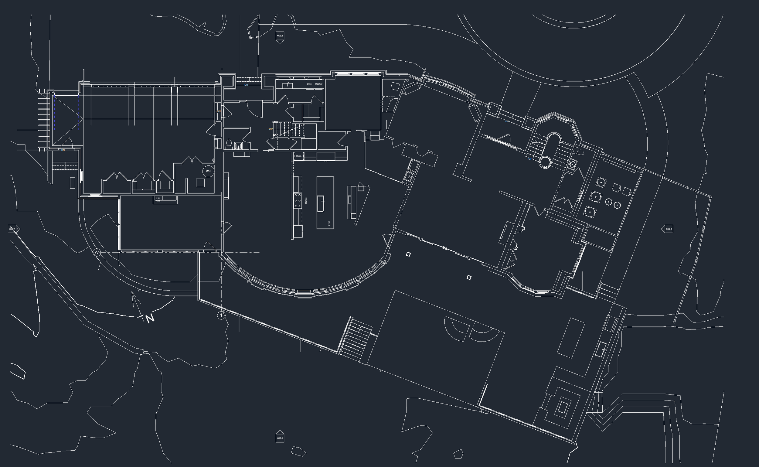
Plans that support decisions.
Technical drawings are organized so the next team can understand space, circulation, geometry, and project scope without starting from scratch.
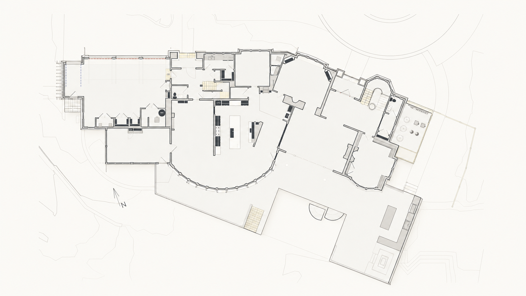
Readable technical graphics.
Plans, sections, and model views give both technical and non-technical stakeholders a clearer way into the project.
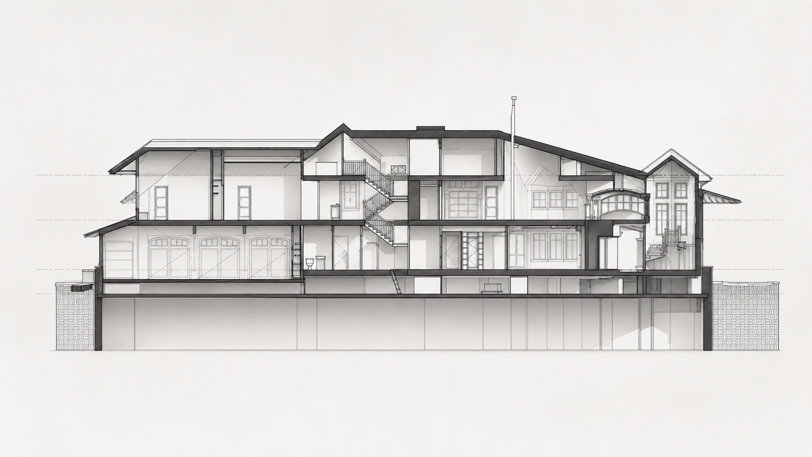
Plans, elevations, sections unified.
The documentation set provides a coordinated reference for building form, floor levels, spatial relationships, and exterior conditions.
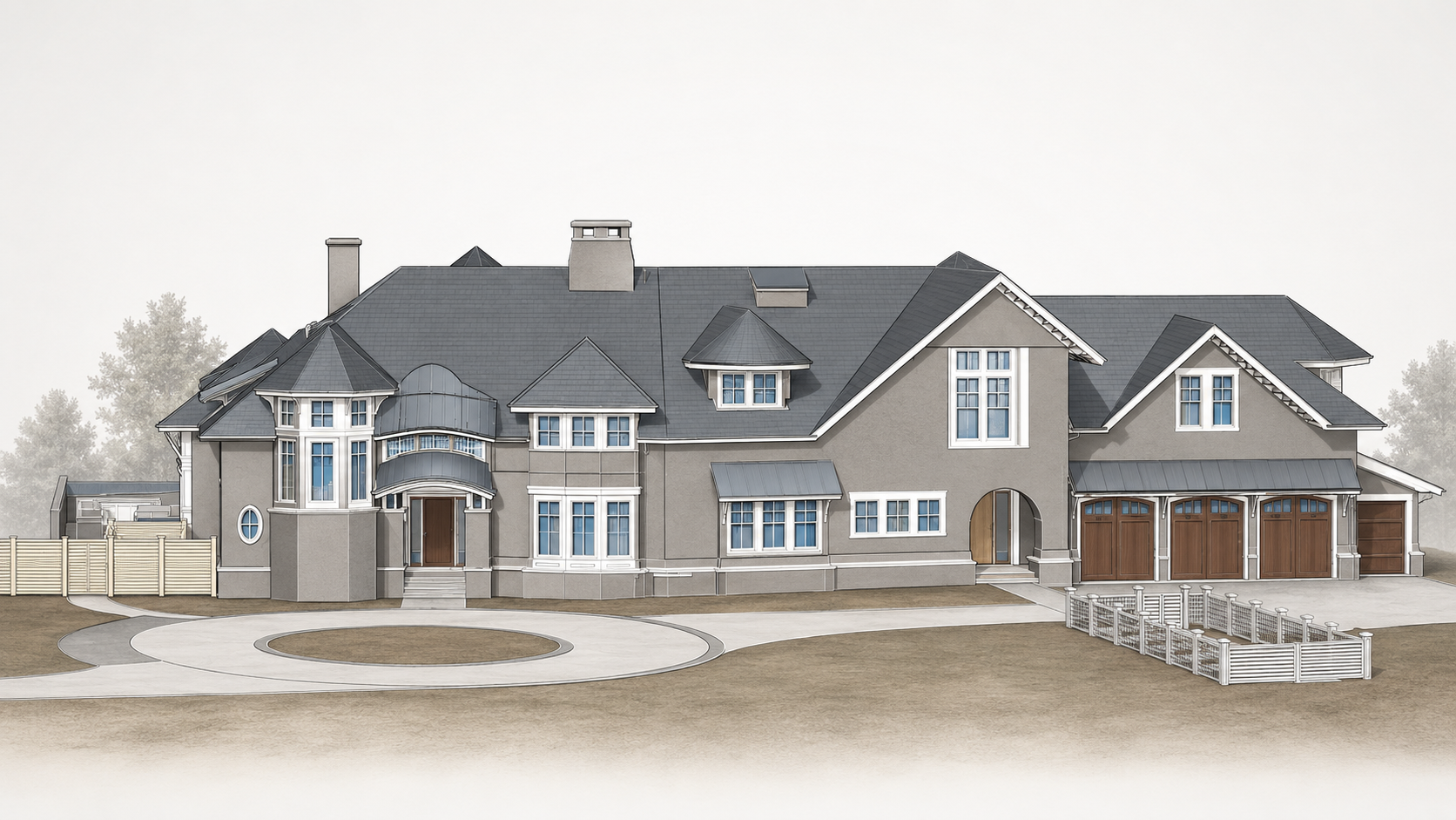
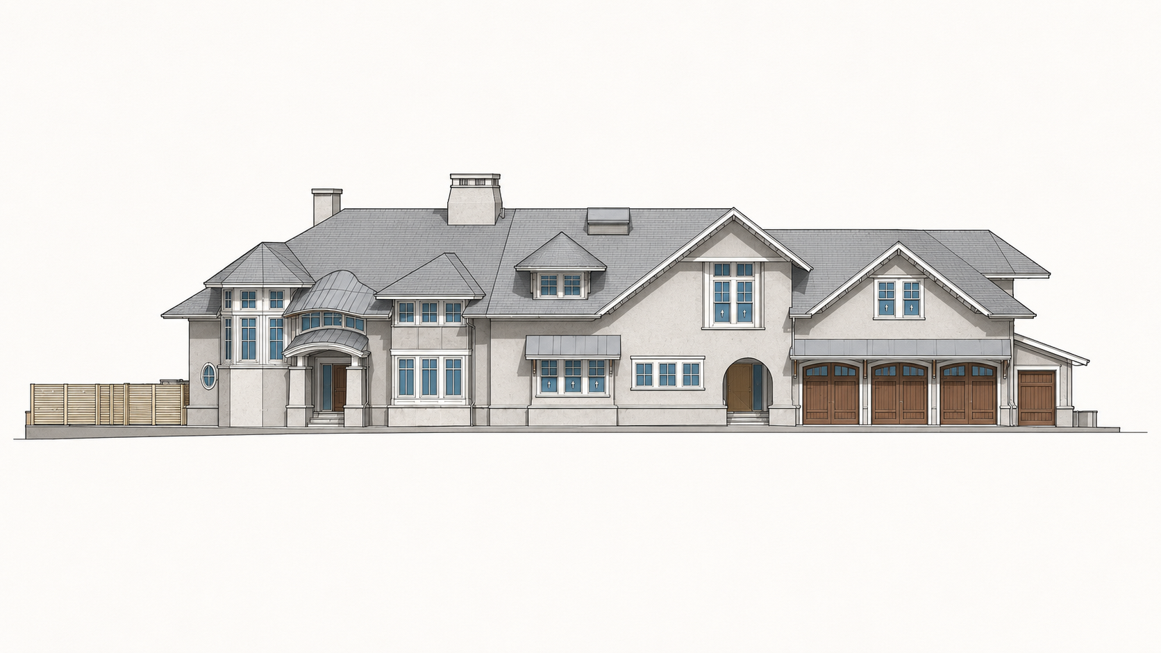
Exterior geometry made legible.
Multiple model views help the team quickly understand massing, façade organization, roof complexity, and exterior features.
Everything the client needs to move faster.
The value is not one file type. The value is the organized context around the property: measured geometry, model intelligence, drawing outputs, visual media, and easy ways for the project team to review what was captured.
Revit existing-conditions model
Design-ready BIM geometry structured for downstream coordination and renovation planning.
SketchUp visual model
Flexible model views for faster communication, massing review, and stakeholder orientation.
CAD + PDF documentation
Plans, elevations, and sections packaged for technical review and project startup.
Drone photo + video
Aerial imagery and video to show shoreline context, roof geometry, landscape, and access.
360 + shared media
Kuula review assets plus organized photo and video folders so the client has more context, not less.
Capture enough context so design starts with fewer assumptions.
A strong existing-conditions package should let the client, architect, builder, and consultants revisit the property virtually, understand the geometry, and make decisions without waiting for another site visit.
The deliverable has to work after we leave the site.
A strong existing-conditions package should let the client, architect, builder, and consultants revisit the property virtually, understand the geometry, and make decisions without waiting for another site visit.
Understanding the site from shoreline to structure.
Waterfront context, surrounding grade, exterior geometry, and access conditions were captured as part of a coordinated existing-conditions documentation package.
Aerial documentation in motion
Click to play video
Shoreline context
Property setting, water frontage, landscape, and neighboring context.

Arrival sequence
Driveway, grade, landscape, exterior access, and garage relationships.
Exterior model
Architecture, roof geometry, façade organization, terraces, and site elements.
Drawing package
Plans, elevations, sections, and model-derived documentation for project startup.
The value is not in the scan itself. It is in what your team can do next.
Design-ready deliverables
Measured information is structured into clean Revit and CAD outputs so architects, owners, and developers can move quickly.
Clear communication
Pointknown focuses on clarity. The process stays in the background. The usable result stays front and center.
One source of truth
A single field effort supports visualization, planning, modeling, and documentation—without repeated site visits or fragmented information.
If you are planning, renovating, leasing, or evaluating a building, clear existing conditions matter.
Pointknown helps design teams and property stakeholders move forward with confidence by turning existing buildings into usable, decision-ready information.