

Brighton Market
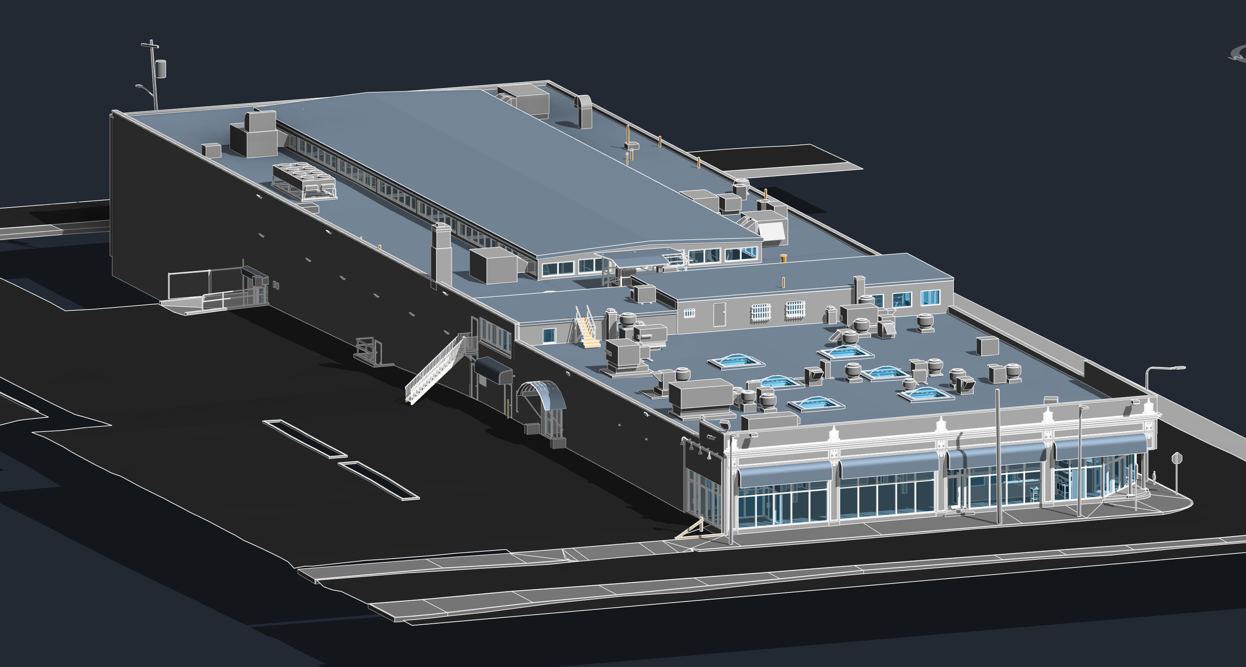
Pointknown documented Brighton Market, a large active commercial property at the intersection of Commonwealth Avenue and Brighton Avenue in Boston, Massachusetts. Spanning more than 100,000 square feet, the project included market spaces, food court areas, mezzanine levels, rooftop conditions, and surrounding site context. The goal was to create a comprehensive existing-conditions dataset that would support ownership, leasing analysis, future renovations, and redevelopment planning.
Commonwealth Avenue + Brighton Avenue + Boston conditions
Active streets, tight site conditions, roof complexity, food court interiors, and an evolving commercial property — all captured as one coordinated documentation package.
A building record that works beyond the first drawing request
The Revit model was developed as a practical foundation for design and planning — not just a visual reference. Roof equipment, storefront conditions, RCP information, interior layout, and site relationships were coordinated into a single usable record. For active commercial properties, this level of documentation helps teams make better decisions earlier. It reduces guesswork, limits repeated field visits, and gives stakeholders a clearer way to understand the property.
Existing conditions, made easier to understand.
Rendered views help communicate building context quickly — especially when ownership, design, leasing, and development teams need to understand the asset without digging through raw files.
A coordinated building model makes complex existing conditions easier to understand, communicate, and build from.
A complete existing conditions package, from reality capture to usable deliverables.
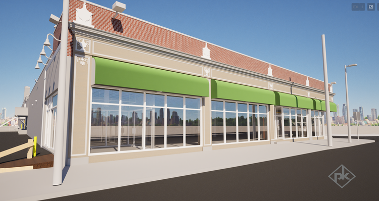
The final package translated field capture into familiar, usable formats for project teams: Revit, CAD, plan graphics, sections, elevations, and leasing-related area calculations.

Architectural Elevation
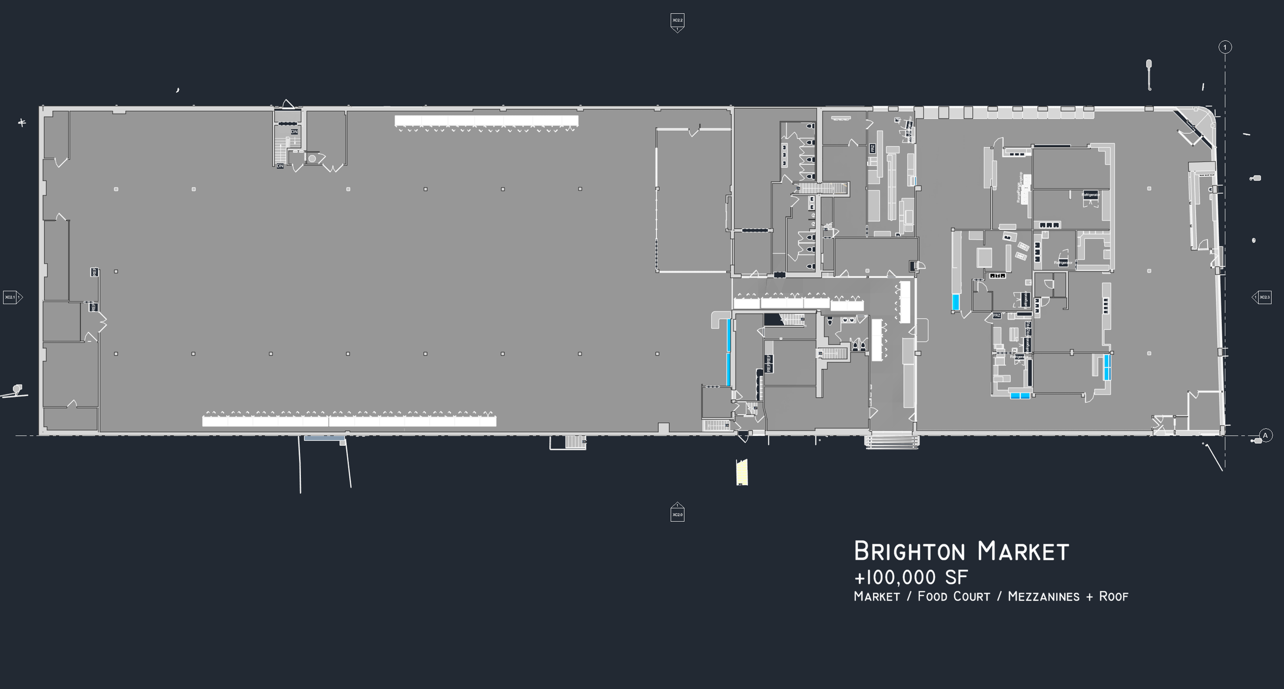
Existing Conditions Floor Plan
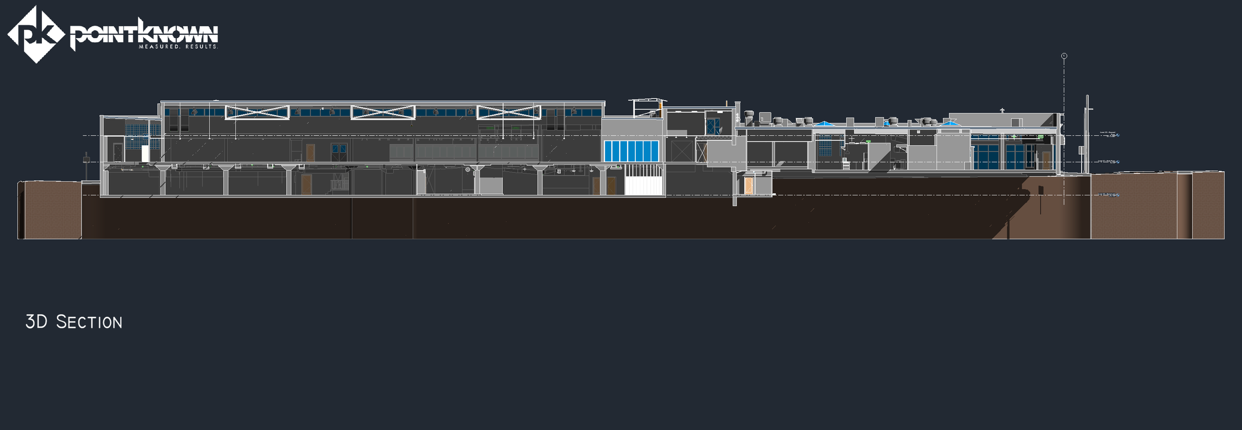
3D Building Section
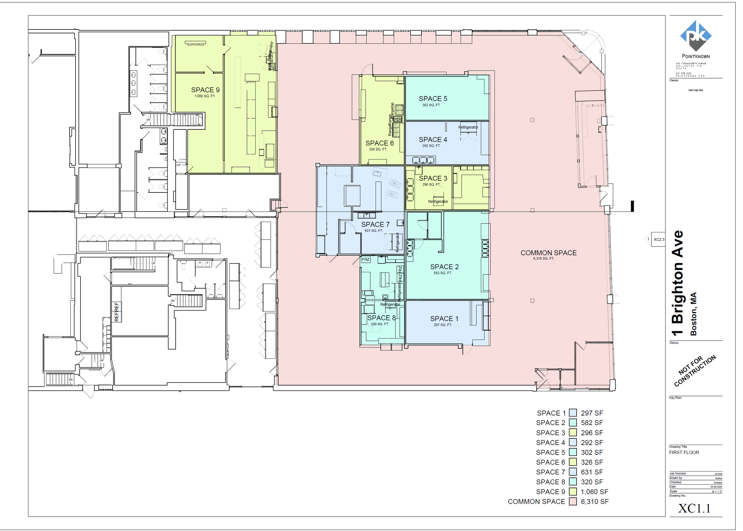
Food Court + Common Area Calculations
The value is not in the scan itself. It is in what your team can do next.
Design-ready deliverables
Measured information is structured into clean Revit and CAD outputs so architects, owners, and developers can move quickly.
Clear communication
Pointknown focuses on clarity. The process stays in the background. The usable result stays front and center.
One source of truth
A single field effort supports visualization, planning, modeling, and documentation—without repeated site visits or fragmented information.
If you are planning, renovating, leasing, or evaluating a building, clear existing conditions matter.
Pointknown helps design teams and property stakeholders move forward with confidence by turning existing buildings into usable, decision-ready information.