

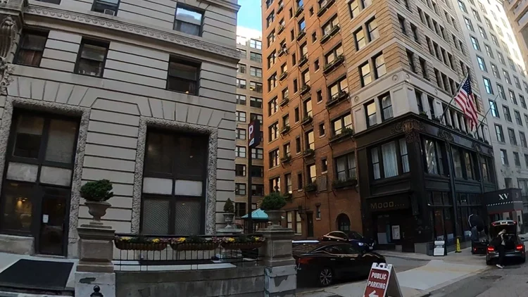
Beacon XV
Pointknown documented a façade-focused project along Beacon Street, capturing exterior conditions of a multi-building urban property commonly referred to as Beacon XV. The goal was to create a precise digital record of building façades and exterior geometry to support design, renovation planning, and architectural coordination.
Beacon Street is one of Boston’s most iconic corridors, lined with a mix of historic brownstones, institutional buildings, and urban residential structures. Projects in this area often require careful documentation to respect architectural character while enabling updates and improvements within a dense, highly visible streetscape.
A complete existing conditions package, from reality capture to usable deliverables.
This project combined SLAM laser scanning, drone capture, and 360° documentation to efficiently map façade conditions along a prominent Boston corridor. The result is a clean, coordinated digital twin that supports architectural design, visualization, and urban project planning with precision.


The value is not in the scan itself. It is in what your team can do next.
Design-ready deliverables
Measured information is structured into clean Revit and CAD outputs so architects, owners, and developers can move quickly.
Clear communication
Pointknown focuses on clarity. The process stays in the background. The usable result stays front and center.
One source of truth
A single field effort supports visualization, planning, modeling, and documentation—without repeated site visits or fragmented information.
If you are planning, renovating, leasing, or evaluating a building, clear existing conditions matter.
Pointknown helps design teams and property stakeholders move forward with confidence by turning existing buildings into usable, decision-ready information.