

34 Parker Island
Lakefront existing-conditions documentation and Revit modeling for a private residence on Lake Winnipesaukee.
Wolfeboro sits on the eastern shore of Lake Winnipesaukee, surrounded by the lakes, forests, and mountains that define New Hampshire’s Lakes Region.
For a project like 34 Parker Island, that context matters. The value of the documentation is not just the house in isolation — it is the home, the site, the water, and the surrounding landscape understood as one coordinated existing condition.
A clear existing-conditions baseline for a lakefront property.
Pointknown documented this Wolfeboro, New Hampshire lakefront property to create a dependable existing-conditions foundation for planning, design, and coordination.
The work combined site context, aerial documentation, and Revit modeling to help the project team understand the relationship between the residence, the shoreline, and the surrounding landscape.
Site information the team can actually see
Drone imagery, exterior photography, video, and 360° review tools provide a complete visual understanding of the property, going far beyond what traditional drawings alone can communicate.
A complete coastal documentation workflow from capture to handoff.
For 34 Parker Island, we developed a structured documentation package that transforms real-world site conditions into coordinated digital deliverables—giving the design team a precise, organized starting point for planning and renovation.
Capture
Full-site documentation of the coastal property using drone imagery, exterior photography, and 360° capture tools. The goal was to preserve both architectural context and environmental conditions in one cohesive dataset.
Model
Laser scan data was translated into coordinated Revit and CAD deliverables, forming an accurate digital base for design development, planning, and technical coordination.
Deliver
A structured handoff package including BIM files, drawings, drone media, 360° review links, and organized file sets— allowing the project team to immediately begin design with confidence and clarity.
From shoreline context to model clarity.
The image sequence moves from broad site understanding into more detailed architectural information: aerial context, site plan, Revit massing, and lakefront orientation.
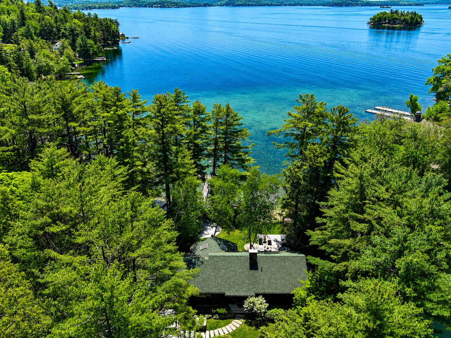
Lakefront context
The aerial image establishes the property’s relationship to Lake Winnipesaukee, surrounding tree cover, and shoreline exposure.
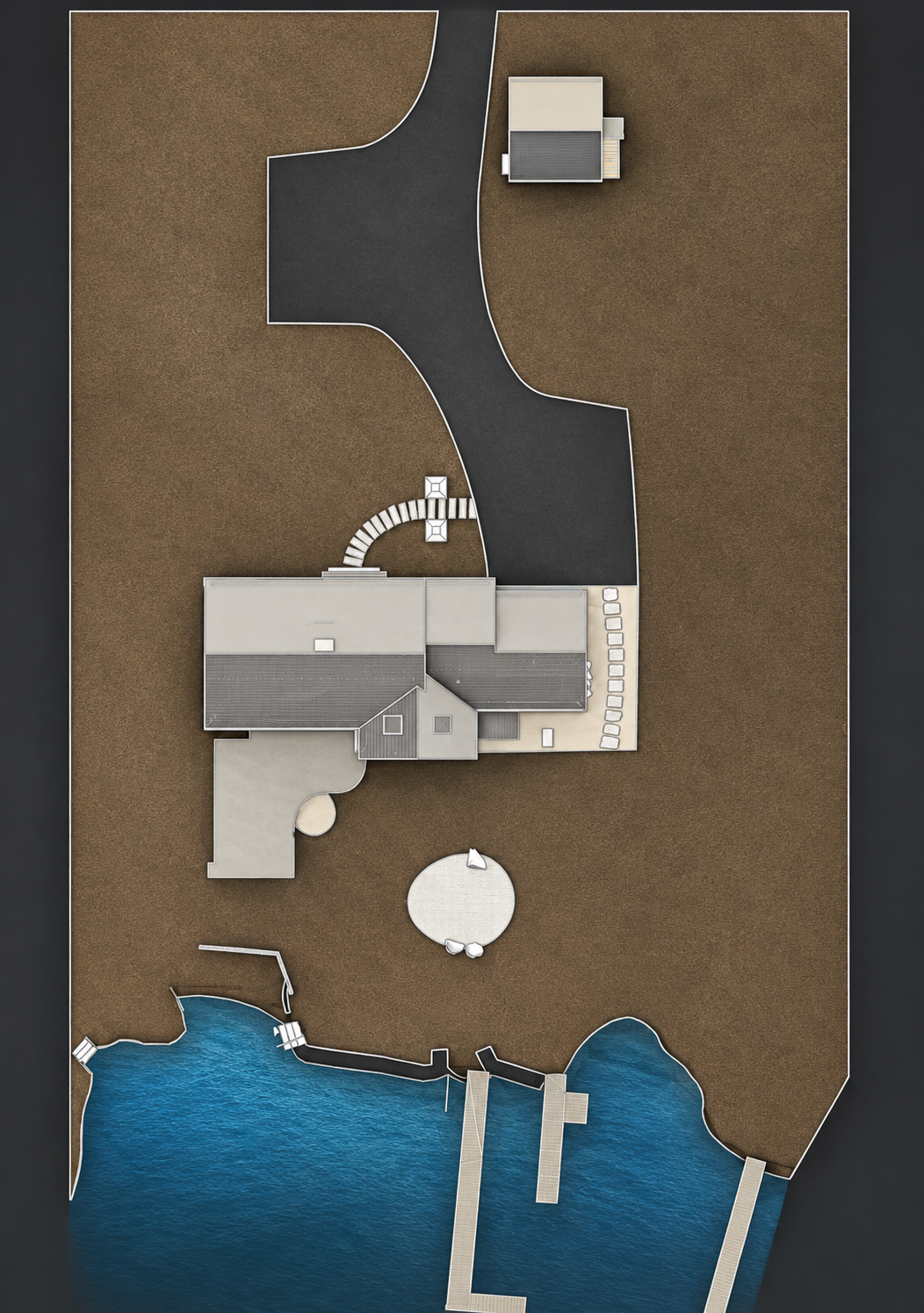
A clean model foundation.
The plan view helps clarify orientation, access, and the relationship between the home, land, and water.

Lakefront Revit model view
Model views translate field information into clear architectural geometry for design and coordination.
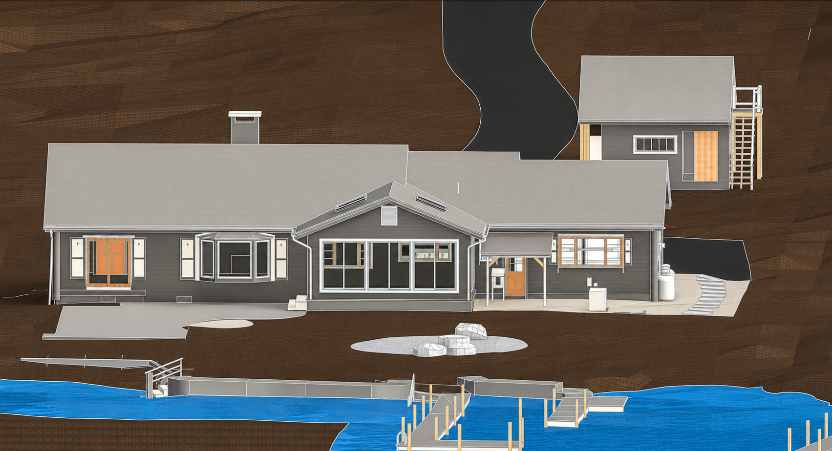
Water-facing view
The lakefront model view highlights the structure’s orientation toward the water and the importance of accurate exterior documentation.
Understanding a complex coastal property before design begins
Coastal renovation projects require a clear understanding of how the building, terrain, waterfront conditions, and surrounding site elements work together. Existing-conditions documentation creates a reliable foundation for evaluating opportunities and constraints before design decisions are made.
The challenge was understanding how every condition connects.
A waterfront property involves more than the building itself. Terrain, elevation changes, exterior relationships, and architectural geometry all influence future design decisions. A coordinated capture process transforms those conditions into usable information for the project team.
Everything the client needs to move faster
The value is not one file type. The value is the organized context around the property: measured geometry, model intelligence, drawing outputs, visual media, and easy ways for the project team to review what was captured.
Revit Model
A coordinated digital model developed to support design and planning workflows.
Site Plan Reference
A clear view of the property layout, orientation, and relationship to the shoreline.
Drone Photography
Aerial context that helps communicate setting, access, tree cover, and lakefront exposure.
Project Imagery
Visual assets for coordination, review, presentation, and future decision-making.
Experience shows up in the handoff.
The best documentation teams do not simply collect data. They know what matters, what to ignore, what to model, what to share, and how to package it so the next team can work.
We scope for the decision ahead.
Each capture effort is shaped around what the client, architect, consultants, and builder need to understand next.
We know the deliverable ecosystem.
Revit, CAD, SketchUp, PDF, drone media, 360 photography, and shared file structures all play different roles.
We make complex properties easier to communicate.
The goal is not to show every piece of data. The goal is to make the right information accessible, clear, and usable.
Have a property that needs clear existing conditions?
Pointknown helps owners, architects, builders, and design teams move forward with accurate site data, clean Revit models, drone documentation, and usable project information.