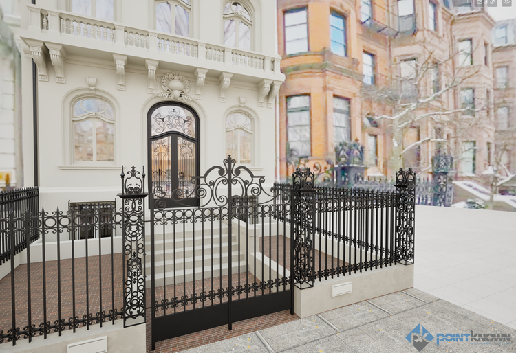
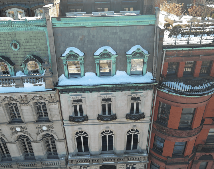
COMM AVENUE BACKBAY · BOSTON

130 Comm Ave Backbay

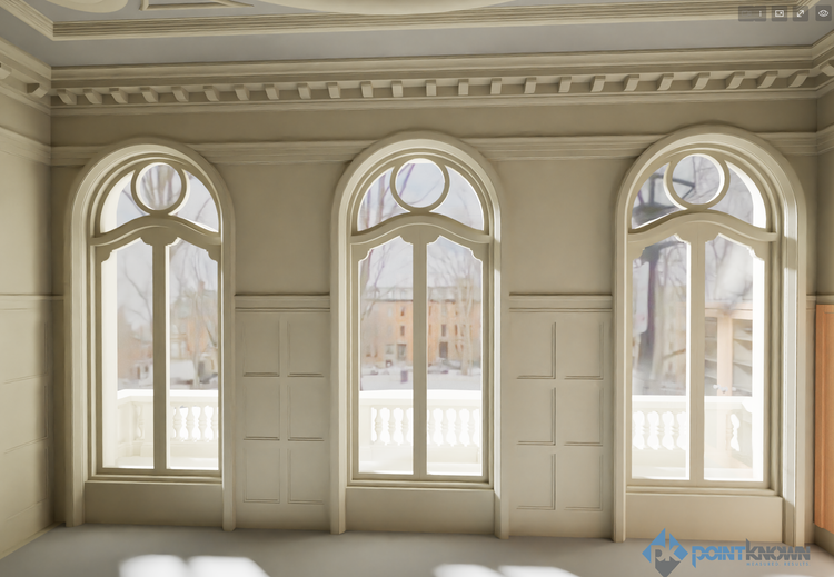
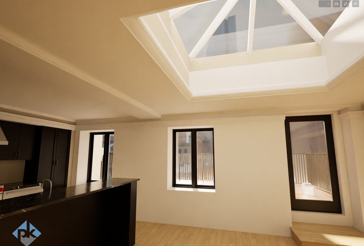
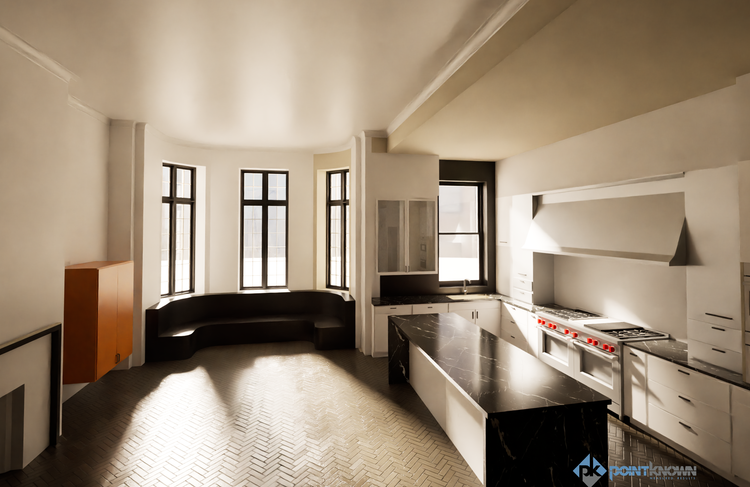
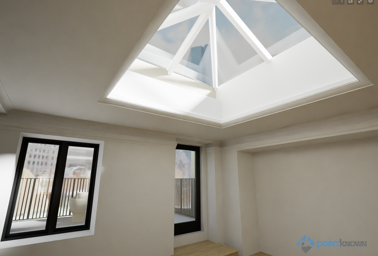
At 130 Commonwealth Avenue in Boston’s Back Bay, Pointknown delivered a full existing-conditions capture of a historic townhouse using a layered reality-capture workflow. The project combined mobile LiDAR, RTK-enabled drone data, and immersive media to create a coordinated, visualization-ready digital foundation for renovation planning and design.

Historic Townhouse
Project Type
Residential/Historic Townhouse
Deliverables
Mobile LiDAR + 360 Photo/Video + HDRI for Twinmotion
Location
Boston, MA
Use Case
Renovation & Planning
Measured once. Delivered ready for design.
What was documented
Pointknown documented the complete interior and exterior geometry of the townhouse, including roof conditions and immediate site context, along with detailed visual references through 360 imagery and walkthrough capture—providing both precise measurements and spatial context.
What was delivered
The project was delivered as a unified dataset including LiDAR-based geometry, drone-derived roof and site data, immersive 360 media, and HDRI environments prepared for visualization workflows—supporting modeling, coordination, and rendering from a single source of truth.
Why it matters
Historic urban properties often contain irregular geometry and layered conditions that can lead to costly errors if not captured accurately. A coordinated digital baseline allows teams to reduce uncertainty, move faster in design, and avoid repeated site visits.
XGRIDS PortalCam interior walkthrough for fast navigation and collaboration.

You can walk through for yourself here: Pointknown 130 Comm Ave : Gaussian Splatt

PROJECT HIGHLIGHTS

A complete existing conditions package, from reality capture to usable deliverables.

A high-fidelity reality capture of a Back Bay townhouse, delivered as a coordinated dataset with LiDAR, drone, and immersive media—enabling faster, more confident renovation planning and visualization.

Project highlight
Project highlight
Project highlight
Project highlight
Project highlight
Project highlight
Project highlight
Project highlight
Project highlight
Project highlight
WHY POINTKNOWN

The value is not in the scan itself. It is in what your team can do next.

Design-ready deliverables

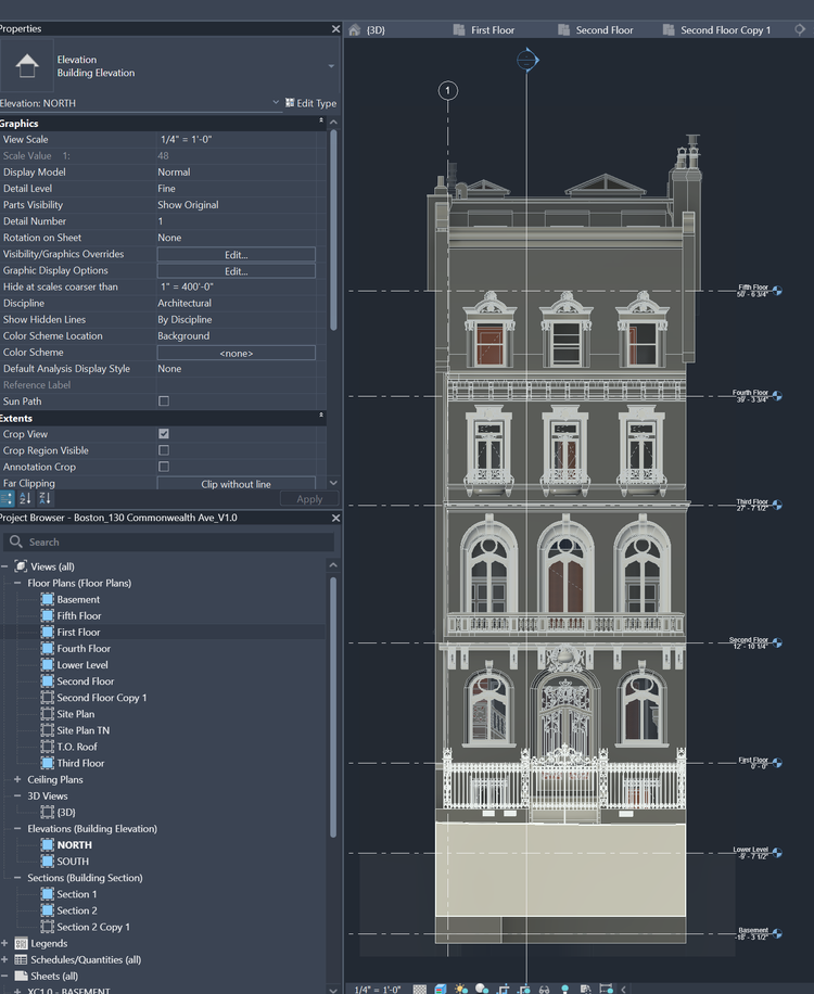
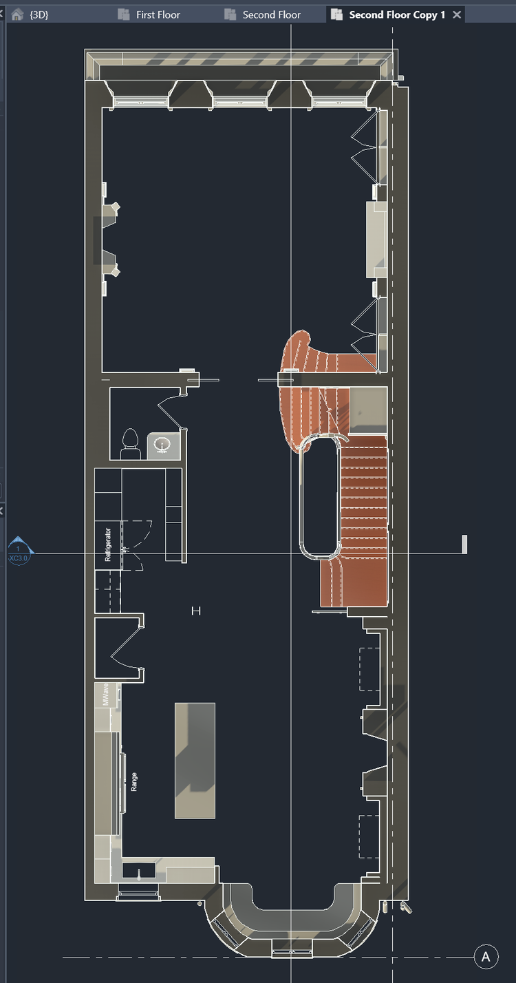
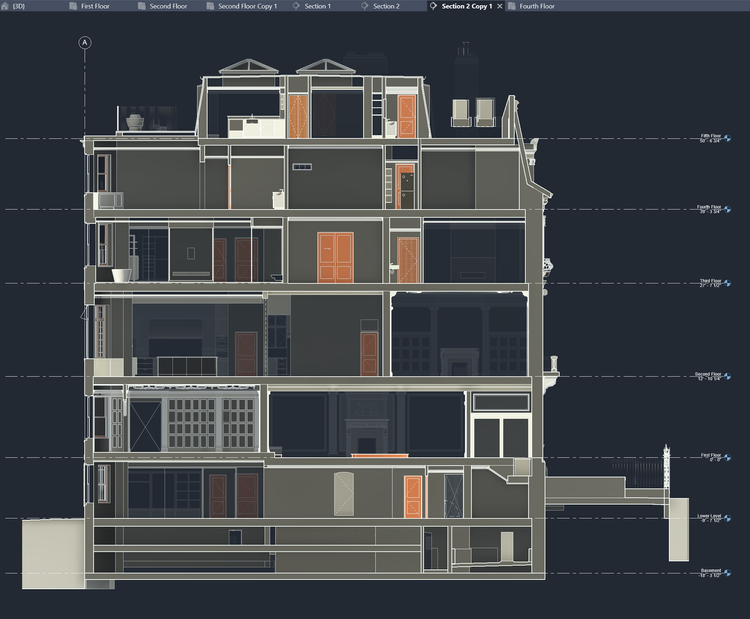
Measured information is structured into clean Revit and CAD outputs so architects, owners, and developers can move quickly.

Clear communication

Pointknown focuses on clarity. The process stays in the background. The usable result stays front and center.

One source of truth

A single field effort supports visualization, planning, modeling, and documentation—without repeated site visits or fragmented information.

Interested in something similar?

If you are planning, renovating, leasing, or evaluating a building, clear existing conditions matter.

Pointknown helps design teams and property stakeholders move forward with confidence by turning existing buildings into usable, decision-ready information.