MATTAPOISETT · MASSACHUSETTS

Mattapoisett

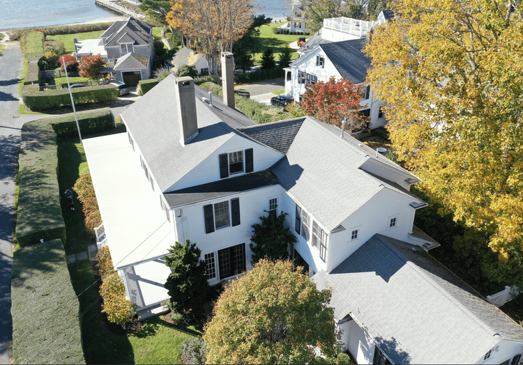
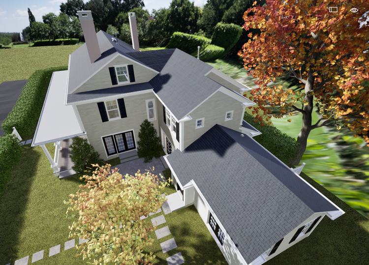
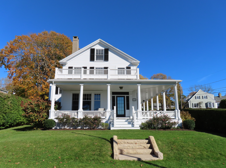
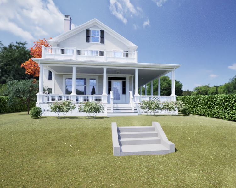
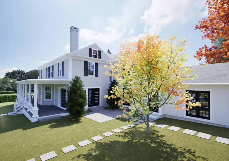
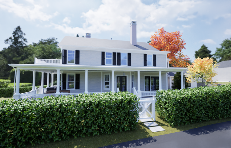
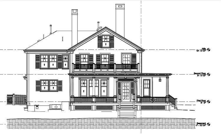
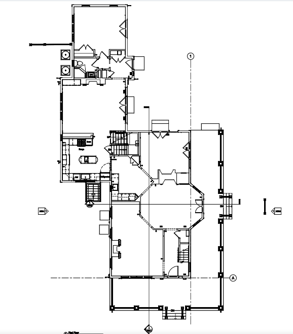
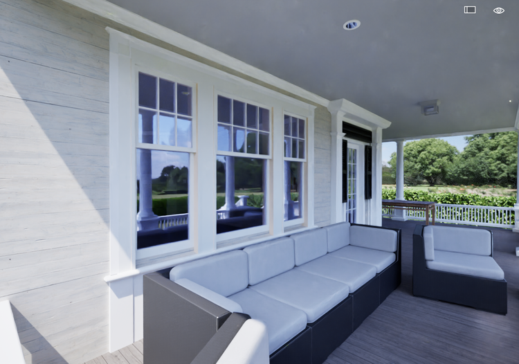
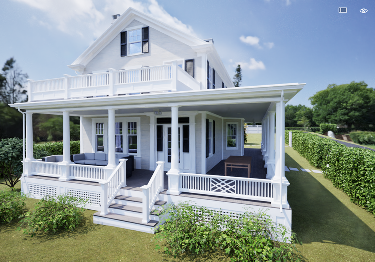
Pointknown documented a waterfront residence located on Shipyard Lane in Mattapoisett, Massachusetts, capturing the home, surrounding hardscape, and coastal context as a unified digital model. The project required a highly detailed existing-conditions survey to support renovation planning in a complex shoreline environment where architecture and landscape are tightly interconnected.

Waterfront Residence
Drone photogrammetry and Aerial imagery
Project Type
Residential
Deliverables
Revit Model
Location
Mattapoisett, MA
Use Case
Renovation & Long-term Planning
Measured once. Delivered ready for design.
What was documented
Our team captured the property using a combination of SLAM-based mobile LiDAR, high-density terrestrial laser scanning, and drone photogrammetry. The workflow recorded interior spaces, exterior façades, roof geometry, decks, and waterfront edge conditions, along with surrounding topography and site hardscape. 360° imagery and video were also collected to preserve spatial context and support design coordination.
What was delivered
Pointknown delivered a coordinated Revit model representing the residence and key site elements, along with a full AutoCAD sheet set including floor plans, elevations, site plans, and sections. Additional deliverables included 360° walkthrough visuals and registered point cloud data formats (E57/RCP), enabling flexible use across architectural and construction workflows.
Why it matters
Waterfront homes pose unique challenges: non-orthogonal facades, complex terrain, roof overhangs, and site features like decks or seawalls. At Shipyard Lane, we captured all of these with our hybrid capture strategy—ensuring the data is not only accurate but also usable for downstream design and construction. Clients love that we provide “digital confidence” at the start of their project.
PROJECT HIGHLIGHTS

A complete existing conditions package, from reality capture to usable deliverables.

This project demonstrates the strength of a hybrid capture approach in complex waterfront environments. From façade detailing and interior volumes to shoreline conditions and outdoor living spaces, every element was unified into a single digital twin, giving the design team a precise and actionable understanding of the property.

Project highlight

Project highlight

Project highlight

Project highlight

Project highlight

Project highlight

Project highlight

Project highlight

Project highlight

Project highlight

WHY POINTKNOWN

The value is not in the scan itself. It is in what your team can do next.

Design-ready deliverables

Measured information is structured into clean Revit and CAD outputs so architects, owners, and developers can move quickly.

Clear communication

Pointknown focuses on clarity. The process stays in the background. The usable result stays front and center.

One source of truth

A single field effort supports visualization, planning, modeling, and documentation—without repeated site visits or fragmented information.

Interested in something similar?

If you are planning, renovating, leasing, or evaluating a building, clear existing conditions matter.

Pointknown helps design teams and property stakeholders move forward with confidence by turning existing buildings into usable, decision-ready information.