

Dairy Farm
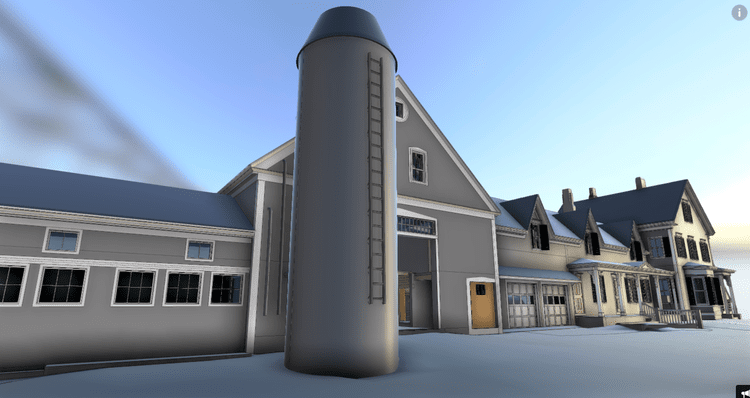
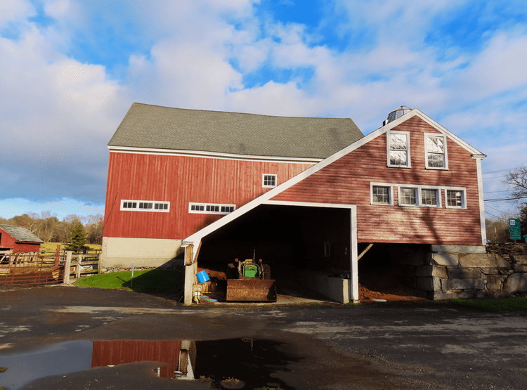
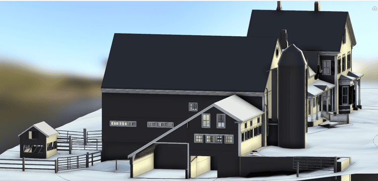
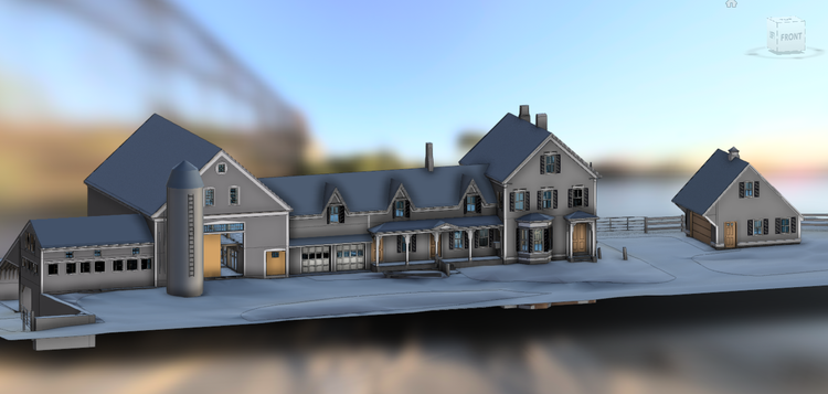
Pointknown documented a working dairy farm property in Dunstable, Massachusetts, capturing all buildings and surrounding landscape to create a complete digital representation of the site. The project focused on developing a unified, design-ready dataset that supports planning, land use, and future improvements across both built and natural elements of the property.
Agricultural properties present a unique mix of structures, open land, and functional layouts that evolve over time. From barns and utility buildings to access paths and terrain, accurate documentation is essential for managing operations, planning upgrades, and coordinating future development while maintaining efficiency on site.
A complete existing conditions package, from reality capture to usable deliverables.
This project integrated mobile LiDAR scanning with drone photogrammetry to create a complete digital twin of both buildings and terrain. The result is a cohesive, high-accuracy dataset that captures the full working environment of the farm—delivered in a format that supports everything from architectural design to land planning.


The value is not in the scan itself. It is in what your team can do next.
Design-ready deliverables
Measured information is structured into clean Revit and CAD outputs so architects, owners, and developers can move quickly.
Clear communication
Pointknown focuses on clarity. The process stays in the background. The usable result stays front and center.
One source of truth
A single field effort supports visualization, planning, modeling, and documentation—without repeated site visits or fragmented information.
If you are planning, renovating, leasing, or evaluating a building, clear existing conditions matter.
Pointknown helps design teams and property stakeholders move forward with confidence by turning existing buildings into usable, decision-ready information.