WESTON · MASSACHUSETTS

Weston

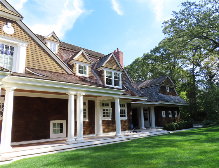
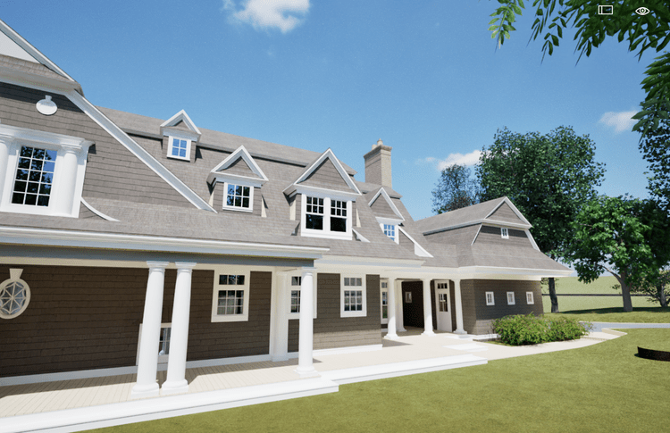
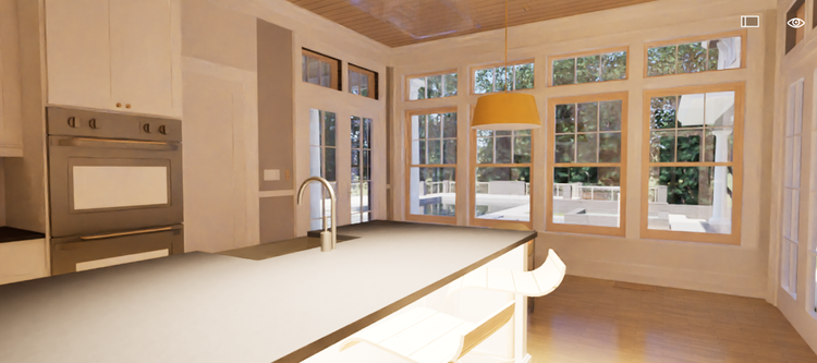
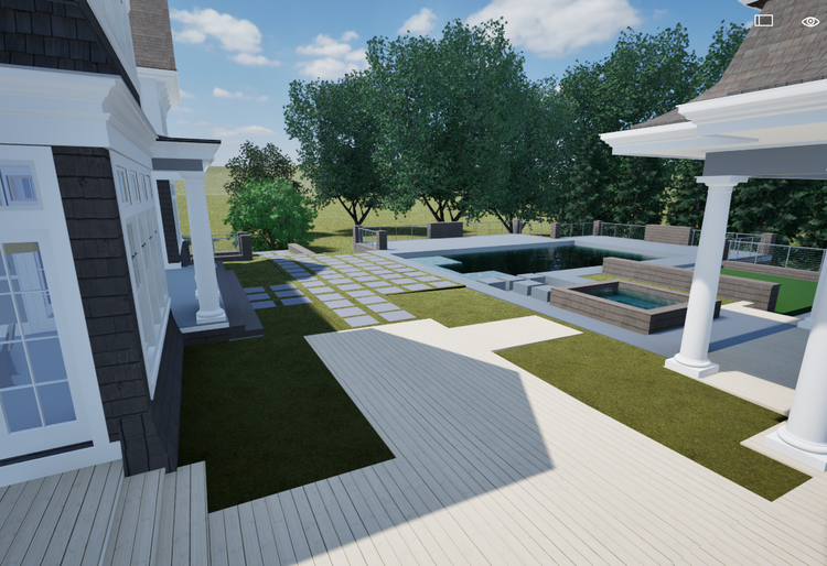
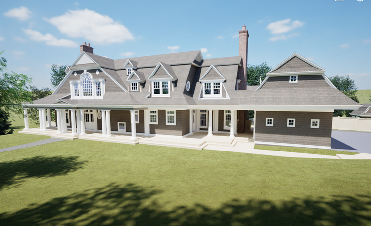
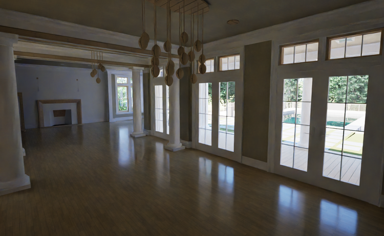
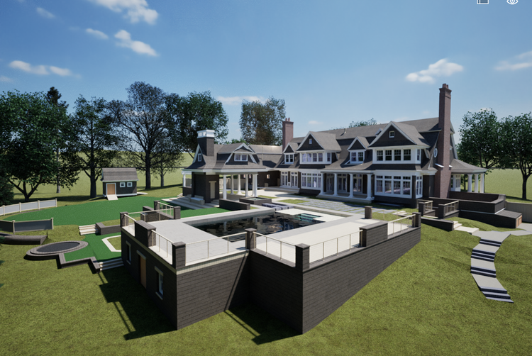
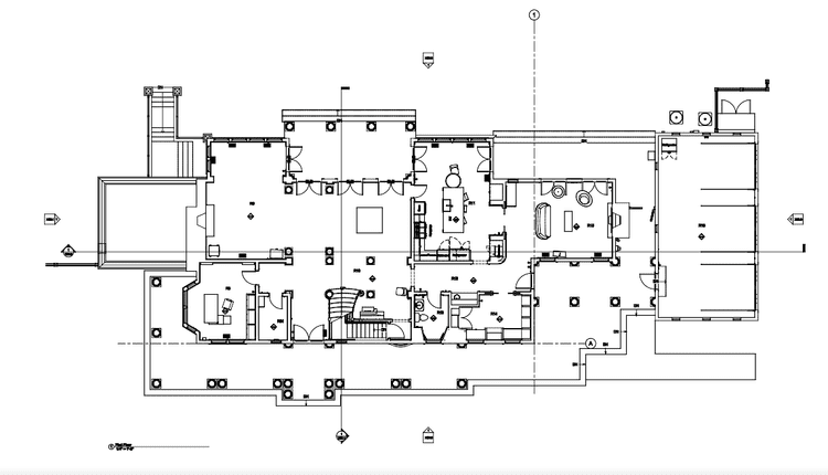
Pointknown completed a full existing-conditions documentation and BIM deliverable for a residential property in Weston, Massachusetts. The project combined high-accuracy reality capture with coordinated modeling workflows to produce a reliable digital foundation for design, renovation, and construction planning. The final dataset included CAD drawings, interior elevations, and both Revit and SketchUp models aligned to verified field data.

Private Residence
Extensive CAD Output
Reality Capture & Data Integration
Project Type
Residential
Deliverables
Full Set of Interior Elevations & both Revit & SketchUp models
Location
Weston, MA
Use Case
Design, Coordination & Planning
Measured once. Delivered ready for design.
What was documented
The entire residence was documented using terrestrial LiDAR scanning and high-resolution photography, capturing interior spaces, key exterior conditions, and architectural details. The survey included full building geometry, circulation areas, structural elements, built-in features, and interior elevations. All scan data was registered into a unified, coordinated point cloud to ensure consistency across the dataset.
What was delivered
Pointknown delivered a complete BIM and drawing package including a Revit existing-conditions model, SketchUp model, CAD floor plans, sections, and detailed interior elevations. A unified point cloud dataset (RCP/E57 as applicable) and supporting QA documentation were also provided. The final deliverables were structured for direct use by architects, designers, and builders for coordination and planning.
Why it matters
Accurate existing conditions are critical in residential renovation projects where design decisions depend on understanding real-world constraints. By aligning scan data with disciplined BIM workflows, this project reduced uncertainty, minimized assumptions, and provided a trusted reference for all stakeholders. The result is a clearer path from existing conditions to design decisions, helping reduce rework and improve coordination efficiency.
PROJECT HIGHLIGHTS

A complete existing conditions package, from reality capture to usable deliverables.

A complete existing-conditions package in Weston, combining reality capture and BIM to deliver a coordinated Revit model, CAD drawings, and interior elevations—providing a clear, design-ready foundation for confident project delivery.

Project highlight

Project highlight

Project highlight

Project highlight

Project highlight

Project highlight

Project highlight

Project highlight

Project highlight

Project highlight

Project highlight

Project highlight

Project highlight

WHY POINTKNOWN

The value is not in the scan itself. It is in what your team can do next.

Design-ready deliverables

Measured information is structured into clean Revit and CAD outputs so architects, owners, and developers can move quickly.

Clear communication

Pointknown focuses on clarity. The process stays in the background. The usable result stays front and center.

One source of truth

A single field effort supports visualization, planning, modeling, and documentation—without repeated site visits or fragmented information.

Interested in something similar?

If you are planning, renovating, leasing, or evaluating a building, clear existing conditions matter.

Pointknown helps design teams and property stakeholders move forward with confidence by turning existing buildings into usable, decision-ready information.