
Residential | Commercial | Industrial
Existing conditions documentation for a complex converted carriage house in Lexington, Massachusetts.
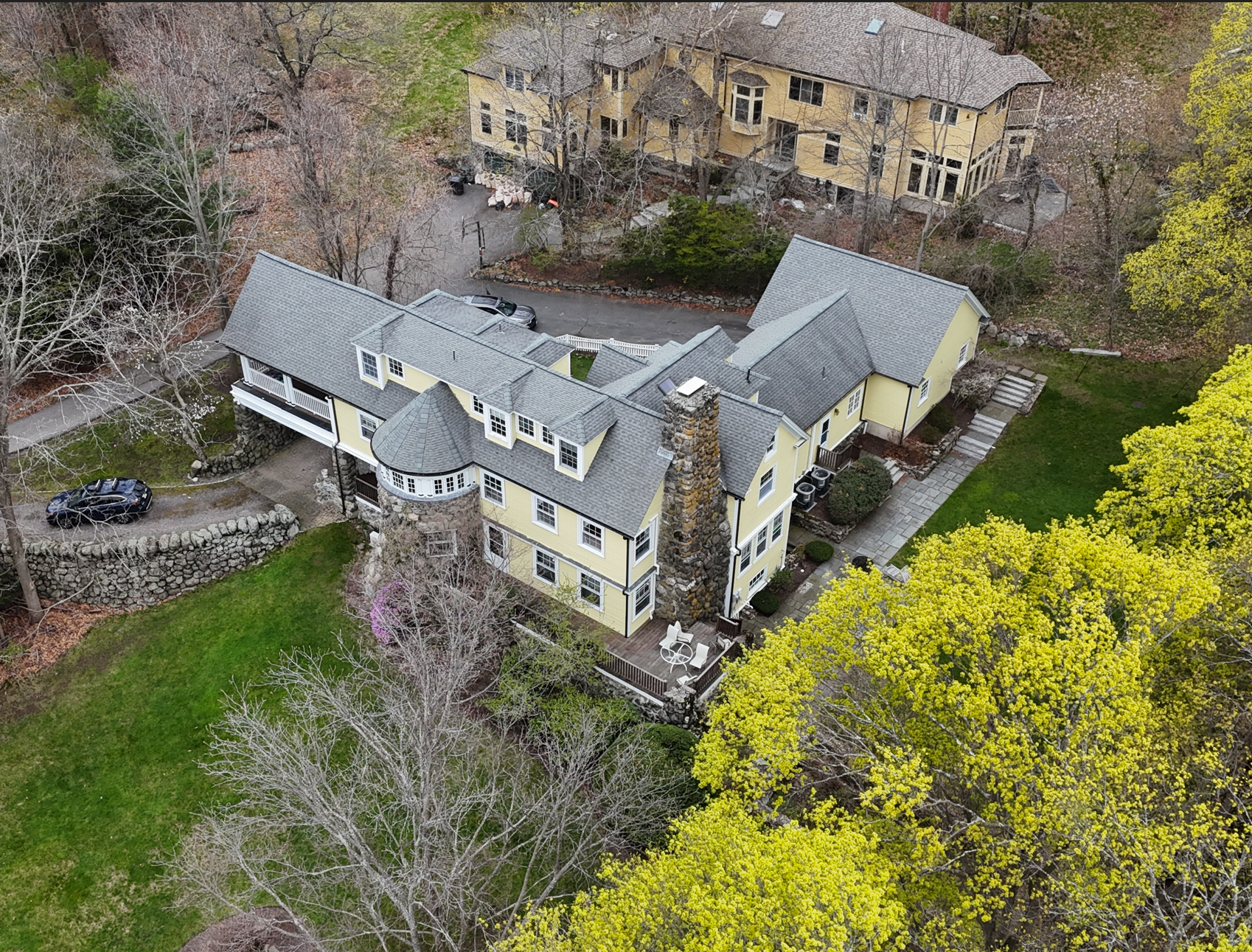
Pointknown was engaged by a design/build firm to document a 4,300 SF residential property on Pleasant Street in Lexington, MA, along with approximately 2,000 SF of surrounding site conditions, including hardscape, retaining walls, patios, decks, and topography.
The goal was to create a clear, reliable existing-conditions baseline so the team could move forward with speed, clarity, and confidence.
Overview
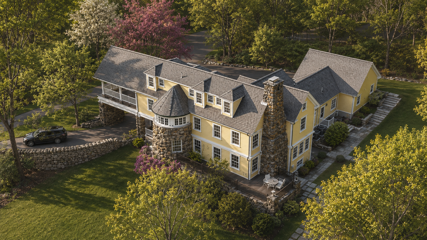
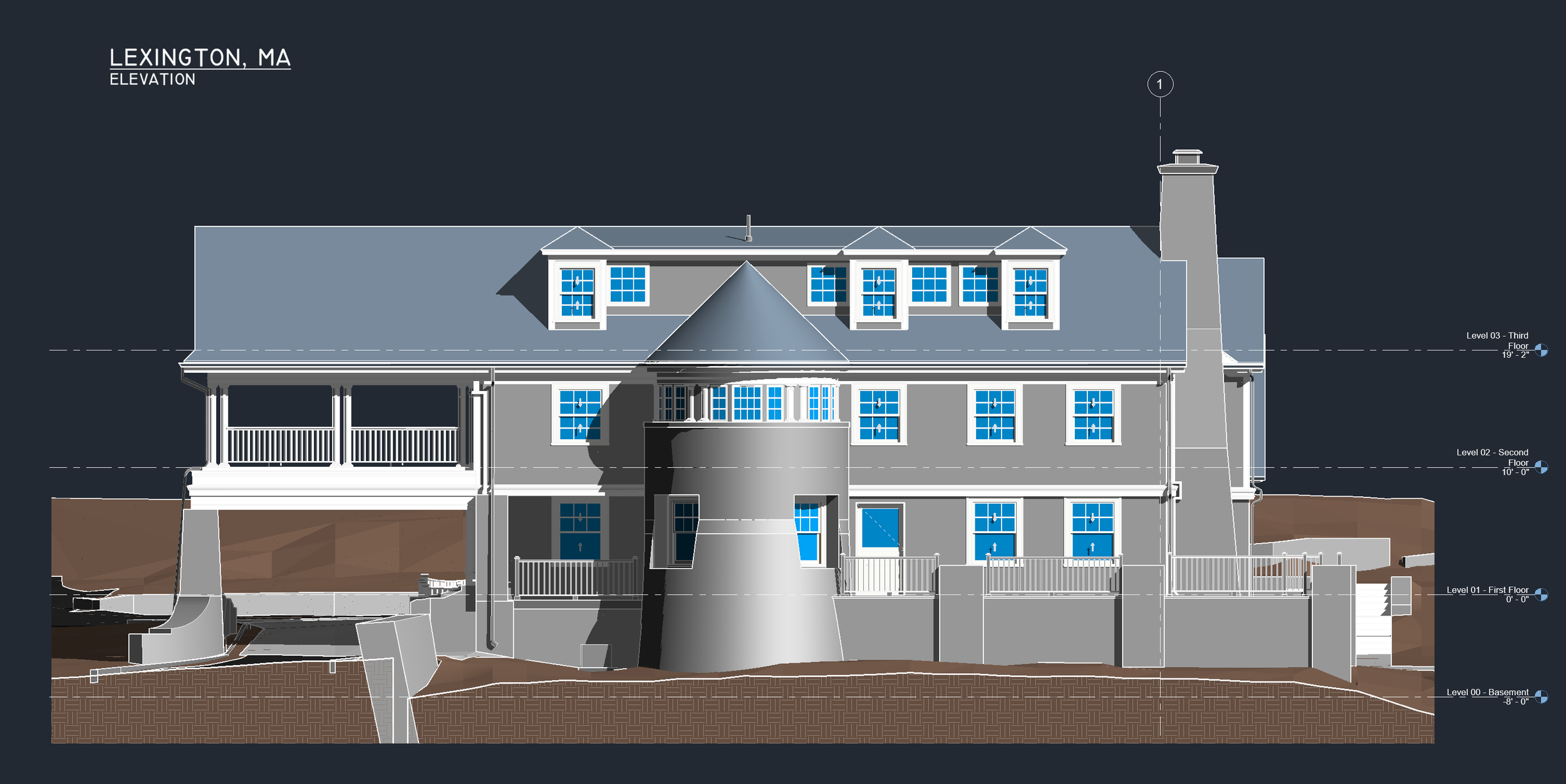
This project centered on a classic converted carriage house with a level of complexity that made accurate documentation especially important.
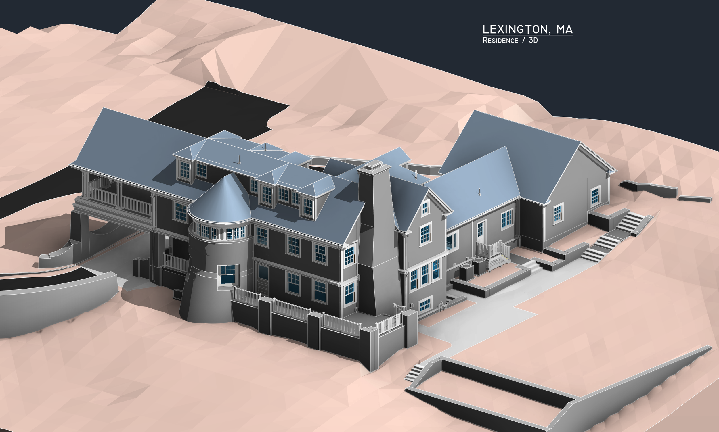
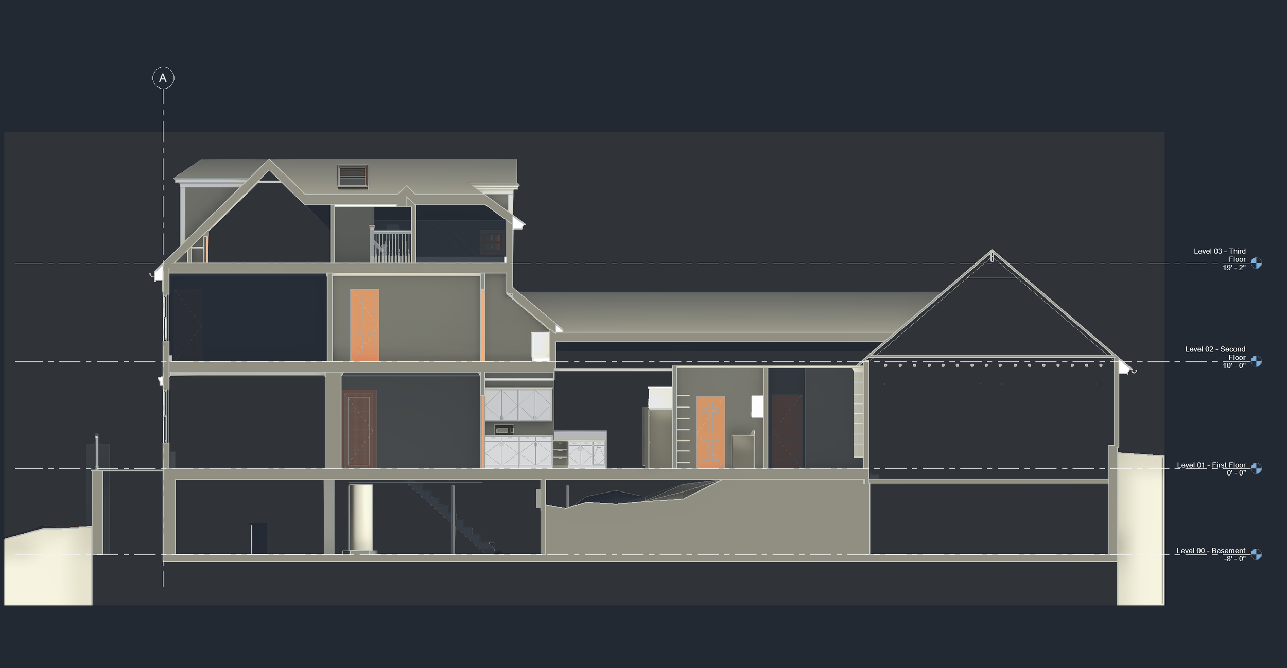
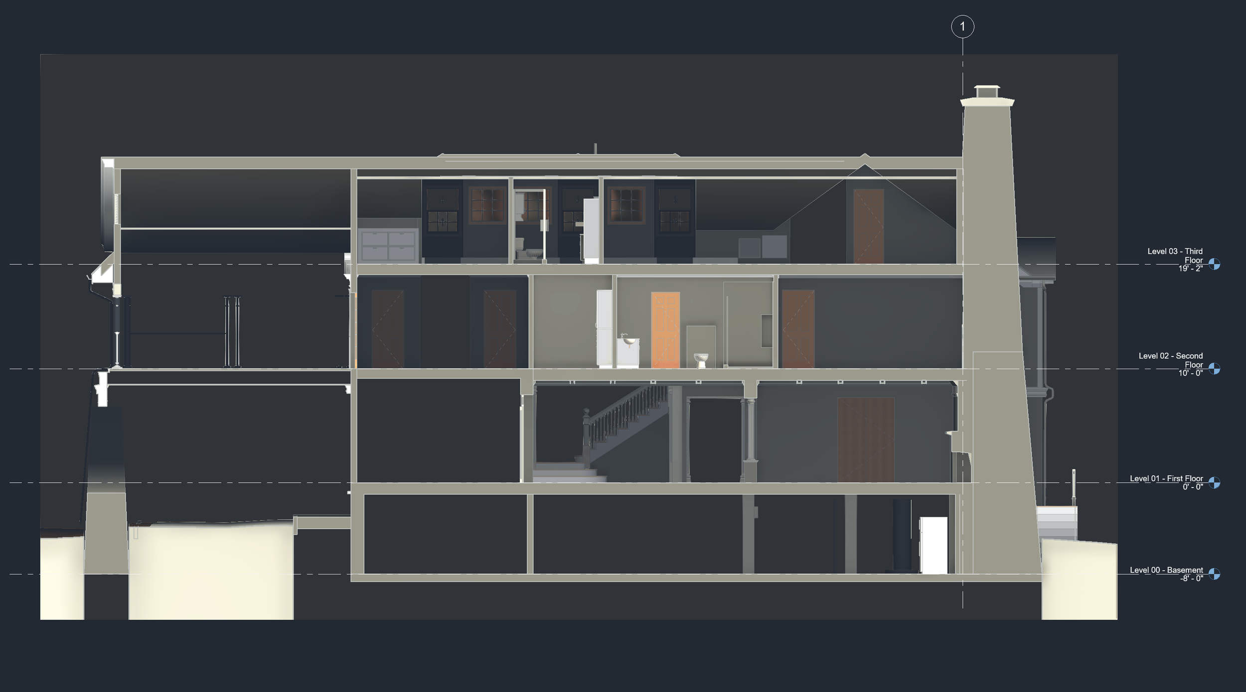
The residence included a porte-cochère, stone turret, chimney, flagstone patios, wood decks, stone retaining walls, and a dense collection of interconnected roof forms. Many of the roof angles and transitions tied into one another in unusual ways, creating the kind of geometry that is difficult to capture through traditional field measuring alone.
Pointknown combined GeoSLAM LiDAR scanning, drone capture, 360 photo documentation, Revit modeling, and site/topographic documentation to give the project team one organized source of truth.
Scope of Work
For this Lexington residential project, Pointknown provided:
GeoSLAM LiDAR scanning
Drone capture
360 photo / video documentation
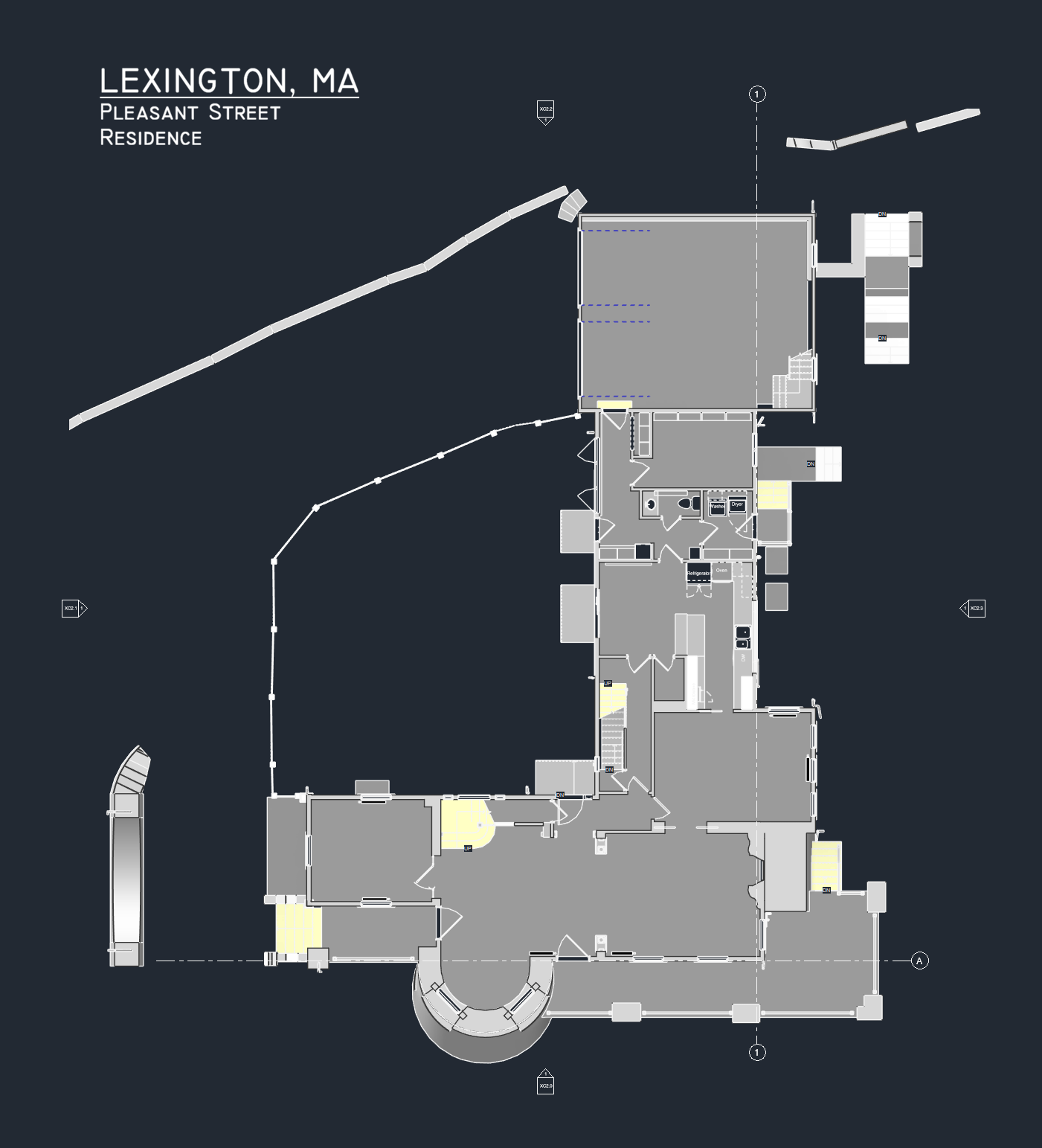
Revit model
Site and topographic documentation
Hardscape and retaining wall documentation
The Challenge
This was not a simple house.
Converted carriage houses often carry layers of history, additions, adjustments, and unique construction logic. Pleasant Street was no exception. The building had a distinctive architectural character, but also a highly involved geometry that required careful capture and interpretation.
The roof system alone included multiple roof types, changing slopes, and interlocking forms. Around the house, patios, decks, retaining walls, and site features all needed to be documented in relation to the building.
For the design/build team, the value was not just having measurements. It was having the existing conditions organized into usable digital information.
The Value
The project team needed to start from a single truth.
By documenting the property thoroughly and translating the information into a coordinated Revit model and site documentation package, Pointknown helped the team reduce uncertainty before design and construction decisions moved forward.
That means:
Faster early design decisions
Better coordination between team members
Fewer assumptions
Reduced risk of field conflicts
Less time lost to rework
Better ability to resolve issues digitally before they become jobsite problems
The hosted 360 imagery also gave the client and project team a simple way to revisit the property remotely. We posted the 360 photos to our Kuula share site so the team could review conditions without downloading or installing a separate 360 viewer.
Accurate existing-conditions documentation is especially valuable when a property has character, complexity, and a lot of moving parts.
For Pleasant Street Lexington, Pointknown helped turn a complicated existing residence and site into a clear, design-ready baseline — giving the team the information they needed to move forward with confidence.
Start with the existing conditions.
Before design decisions become field decisions, Pointknown helps teams capture, organize, and understand the buildings they are working with.
Need LiDAR scanning, Revit modeling, drone capture, or site documentation for a residential project?
Let’s start the conversation.