• Projects
  • Services
  • Software
  • About US
  • Blog
  • Contact
Pointknown

Residential | Commercial | Industrial

  • Projects
  • Services
  • Software
  • About US
  • Blog
  • Contact


Lexington, Massachusetts / Residential Existing Conditions

Pleasant Street Lexington

Existing conditions documentation for a complex converted carriage house — combining LiDAR scanning, drone capture, 360 imagery, Revit modeling, and site/topographic documentation into one design-ready baseline.

4,300 SF residence documented
2,000+ SF surrounding topo, hardscape, patios, decks, and retaining walls
5 Capture and documentation workflows combined
1 Shared existing-conditions baseline for the design/build team
Project Overview

A clear starting point for a complicated residence.

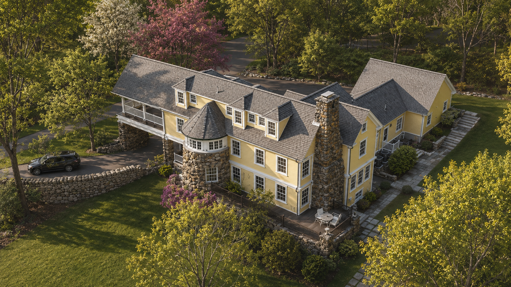
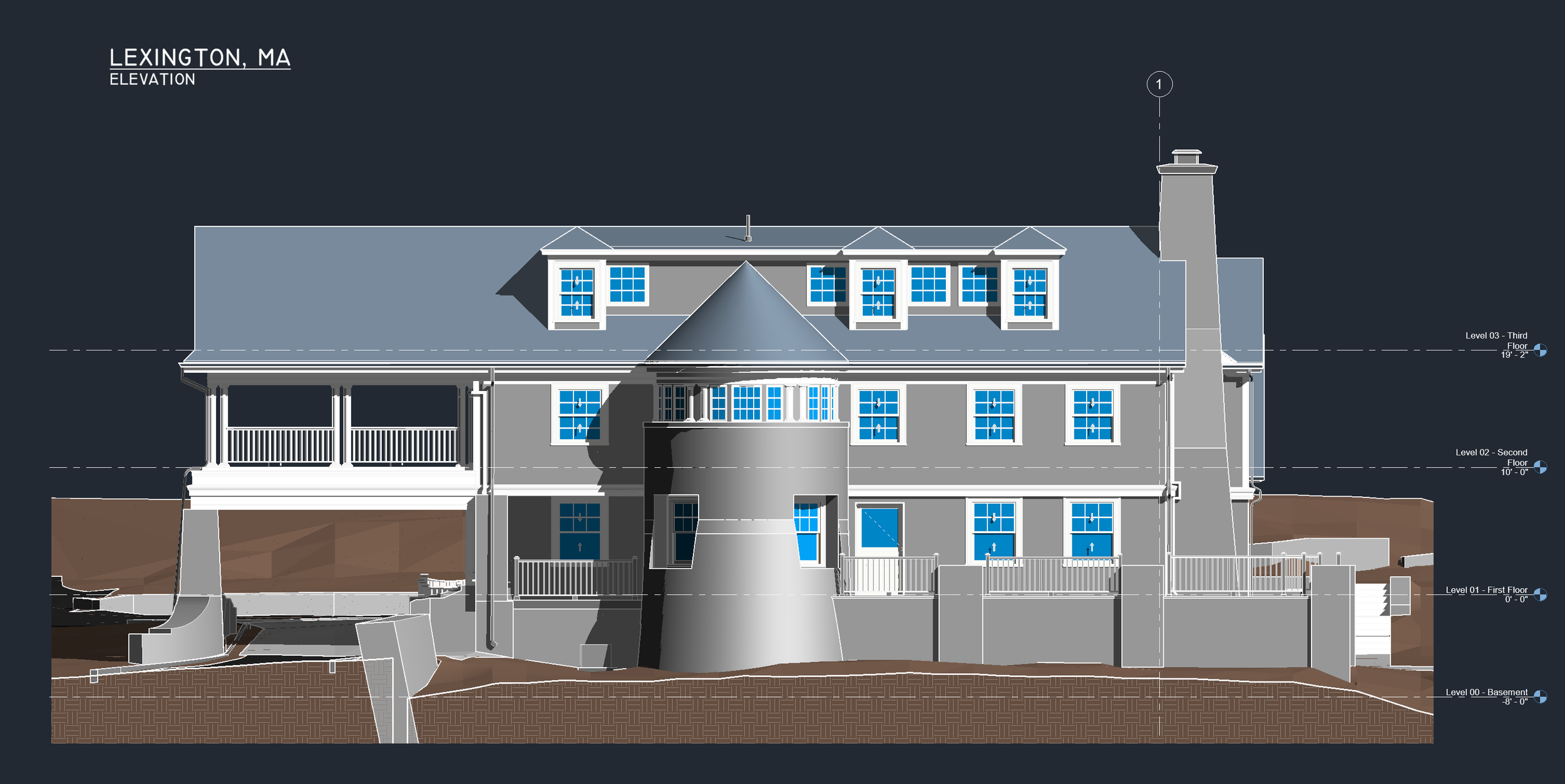
Pointknown was engaged by a design/build firm to document a 4,300 SF residential property on Pleasant Street in Lexington, MA, along with surrounding site conditions.

The property includes a classic converted carriage house with a porte-cochère, stone turret, chimney, flagstone patios, wood decks, stone retaining walls, and a dense collection of interconnected roof forms.

The goal was to create a reliable existing-conditions record so the team could move forward with speed, clarity, and confidence.

Architectural rendering of Pleasant Street Lexington existing conditions model with site context
Twinmotion-style visualization developed from the existing conditions model and site context.
Drone + Site Context

The building and the site needed to be understood together.

The surrounding conditions were part of the story: retaining walls, patios, decks, stairs, driveway conditions, topography, and the way the house sits into the landscape.

Drone capture helped clarify roof geometry and site relationships that are difficult to understand from the ground alone.

Scope of Work

Capture, organize, and deliver the existing conditions.

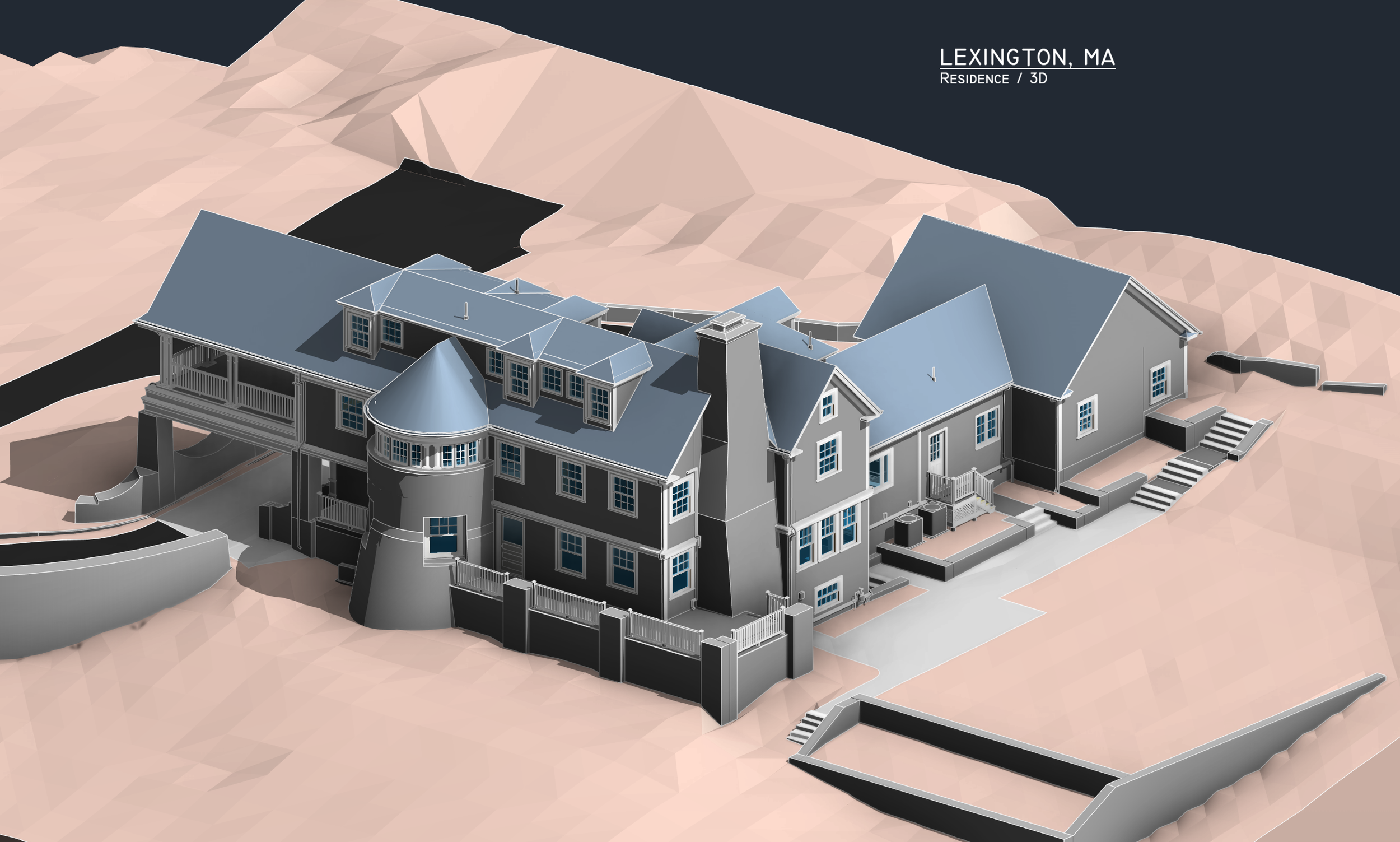
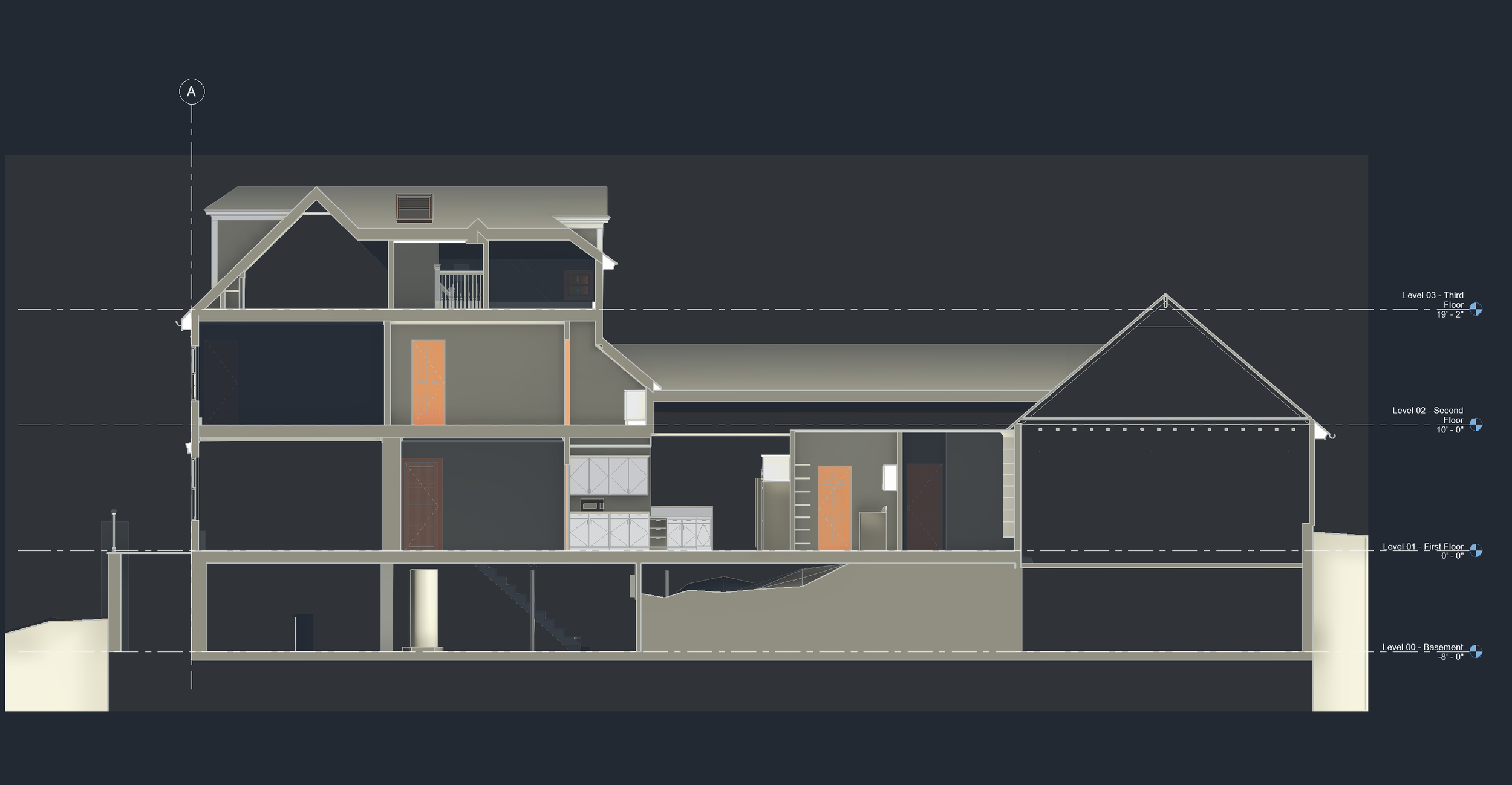
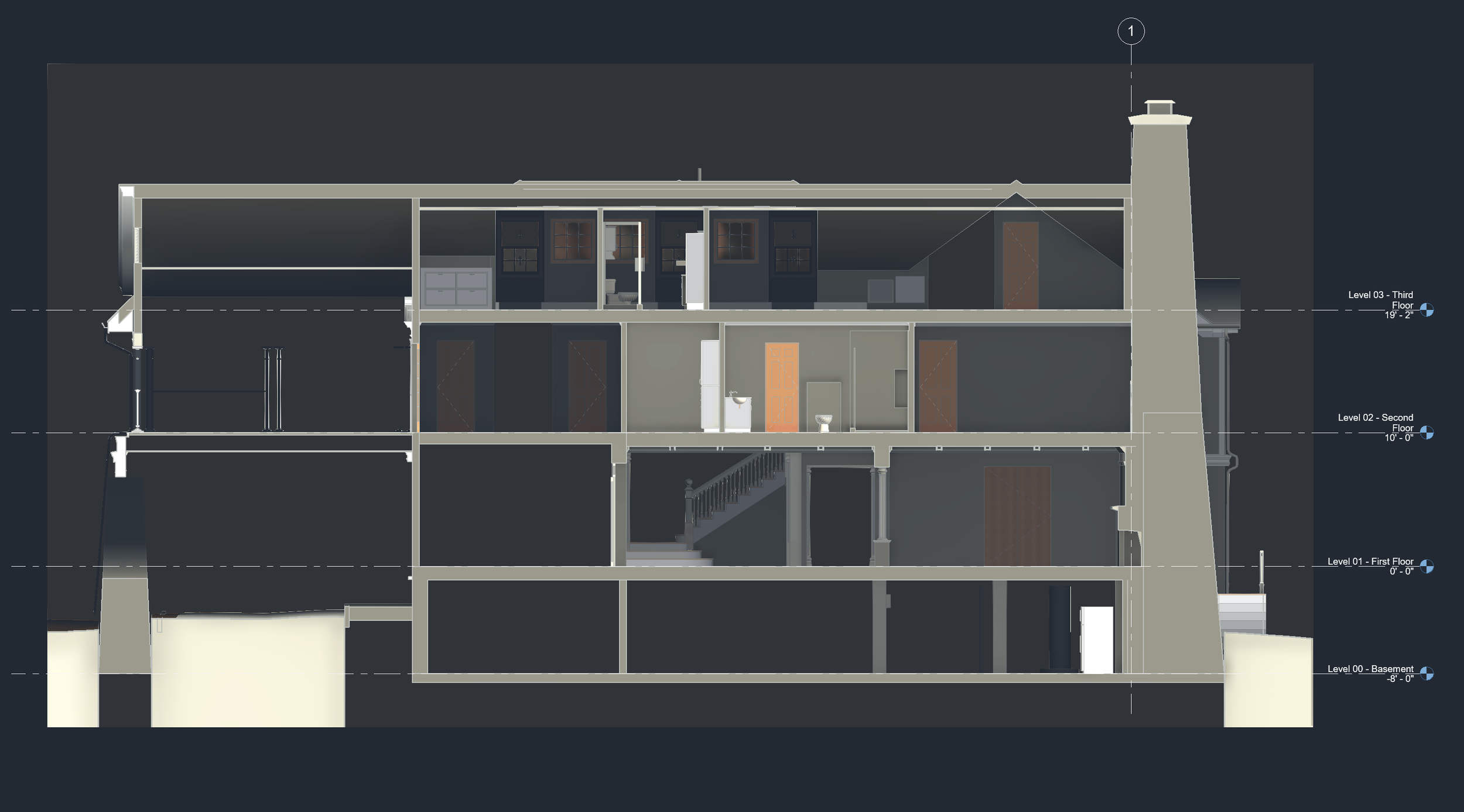
Pointknown combined field capture, visual documentation, and Revit modeling to give the project team one organized source of truth.

GeoSLAM LiDAR Scanning

Efficient field capture of the residence, exterior conditions, and complex building geometry.
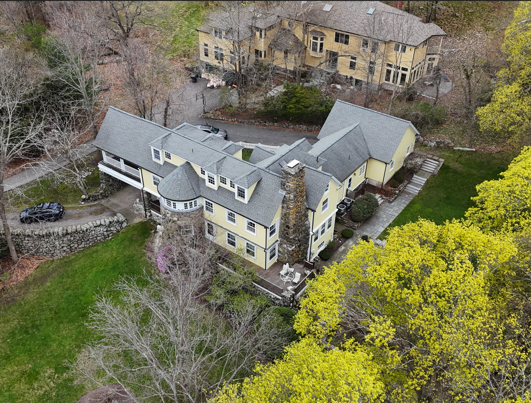
Drone Capture

Aerial context for roof geometry, site relationships, hardscape, and surrounding conditions.

360 Photo / Video

Hosted visual documentation for remote review without requiring a separate 360 viewer download.

Revit Model

A coordinated existing-conditions model built to support design and planning decisions.

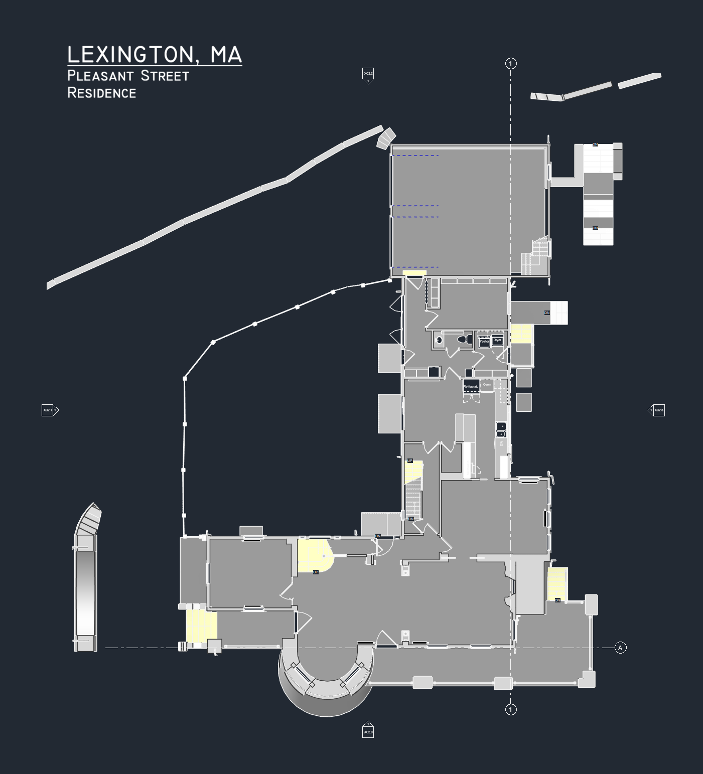
Site / Topo Documentation

Documentation of surrounding grades, patios, decks, retaining walls, stairs, and hardscape.

Design-Ready Baseline

Accurate information organized so the design/build team could move forward from the same starting point.

Why It Mattered

This was not a simple house.

Converted carriage houses often carry layers of history, additions, adjustments, and unique construction logic. Pleasant Street was no exception.

The roof system alone included multiple roof types, changing slopes, and interlocking forms. Accurate documentation reduced the need to guess — and helped the team work through issues digitally before they became field problems.

Revit existing conditions model of Pleasant Street Lexington with LiDAR-derived site topography
Revit existing conditions model showing the residence, roof forms, turret, chimney, site walls, stairs, and surrounding topography.
The Value

One shared truth for the whole team.

The project team needed more than measurements. They needed usable information.

By documenting the property thoroughly and translating the capture into a coordinated model and site documentation package, Pointknown helped reduce uncertainty before design and construction decisions moved forward.

That means faster early design decisions, better coordination, fewer assumptions, reduced risk of field conflicts, less time lost to rework, and a stronger ability to resolve issues digitally before work happens on site.

Pointknown Approach

Complex property. Clear starting point.

Deliverables

From field capture to design-ready documentation.

The final package gave the design/build team a practical foundation for planning, coordination, and decision-making.

Drone aerial photograph of Pleasant Street Lexington residence and surrounding site conditions
Drone aerial capture documenting roof geometry, site context, retaining walls, patios, decks, and surrounding landscape.
Existing conditions floor plan for Pleasant Street Lexington residence
Plan documentation organized for design coordination and existing-conditions review.
Existing conditions elevation of Pleasant Street Lexington residence
Elevation output showing exterior geometry, site grades, turret, chimney, and façade relationships.
Existing conditions building section through Pleasant Street Lexington residence
Section view illustrating floor relationships, roof geometry, and internal building conditions.
LiDAR-informed section through Pleasant Street Lexington residence and chimney
LiDAR-informed section output used to understand building geometry and vertical relationships.
Start with the existing conditions

Before design decisions become field decisions.

Pointknown helps architects, owners, and design/build teams capture, organize, and understand the buildings they are working with.

Start a Conversation