Marston Mills, Cape Cod MA
Coastal Estate | Existing Conditions & Site Modeling
Project Overview
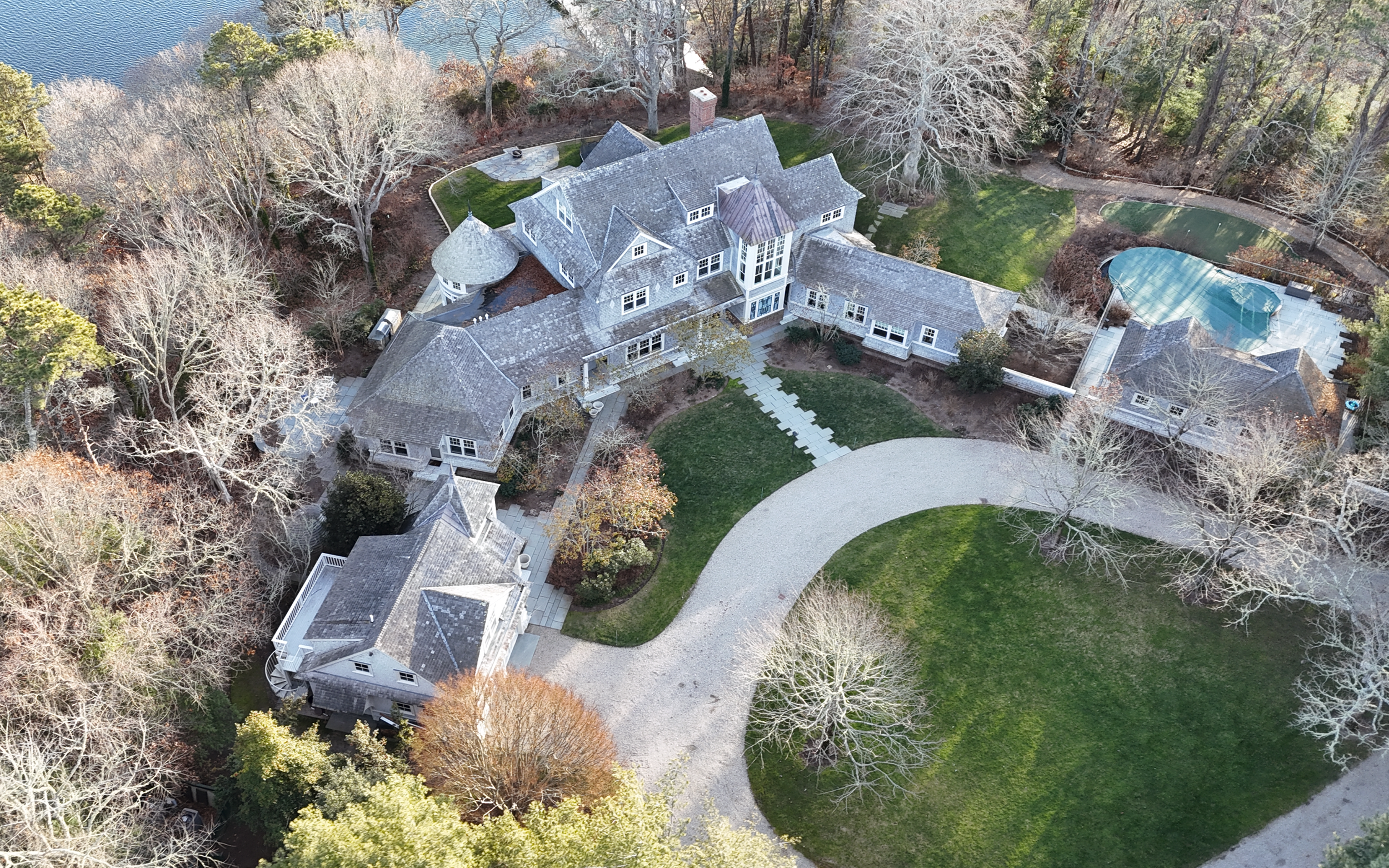
This project involved comprehensive existing‑conditions documentation of a multi‑acre coastal estate in Marston Mills, Cape Cod, Massachusetts. The scope extended well beyond a single structure—capturing the entire site and multiple buildings with a level of detail that allowed the design team to move immediately into planning, analysis, and future design work.
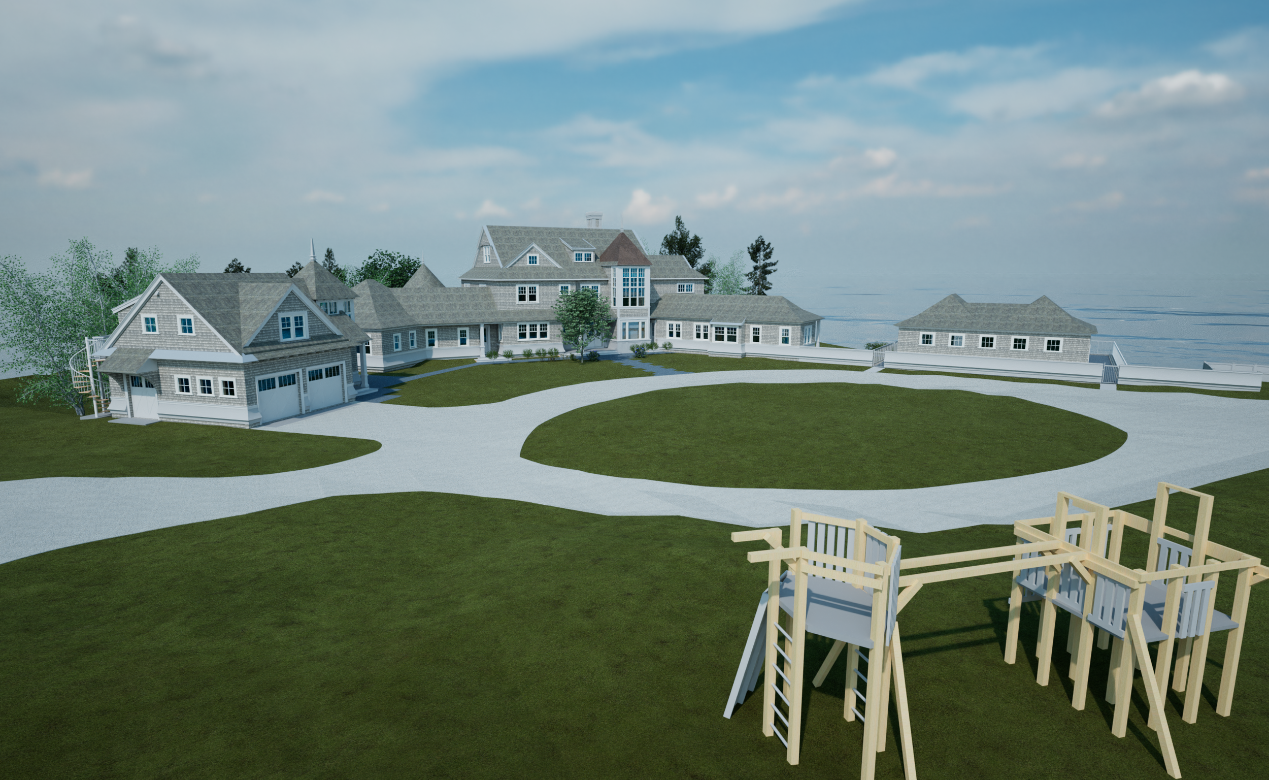
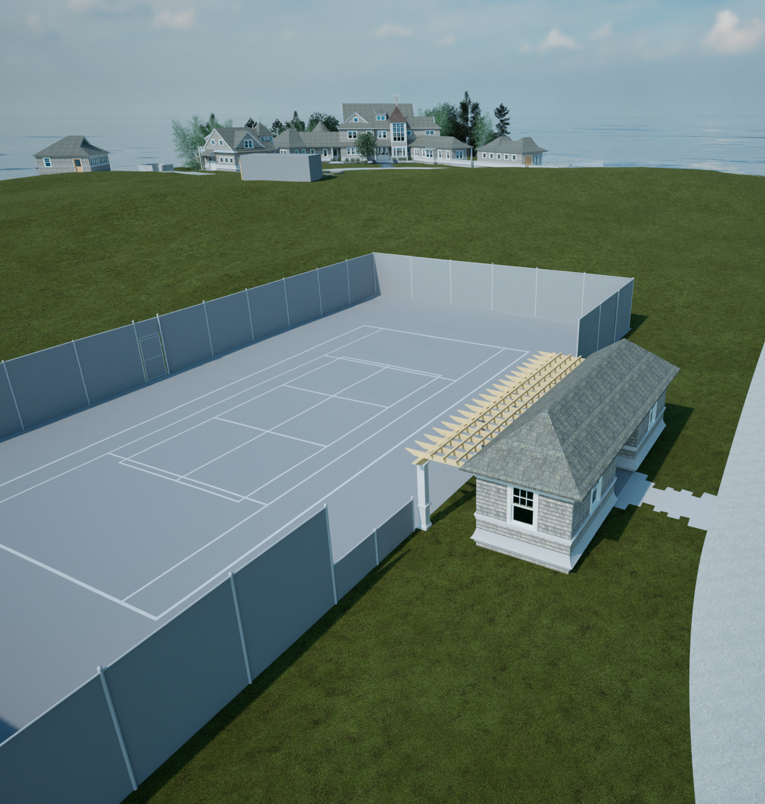
Set directly along the coast, the property includes a main residence, carriage house, pool house, tennis court, and landscaped grounds, all of which were captured, modeled, and coordinated into a unified digital dataset.
Scope of Work
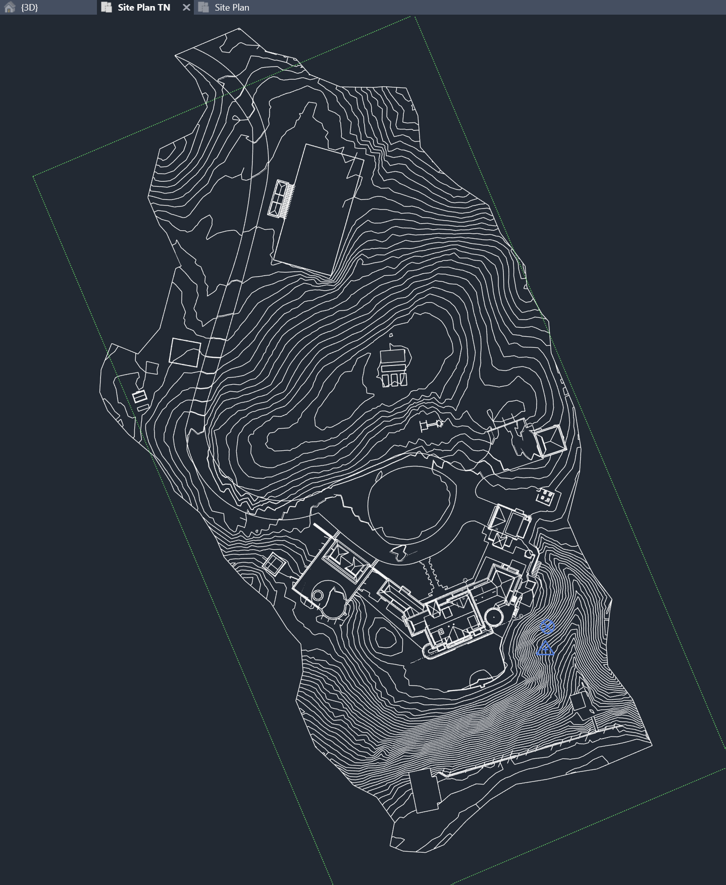
Site & Topography
Mobile and aerial reality capture of the full multi‑acre property
Detailed terrain modeling and terraforming of the entire site
Creation of a site plan with 1‑foot contour intervals, exported to AutoCAD for direct use by architects, landscape architects, and engineers
Modeling of exterior site features including paths, hardscape, and play structures / swing sets
Buildings & Structures
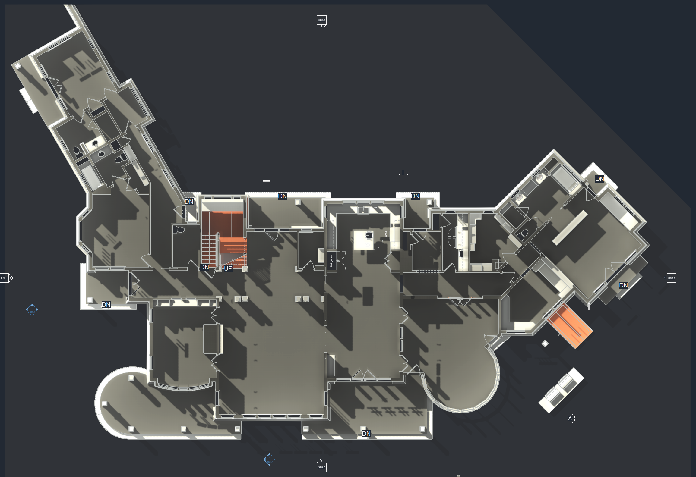
Laser scanning and modeling of:
Main House
Carriage House
Pool House
Full exterior and interior existing‑conditions documentation
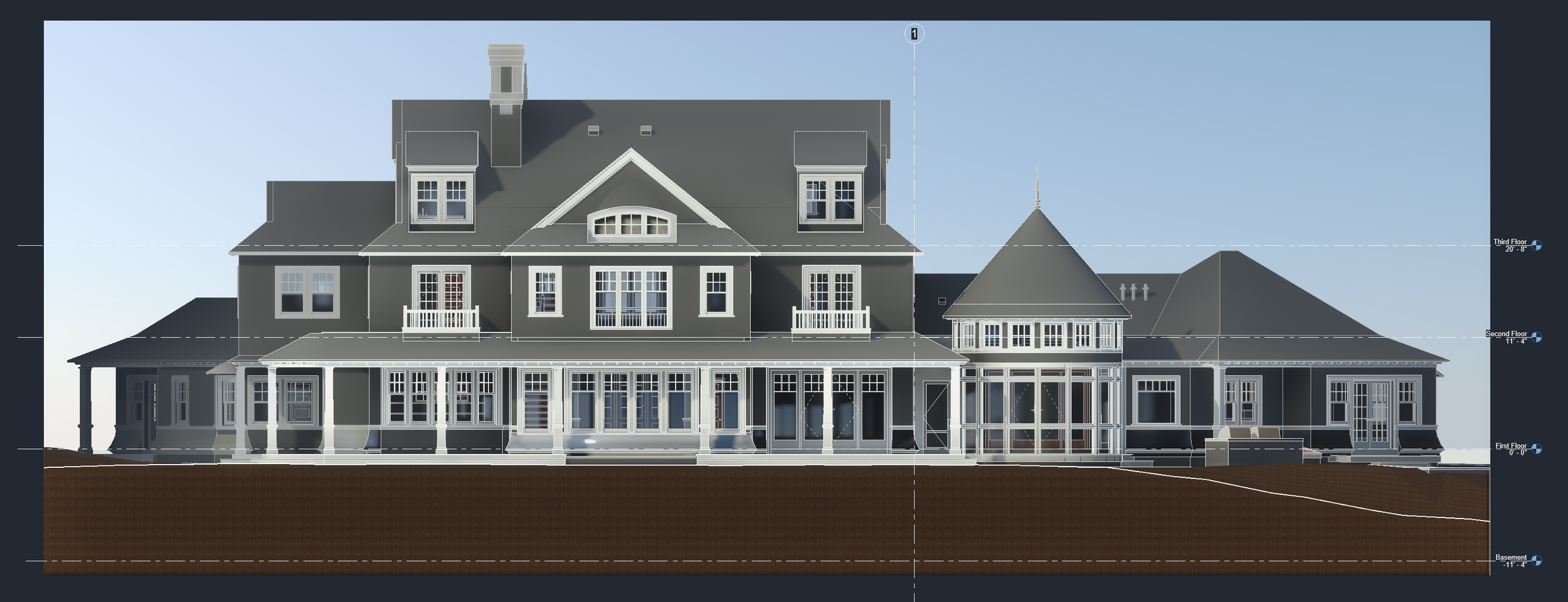
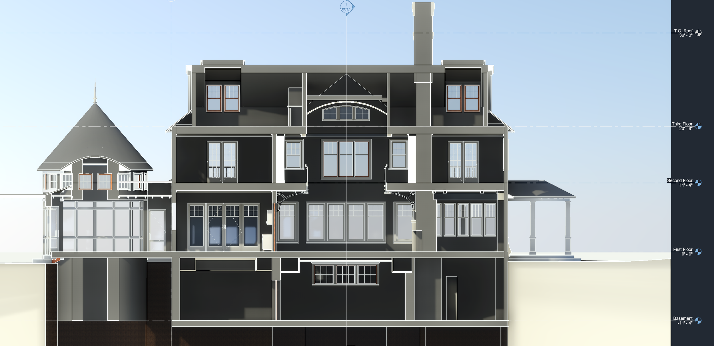
Architectural Detail
High‑fidelity modeling of the main residence’s dramatic three‑story vaulted space, including:
Floor‑to‑ceiling window systems
Integrated shelving
Second‑floor atrium walkway
Cast‑iron structural supports
This level of detail allows the model to function not only as a record of existing conditions, but as a design‑ready foundation for future architectural work.
Deliverables
AutoCAD
Complete site plan with 1’ contour intervals
Architectural plans, sections, and elevations exported directly from the model
SketchUp
Entire property and building set exported for flexible use by designers, builders, and consultants
3D Views & Diagrams
3D floor plan views
Exterior and interior elevations
Sectional perspectives illustrating complex spatial relationships
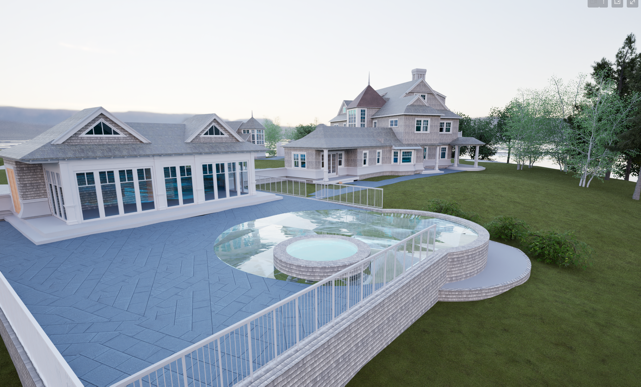
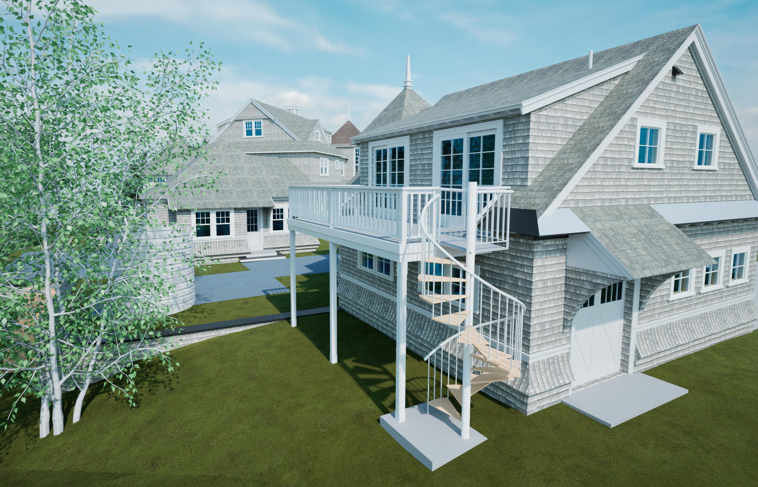
Twinmotion Visualizations
Contextual renderings produced to clearly communicate scale, terrain, and architectural character
Used primarily for visual storytelling and documentation on our website
Why This Matters
By capturing the entire estate—from coastal terrain to architectural detail—the project team received a coordinated, accurate digital baseline. This approach reduces uncertainty, accelerates design workflows, and allows all stakeholders to work from the same trusted source of information.
At Pointknown, we focus on delivering measure‑once, design‑right documentation—especially on complex properties where site, structure, and architecture are deeply interconnected.
Tools & Technology
Mobile LiDAR laser scanning
Drone photogrammetry
AutoCAD
SketchUp
Revit (model coordination and export source)
Twinmotion (visualization)
Project location shown as Marston Mills, Cape Cod MA. Specific address withheld for client privacy.