
Residential | Commercial | Industrial
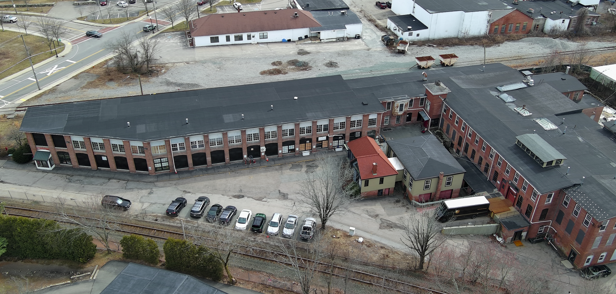
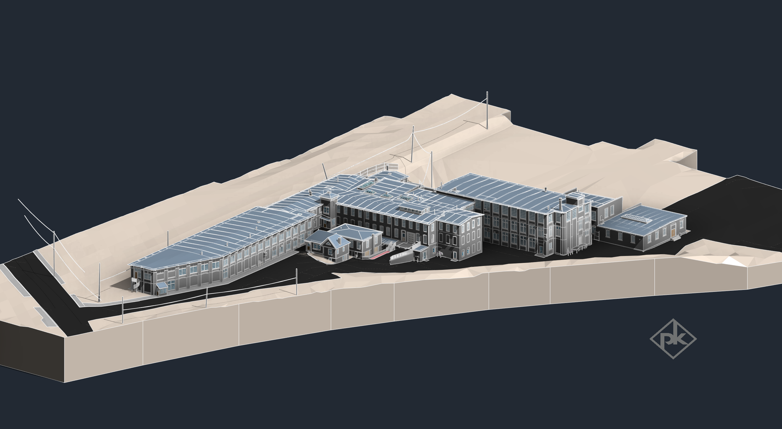
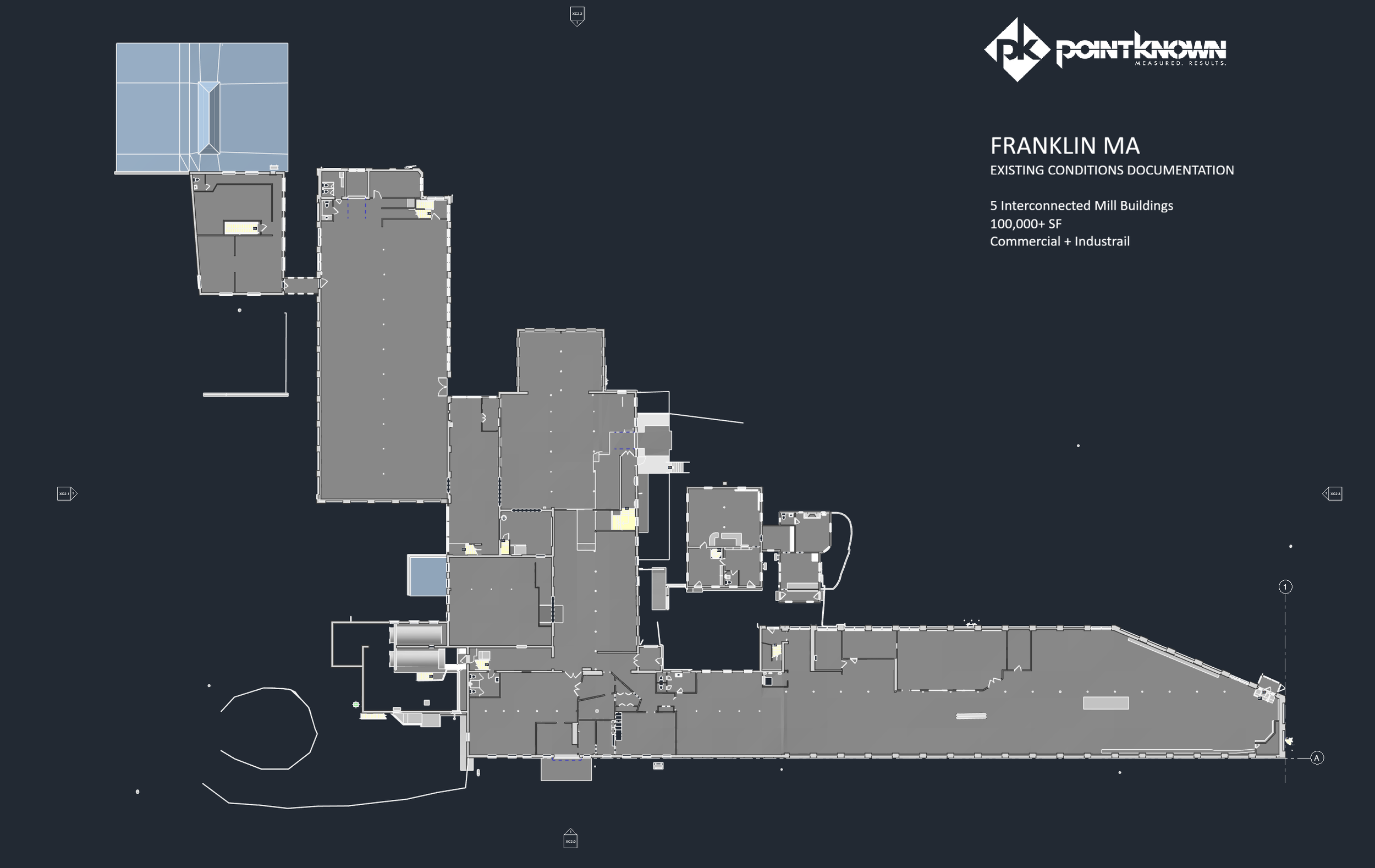
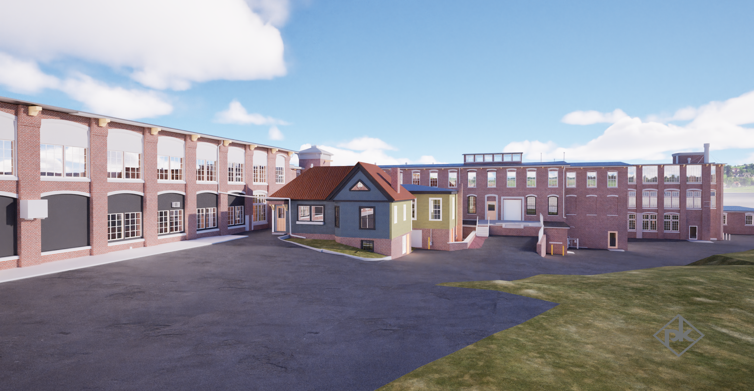
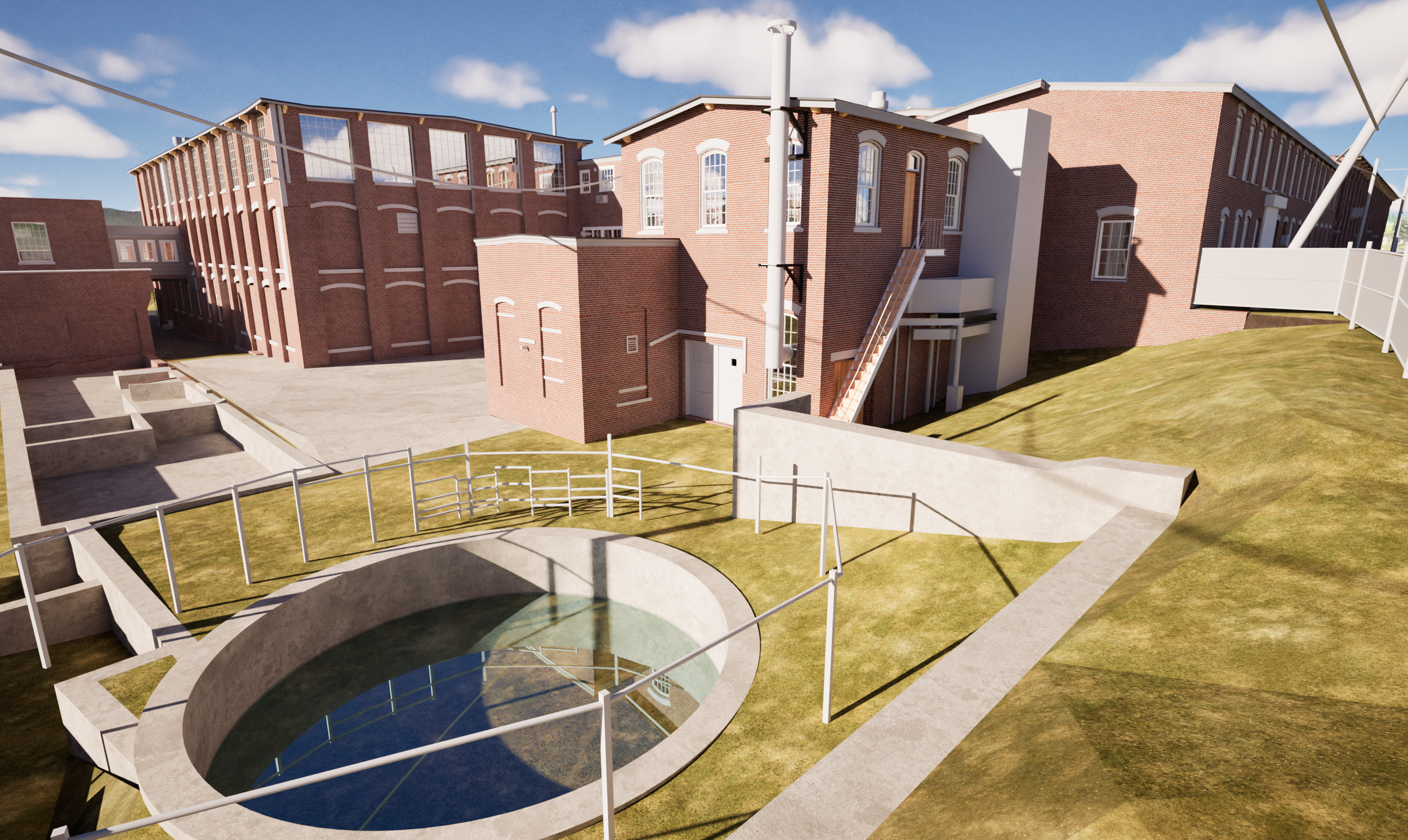
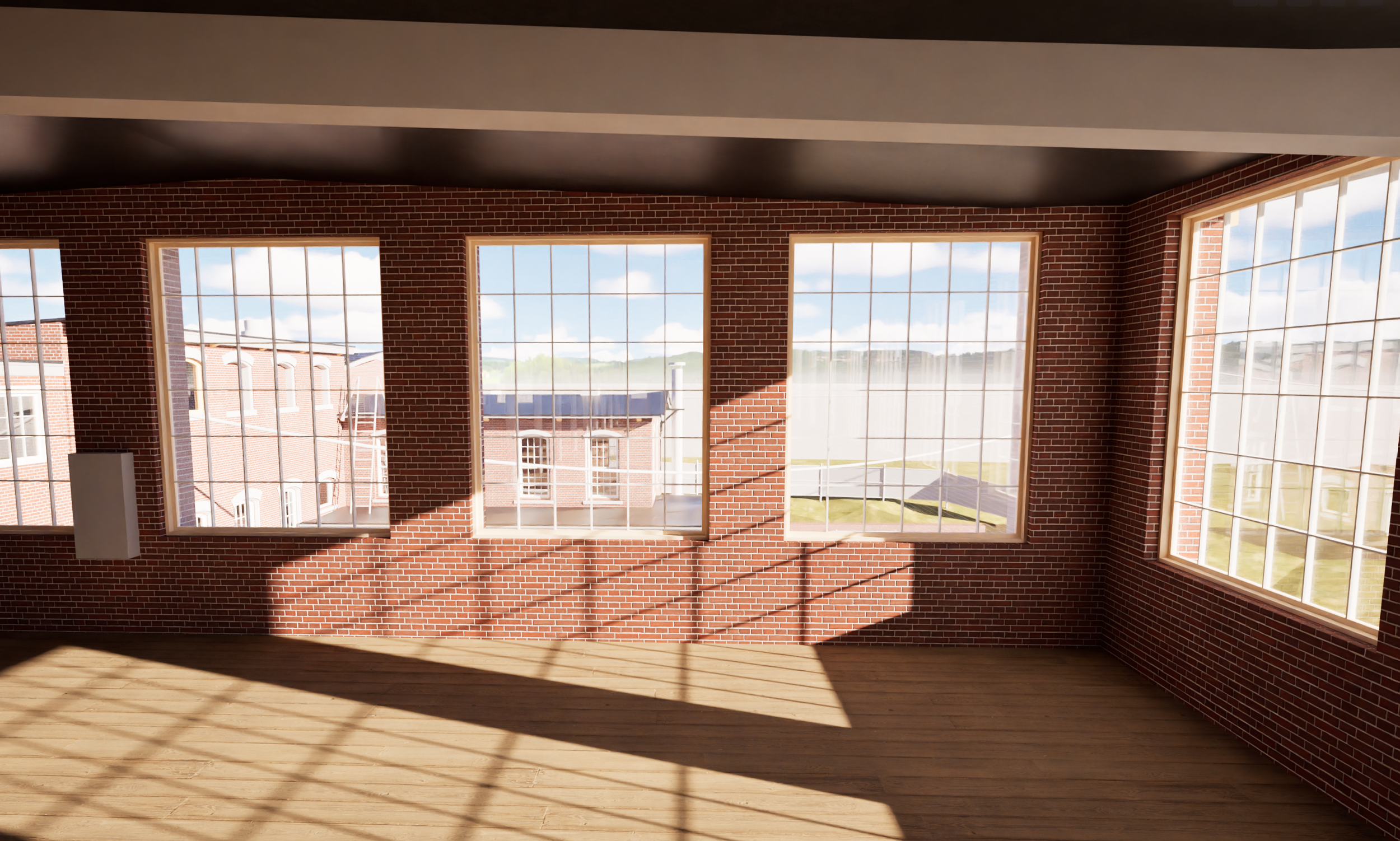

This Franklin Mill is a large, interconnected mill complex in Franklin, Massachusetts documented by Pointknown for redevelopment planning and design. The assignment involved over 100,000 square feet across five connected mill buildings, each with its own quirks, floor transitions, structural realities, and long-built layers of change. Our role was to capture the property as it exists today and turn that complexity into usable information the design team could trust.
Project overview
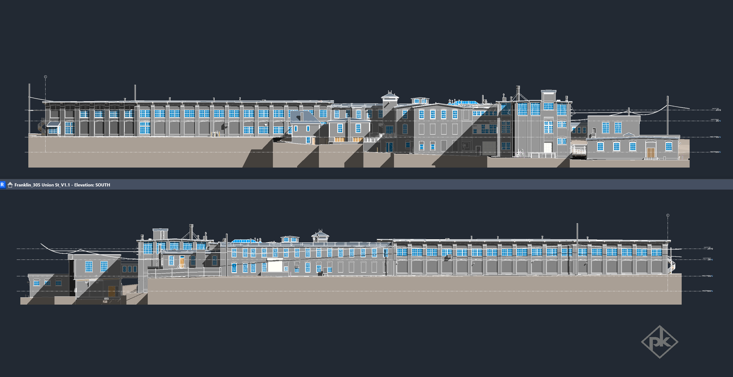
Working for a developer and architect team, Pointknown provided full existing conditions documentation for this mixed-use industrial and commercial property at 305 Union Street. The scope combined mobile LiDAR, terrestrial scanning, drone capture, 360 imagery, surrounding topo and hardscape documentation, and a full Revit model of the site and buildings.
Why it mattered
Mill buildings rarely behave like clean, flat, modern shells. Franklin Mill included sloping floors, elevation changes, sag conditions, and multiple connected structures that needed to be understood together, not as isolated parts. By documenting the building accurately at the outset, the team could make informed layout decisions early, identify where leveling or corrective work may be required, and reduce the chance of costly surprises later in design or construction.
Scope of work
Mobile and terrestrial LiDAR scanning
Drone photography for site and roof context
360 photo and video capture
Full existing conditions Revit model
Surrounding topo and hardscape documentation
Deliverables
Existing conditions Revit model
Accurate building geometry across all floors
Exterior documentation and site context
Digital base information for redevelopment planning
Outcome
The result was a reliable existing conditions model that helped the project team move faster and design with more confidence. Complex floor conditions and interconnected mill geometry were captured up front, allowing the architect to plan with purpose and address irregularities digitally before materials were ordered or work began on site. The documentation also supported preservation-minded planning by accurately recording exterior character and existing building conditions.
For adaptive reuse, mixed-use redevelopment, and mill conversion work, good decisions depend on accurate existing information. Franklin Mill is a good example of how Pointknown helps teams understand complicated buildings quickly, clearly, and in a format that is ready to use.