
Residential | Commercial | Industrial
Franklin Mill
A dark, data-rich case study for a complex mixed-use mill redevelopment in Franklin, Massachusetts — captured with LiDAR, drone documentation, 360 imagery, and a full existing conditions Revit model.
A complex mill redevelopment, measured as it actually exists.
Franklin Mill is a large, interconnected mill complex in Franklin, Massachusetts documented by Pointknown for redevelopment planning and design. The assignment involved more than 100,000 square feet across five connected mill buildings, each with its own quirks, floor transitions, structural realities, and long-built layers of change.
Working for a developer and architect team, Pointknown provided full existing conditions documentation for this mixed-use industrial and commercial property at 305 Union Street. The scope combined mobile LiDAR, terrestrial scanning, drone capture, 360 imagery, surrounding topo and hardscape documentation, and a full Revit model of the site and buildings.
Why this project mattered
Mill buildings rarely behave like clean, flat, modern shells. Franklin Mill included sloping floors, elevation changes, sag conditions, and multiple connected structures that needed to be understood together — not as isolated parts.
Existing conditions data, built for actual design use.
By documenting the property accurately at the outset, the team could make informed layout decisions early, identify where leveling or corrective work may be required, and reduce the chance of costly surprises later in design or construction.
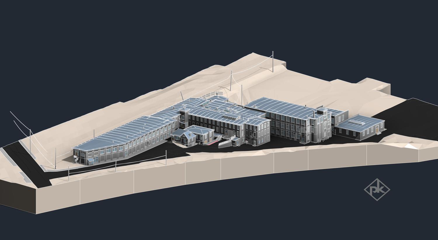
Overall 3D model view showing the interconnected mill complex and surrounding topographic context.
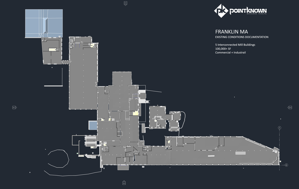
Floor plan documentation used to support design coordination and redevelopment planning.
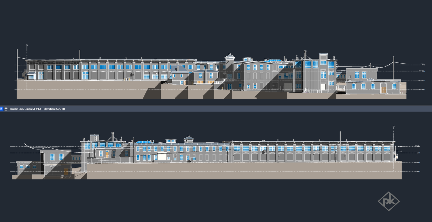
Exterior elevation documentation capturing the as-built geometry and relationships across the building complex.
Capture
Mobile LiDAR scanning, terrestrial laser scanning, drone documentation, and 360 photo + video capture were used to document the full site and building conditions.
Modeling
Pointknown delivered a full existing conditions Revit model representing all interconnected building areas and the irregularities that matter in real-world design.
Site Context
Surrounding topo and hardscape were documented as part of the overall capture so the design team could work with a complete digital base.
Site, exterior, and interior views.
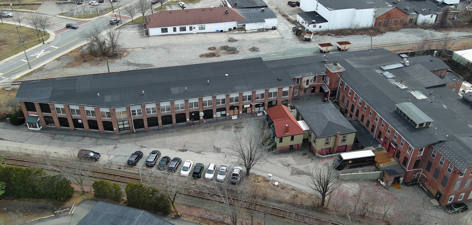
Site-wide aerial capture providing roof, massing, and context information.
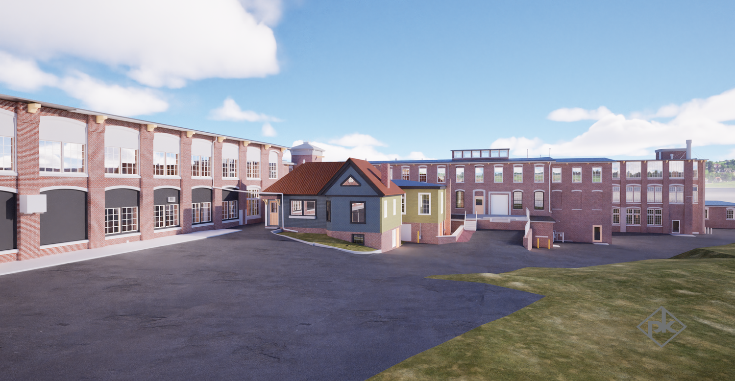
Visualization showing internal building relationships and redevelopment potential.
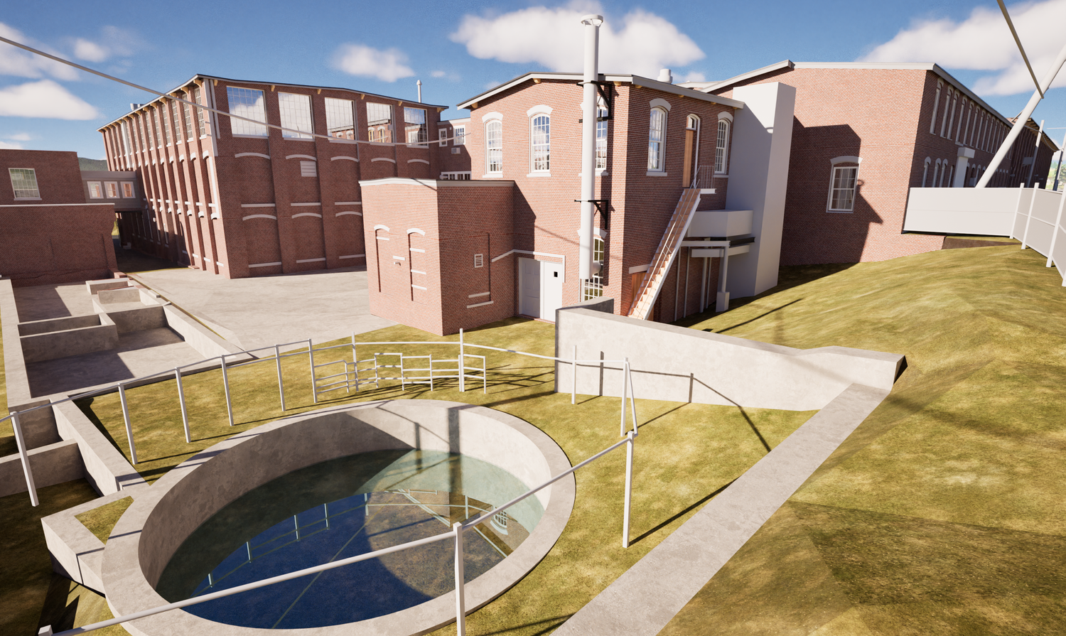
Visualization documenting the rear utility zone, site conditions, and surrounding grade relationships.
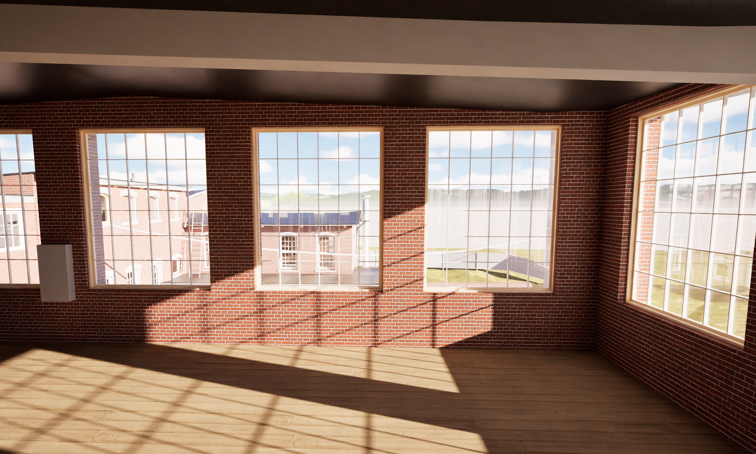
Interior visualization showing daylight, historic window rhythm, and reuse character.
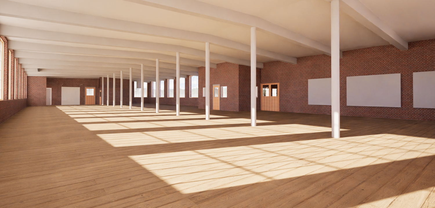
Large open floor view capturing column spacing, structural rhythm, and adaptive reuse potential.
Interconnected buildings. Uneven reality.
Franklin Mill included five interconnected mill buildings with multiple levels, sloping floors, sag conditions, and building-to-building transitions that needed to be understood precisely. The full property was captured as-is so the architect could lay out with purpose and understand where floors or surfaces might need leveling or intervention.
This kind of documentation helps unearth issues digitally before materials are even delivered — where changes are cheaper, faster, and far less painful.
Speed, accuracy, and smarter preservation planning.
The work gave the project team a reliable digital base for design, coordination, and decision-making. Accurate existing conditions documentation replaced assumption with measured information, reducing uncertainty and helping the team move faster with more confidence.
The documentation also supported preservation-minded redevelopment and helped preserve important exterior character — contributing to planning strategies tied to historical tax credit opportunities.
Older mill buildings do not need more guesswork. They need accurate information — especially when multiple connected structures, sloping floors, and inherited irregularities all have to work together in one coordinated design process.
Franklin Mill • PointknownDocument first. Design with confidence.
Pointknown helps developers, architects, and owners move faster with accurate building documentation, LiDAR scanning, drone capture, and Revit-ready deliverables built for real-world design and redevelopment.
Start a Conversation