
Residential | Commerical | Industrial
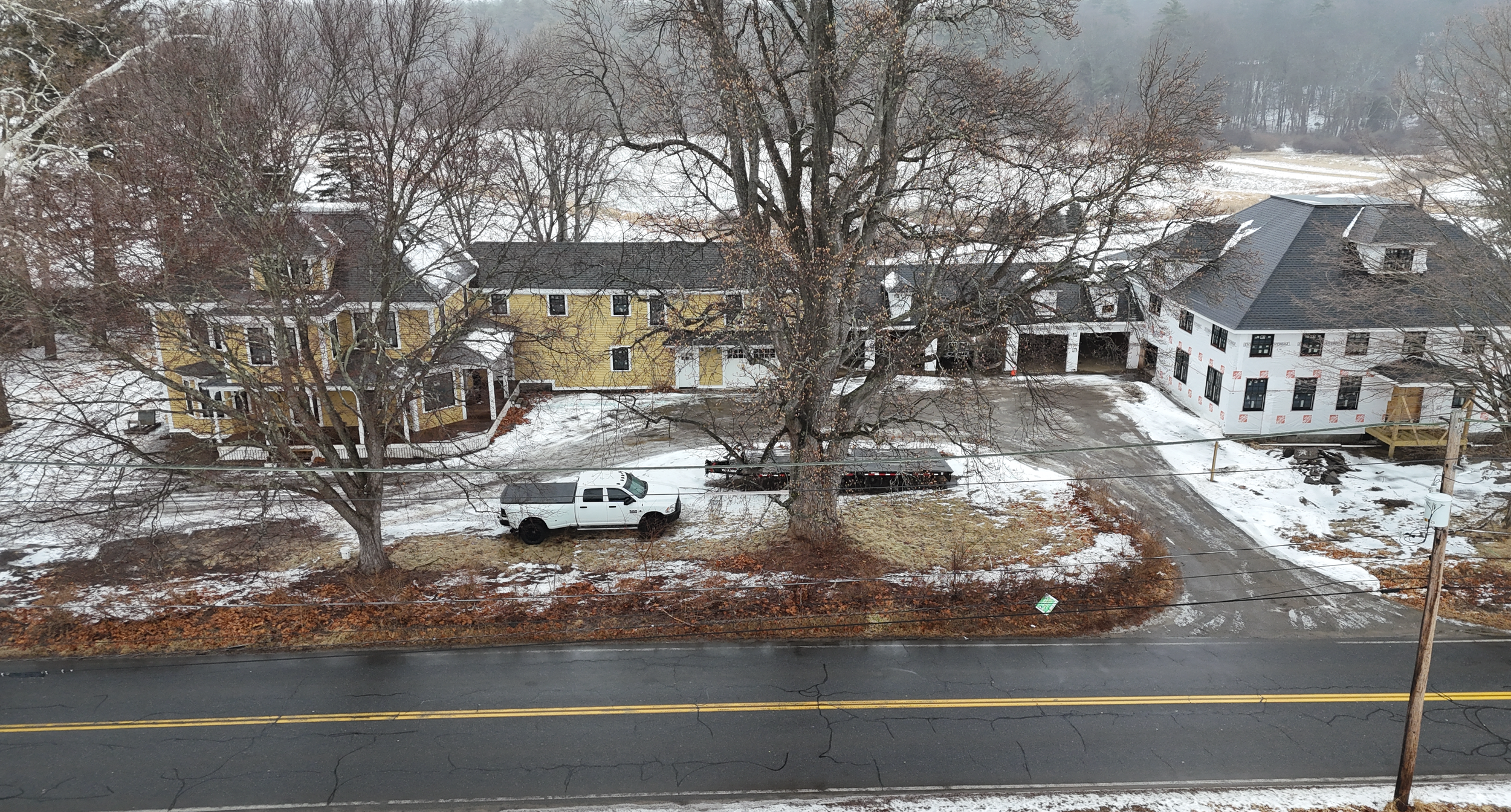
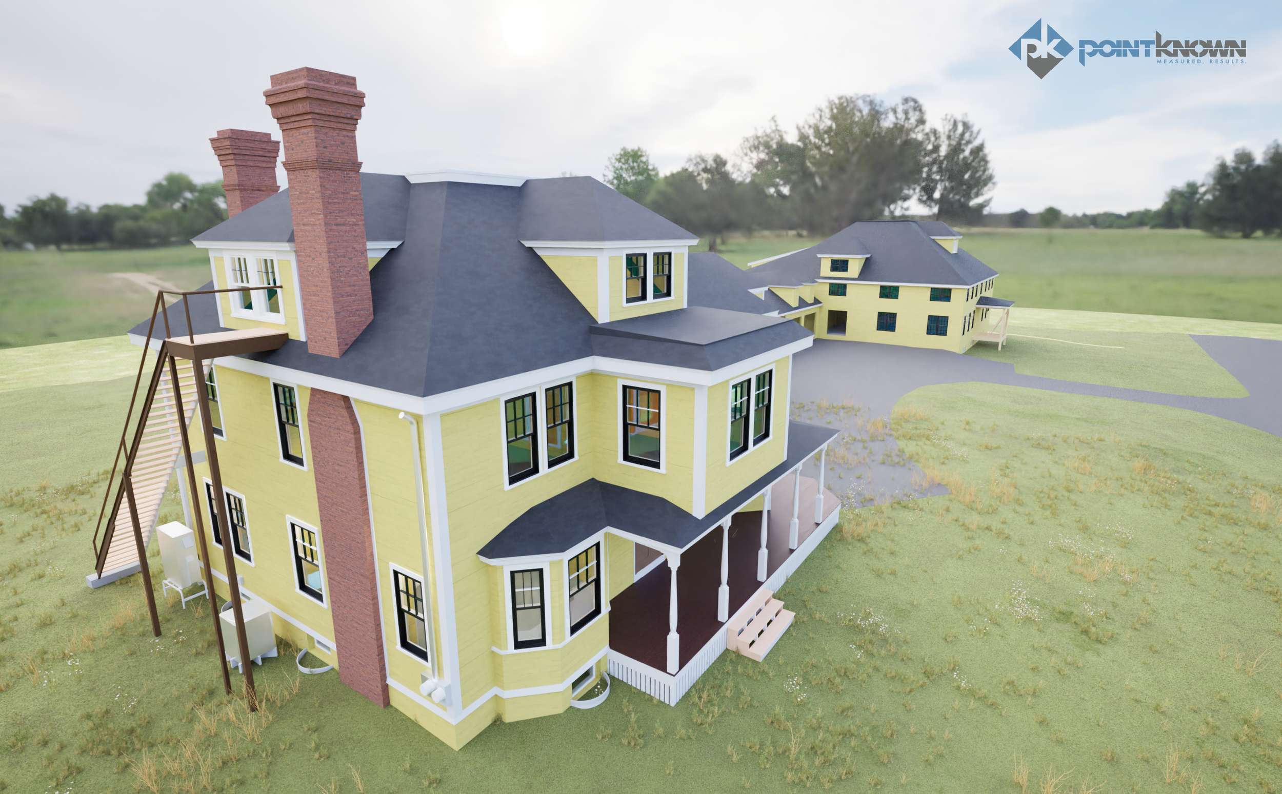
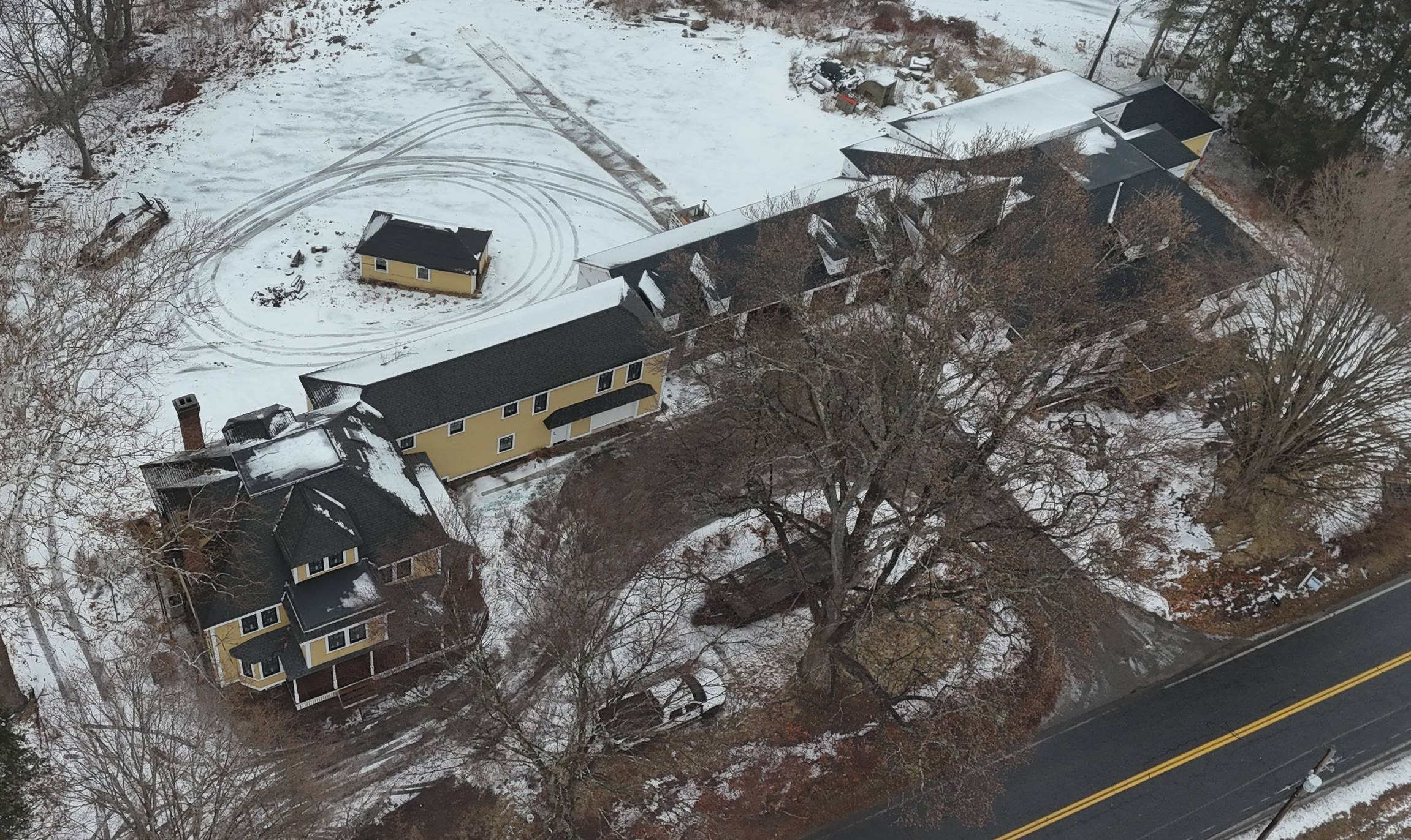
This historic property along Fitchburg Turnpike in Concord, Massachusetts is entering a new chapter—transforming from a partially completed structure into a future wellness retreat.
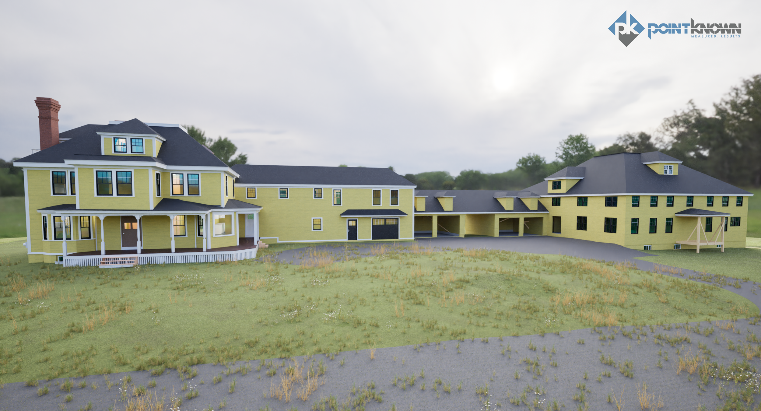
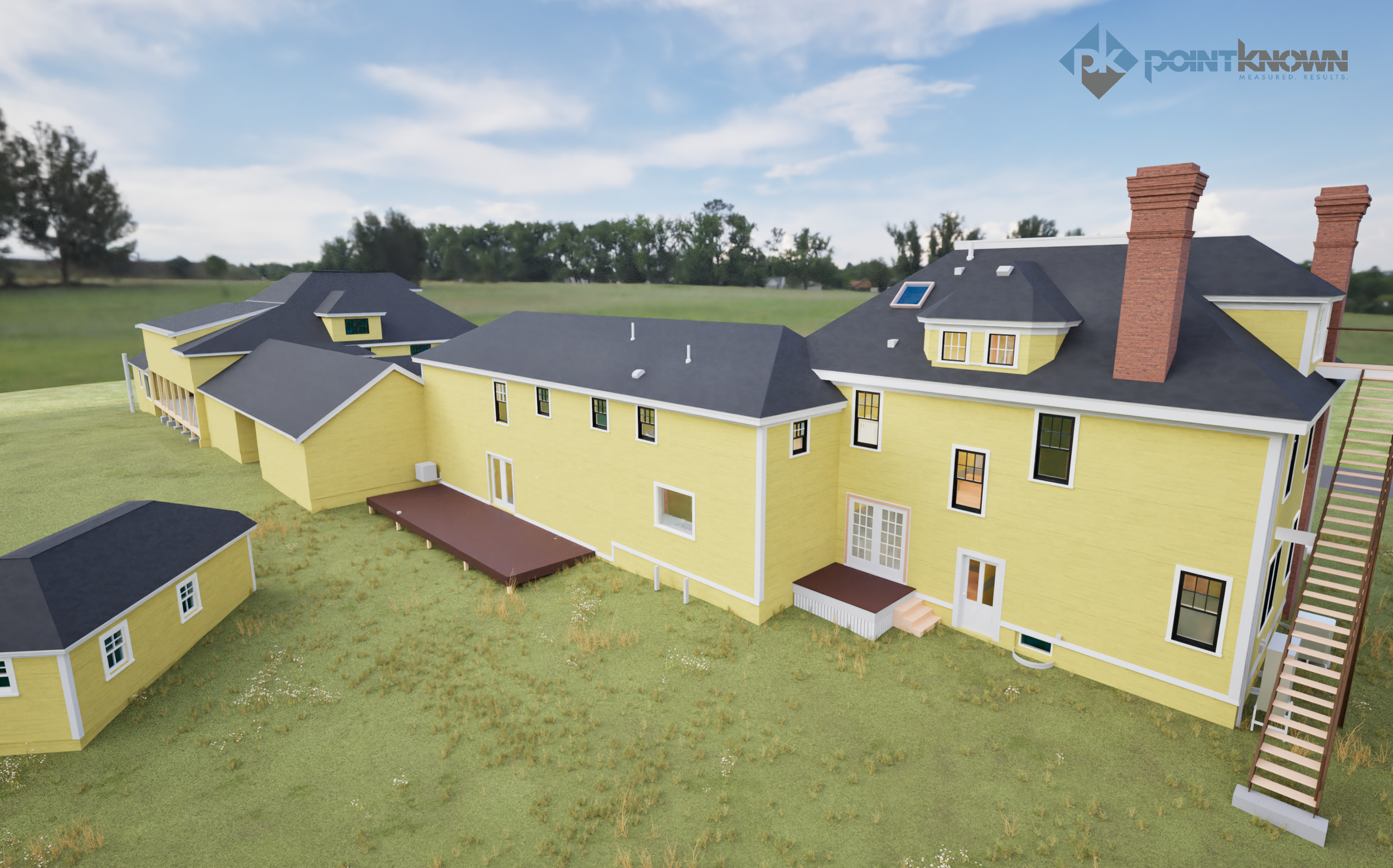
Pointknown was brought in to document the entire site using laser scanning and drone photogrammetry, then translate that data into a clean, design-ready package: CAD drawings, a full Revit model, and Twinmotion visuals to help the project team plan the next phase with clarity and confidence.
Concord is a place where history and reinvention naturally intersect. From its early American roots to the industrial and rail growth that shaped West Concord in the 1800s, the town has always balanced preservation with progress. This project continues that tradition—capturing what exists today to support what comes next.
Project Snapshot
Location: Concord, MA (Fitchburg Turnpike corridor)
Property Type: Historic residential compound with multiple structures
Project Goal: Existing-conditions documentation to support adaptive reuse into a wellness retreat
Pointknown Services: Site + building capture, CAD exports, Revit modeling, Twinmotion visuals
Why This Capture Was Important
Properties in transition often contain a mix of original construction, unfinished work, and undocumented changes. That uncertainty can slow design and introduce risk.
Reality capture provides one reliable source of truth:
Accurate geometry across all structures
Fewer assumptions during design
Reduced field revisits
Clearer coordination between architects, engineers, and owners
By capturing everything once, the team can move forward with confidence.
What We Captured
Mobile Laser Scanning
We documented interior and exterior building geometry to produce accurate existing conditions throughout rooms, circulation paths, structural elements, and roof transitions—especially valuable in older buildings where irregularities are common.
Drone Aerial Capture
Aerial flights captured roof forms, elevations, and full site context, supporting early planning and exterior coordination.
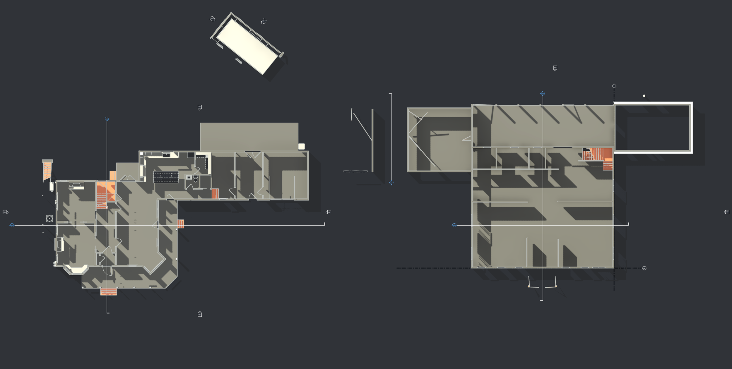
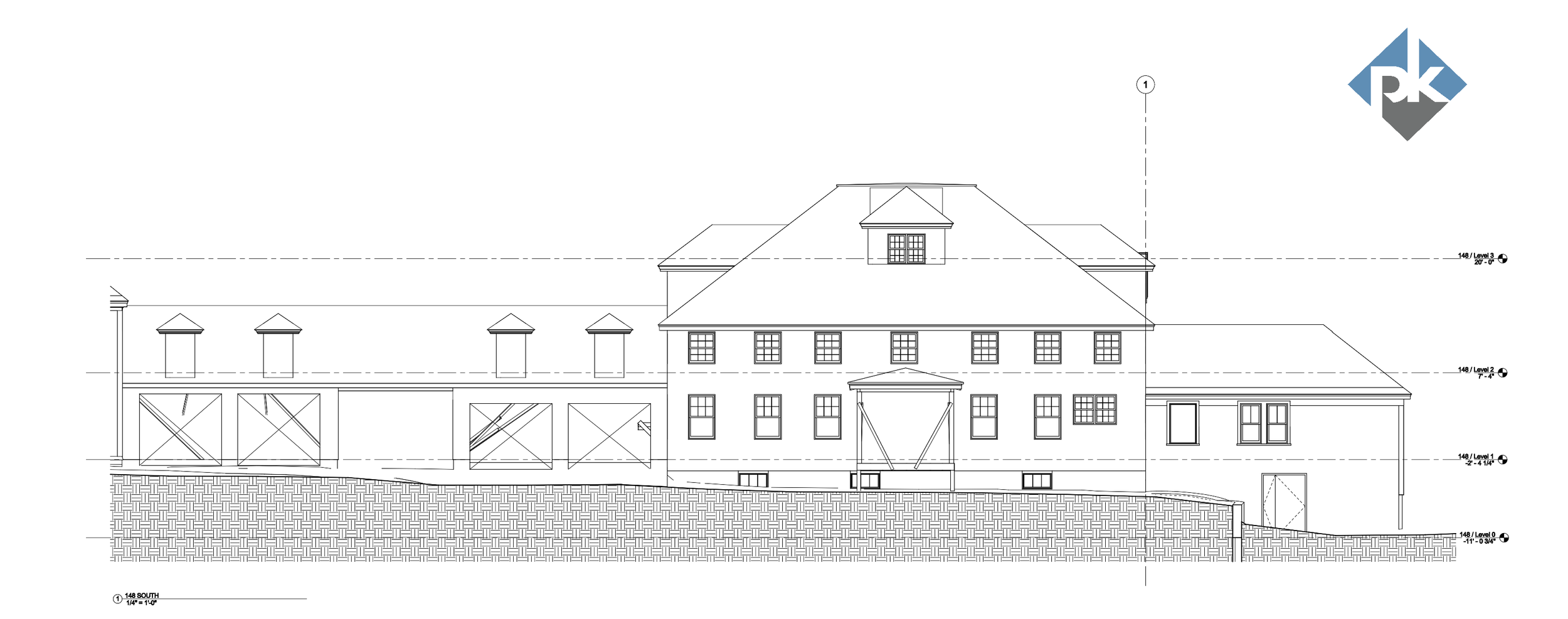
Deliverables
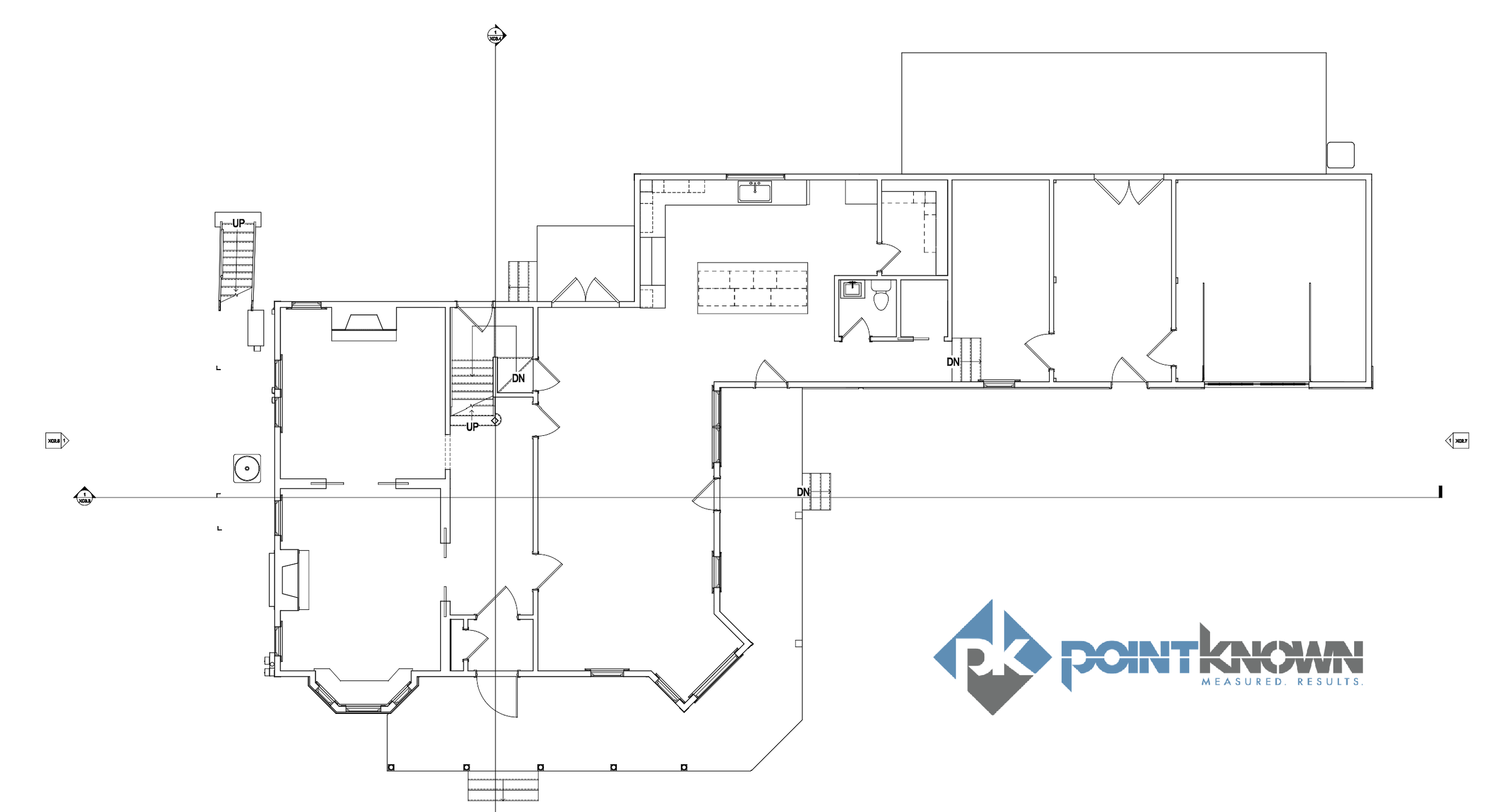
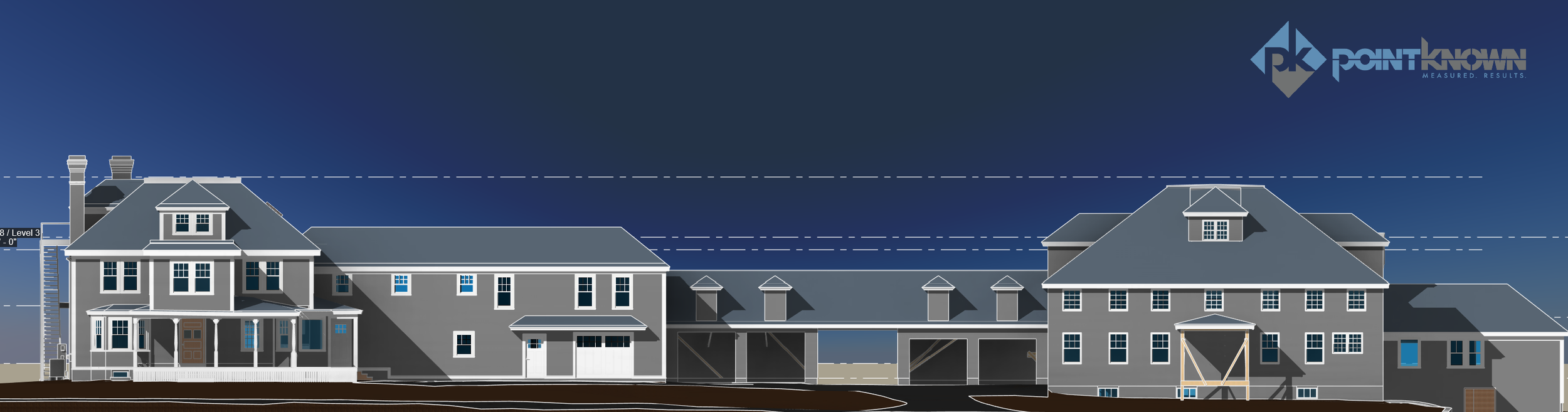
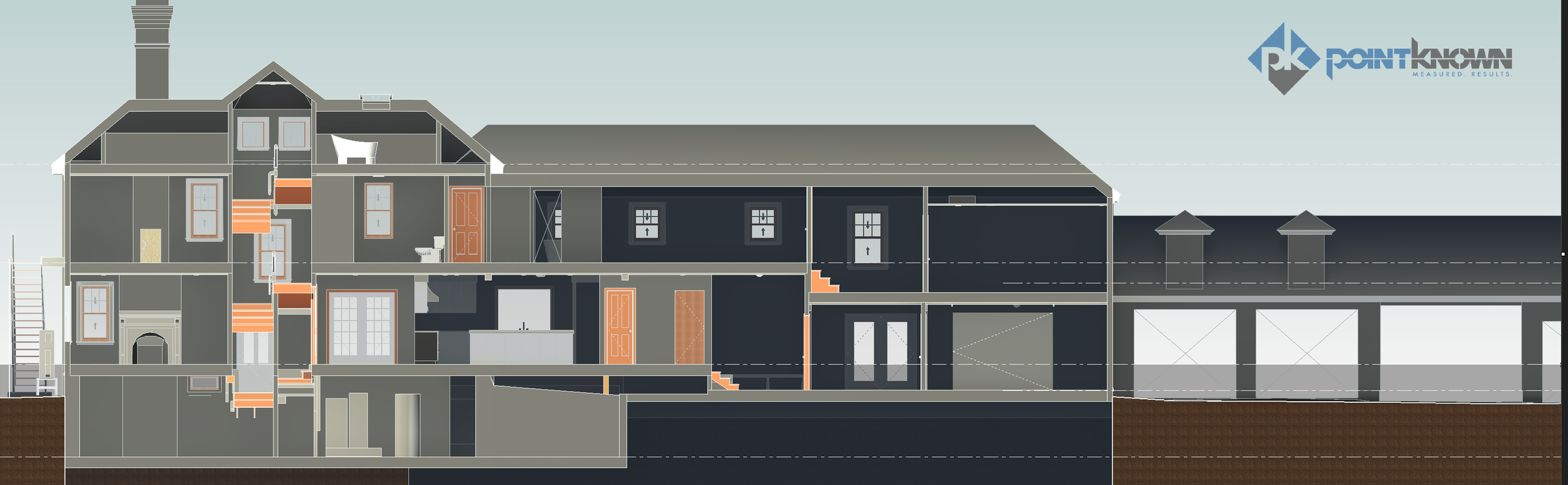
Existing Conditions CAD Drawings
Floor plans
Exterior elevations
Building sections as required
Key overhead and structural conditions
Site context exports for planning and consultant use
Revit Model
A fully navigable and measurable model that allows the design team to:
Generate additional sections and views on demand
Coordinate new design work with existing geometry
Export to multiple formats for consultants and permitting
The Outcome
The project team now has a unified digital foundation to support the building’s transformation into a wellness retreat:
Faster design iteration
Fewer unknowns
Reduced need for repeat site visits
Improved communication across the team
For renovation and adaptive reuse projects—especially historic properties—clear existing-conditions data is the starting point for smart design decisions.
Planning a renovation or adaptive reuse project?
We capture once and deliver models and drawings your team can rely on.