
Residential | Commerical | Industrial
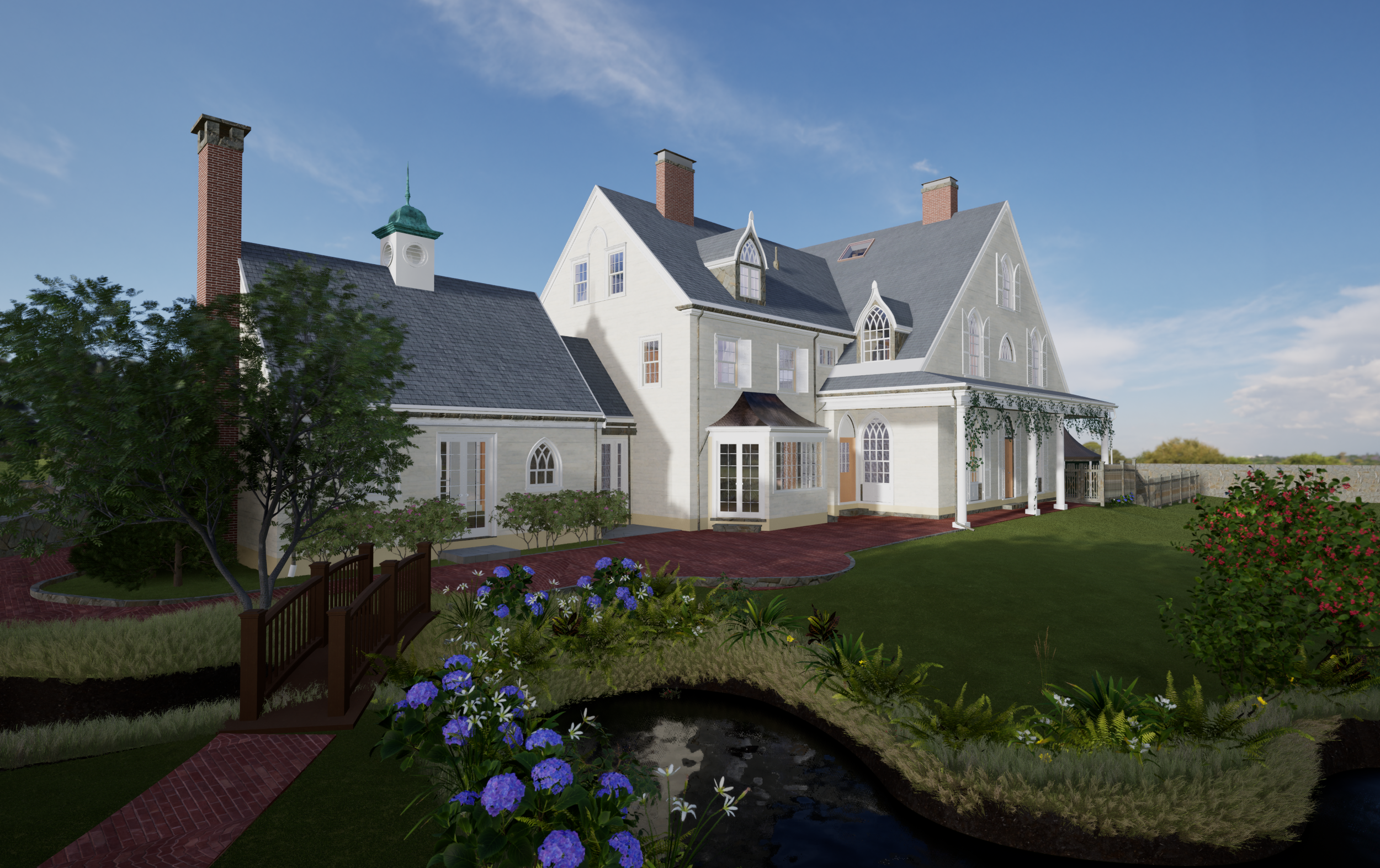
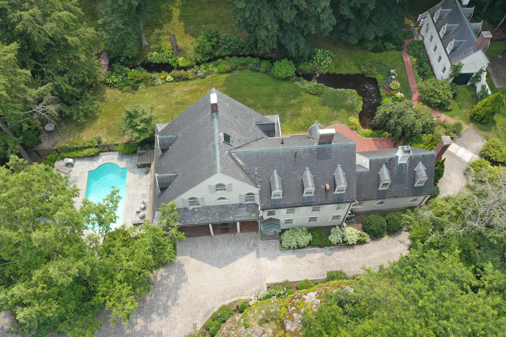
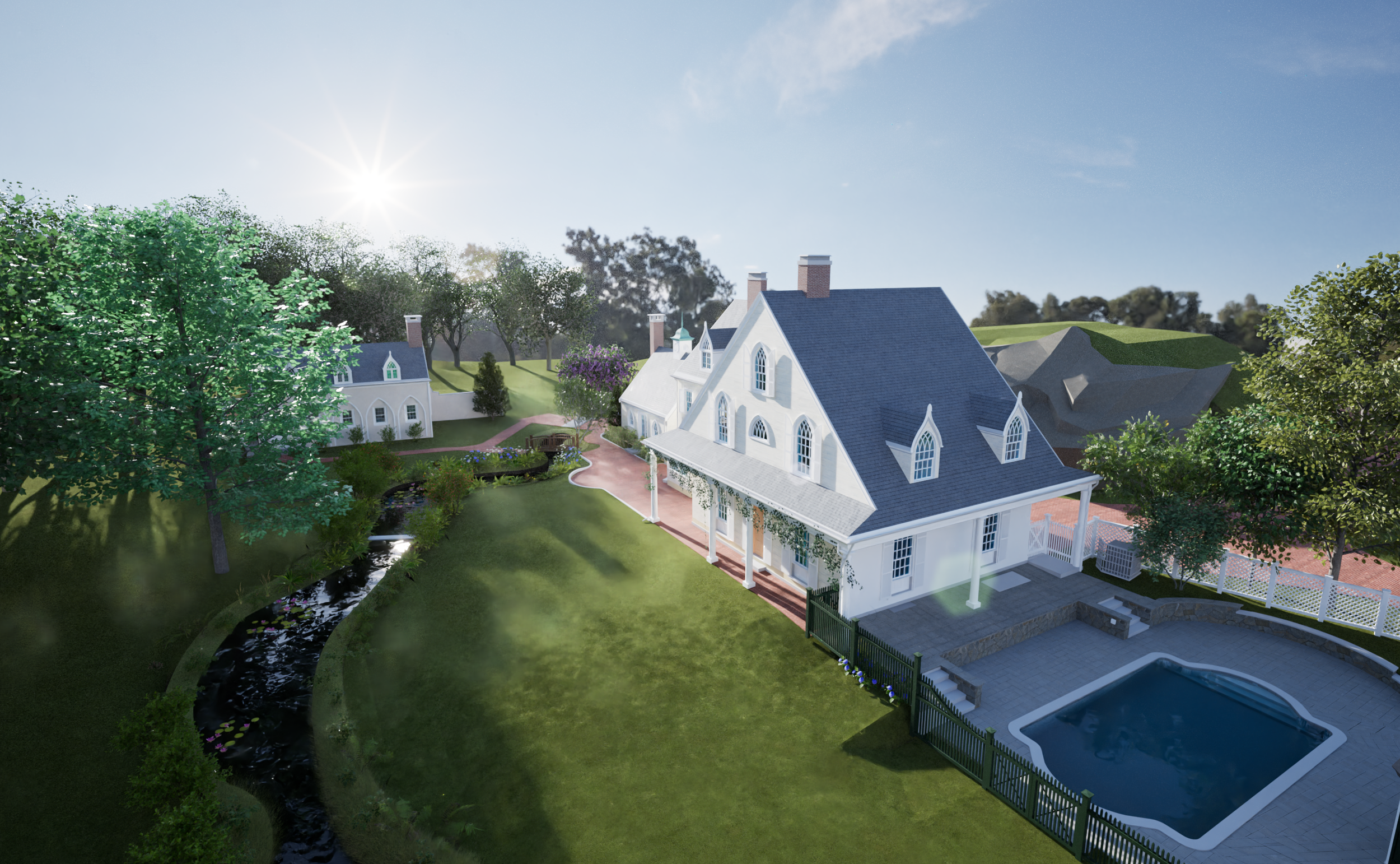
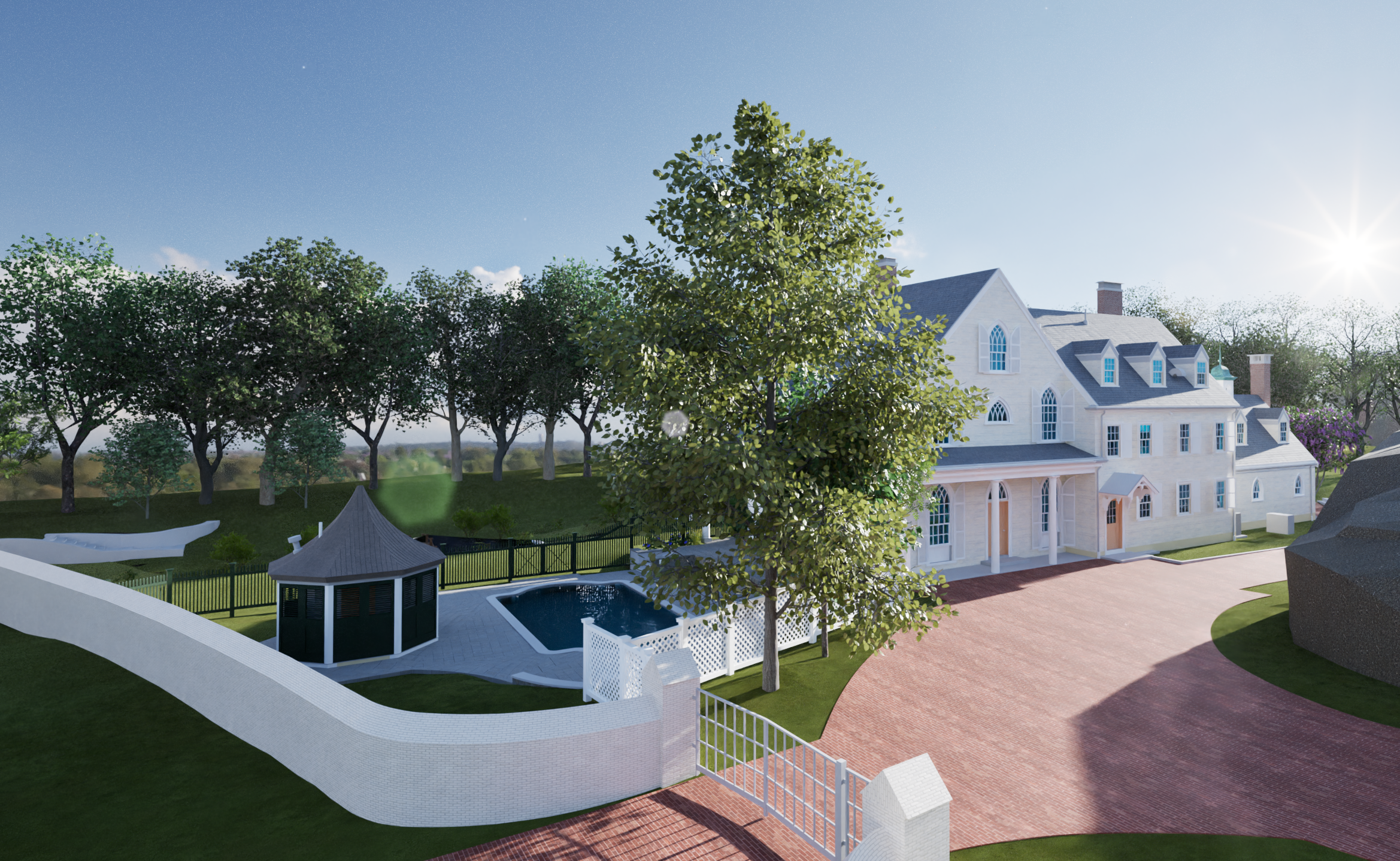
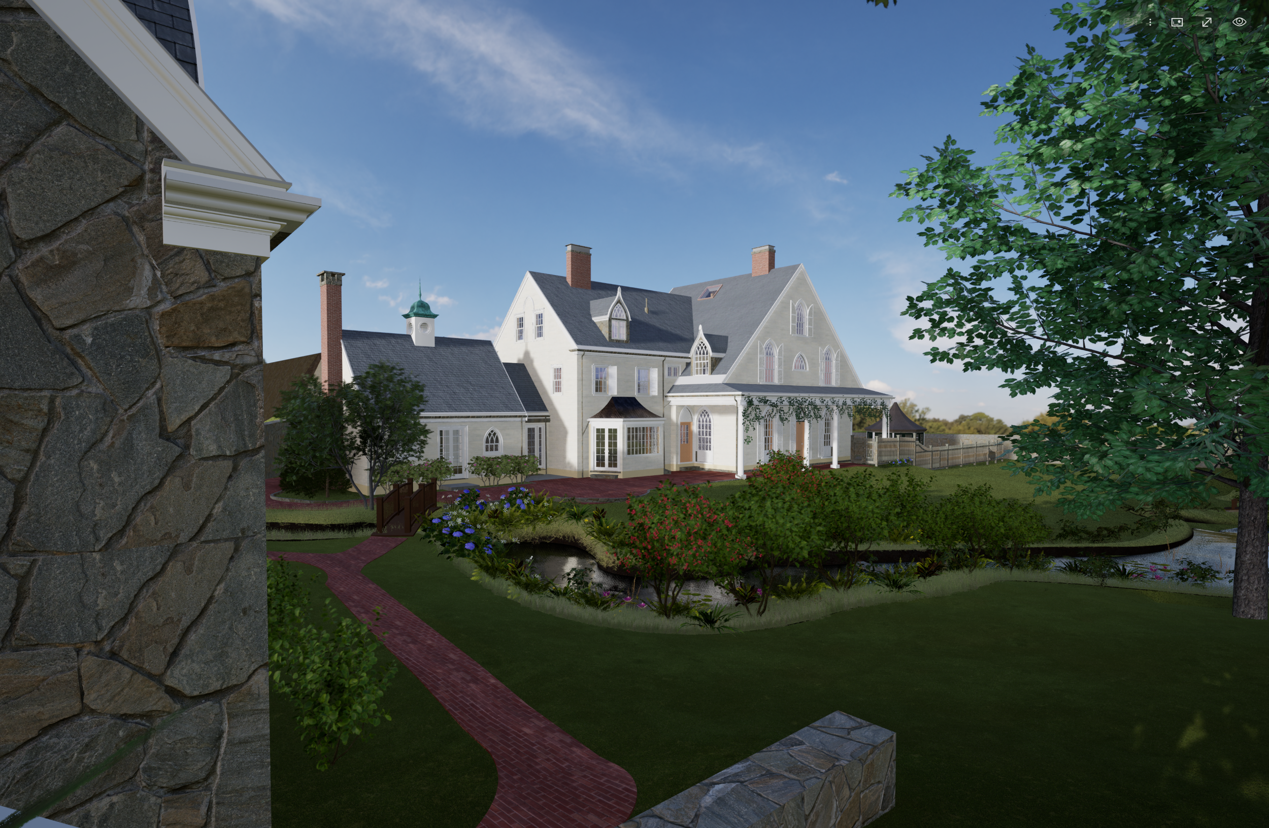
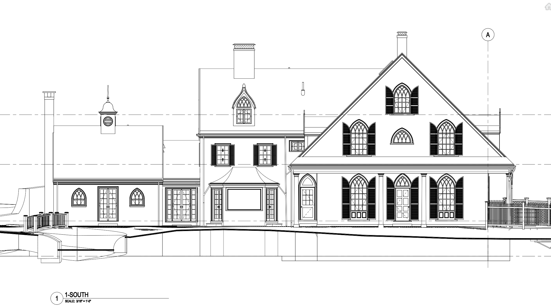
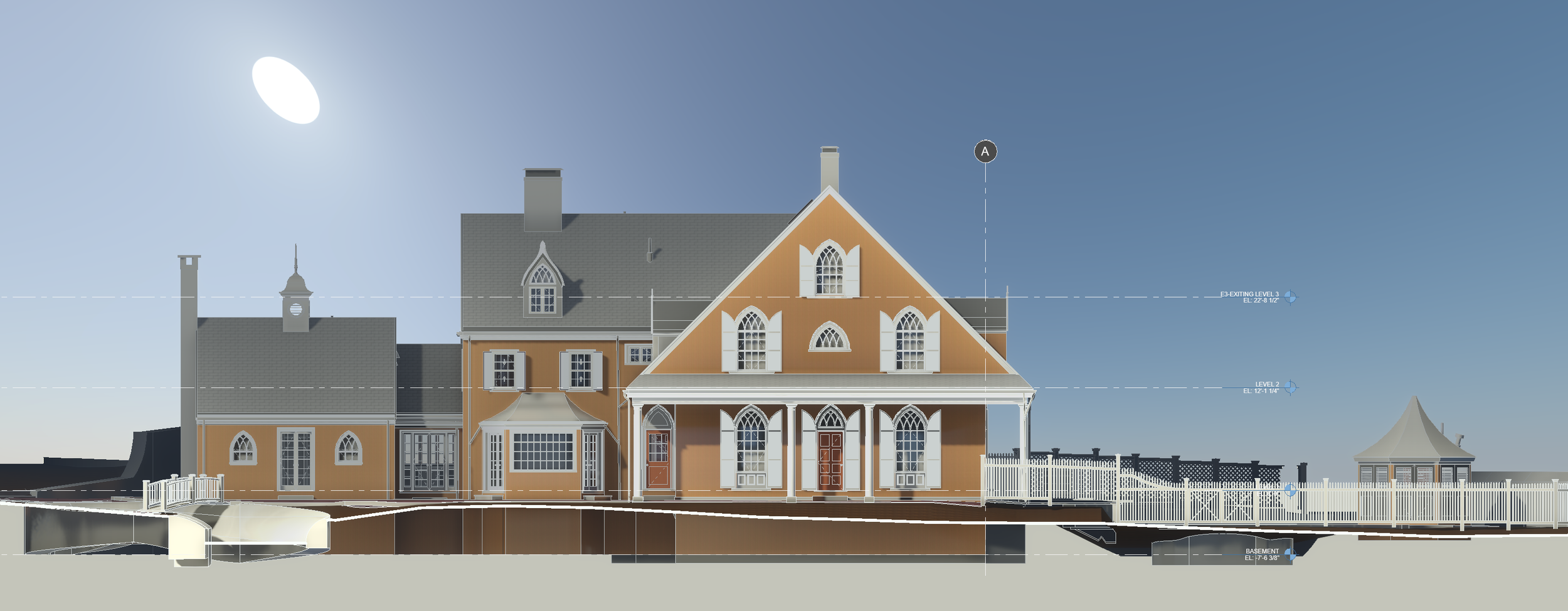
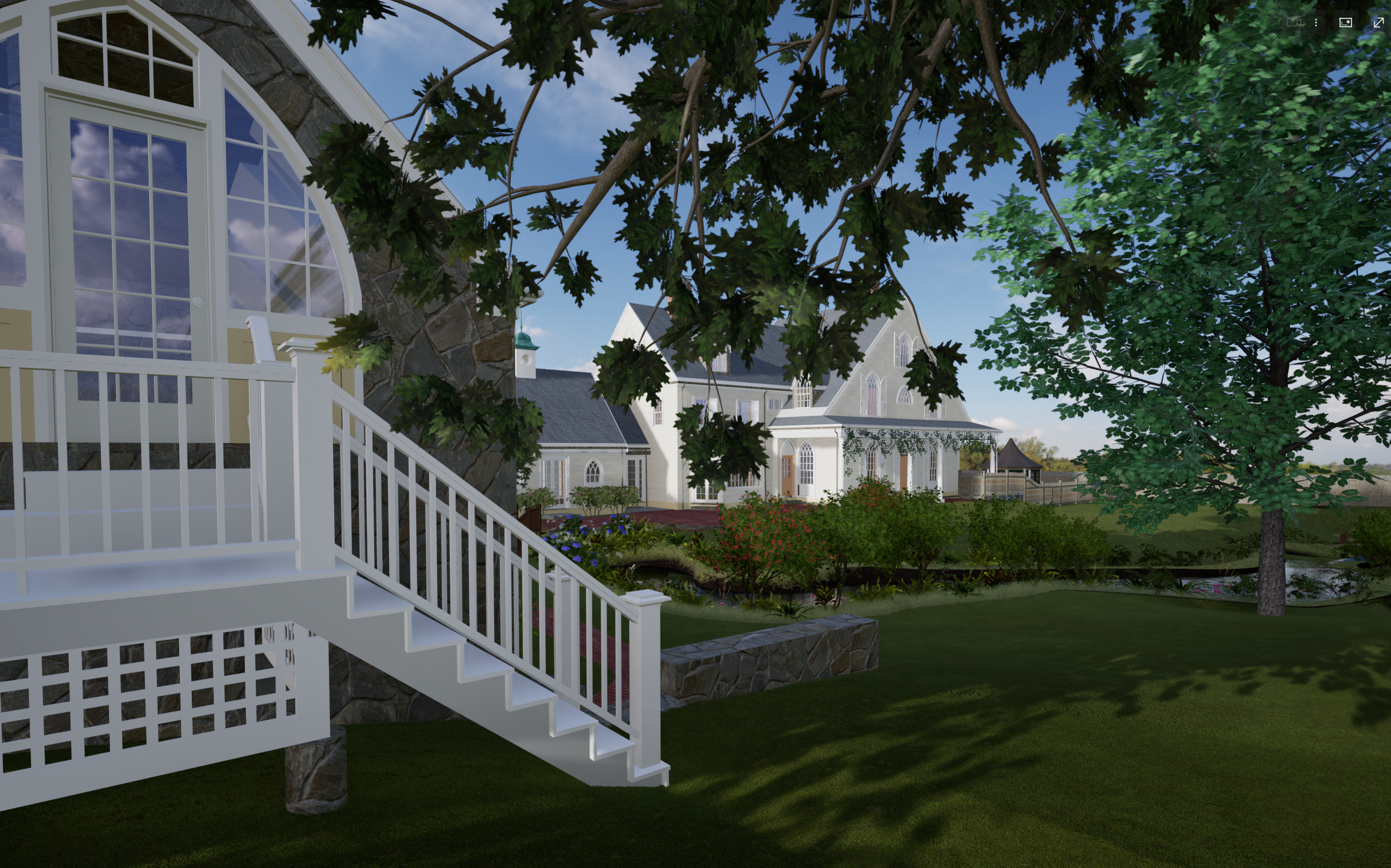
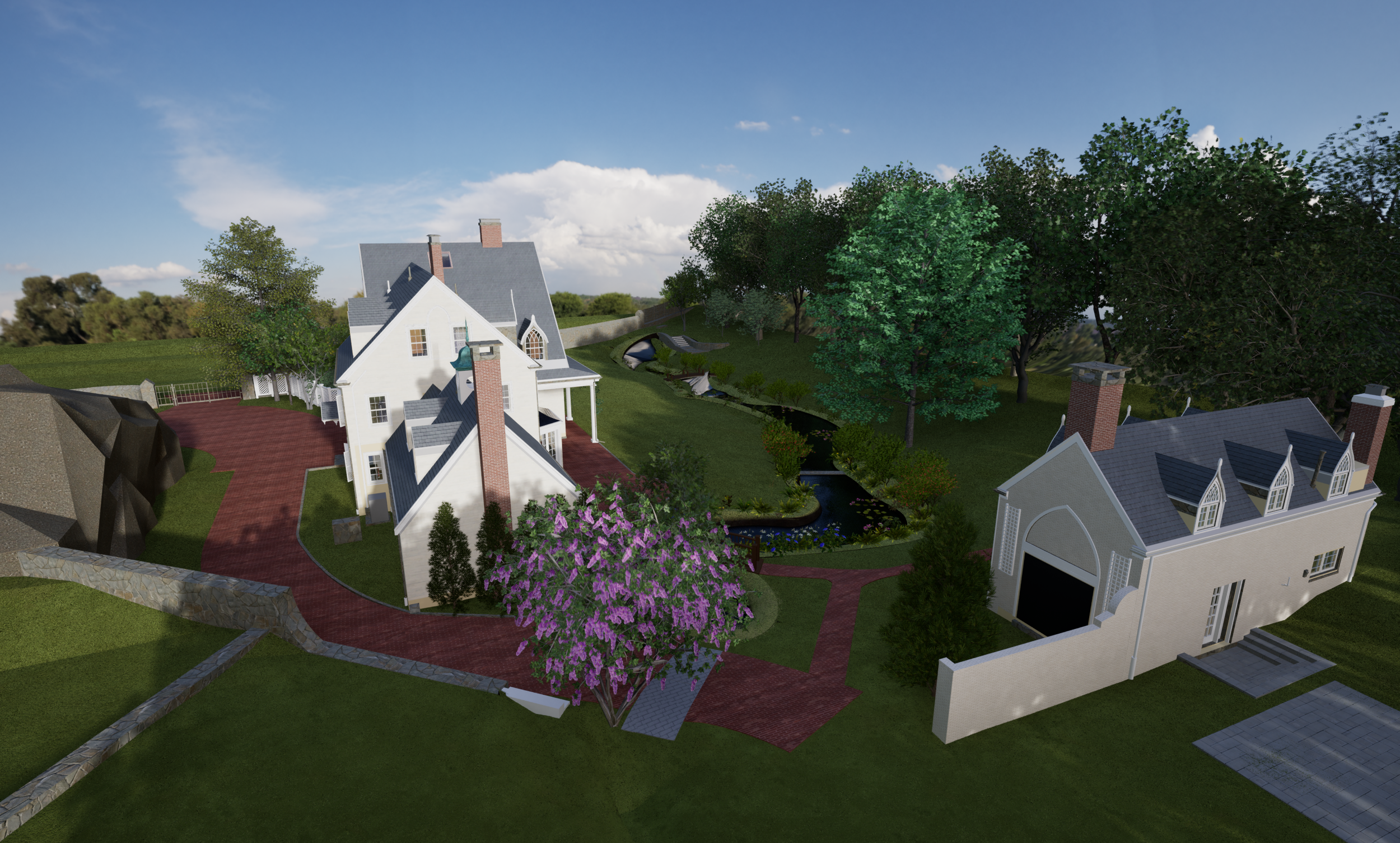
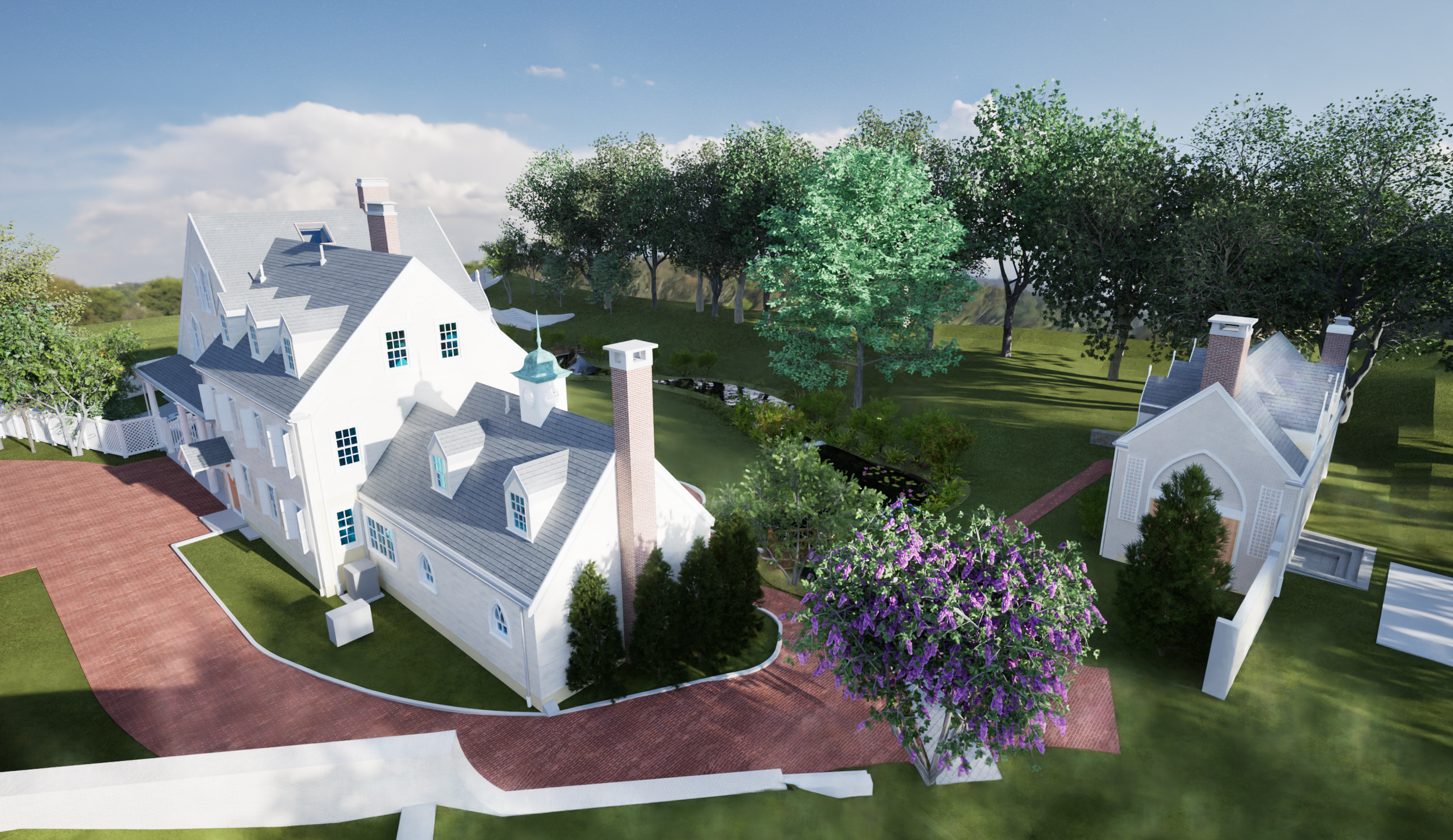
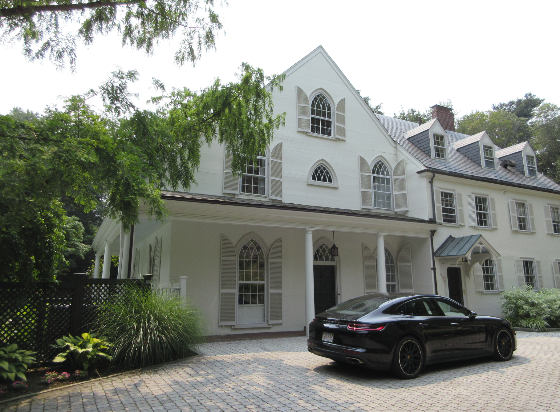
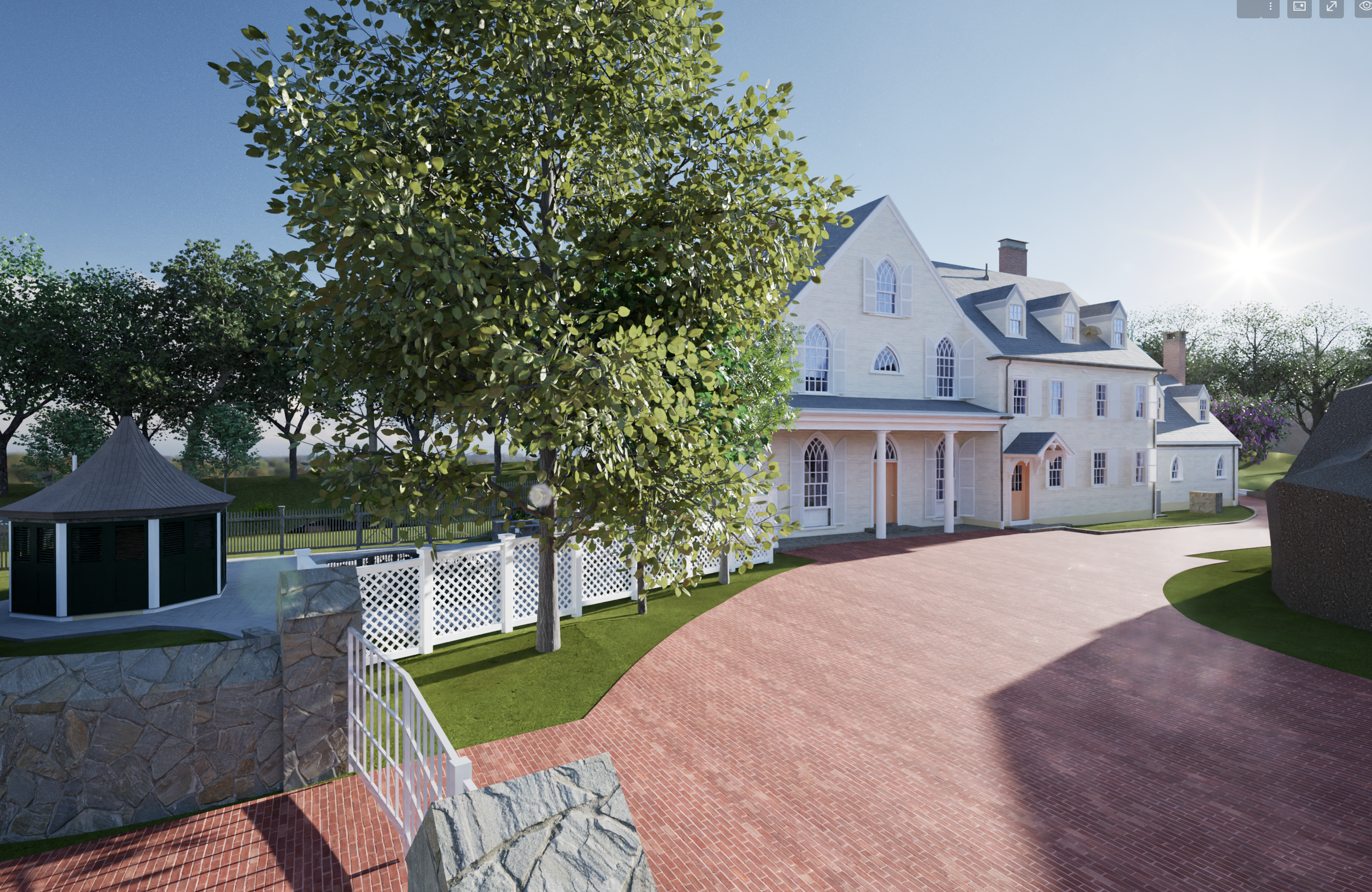
For this residential project in Brookline, Pointknown was engaged to document a Gothic Revival–style property where architecture and landscape are deeply interconnected. The scope extended well beyond the primary residence to include a detached carriage house, dramatic elevation changes, exposed ledge, and a natural stream running through the site.
The Gothic Revival style—defined by its vertical proportions, steep rooflines, and expressive detailing—demands an exceptional level of accuracy when preparing for renovation or restoration. Equally critical was capturing the surrounding terrain, where topography and natural features directly influence design feasibility, drainage, and constructability.
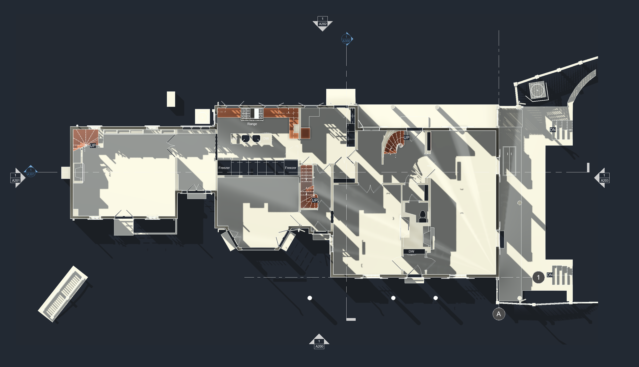
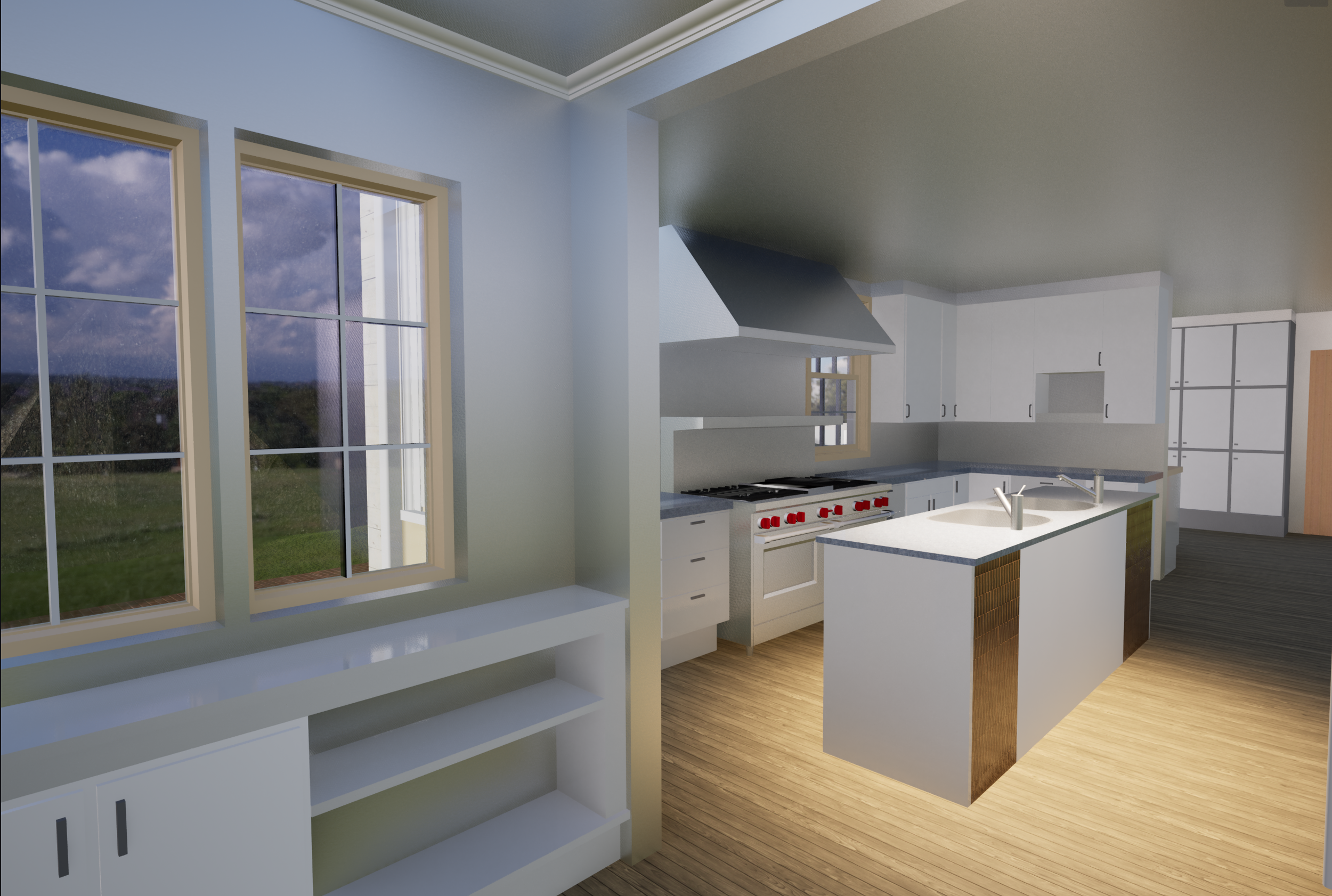
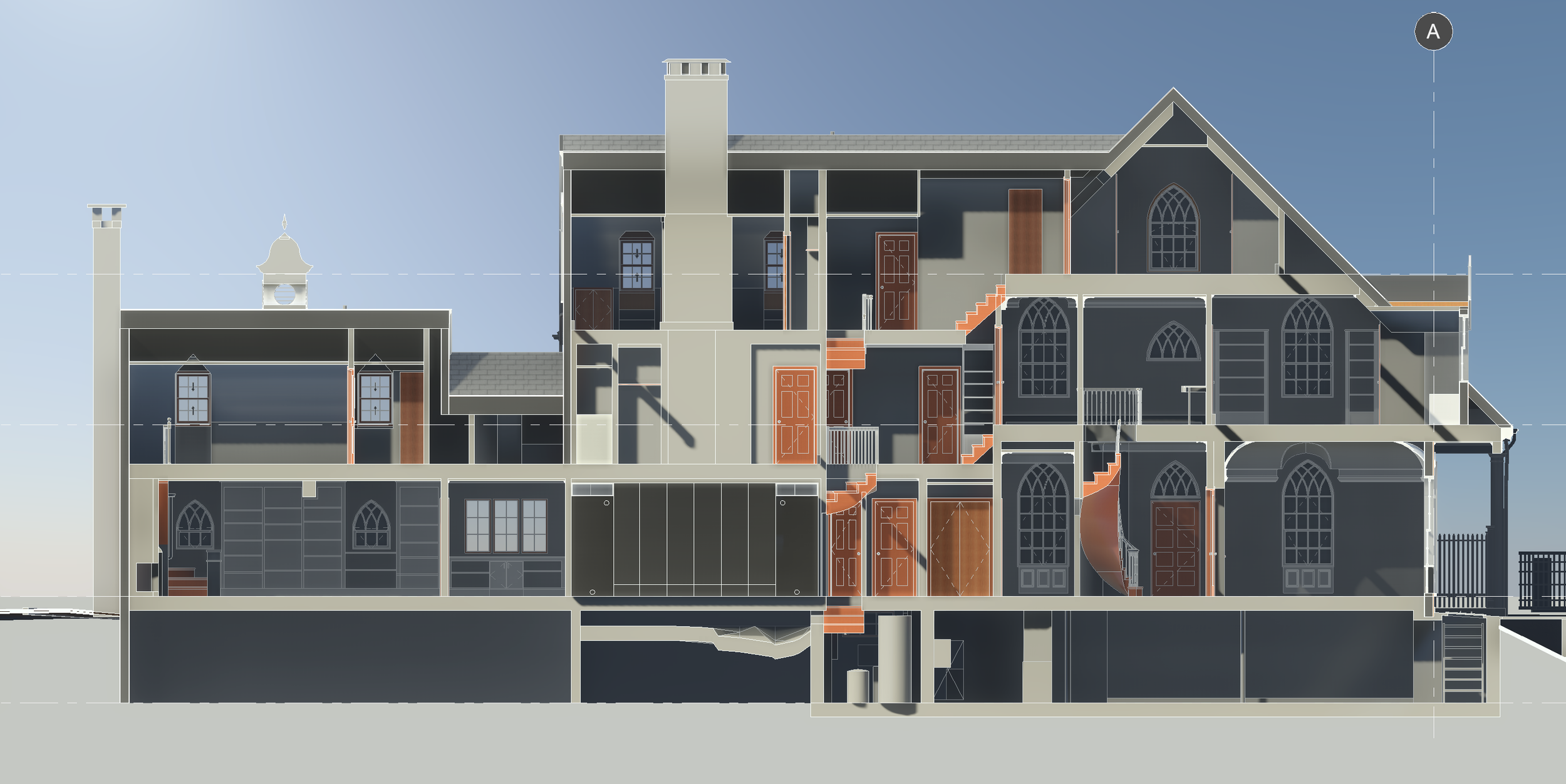
Using a combination of mobile laser scanning, terrestrial LiDAR, drone photogrammetry, and ground-based imagery, we created a unified digital representation of the entire property. The result is a highly accurate existing-conditions model that allows project teams to understand the site as a single, connected system—architecture, land, and natural features working together.
Scope of Work
Reality Capture
LiDAR scanning of the Gothic Revival main residence and carriage house
Drone capture of roof geometry, elevation change, and site context
Ground-based scanning of terrain, ledge outcroppings, and stream corridor
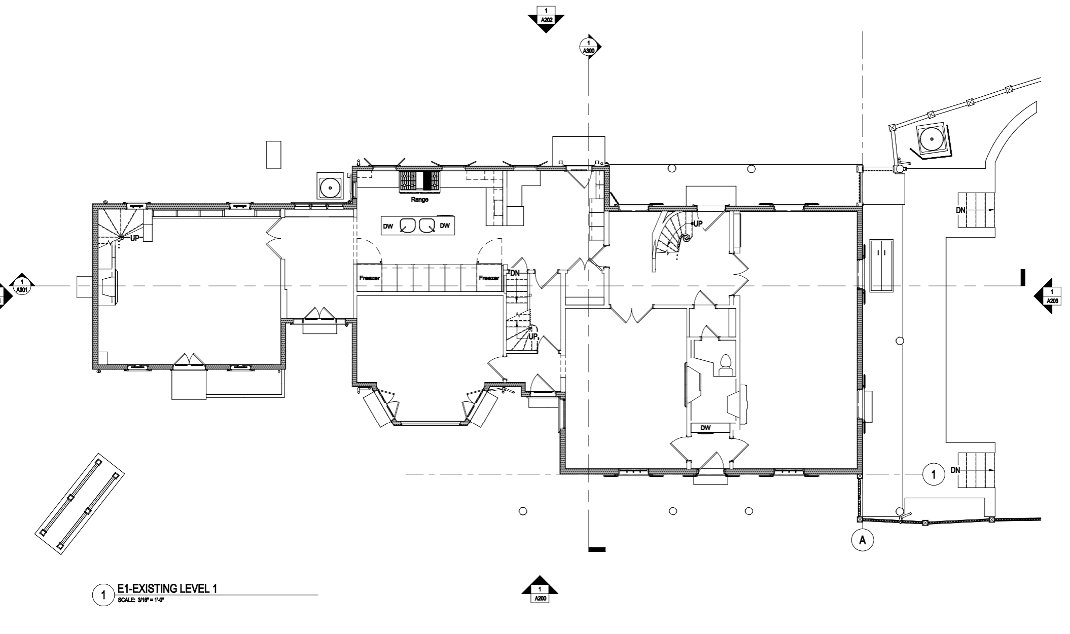
3D Modeling & Documentation
Detailed existing-conditions model of all structures
Modeled site topography reflecting true grade and slope
Ledge and natural site features modeled for design coordination
Stream alignment and surrounding landscape captured for planning and review
Deliverables
Coordinated 3D model suitable for architectural, structural, and civil workflows
Accurate base model supporting restoration, renovation, and permitting efforts
Why This Matters
Historic properties set within complex landscapes require more than traditional building documentation. By capturing both the Gothic Revival architecture and the natural terrain as one integrated dataset, design teams gain the clarity needed to:
Respect and preserve historic character
Anticipate grading, drainage, and foundation challenges
Reduce risk during permitting and construction
Make informed decisions grounded in real-world conditions
This approach is especially valuable for hillside and environmentally sensitive sites, where assumptions can quickly become costly.
Location
Brookline, Massachusetts