
Residential | Commerical | Industrial
Understand the Space Before You Design It
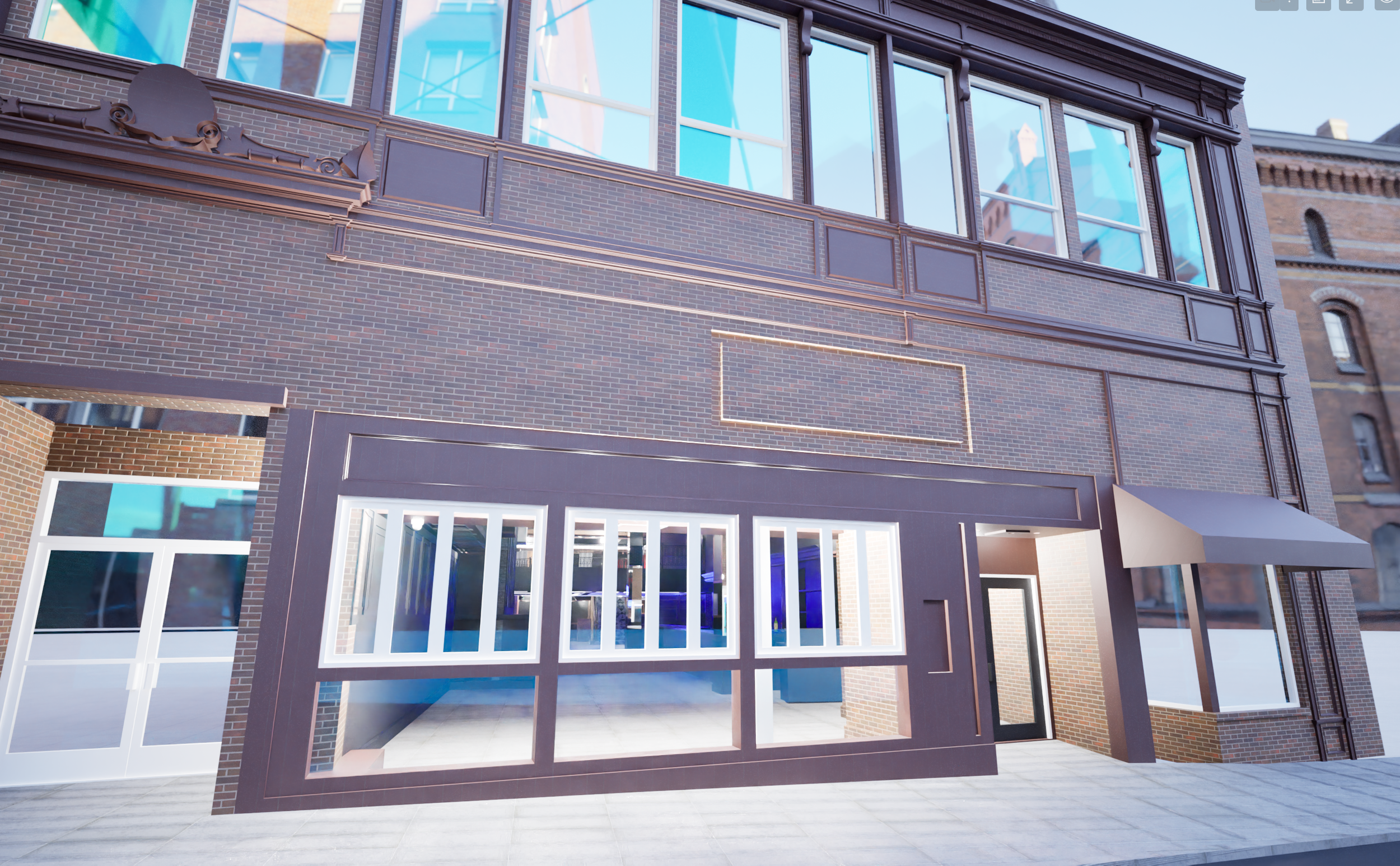
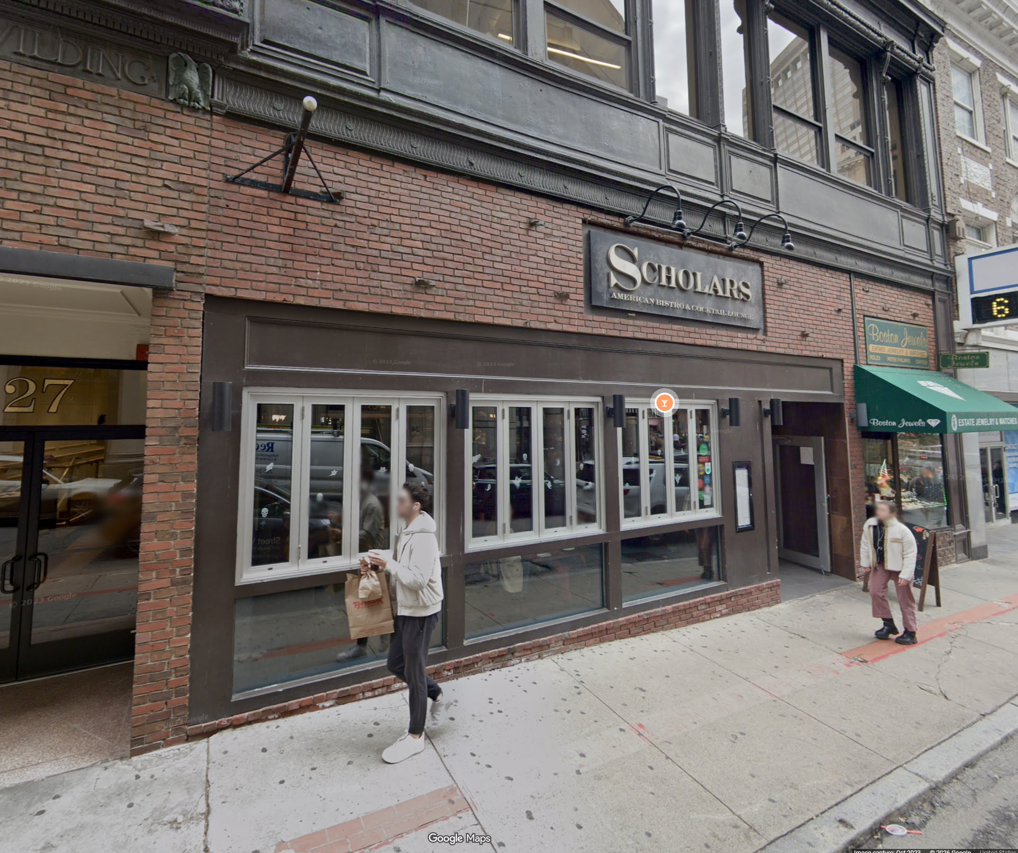
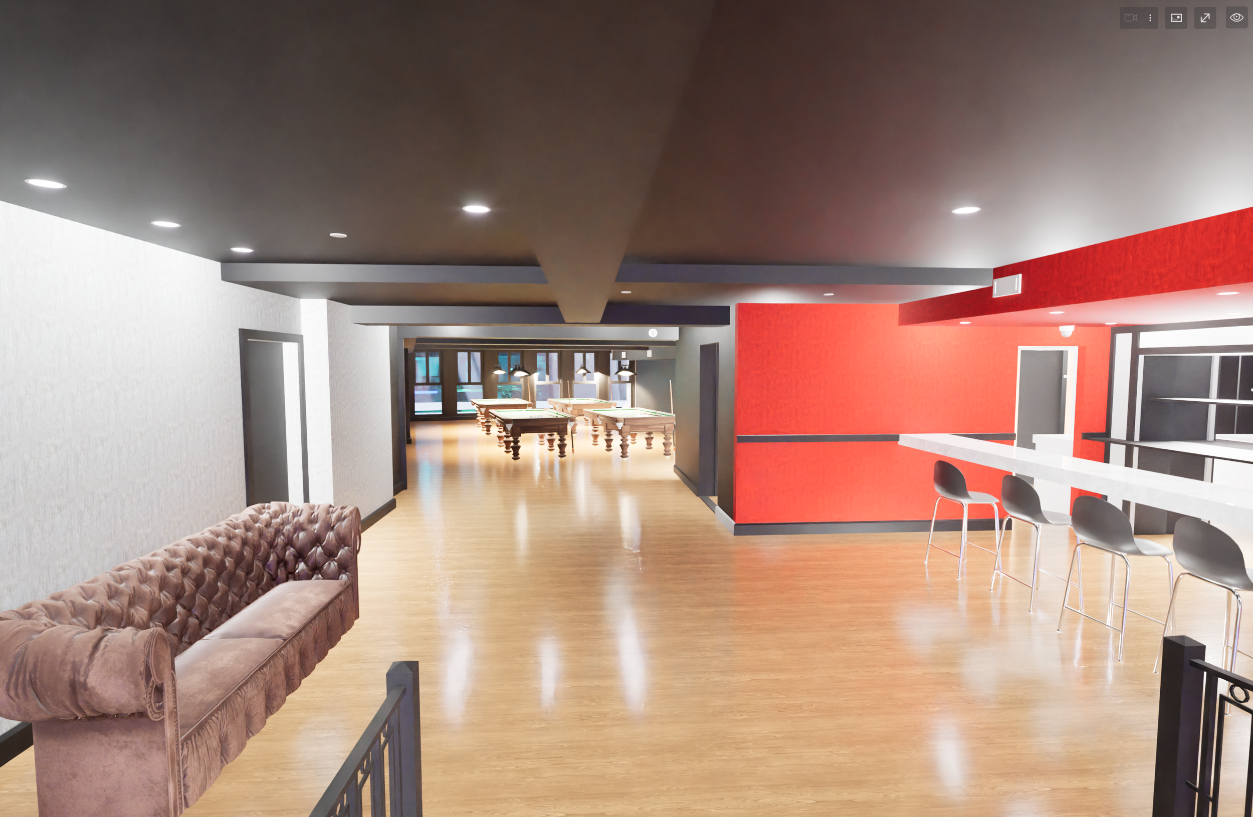
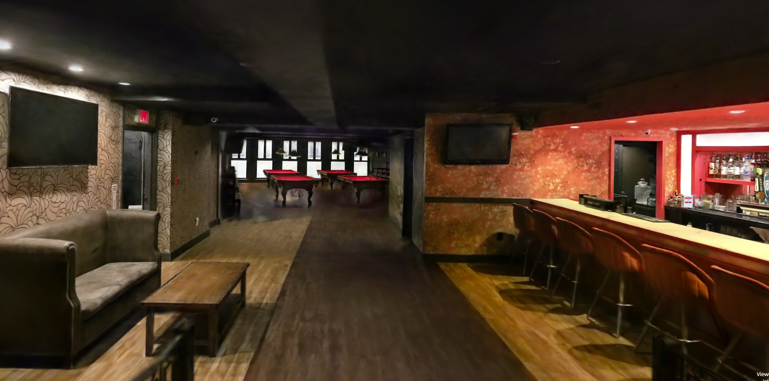
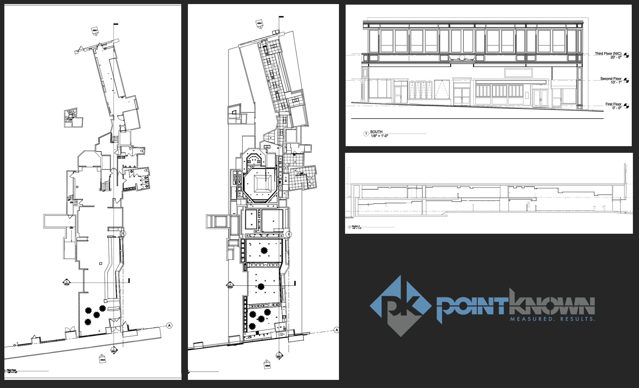
A full-building capture of 25 School Street — delivered as a clear, navigable, and design-ready dataset.
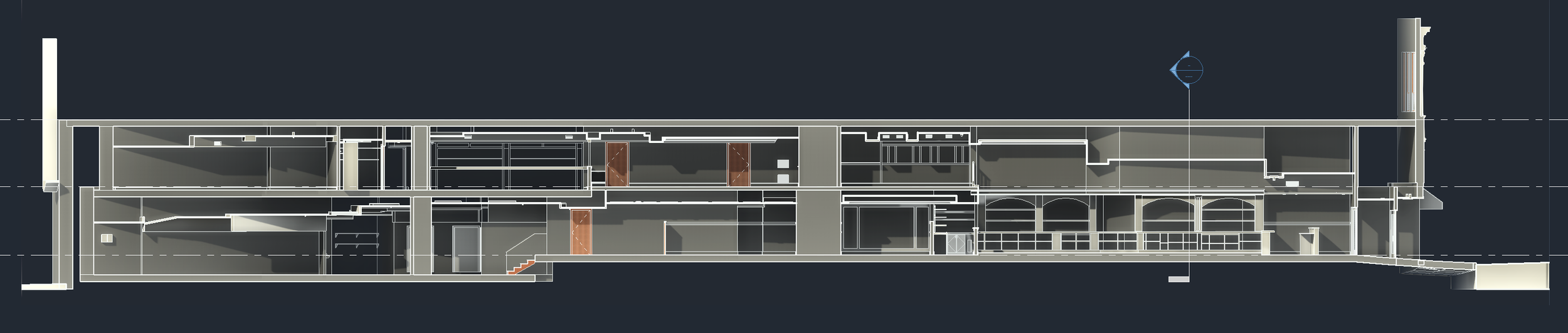
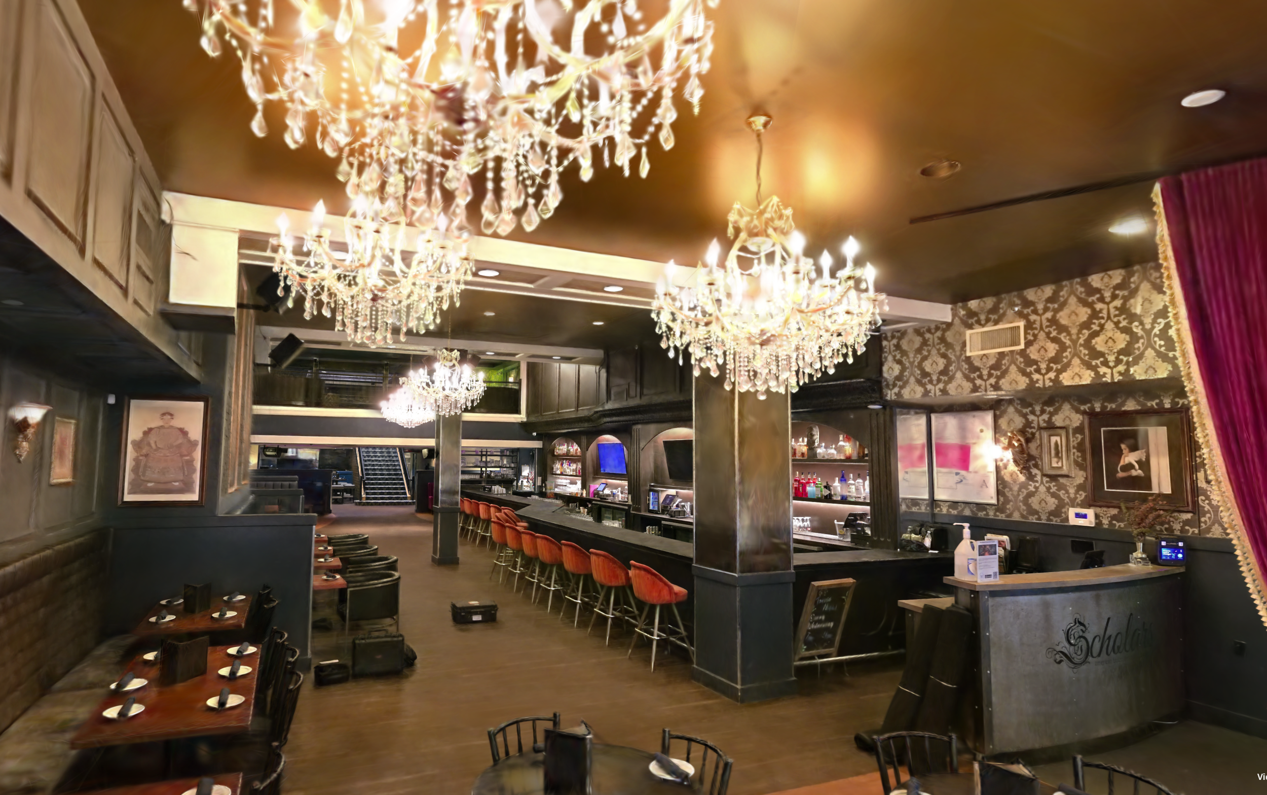
The space at 25 School Street in downtown Boston, formerly home to Scholars Pub and soon to become Off The Rails Boston, spans approximately 10,000 SF across two interconnected levels.
Its layout is not immediately legible from traditional documentation.
Pointknown was engaged to create a complete and accurate understanding of the existing conditions — allowing the design team and ownership group to move forward with clarity.
Scope of Work
Mobile LiDAR Scan
360 Video + Photography
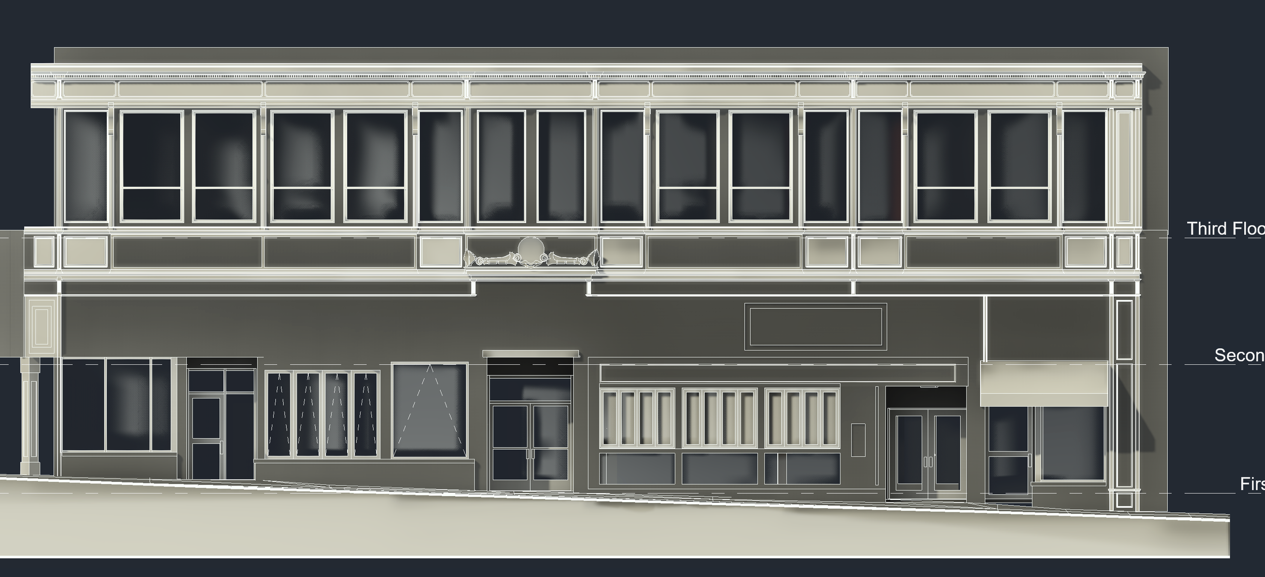
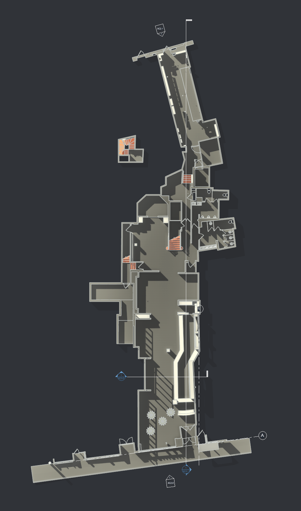
Revit Model (coordinated existing conditions)
CAD Deliverables (plans, RCP, sections, elevations)
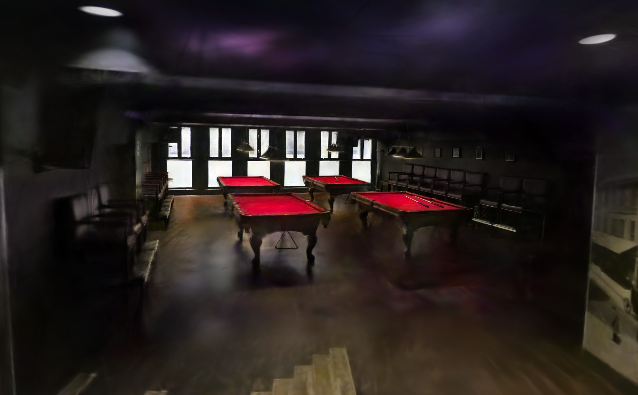
Gaussian Splat (immersive environment)
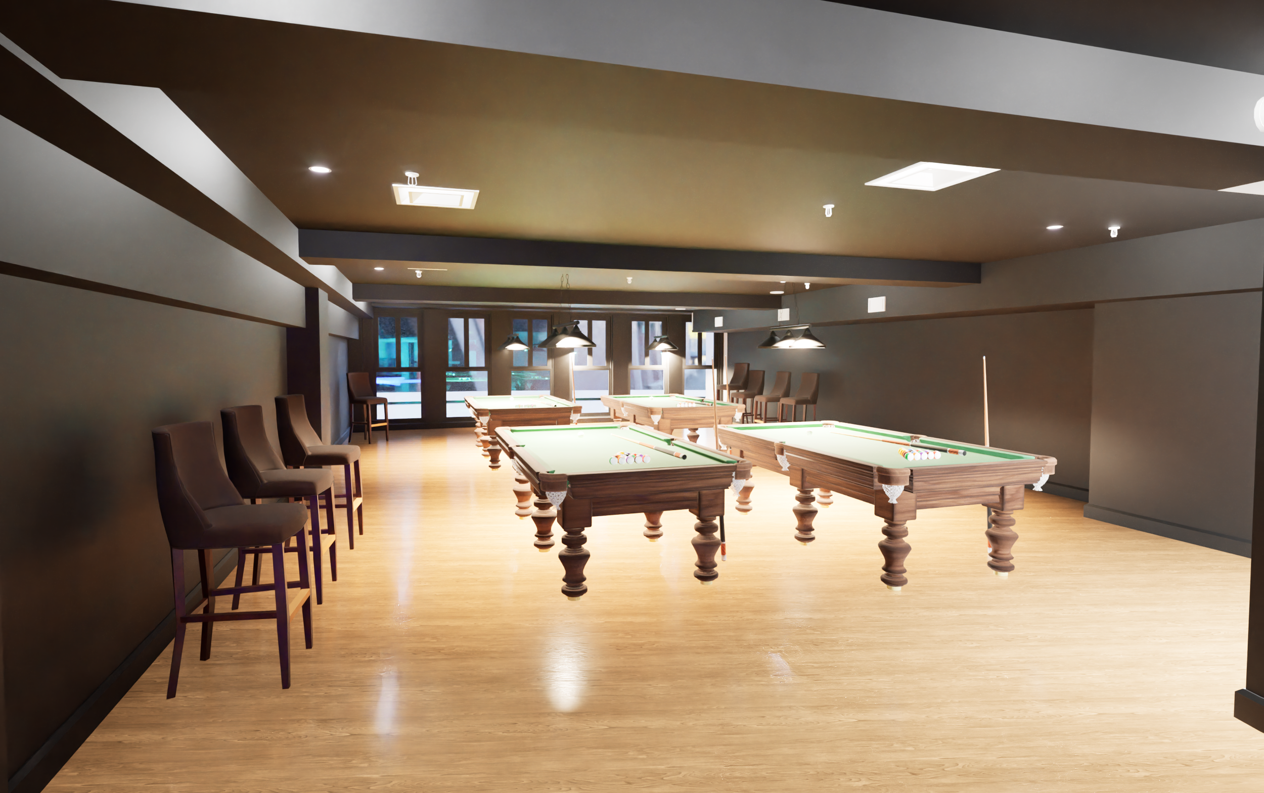
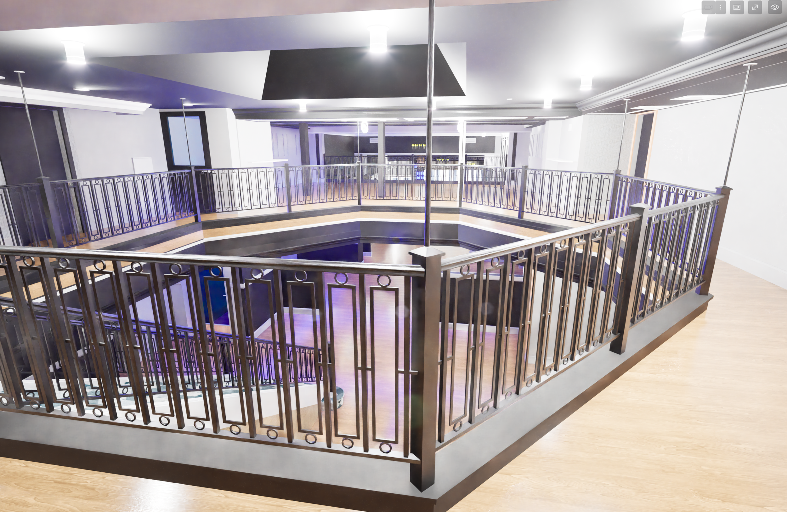
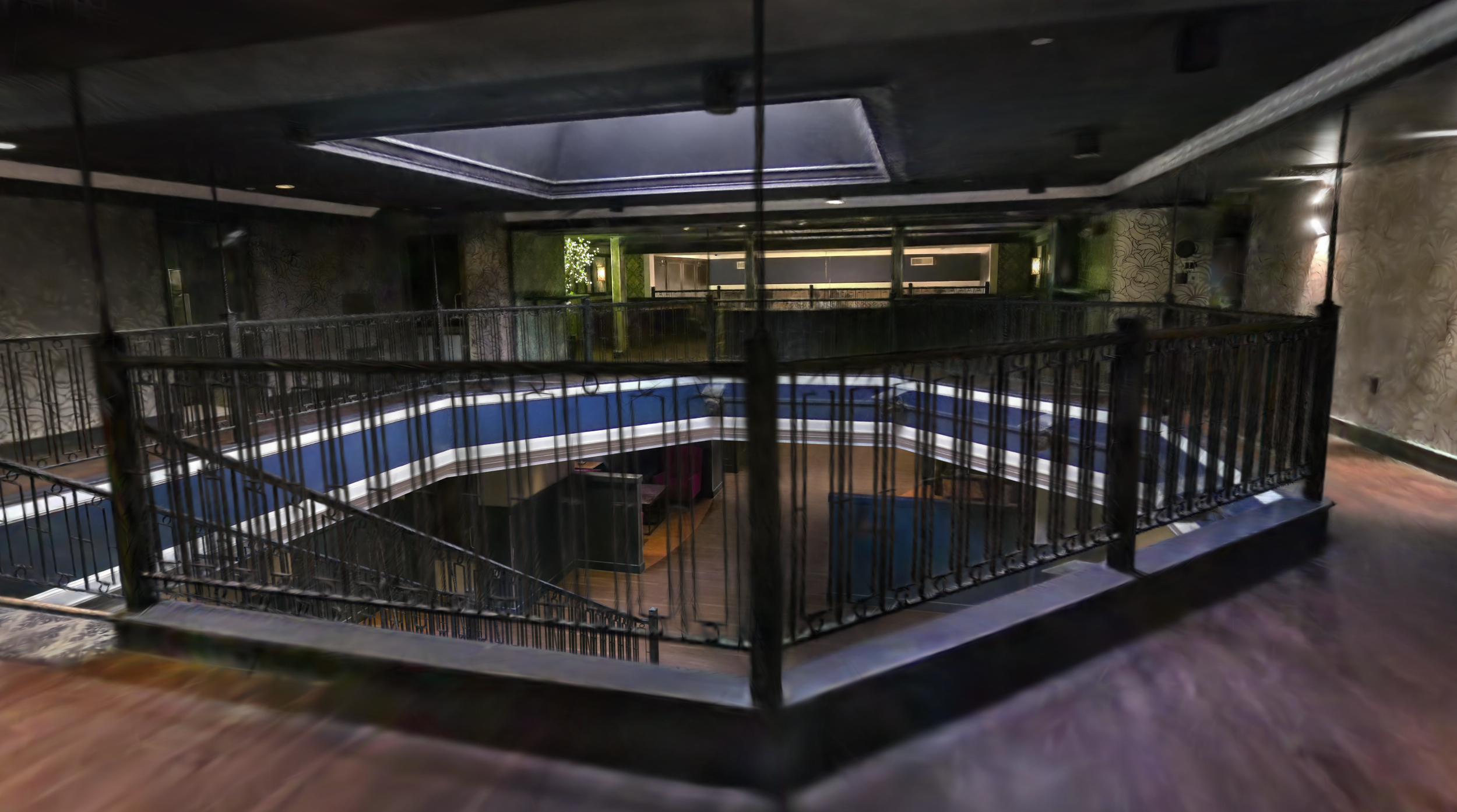
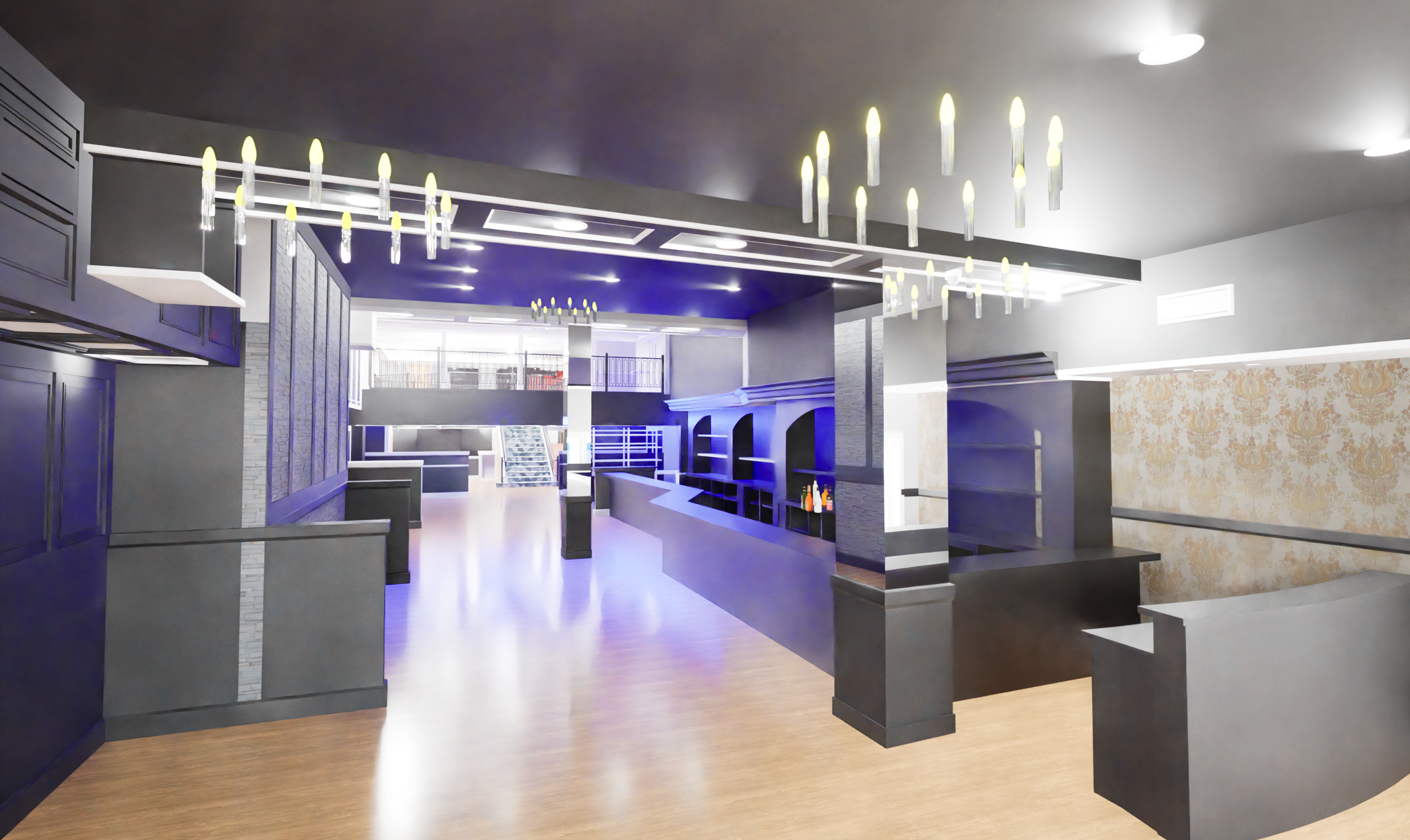
The Space
This is a space that reveals itself only when experienced.
Extends through the building across two levels
Contains irregular geometry and transitions
Reflects multiple layers of prior build-outs
Traditional plans alone would not fully communicate how it works.
Our Approach
We created a layered dataset designed to remove uncertainty:
LiDAR scanning to capture full geometry efficiently
360 imagery to retain material and lighting context
Gaussian Splat environment for intuitive navigation
Revit model + CAD outputs for design and documentation
Each component supports a different way of understanding the space — together, they align the team.
Interactive Viewer
Explore the space:
👉 https://lcc-viewer.xgrids.com/pub/dbcpax-scholars
Outcome
Clear understanding of complex existing conditions
Faster early-stage layout and design decisions
Reduced need for repeat site visits
Alignment between architect and ownership
Measure Once. Design Right.