
Residential | Commerical | Industrial
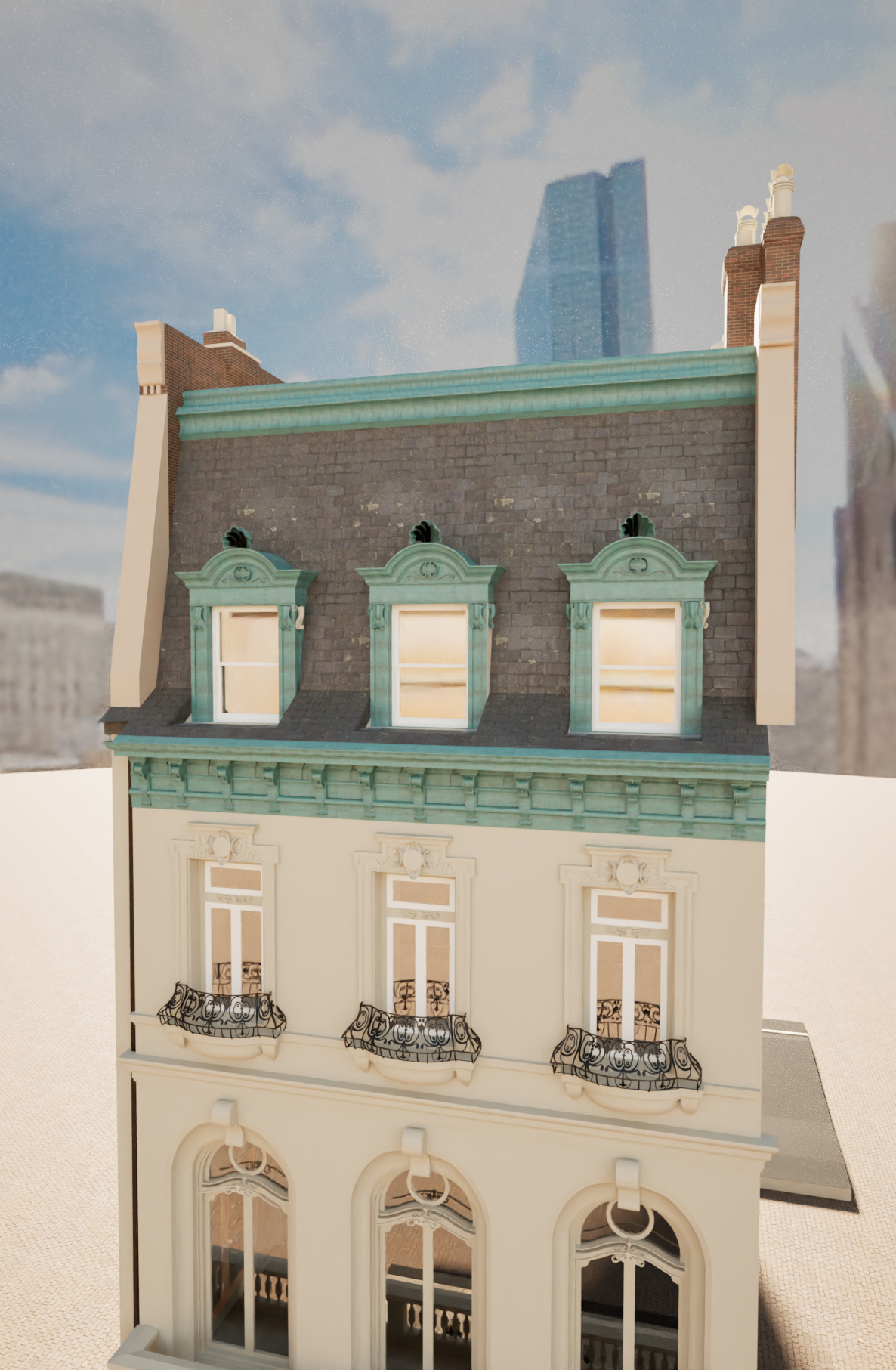


30 Commonwealth Avenue — Back Bay Existing Conditions Capture
Capture once. Design faster.
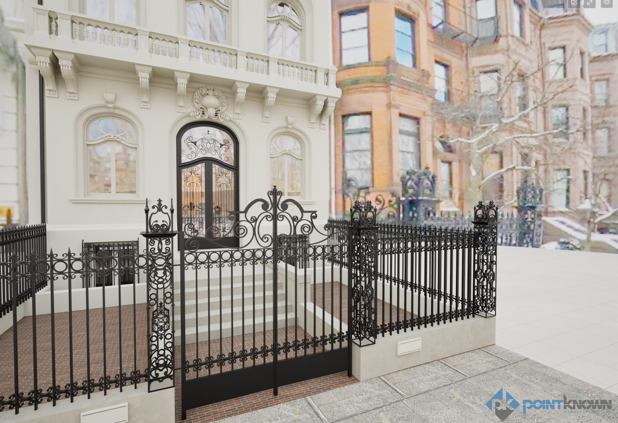
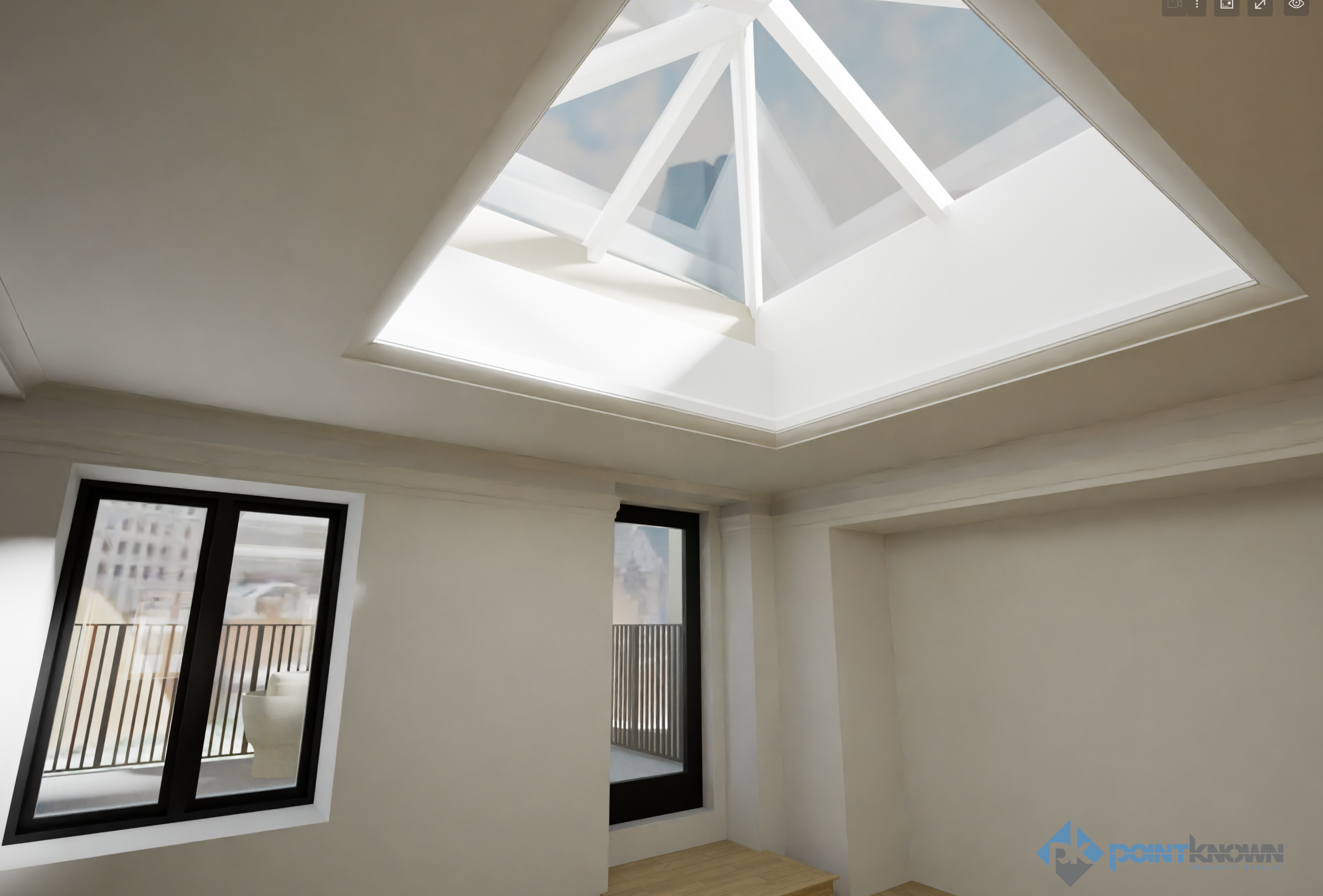
Pointknown documented 130 Commonwealth Avenue in Boston’s Back Bay using a layered reality-capture workflow that supports renovation planning, design coordination, and visualization from day one. This project combined mobile LiDAR, RTK-enabled drone capture, and 360 media — plus HDRI environments exported for Twinmotion renderings.
PROJECT OVERVIEW
Location: Boston, Massachusetts — Back Bay
Project Type: Historic Townhouse Documentation
Scope: Interior + exterior capture + roof/site context + visualization-ready media
Capture Stack: Mobile LiDAR | RTK Drone | 360 Photo/Video | XGRIDS PortalCam | HDRI for Twinmotion
Back Bay projects demand precision. From historic detailing to renovation-sensitive geometry, accurate existing conditions reduce risk and accelerate decision-making across owners, architects, and designers.
THE CHALLENGE
Historic urban properties often include irregular framing, layered renovations, tight access, and detail-rich façades where small measurement errors become expensive downstream. Meanwhile, project teams need both hard geometry and visual context to move quickly.
The goal: deliver a single coordinated dataset that supports planning, modeling, and visualization without repeated site visits.
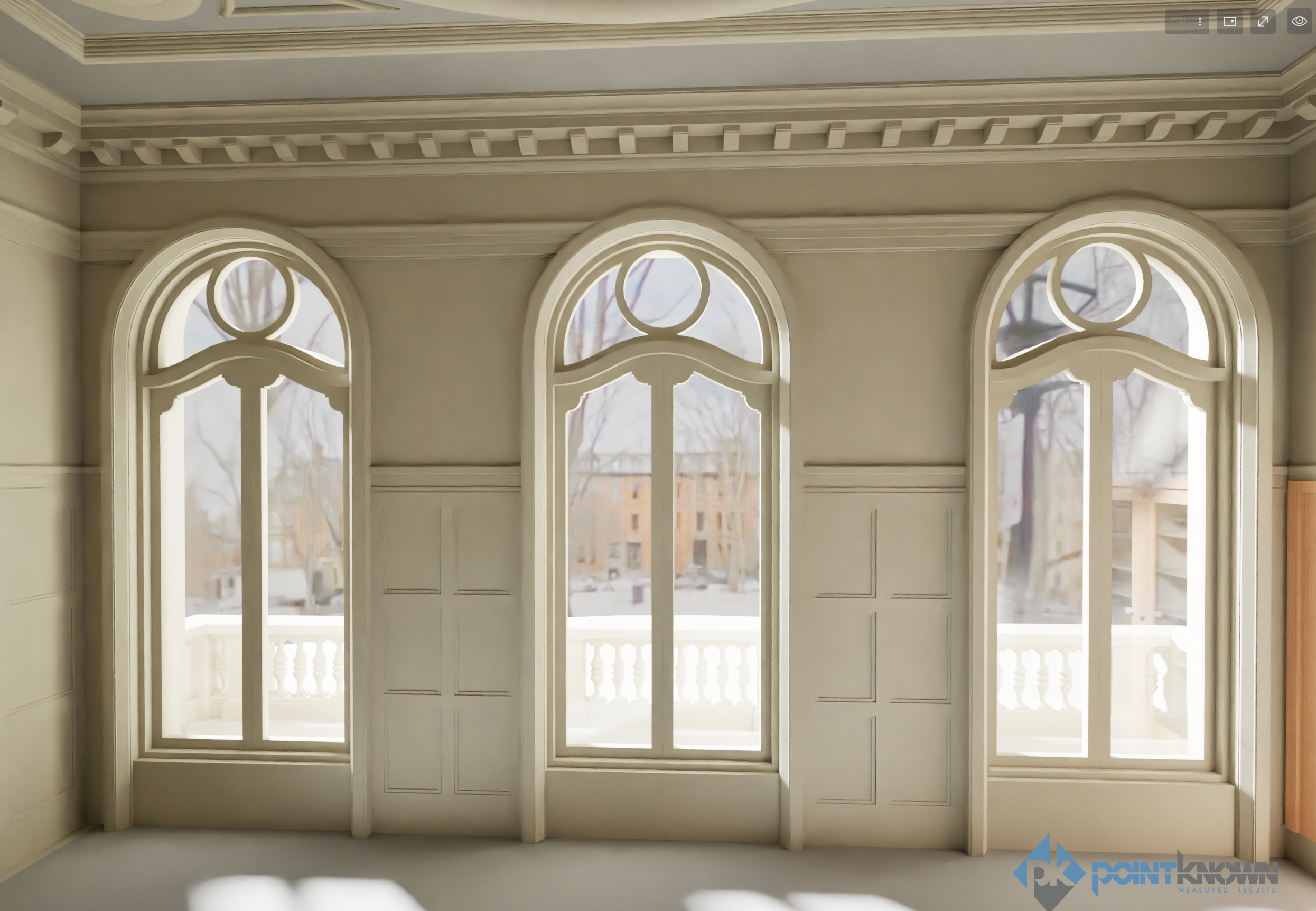
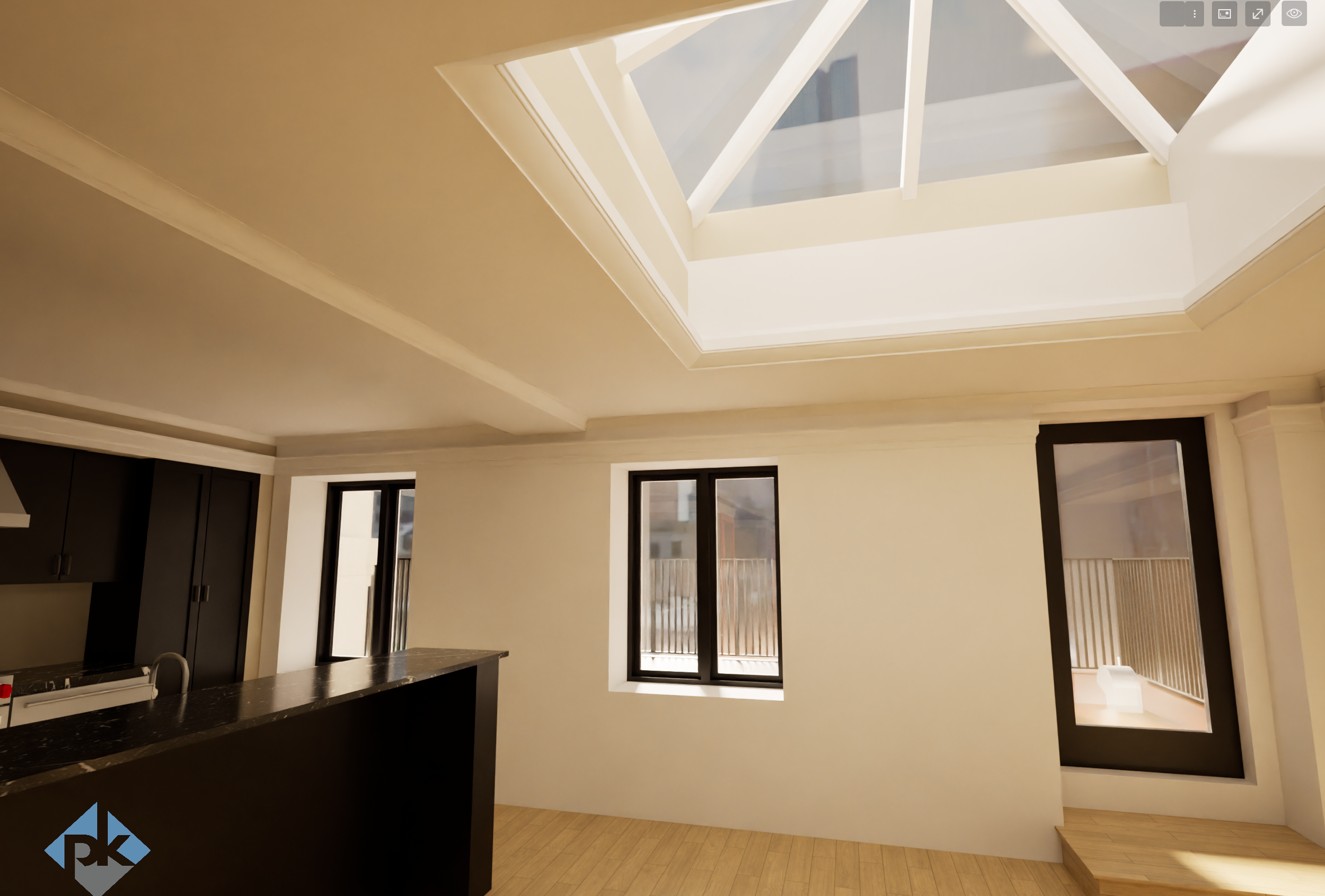
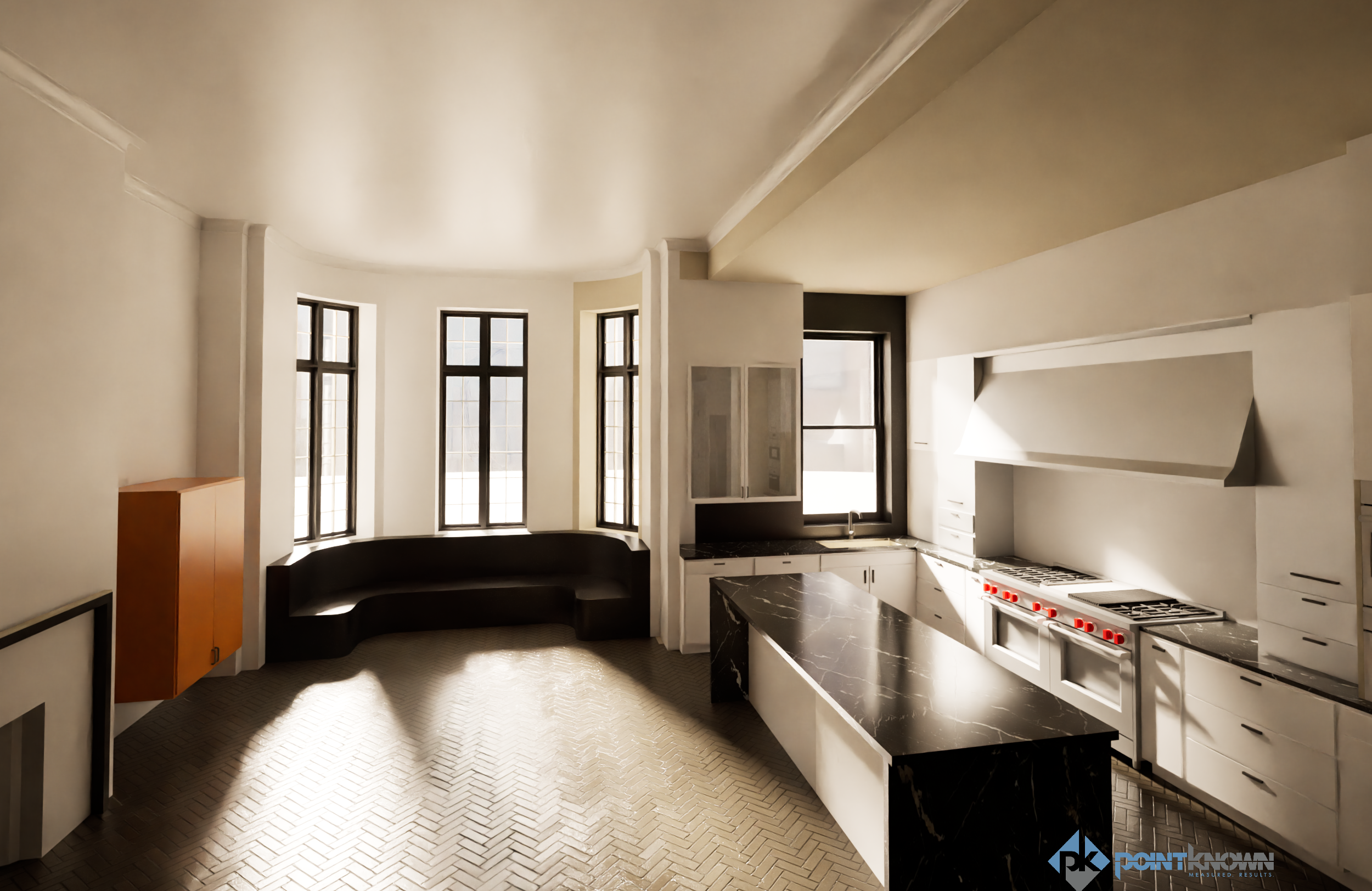
WHAT POINTKNOWN DELIVERED
Pointknown created a comprehensive digital baseline of the property using multiple aligned capture technologies.
Reality Capture Package
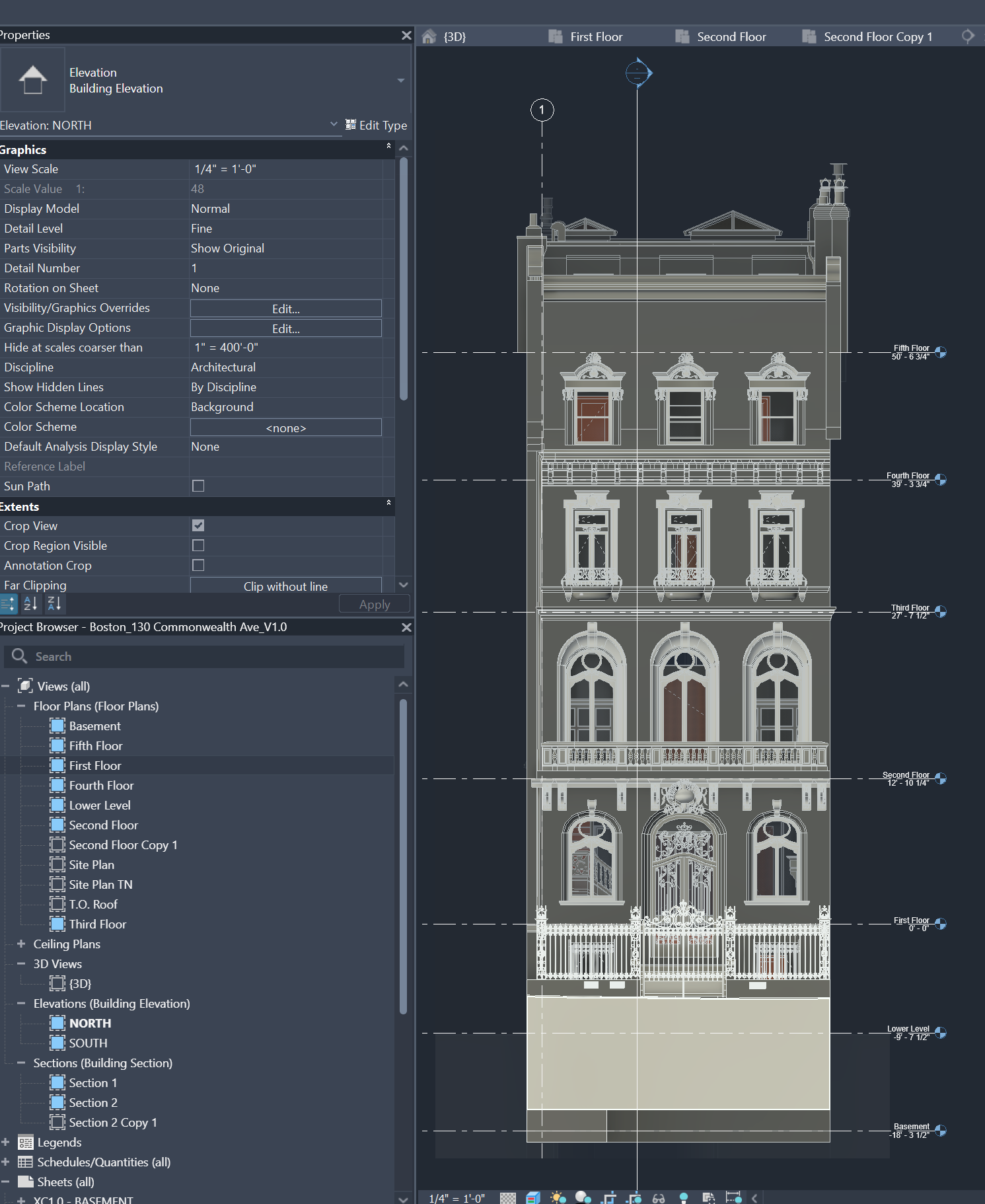
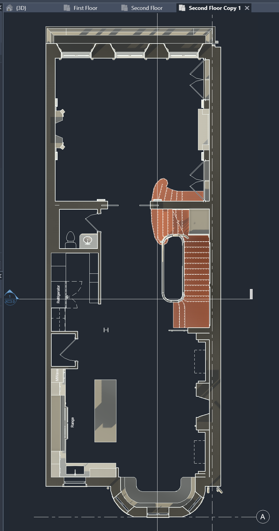
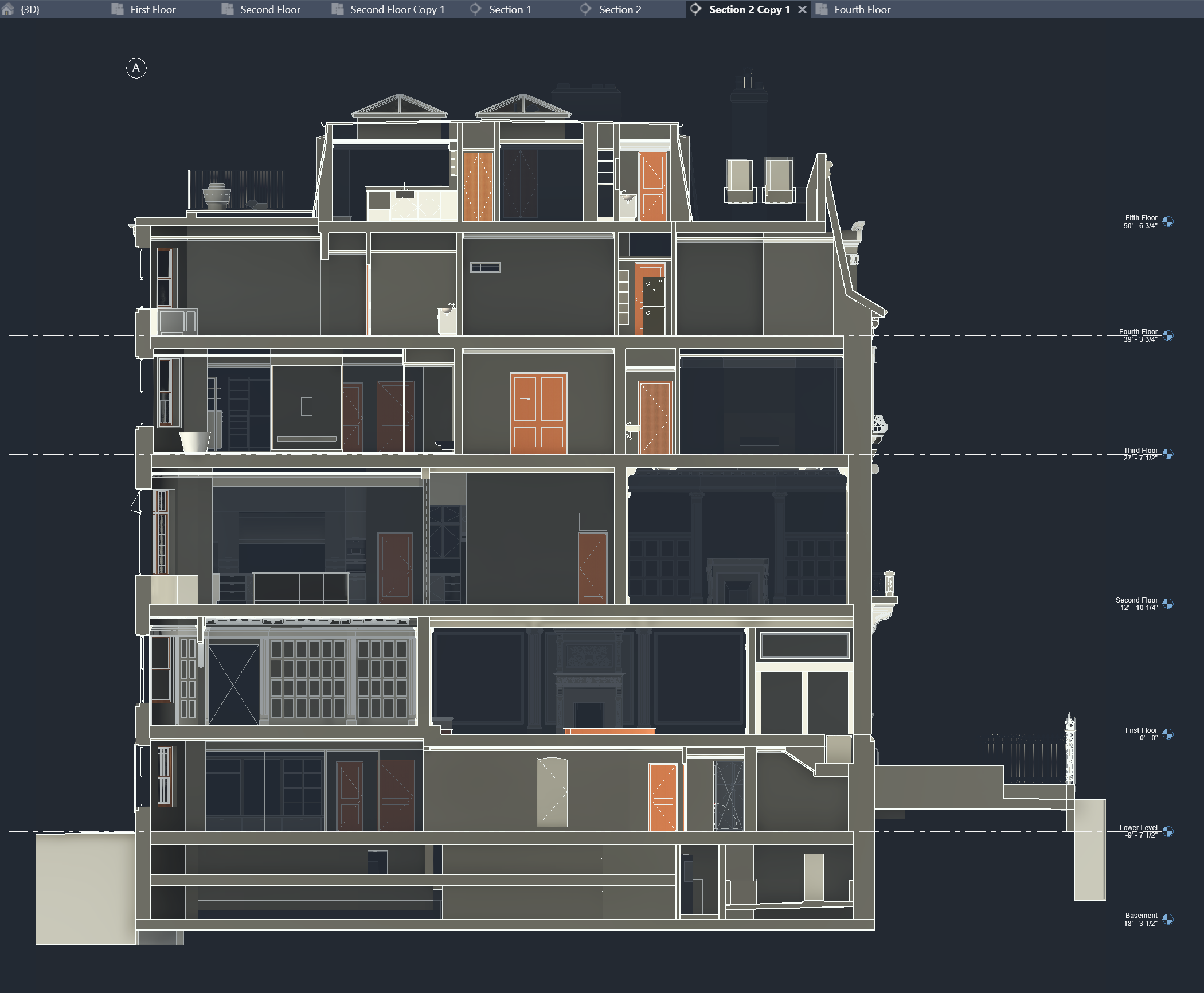
Complete mobile LiDAR scan of interior + exterior geometry
RTK-enabled drone flights for accurate roof and site context
360 photos + 360 video for immersive visual reference
XGRIDS PortalCam interior walkthrough for fast navigation and collaboration. You can walk through for yourself here: Pointknown 130 Comm Ave : Gaussian Splatt
360 imagery exported to HDRI environments for Twinmotion lighting/context
Twinmotion-ready workflow support for renderings and design studies
The result: a coordinated dataset supporting designers, modelers, and stakeholders simultaneously.
RESULTS & IMPACT
With accurate spatial data delivered early, project teams can:
Reduce uncertainty in renovation planning
Coordinate faster across disciplines
Limit repeat site visits
Improve communication with owners and stakeholders
Accelerate schedules and design decisions
This approach embodies Pointknown’s philosophy:
Measure Once. Design Right.